 |
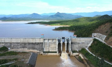
In recent days, heavy rains combined with hydropower dam discharges caused dozens of communes in eastern Dak Lak (formerly Phu Yen) to be deeply flooded, resulting in severe damage to many infrastructure facilities.
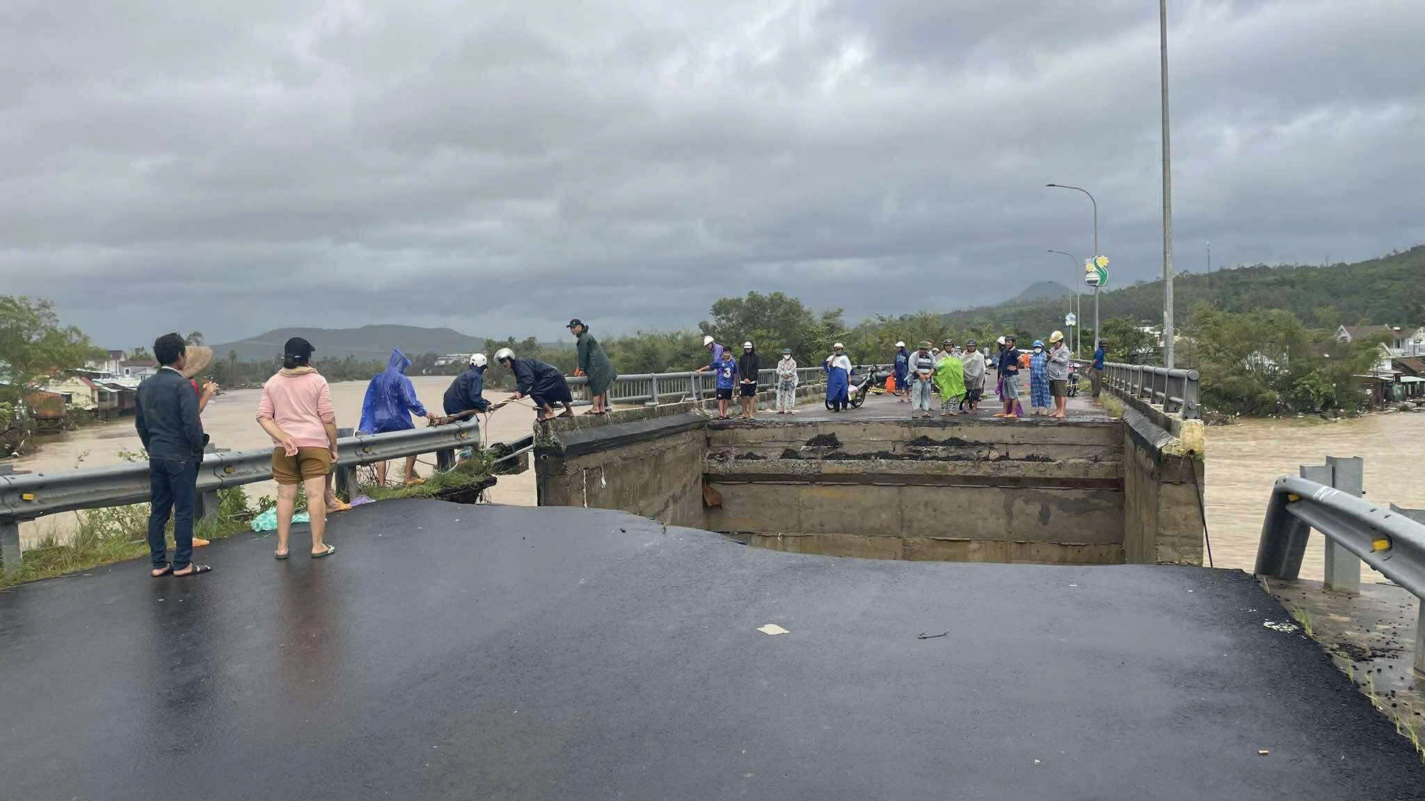
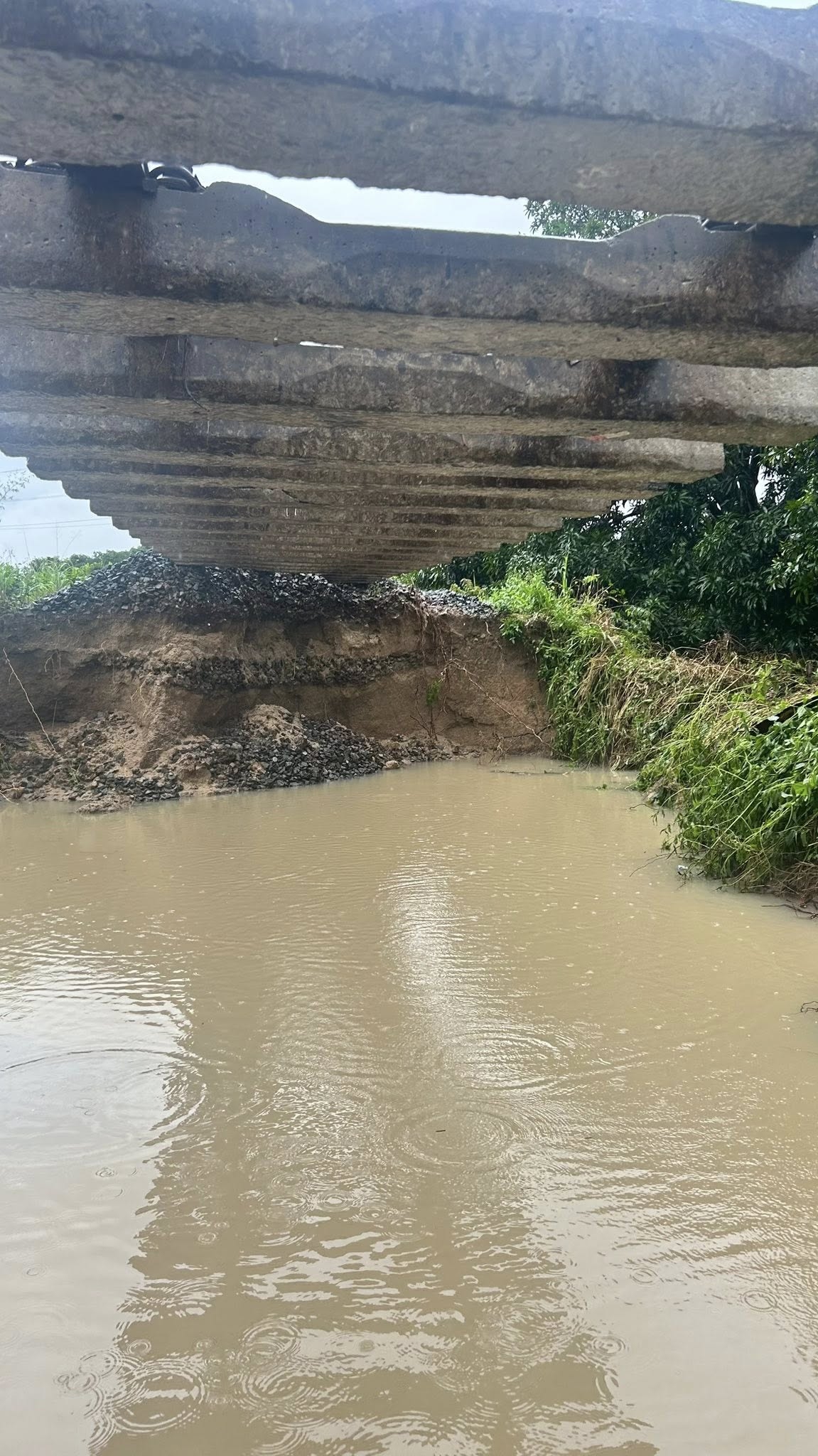
Torrential floodwaters collapsed the abutment of Lo Gom bridge in Tuy An Dong commune, cutting off the route across Ngan Son River and isolating Tuy An Bac from Tuy An Dong.
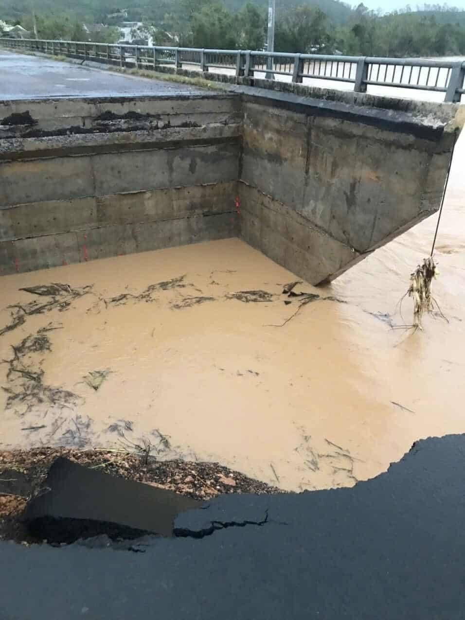 |
The eroded section stretched nearly 12 m long and was over 5 m deep; the entire Lo Gom bridge abutment was washed away by the water, creating a deep, wide crater, and the guardrail on the approach road collapsed.
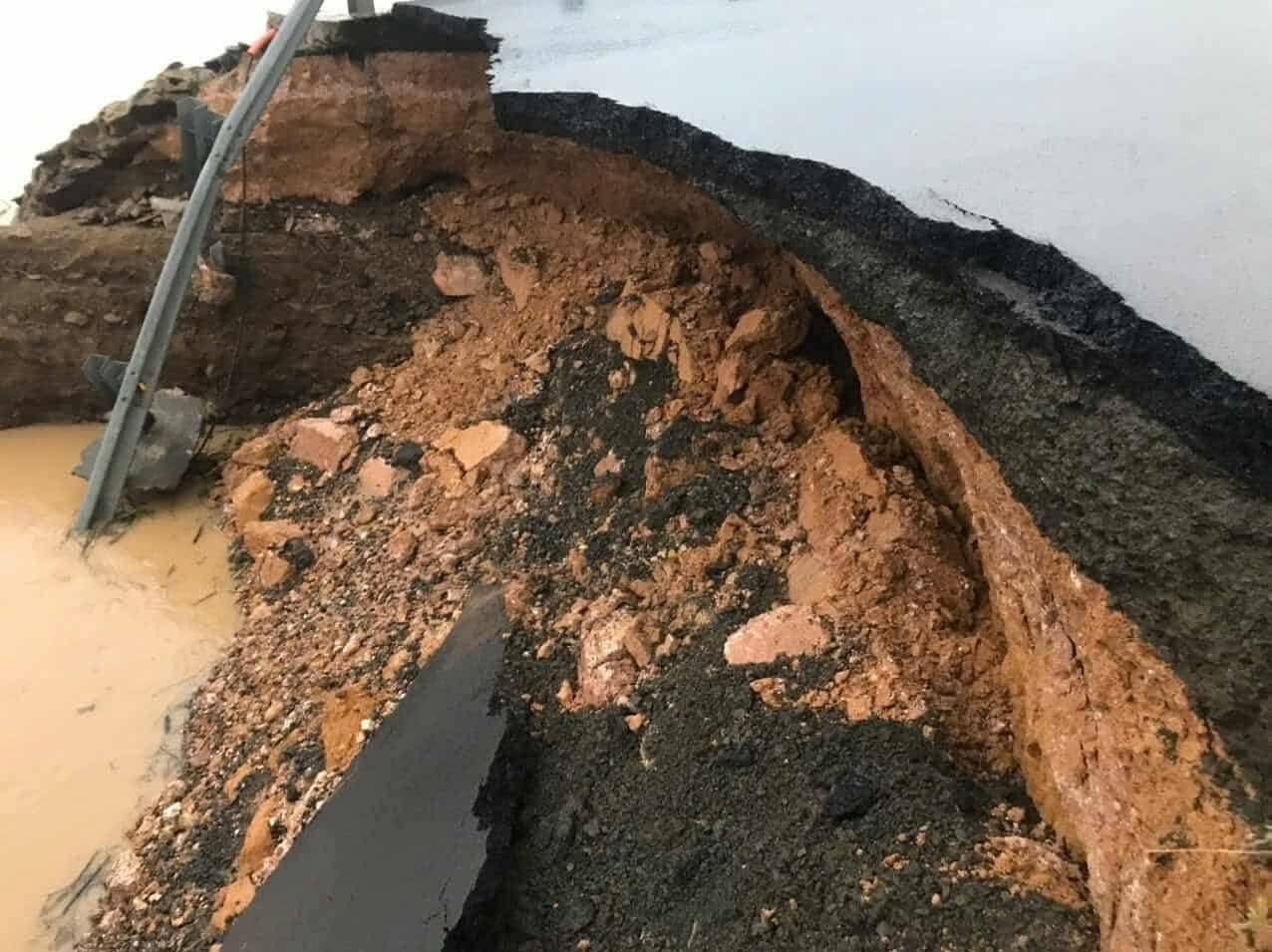 |
Below the bridge, a deep, wide crater appeared, and the guardrail on the approach road collapsed. The entire Tuy An Dong commune remains isolated, with Ngan Son River floodwaters still at high levels.
 |
Many sections of roads and culverts in the Tam Giang area (formerly Tuy An district) also sustained damage. According to the National Center for Hydro-Meteorological Forecasting, flood levels on the Ky Lo and Ngan Son rivers exceeded record levels from 2009.
 |
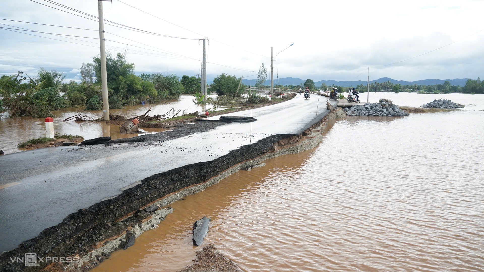
The concrete median barrier on National Highway 1, along the Dak Lak section, was swept away by floodwaters and severely damaged.
 |
In Khanh Hoa, rising floodwaters over recent days paralyzed the North-South railway. Approximately 100 m of railway tracks in the Nha Trang – Cay Cay section were eroded, scoured nearly 10 m deep, and severely damaged.
 |
Heavy rains and floodwaters caused severe erosion, washing away the roadbed and leaving the railway tracks suspended. The railway sector is developing an urgent repair plan for when the water recedes.
 |
In Gia Lai, the approach to Quy Duc bridge on Truong Son Dong road, connecting Ayun Pa ward with Ia Pa commune, had its asphalt washed away in sections by floods, causing erosion and damage extending over 30 m.
This is a vital route connecting provinces in the Central Highlands. Gia Lai authorities are planning repairs and restoration to ensure traffic flow.
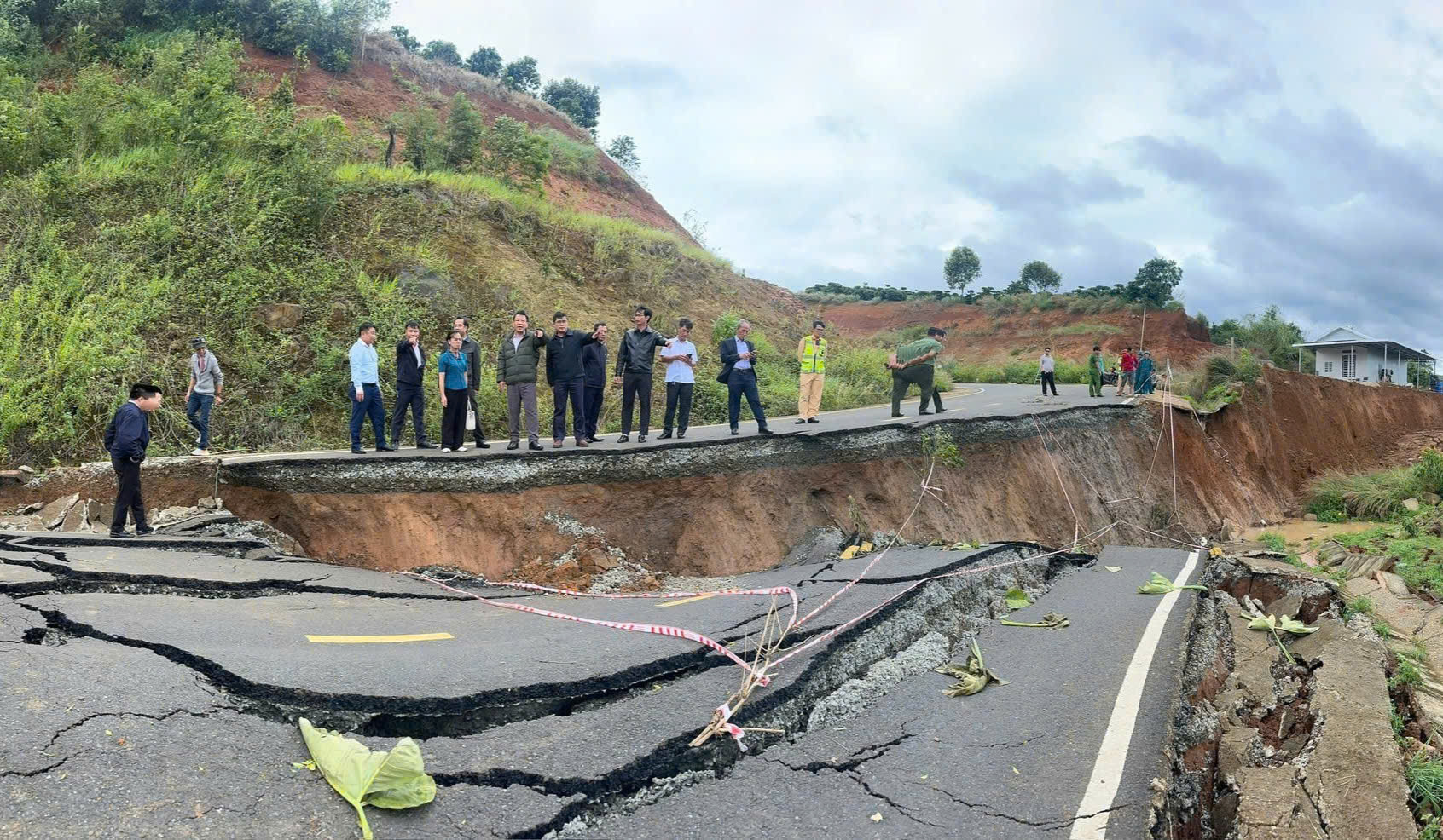 |
In recent days, Lam Dong experienced widespread heavy rains, causing landslides on many mountain pass sections. On the route from Dan Phuong commune to Tan Thanh (now part of Tan Ha, Lam Ha commune), over 500 m of road surface buckled and cracked. The roadbed collapsed over 1 m deep, cutting across the route. The gabion and drainage systems were displaced, compromising traffic safety.
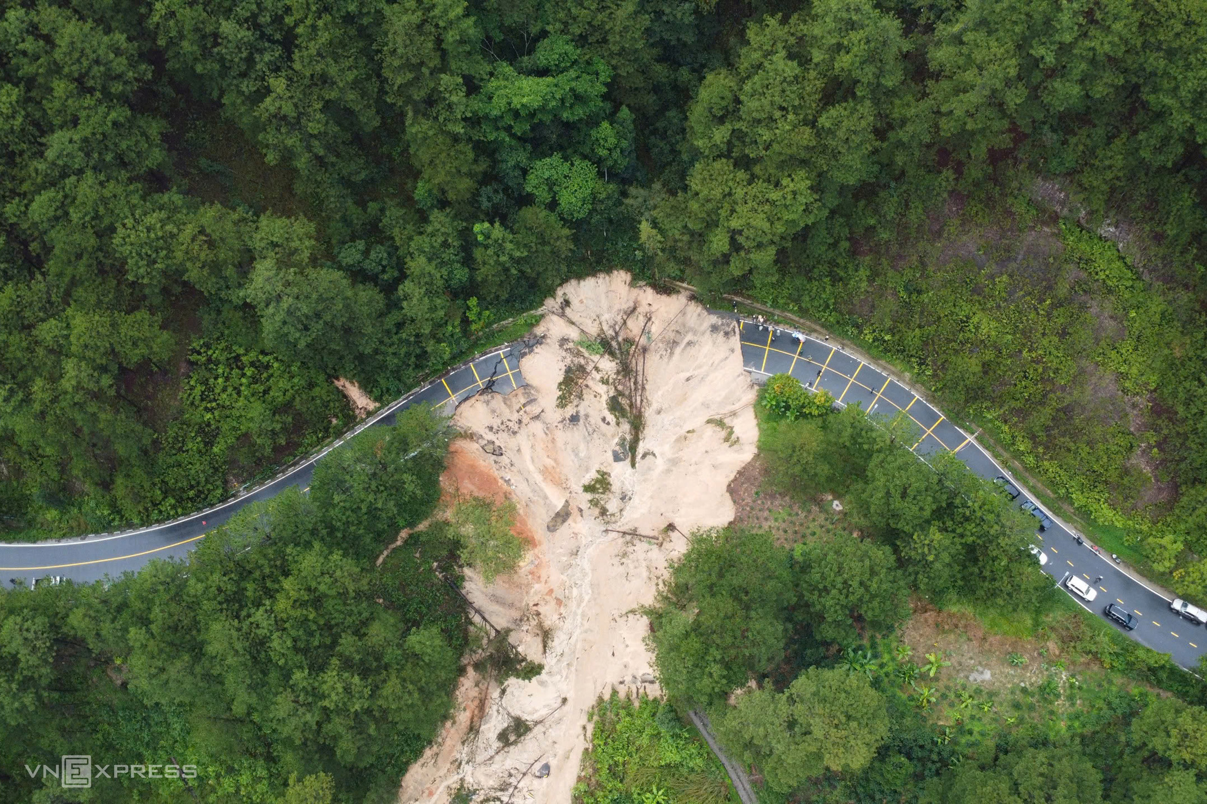 |
Mimosa Pass – a gateway to Da Lat – was torn apart for over 50 m on the morning of 20/11, as soil, rocks, and trees spilled down the negative slope, nearly sweeping a passenger bus into the ravine.
In recent days, many routes around Da Lat have experienced continuous landslides. Prenn Pass near Datanla waterfall suffered erosion, National Highway 20 at the D'ran Pass suspension bridge section showed subsidence and cracking, and Khanh Le Pass experienced landslides, making travel difficult between Nha Trang and Da Lat. Vehicles currently must detour via Ta Nung Pass (provincial road 725), increasing the travel distance by 30-35 km.
Phuoc Tuan - Tran Hoa