Professor Ohta Yusaku of Tohoku University, Japan, announced on 9/7 that after analyzing Earth's crustal movement data, he found Kodakarajima Island had moved 6 cm north-northwest over a three-day period, starting after a 5.6 magnitude earthquake on 2/7.
During the same period, Takarajima Island moved 3.5 cm in the opposite direction, southward, increasing the distance between the two islands by almost 10 cm. Both islands are part of the Tokara Islands in Kagoshima Prefecture.
According to Ohta, such movement between the two islands has not been previously recorded. Notably, both islands were previously moving northeastward, while the current trend suggests they are separating.
Seismic activity has increased around the islands in recent weeks. According to the Japan Meteorological Agency, between 21/6 and 9/7, the Tokara Islands experienced 1,688 tremors.
Similar seismic activity occurred in the Tokara Islands in September 2023, when 346 tremors were recorded within 15 days.
Ohta suggests the shift between Kodakarajima and Takarajima may not be due to the 5.6 magnitude earthquake, as its epicenter was relatively distant. He believes other factors, such as a slow-slip fault in the shallow part of the continental plate, caused the phenomenon.
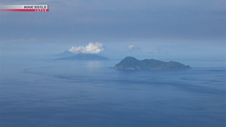 |
The Tokara Islands in Kagoshima Prefecture, Japan. Photo: NHK |
The Tokara Islands in Kagoshima Prefecture, Japan. Photo: NHK
The professor stated it remains unclear whether this crustal movement will lead to a major earthquake. He will continue analyzing past data to understand the phenomenon.
Japan, with a population of 125 million, is one of the most seismically active countries globally due to its location on four major tectonic plates along the western edge of the Pacific "Ring of Fire." The country experiences approximately 1,500 earthquakes annually, accounting for about 18% of the world's earthquakes.
In March, the Japanese government warned of the potential consequences of a "mega-quake" occurring within the next 30 years in the Nankai Trough, which runs along the country's southern Pacific coast.
The Nankai Trough is an approximately 800 km long subduction zone extending from Shizuoka, west of Tokyo, to the southern tip of Kyushu Island. Here, the Eurasian Plate collides with the Philippine Sea Plate, causing the latter to slide beneath and sink into the Earth's mantle. Subduction zones often produce powerful earthquakes of magnitude 8-9.
According to the Japanese government's report, if a mega-quake occurs, a total of 764 municipalities in 31 of 47 prefectures would experience tremors at level 6 or higher on Japan's 7-point seismic intensity scale, as well as tsunamis at least 3 meters high.
Such a mega-quake and tsunami could cause nearly USD 2,000 billion in damage and result in 298,000 deaths, including 215,000 from the tsunami, 73,000 from building collapses, and 9,000 from fires.
Huyen Le (NHK)