"Starting from 6 p.m. on 23/9, Cathay Pacific passenger flights to and from Hong Kong International Airport will be suspended until operations resume on the morning of 25/9. Currently, more than 500 flights are expected to be canceled," a Cathay Pacific spokesperson announced at a press conference today.
Qantas Airways previously announced that Hong Kong International Airport would be closed from 8 p.m. on 23/9 to 8 a.m. on 25/9. A total of over 700 flights will be canceled from the evening of 23/9, when super typhoon Ragasa is expected to hit Hong Kong.
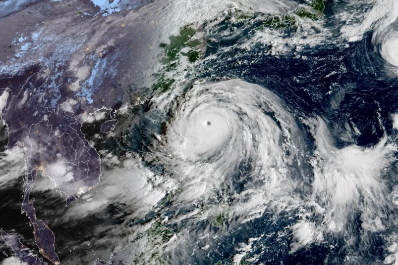 |
Super typhoon Ragasa with a clear eye, captured by satellite on the morning of 22/9. Photo: RAMMB/CIRA |
Super typhoon Ragasa with a clear eye, captured by satellite on the morning of 22/9. Photo: RAMMB/CIRA
A spokesperson for the Hong Kong Airport Authority said they are closely monitoring the development of super typhoon Ragasa and have begun preparations. The agency is considering the most extreme scenario of banning all flights for 36 hours starting from 6 p.m. on 23/9, due to the risk of a "serious threat" from super typhoon Ragasa.
Weather is forecast to deteriorate rapidly from 23/9, with gale-force winds expected on 24/9, according to the Hong Kong Observatory. All schools in the special administrative region will be closed for two days, 23/9 and 24/9. Public hospitals are implementing special measures to ensure emergency services are not affected during the storm.
"The weather will be very unfavorable, with continuous heavy rain and significant storm surges," the Hong Kong Observatory said.
Authorities plan to build sandbag and flood defenses for some coastal villages.
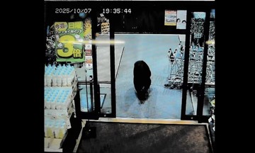
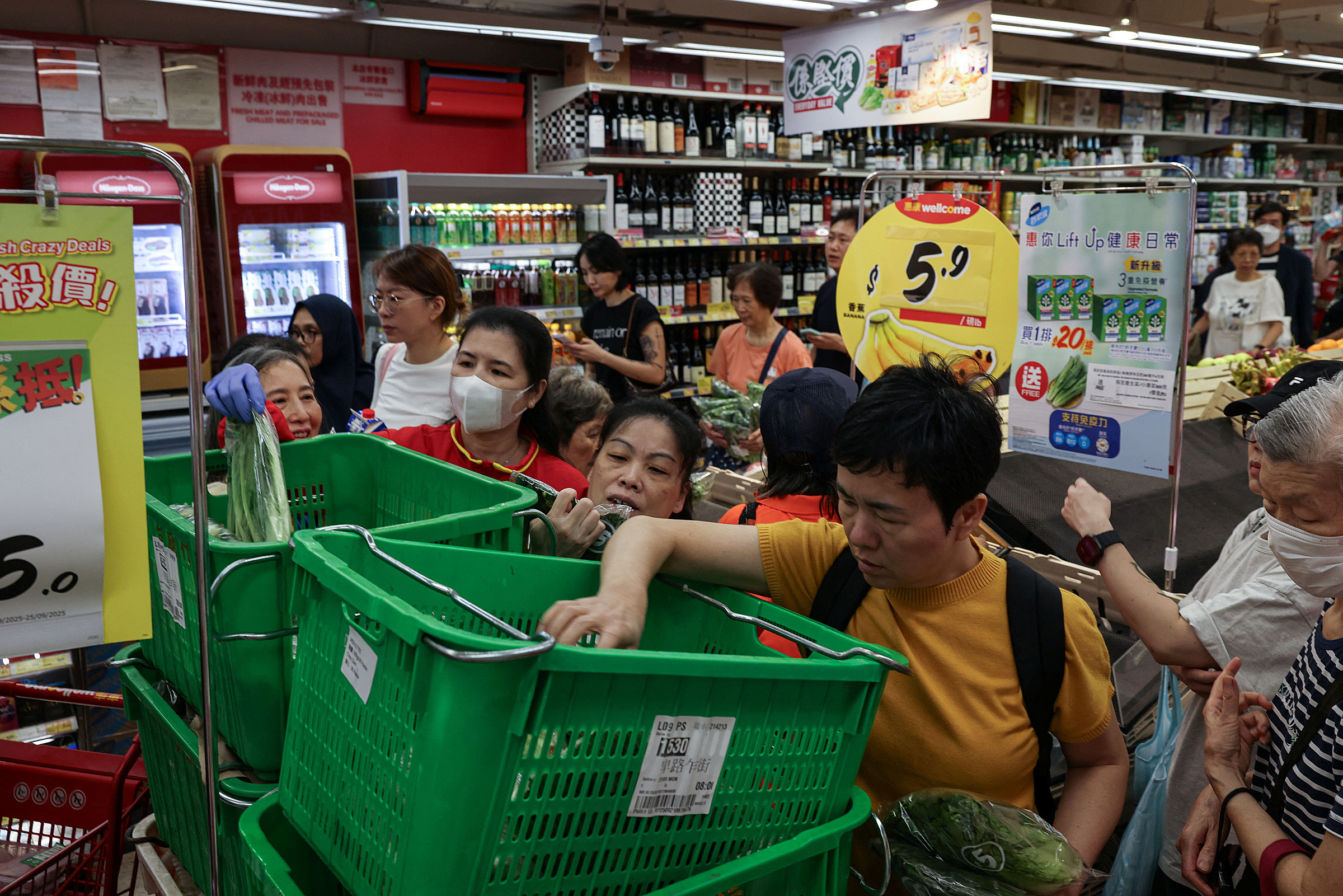 |
Hong Kong residents shop in a supermarket on 22/9, before super typhoon Ragasa's arrival. Photo: Reuters |
Hong Kong residents shop in a supermarket on 22/9, before super typhoon Ragasa's arrival. Photo: Reuters
Across Hong Kong, residents began flocking to supermarkets to stock up on essentials from the morning of 22/9. Vegetable prices in markets have more than tripled.
The Philippines national weather agency said that as of 11 a.m. today, the maximum sustained winds near the center of super typhoon Ragasa were 215 km/h with gusts of 265 km/h. The typhoon is passing through the Luzon Strait between the south of Taiwan and the north of the Philippines, and is expected to make landfall in Hong Kong and southern mainland China on 23/9 and 24/9.
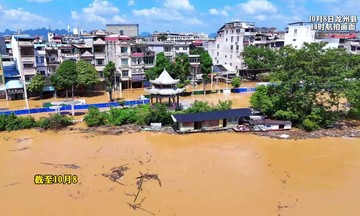
According to the China Meteorological Administration, the storm is expected to hit coastal areas from Guangdong province to Hainan province. Officials in Shenzhen city, Guangdong province, have warned of an impending "catastrophic disaster" and plan to evacuate 400,000 residents.
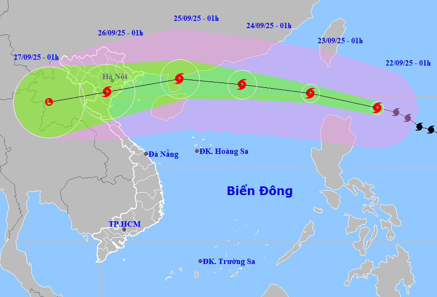 |
Forecast path and affected area of super typhoon Ragasa on 22/9. Photo: NCHMF |
Forecast path and affected area of super typhoon Ragasa on 22/9. Photo: NCHMF
Huyen Le (According to AFP, Reuters, SCMP)