Hong Kong is making urgent preparations for super typhoon Ragasa, with officials warning it poses a "serious threat," comparable to some of the most damaging storms in history.
Super typhoon Ragasa is currently over the northeastern part of the South China Sea, with maximum sustained winds of 221 km/h, equivalent to a category 17 storm, gusting above category 17. It's moving west-northwest at 20 km/h. According to Chinese meteorological agencies, Ragasa will approach Hong Kong and Macau tomorrow morning.
"The level of destruction could be similar to typhoon Hato in 2017 and typhoon Mangkhut in 2018," Hong Kong Chief Secretary Eric Chan said, referring to two super typhoons that caused extensive damage to the special administrative region.
Hong Kong residents are rushing to stockpile essential supplies before the storm's arrival, leaving supermarket shelves bare of fresh food, vegetables, and bread. Vegetable prices at markets have more than tripled. "Everyone is definitely very worried about this typhoon," said 22-year-old student Zhu Yifan, who was shopping at a supermarket.
In Wan Chai district, Zoe Chan, in her 50s, was stacking sandbags outside her clothing store to prevent flooding. "It's important to take precautions so we can feel more secure," she said.
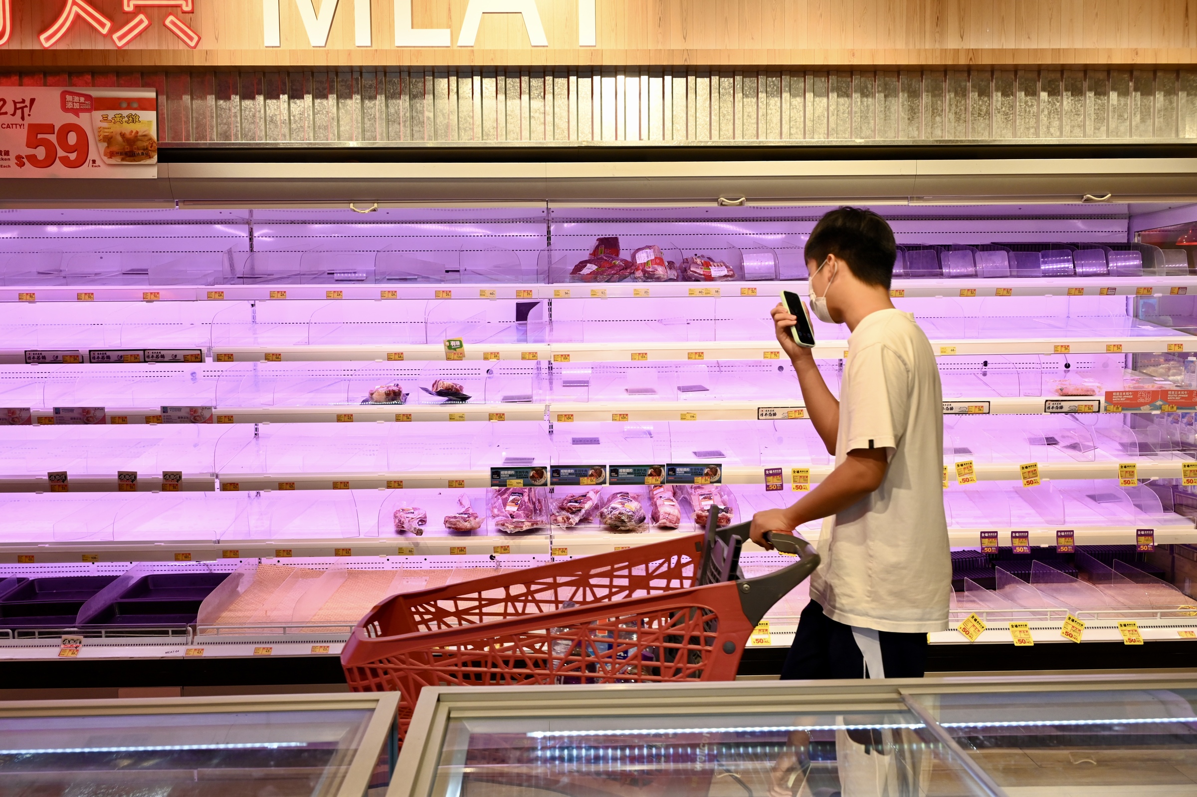 |
Empty supermarket shelves in Hong Kong, China, 22/9. Photo: Reuters |
Empty supermarket shelves in Hong Kong, China, 22/9. Photo: Reuters
Authorities have warned residents in low-lying areas to be vigilant about flooding and have opened 46 temporary shelters. Schools in the special administrative region will be closed today and tomorrow. Over 700 flights have been canceled.
Authorities in Shenzhen, near Hong Kong, have also evacuated 400,000 people as a precaution. Shelves of meat and fresh vegetables in Shenzhen are also nearly empty. In Bao'an district, long lines of people queued to pay, while others rushed to find food. Bread sold out by midday.
The Chinese government has activated flood control measures in several southern provinces, warning of heavy rain from the evening of 23/9. The Guangzhou Railway Corporation announced the suspension of all train services on 24/9.
According to Vietnam's National Center for Hydro-Meteorological Forecasting, as of 4 a.m. on 25/9, the typhoon was over the southern province of Guangzhou, with maximum sustained winds of category 12, gusting to 15, moving west-northwest at 20-25 km/h. The typhoon then rapidly weakened into a tropical depression, and by 4 a.m. on 26/9, it was over northern Vietnam, with wind speeds reduced to category 6, gusting to 8.
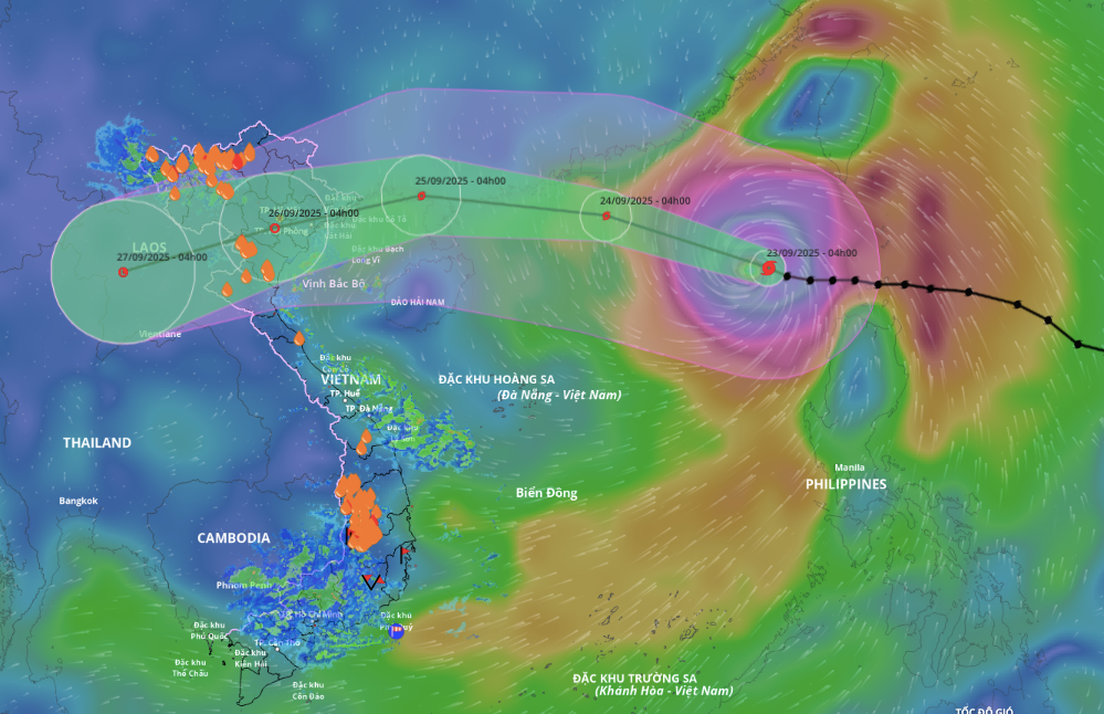 |
Forecast path and area of influence of the super typhoon, morning of 23/9. Photo: Disaster Monitoring System |
Forecast path and area of influence of the super typhoon, morning of 23/9. Photo: Disaster Monitoring System
Duc Trung (CNA, AFP)