The Philippine weather agency announced today that super typhoon Ragasa is "rapidly intensifying" and is expected to make landfall on Batanes or Babuyan Island on the afternoon of 23/9. As of 11 a.m. today, the maximum sustained winds near the center of the storm were 185 km/h, with gusts up to 230 km/h.
Philippine weather specialist John Grender Almario warned of the risk of severe flooding and landslides in the northern part of Luzon Island. "We forecast that the super typhoon will begin impacting the Philippines starting the evening of 21/9. The strongest impact will occur from 8 a.m. tomorrow," he said.
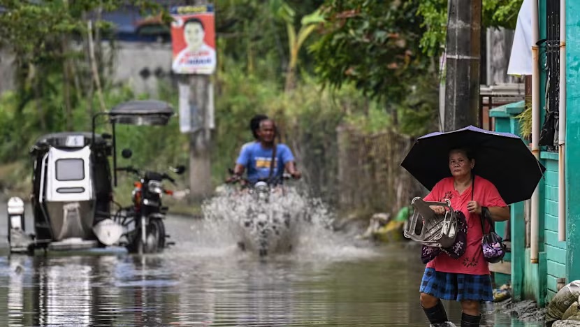 |
Residents wade through a flooded area in Bulacan, central Luzon Island on 15/9. Photo: AFP |
Residents wade through a flooded area in Bulacan, central Luzon Island on 15/9. Photo: AFP
Philippines Interior Secretary Jonvic Remulla urged local officials to "waste no time in relocating families out of dangerous areas." On 20/9, Philippine authorities evacuated around 380 people in the northern and central regions of Luzon Island.
The Cagayan Provincial Information Office reported today that the health department and lower-level hospitals are on high alert and ready to respond to any emergencies caused by the typhoon. Generators are also prepared in case of power outages.
The Philippine weather agency predicts that most of the Manila metropolitan area will not be significantly affected by super typhoon Ragasa.
The Philippines is hit by an average of 20 typhoons annually, trapping millions of people in vulnerable areas in a cycle of poverty. In 2013, super typhoon Haiyan claimed the lives of more than 6,000 people in the country.
 |
Projected path and area of impact of typhoon Ragasa on 21/9. Photo: NCHMF |
Projected path and area of impact of typhoon Ragasa on 21/9. Photo: NCHMF
Thanh Tam (AFP, Rappler)