Typhoon Wipha made landfall in Taishan City, Guangdong province, southern China, at 5:50 p.m. local time (4:50 p.m. Hanoi time), with maximum sustained winds near the center of about 108 km/h, equivalent to a category 11 storm, according to China Central Television (CCTV).
Before the typhoon's arrival, Hong Kong experienced heavy rain and strong winds, causing trees and scaffolding to collapse throughout the city. Hong Kong authorities issued a signal 10 typhoon warning, the highest in the local warning system. This was the first time a signal 10 warning had been issued in Hong Kong since Super Typhoon Saola in 2023.
The warning was lowered to signal 8 at 4:10 p.m. after Wipha passed through the region.
"Strong winds affected some areas of the special administrative region. Heavy rainfall from the typhoon's circulation also poured down on areas around the Pearl River estuary," the Hong Kong weather forecasting agency said.
Hong Kong authorities also received more than 450 reports of fallen trees and flooding, including on a major road in Wong Tai Sin district.
The nearby Macau Special Administrative Region also issued its highest typhoon warning after noon, and local authorities suspended all public transport. According to TDM, Macau authorities lowered the typhoon warning to signal 8 this afternoon, forecasting a risk of flooding in coastal areas and advising residents to ensure their safety.
Hainan and Guangdong provinces in southern China also issued typhoon warnings.
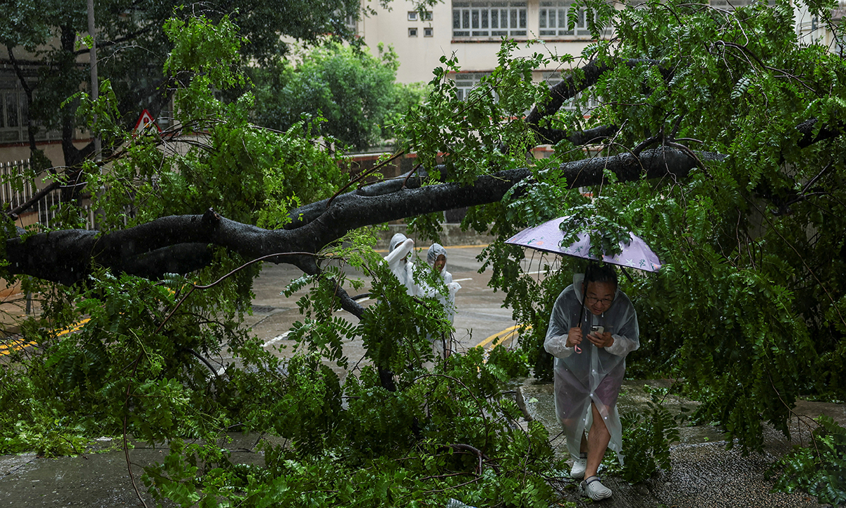 |
A fallen tree on a street in Hong Kong, China, on 20/7. Photo: _Reuters_ |
Vietnam's National Center for Hydro-Meteorological Forecasting stated that as of 4 p.m. today, the typhoon's center was about 500 km east of Quang Ninh - Hai Phong, with maximum sustained winds reaching category 12 (133 km/h), and gusts of category 15. The typhoon was moving west at a speed of 20-25 km/h. The center predicted that on the afternoon of 21/7, the typhoon would enter the Gulf of Tonkin with an intensity of category 10-11, with gusts of category 14; and on 22/7, it would make landfall in the northern provinces to Nghe An.
The typhoon will cause widespread heavy rain in northern Vietnam, from Thanh Hoa to Ha Tinh, starting 21/7. The northeast, the northern delta, Thanh Hoa, and Nghe An will experience continuous rain for three days, from 21/7 to 23/7, with common rainfall totals of 200-350 mm, exceeding 600 mm in some areas. Other areas will receive 100-200 mm of rain.
Many rivers will experience flooding with amplitudes of 3-6 m. Peak floods on the Thao River could reach warning levels two and three; the Lo, Cau, Thuong, and Luc Nam rivers will be at warning levels one and two, and above warning level two.
Nguyen Tien (_CCTV, Reuters, AFP_)