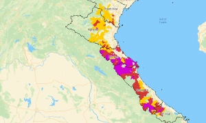
A persistent low-pressure trough is expected to bring a week of rain to Vietnam's Northern region, with increased intensity and coverage from 4/8 to 7/8.
The northern region is forecast to experience widespread thunderstorms from the night of 27/7 to the morning of 29/7, with some mountainous and midland areas receiving over 250 mm of rain, posing a high risk of flash floods and landslides.
Northern Vietnam is expected to experience thunderstorms early next week, with a brief decrease before increasing again towards the weekend, while the central region will endure hot weather until around 22/7.
Bac Bo will experience reduced rain and sunny weather from the beginning of the week, but widespread rainstorms are possible around 19/7; Tay Nguyen and Nam Bo will continue to see significant afternoon and evening rain.
Following the dissipation of storm Maysak, northern Vietnam continues to experience rain and thunderstorms due to a low-pressure trough, while central and southern regions enjoy sunny days with evening showers.
Over the next 10 days, the South China Sea is likely to see a tropical depression form, potentially intensifying into a typhoon with a 65% probability; meanwhile, northern Vietnam and Thanh Hoa province could experience widespread heavy rain this weekend.
Northern and southern Vietnam are entering a period of widespread thunderstorms in the coming days, while the heatwave in central Vietnam is expected to gradually decrease from early July.
Nearly 200 mm of rain recorded in many northern provinces, while a thunderstorm from Thai Nguyen is forecast to hit Hanoi during the morning rush hour on 26/6.
Thunderstorms expected from late afternoon on 25/6 will help northern Vietnam cool down, ending a prolonged heatwave, while central Vietnam continues to experience intense heat.
The northern region is set to experience widespread rain, lasting until approximately 19/6, influenced by a low-pressure trough and high-altitude wind convergence around 5,000 m.