On 23/9, Reuters published a time-lapse of Super Typhoon Ragasa's path over the past three days. The images were compiled from satellite data from Colorado State University (CSU), the Japan Meteorological Agency (JMA), and the Japan Aerospace Exploration Agency (JAXA).
Ragasa, the strongest storm globally this year, with winds of 270 km/h, has been dubbed "King of Storms" by the China Meteorological Administration. The typhoon originated on 18/9 as a tropical depression off the coast of the Philippines and intensified to a super typhoon three days later.
Images from space depicted the typhoon's enormous eye and dense circulation, resembling a swirling mass of white and silver, moving from the Pacific Ocean through the strait separating the Philippines and Taiwan.
Heavy rainfall from the typhoon caused a reservoir to burst in Taiwan on 23/9, resulting in at least 14 fatalities. The super typhoon continued to move north in the South China Sea, approaching Hong Kong and nearing landfall on China's southern coast.
Japanese astronaut Kimiya Yui shared striking images of the super typhoon captured from the International Space Station (ISS) over the weekend.
"The station happened to fly over Typhoon Ragasa. I was really worried about the people on the ground," Yui wrote in the description. The astronaut's post garnered 10 million views.
"It looks like the Earth's navel, it's amazing," one user commented about the eye of the storm. "It feels like being swallowed up when looking at it. This image reminds me of how small humans are in the face of nature," wrote another.
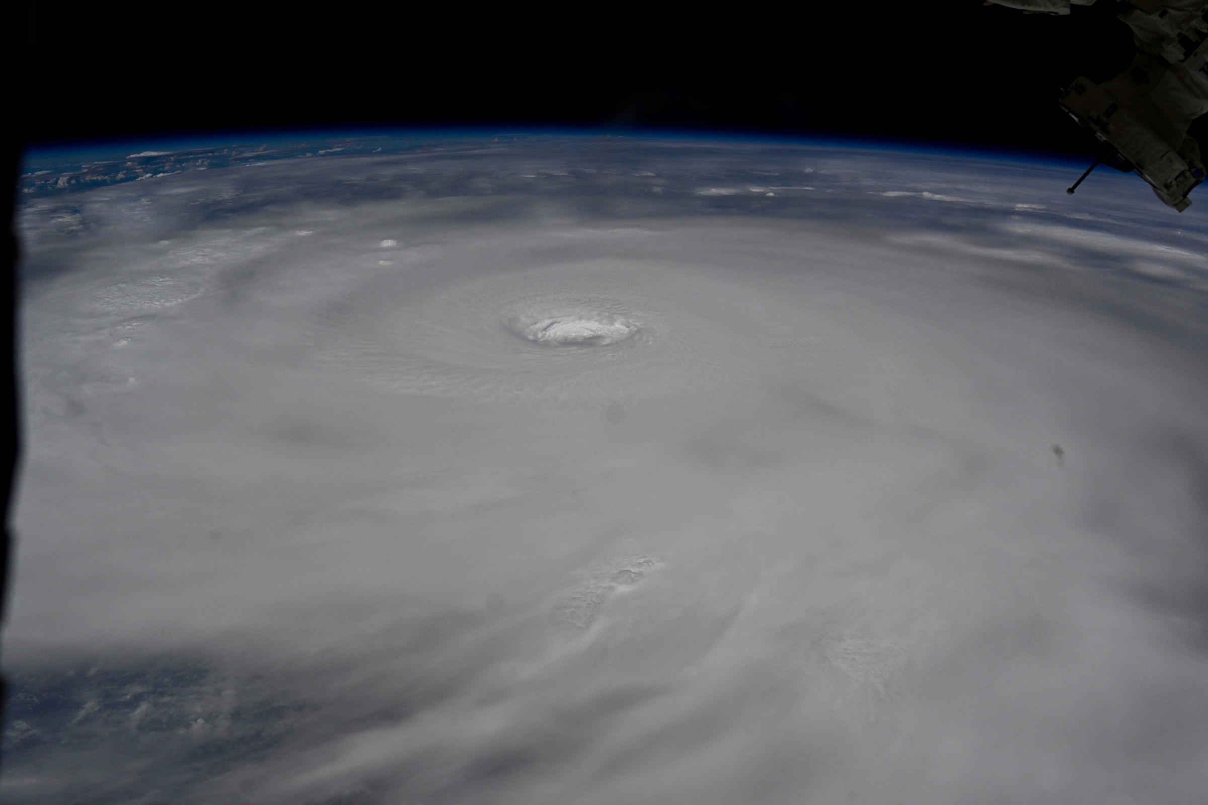 |
Super Typhoon Ragasa as seen from the ISS. Image: X/Kimiya Yui |
Tens of millions of people are expected to be affected as Super Typhoon Ragasa sweeps south of major cities in Guangdong and Guangzhou provinces. Local authorities have issued warnings and evacuated hundreds of thousands of residents in preparation.
As of this morning, Ragasa has begun to rapidly weaken due to the influence of a continental high-pressure system. At 4 a.m. this morning, the typhoon's center was located in the northern part of the South China Sea, approximately 650 km east of Mong Cai, with maximum sustained winds of 201 km/h.
According to the National Center for Hydro-Meteorological Forecasting, by 4 a.m. tomorrow, the typhoon will be over coastal waters of Guangxi, about 150 km east of Mong Cai, with maximum sustained winds of level 11, gusting to level 13. During the day, the typhoon will enter the Gulf of Tonkin and make landfall in Quang Ninh with winds of level 8-9. By the morning of 26/9, the typhoon is expected to weaken into a tropical depression and then a low-pressure area in Northwest Vietnam.
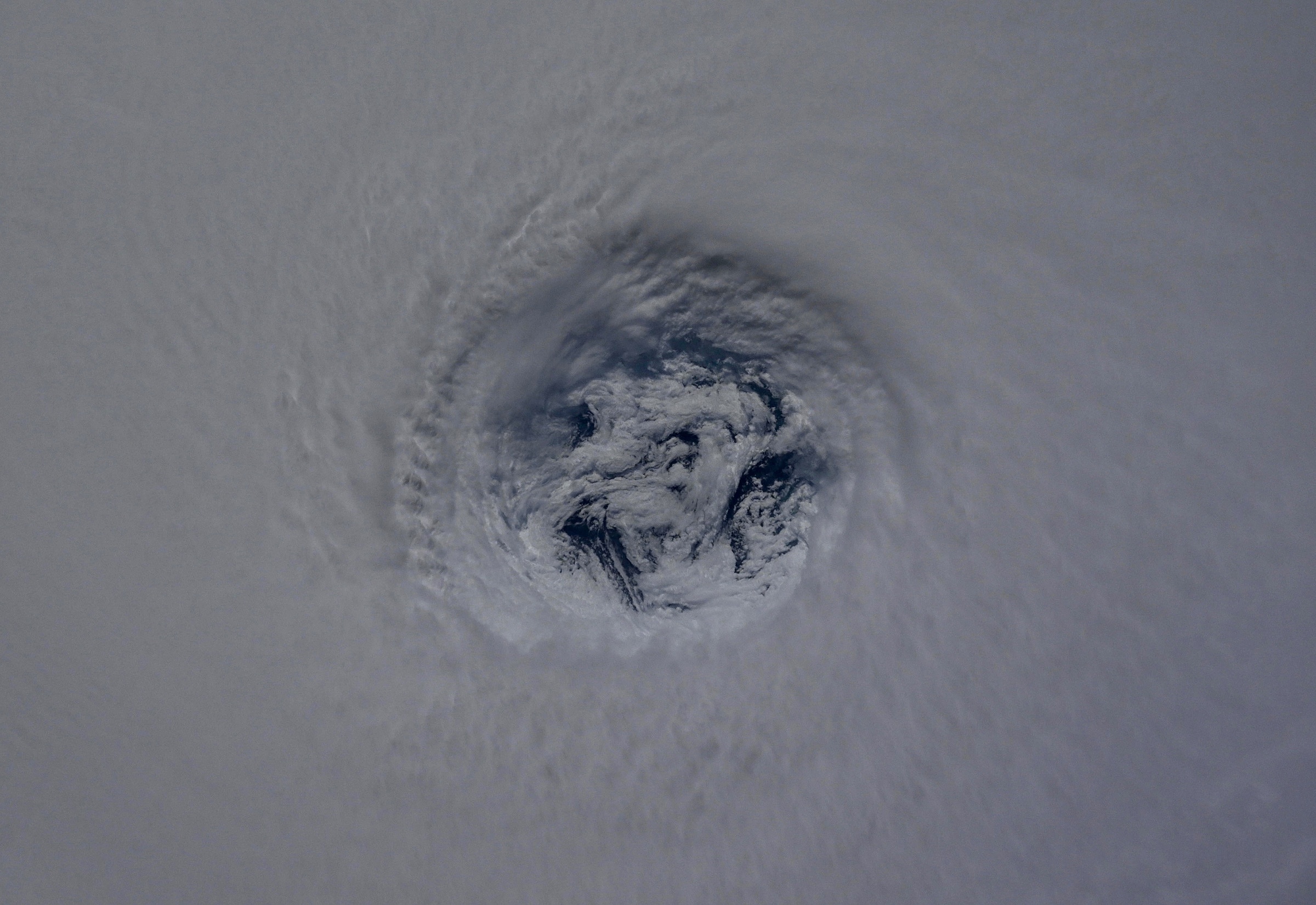 |
Close-up of Super Typhoon Ragasa's eye as seen from the ISS. Image: X/Kimiya Yui |
Duc Trung (According to Standard, CNN)