Currently, Hanoi has six operational bridges across the Red River: Thang Long, Nhat Tan, Long Bien, Chuong Duong, Vinh Tuy, and Thanh Tri. Six more bridges are under construction: Hong Ha, Thuong Cat, Tu Lien, Tran Hung Dao, Ngoc Hoi, and Me So. With the planned addition of five more bridges, the system of Red River crossings along the Landscape Boulevard Axis will increase to 17, stretching from Hong Ha Bridge to Me So Bridge. This initiative is part of a larger investment project slated for implementation from 2026 to 2038.
This extensive bridge system aims to establish continuous connections across road, waterway, and urban rail transport. It seeks to stimulate development for both the region and Hanoi, aligning with essential flood prevention and safety guidelines. The primary goal is to ensure high traffic capacity and seamless flow for the transportation network along both riverbanks, as the Landscape Boulevard Axis has been designated one of the capital's nine key development axes.
The proposal for these additional bridges is outlined in the comprehensive adjustment of the Red River Urban Subdivision Master Plan (1/5.000 scale). This plan supports the Red River Landscape Boulevard Axis investment project, for which the Hanoi People's Committee is collecting public feedback from 7/9 to 27/9. The study area covers 40 km in a northwest-southeast direction, traversing the central urban area and encompassing 16 communes and wards situated along the Red River.
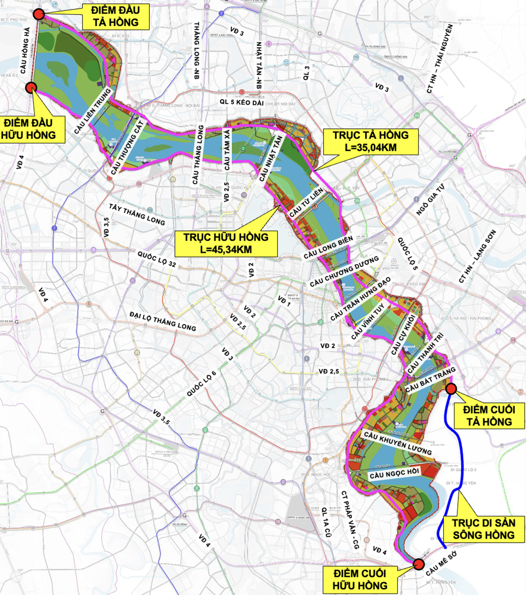 |
The system of river-crossing bridges along the Red River Landscape Boulevard Axis. *Source: Hanoi People's Committee* |
According to the master plan, Lien Trung Bridge will connect O Dien commune with Thien Loc commune. Tam Xa Bridge is proposed along the route through Phu Thuong ward, positioned between Thang Long and Nhat Tan bridges. Cu Khoi Bridge will link Linh Nam ward with Long Bien, situated between Vinh Tuy and Thanh Tri bridges. Bat Trang Bridge is planned to connect Linh Nam ward with Bat Trang commune, while Khuyen Luong Bridge will connect Hanoi with Hung Yen province.
A report dated 12/8 from the Hanoi Transport Project Management Board indicates that all land for the bridges currently under construction has been handed over according to project boundaries. However, some challenges persist. For Tu Lien and Tran Hung Dao bridges, issues remain concerning demolition and relocation of technical infrastructure. Thuong Cat Bridge requires additional land clearance of over 1,1 hectares due to project adjustments approved by the city in late July. Ngoc Hoi Bridge, located in Van Giang and Phung Cong communes, Hung Yen province, still has 9,86 hectares (over 43,5%) of land to be cleared, posing a risk to the project's progress.
Construction progress for Hong Ha Bridge has reached 42,6%, Me So Bridge 41,6%, Tu Lien Bridge nearly 15,6%, Tran Hung Dao Bridge over 30%, Ngoc Hoi Bridge 20,7%, and Thuong Cat Bridge 14,3%.
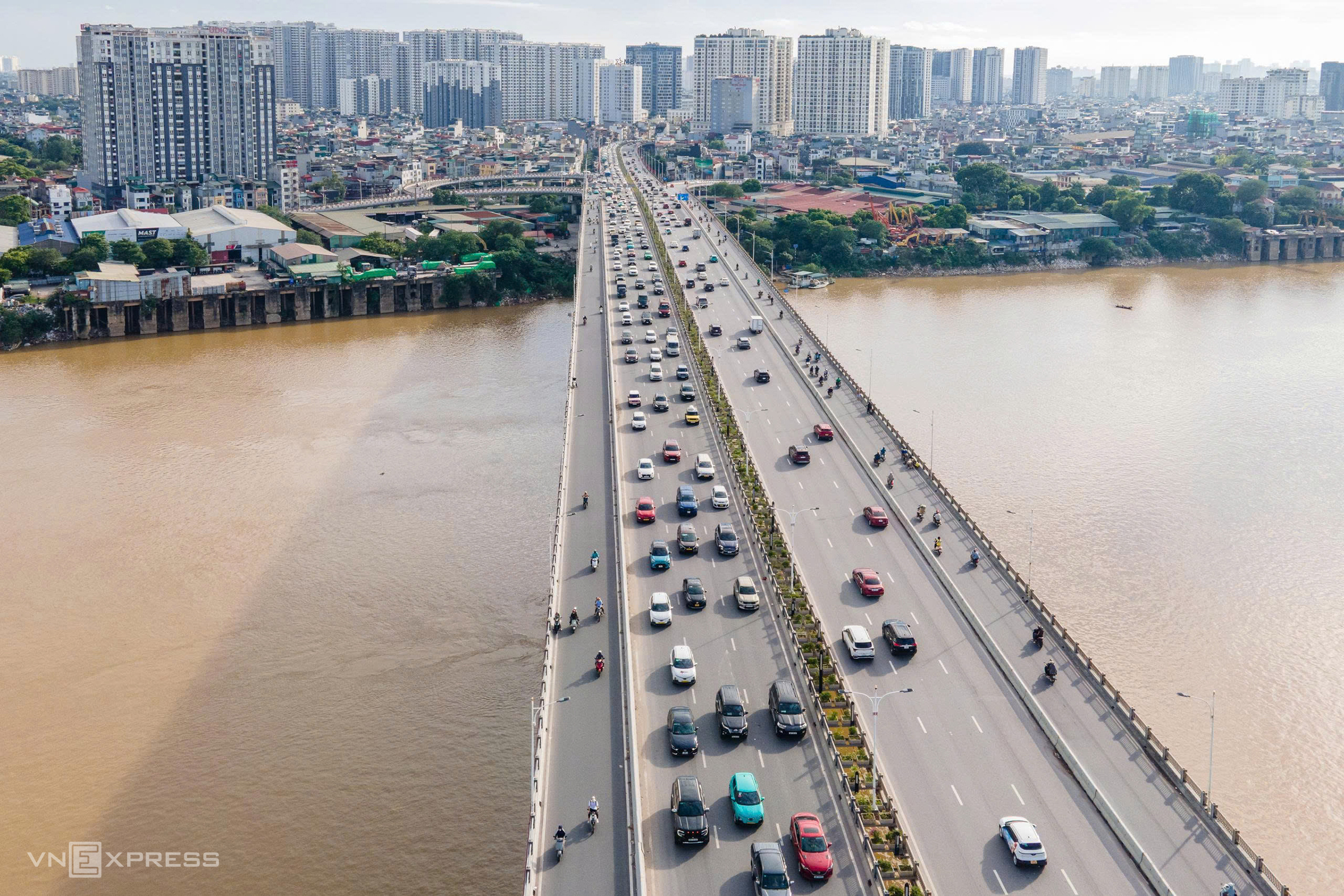 |
Traffic on Vinh Tuy Bridge over the Red River, 8/2026. *Photo: The Bang* |
The Red River flows through Hanoi for approximately 120 km. The current project's study area spans about 40 km in a northwest-southeast direction, from Hong Ha Bridge to Me So Bridge, accounting for one-third of the river's total length within the capital.
Hong Chieu - Vo Hai