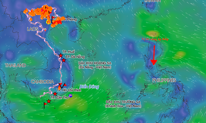
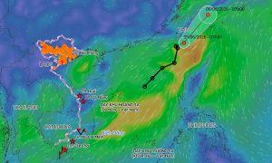
A tropical depression is forecast to intensify into a typhoon and enter the South China Sea, while another low-pressure area persists in the central South China Sea.
The tropical depression in the East Sea (South China Sea) has intensified into a typhoon and is expected to make landfall in China on 8/9. The remnants of the storm are predicted to affect Vietnam's mountainous regions.
A tropical depression formed in the northeastern South China Sea on the evening of 5/9 and is forecast to strengthen into Typhoon No. 7 tomorrow, bringing strong winds and high waves.
As floodwaters recede in Nghe An and Ha Tinh recovers from Typhoon Kajiki, residents are cleaning up and reinforcing their homes in preparation for a tropical depression that could intensify into a typhoon.
A tropical depression is expected to intensify into a typhoon near the Paracel Islands, but its strength is predicted to remain at level 8, with gusts up to level 10.
At 4 a.m. today, the storm weakened to a tropical depression over Laos, with maximum sustained winds of 61 km/h (level 7), continuing to bring heavy rain to northern and north-central Vietnam.
Overnight, a tropical depression crossed Luzon Island (Philippines) and entered the South China Sea. It is forecast to strengthen into a typhoon today and continue to intensify.
Entering the East Sea tonight, the tropical depression is forecast to intensify into a typhoon, moving quickly and impacting north central Vietnam early next week.
The tropical depression brought strong winds of 49 km/h (level 6) to coastal areas of Quang Ninh and Hai Phong this morning, while inland areas experienced light winds and no rain.