 |
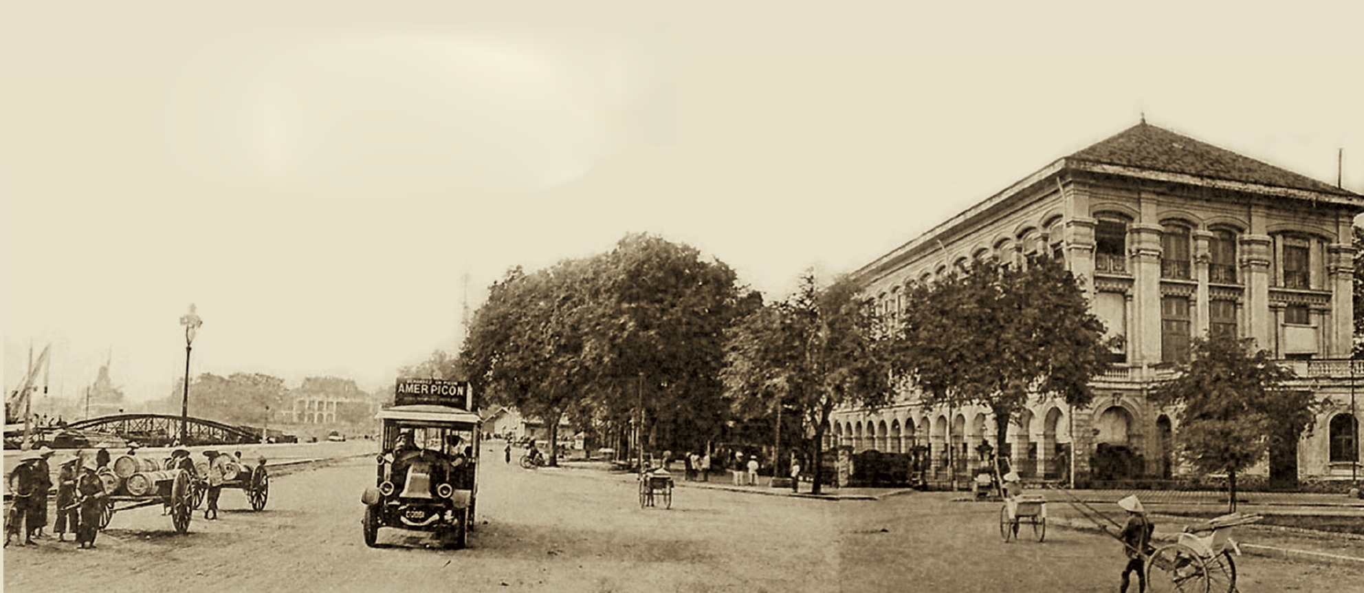
People on Ton Duc Thang Street in the early 20th century. In 1865, the French named this street Boulevard de la Citadelle. At that time, the primary mode of transportation was the rickshaw, with around 400 operating throughout Saigon. This image is featured in the book "Saigon - Ho Chi Minh City Heritage," edited by Nguyen Hanh and recently published by the Ho Chi Minh City General Publishing House. |
 |
Workers relaxing on Ton Duc Thang Street. |
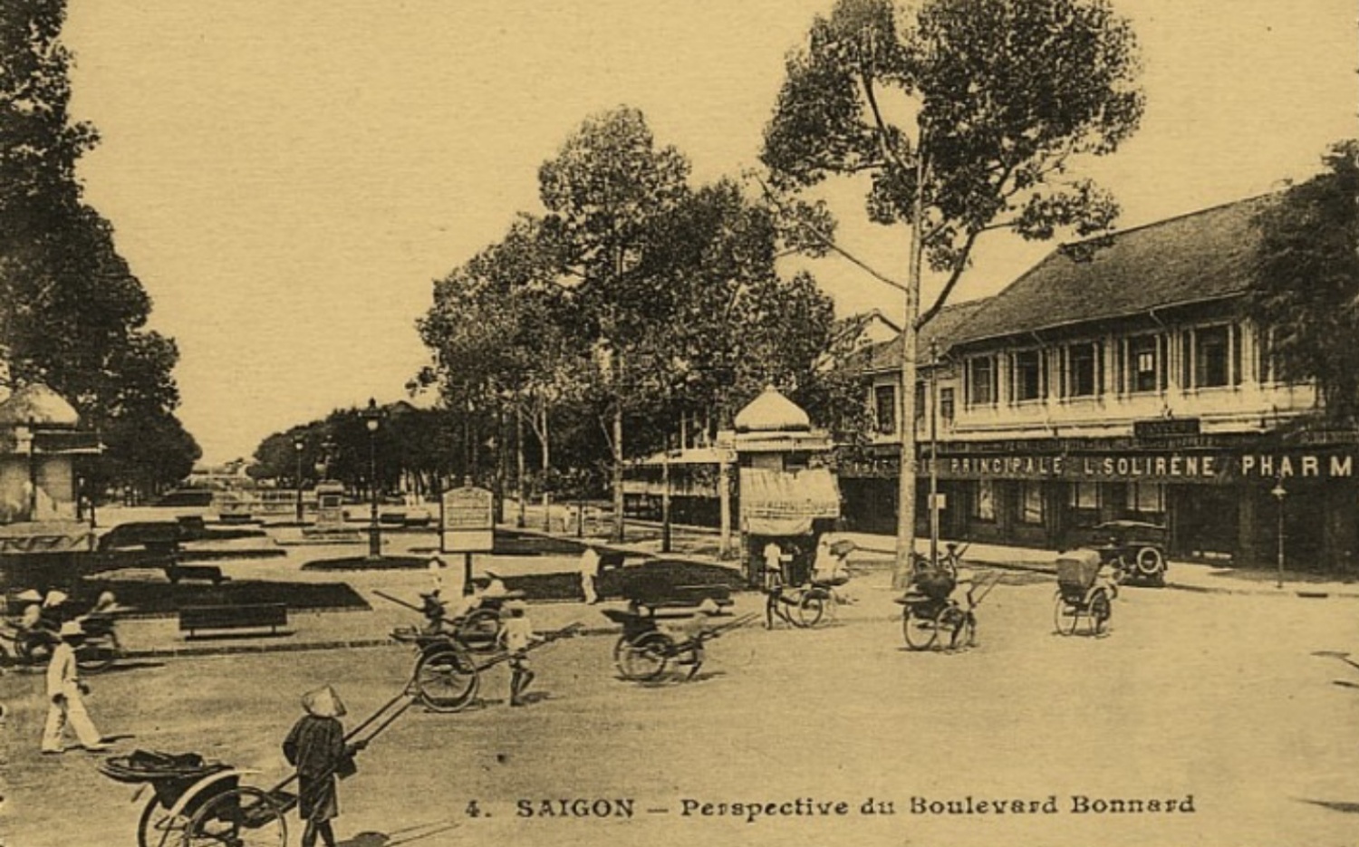 |
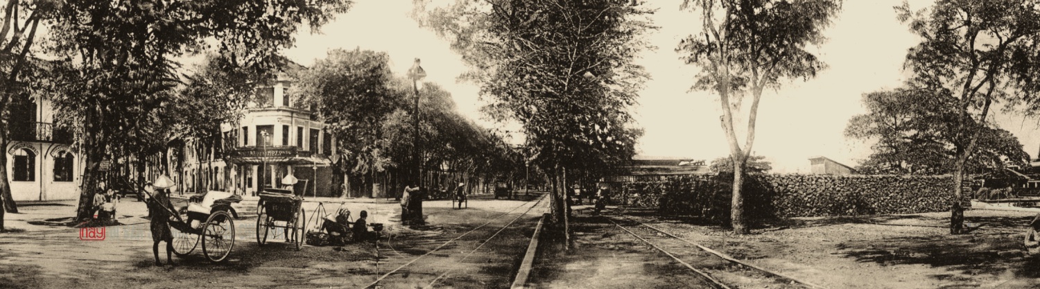
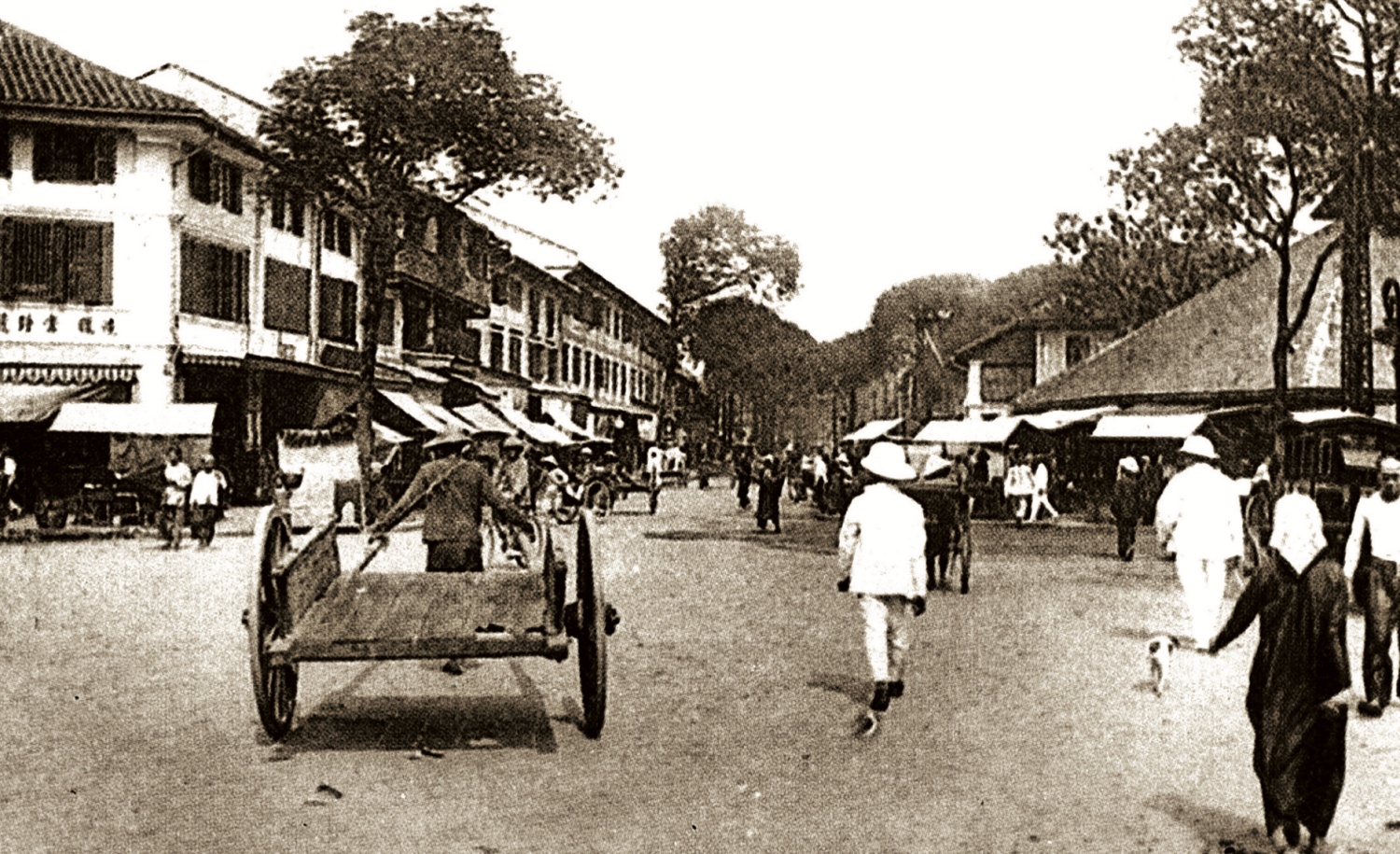
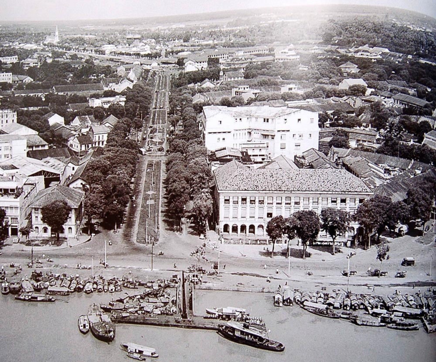
Le Loi Street is one of the oldest and most iconic streets in the city. Originally a 0.8 km canal dug between 1861 and 1862, the road alongside the canal was initially called Street Number 13 before being renamed Bonard Street in 1865. |
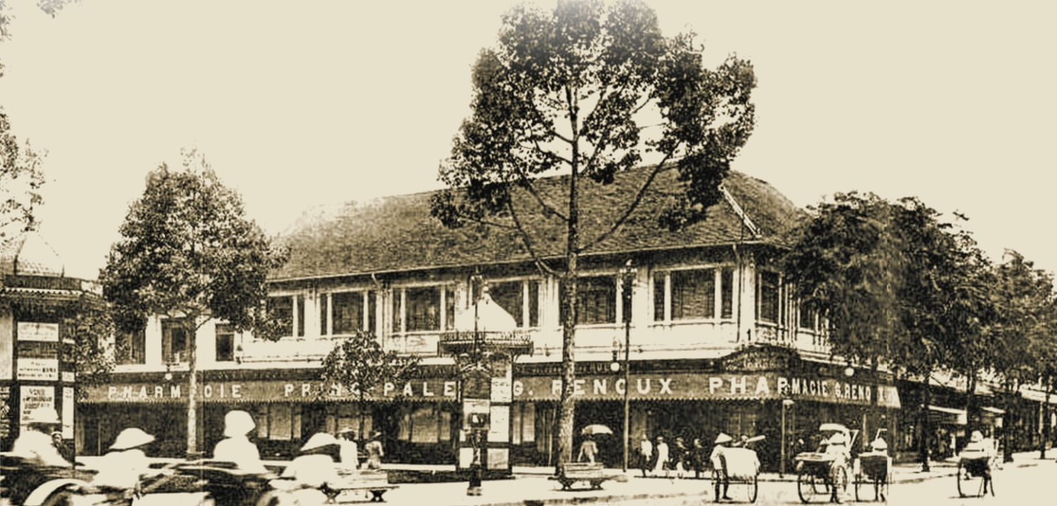 |
Le Loi Street was also one of the busiest streets in old Saigon, home to numerous hotels and shops of major brands. |
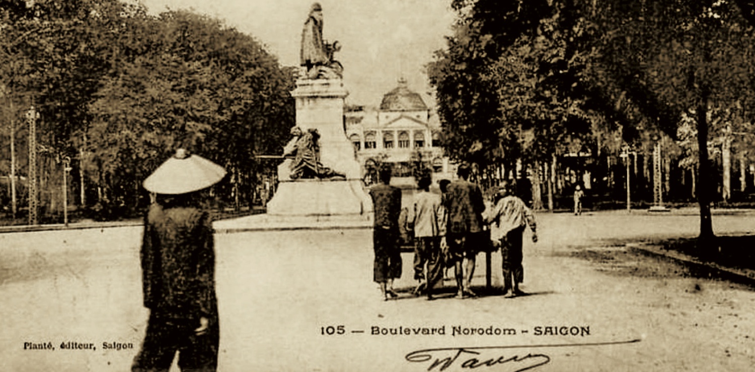 |
Le Duan Street, formed in the 1870s, was initially called Boulevard Norodom as it led to Norodom Palace (Independence Palace). This nearly 2 km street is surrounded by some of the city's oldest buildings, including Notre Dame Cathedral, the Onzieme Barracks, and the Botanical Gardens. |
 |
Ho Tung Mau Street was originally called Adran Street and later Georges Guynemer Street. |
 |
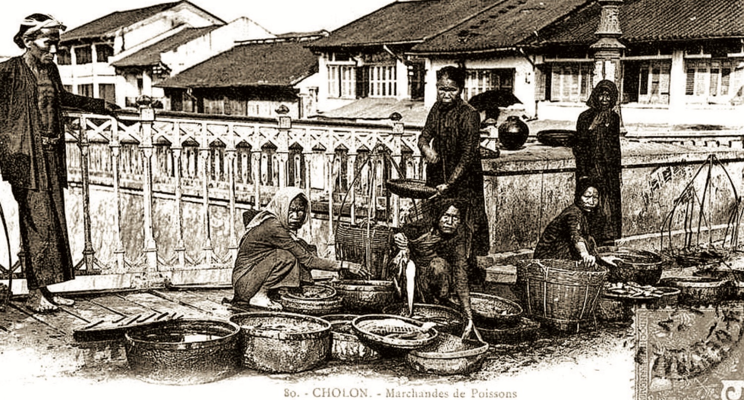
Vendors on Cha Va Bridge, a historical bridge over 100 years old connecting District 5 and District 8, spanning Tau Hu Canal. The area near the bridge was an Indian market specializing in fabrics. According to Nguyen Hanh, the French initially named the bridge Malabar, after a coastal region in western India from which many people emigrated to Saigon. |
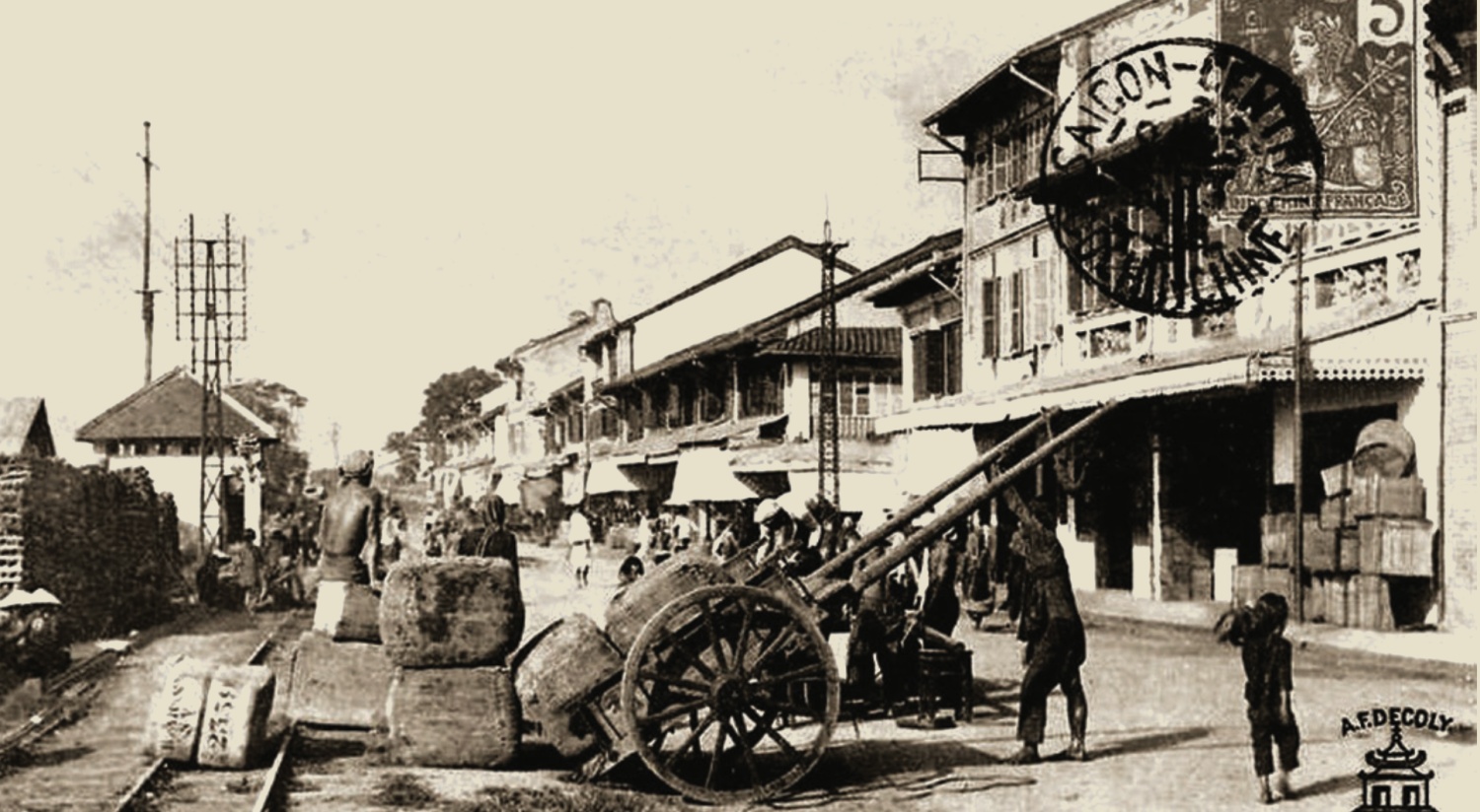
Workers in Cholon in the early 20th century. Until 1865, Saigon and Cholon were separate cities, divided by villages and swampy fields. The French built a road through these fields, and the section from Cholon was named Rue des Marins (Sailors' Street).
In 1916, the two cities were connected by Gallieni Boulevard. Initially paved with laterite, the boulevard was later asphalted, with a central row of electric lights and tram tracks on either side.
 |
Bach Dang Wharf on the Saigon River. This area is located on Ton Duc Thang Street, extending from Khanh Hoi Bridge to Ba Son shipyard. According to researcher Vuong Hong Sen, Bach Dang is named after the three victories against the Mongol-Yuan invaders, commemorating the heroic feats of the Dai Viet army and people. |
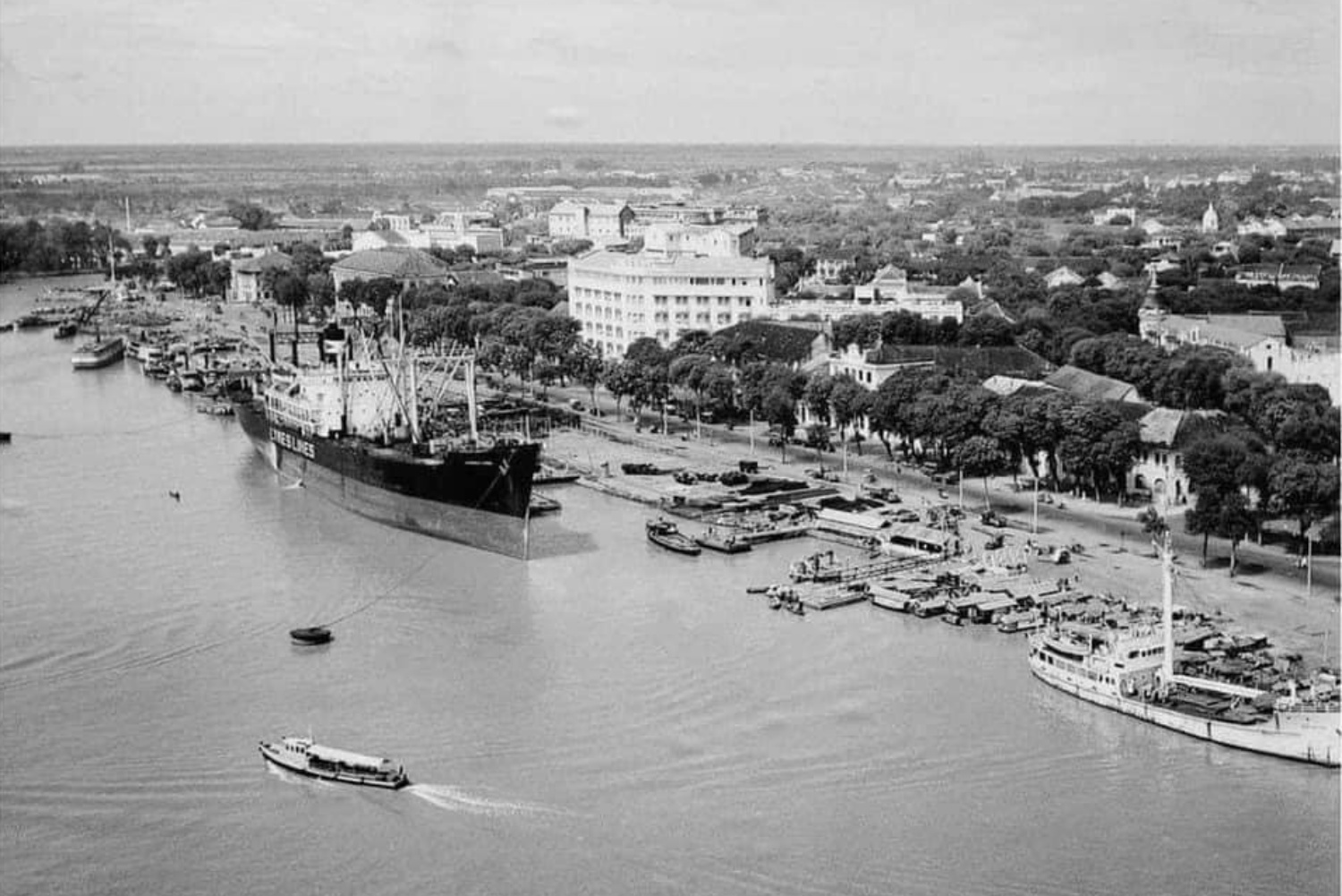 |
River life on the Saigon River. In the middle of the wharf is the Tran Hung Dao Monument, situated in the crescent-shaped Me Linh Square, where six streets intersect: Ton Duc Thang, Thi Sach, Hai Ba Trung, Phan Van Dat, Ho Huan Nghiep, and Ngo Duc Ke. During the French colonial period, this square was called Rigault de Genouilly, after the French admiral and former Governor of Cochinchina. |
 |
Mai Nhat
Photos: Provided by the publisher