

The Department of Dike Management and Disaster Prevention, under the Ministry of Agriculture and Environment, reported that most incidents occurred in Ninh Binh (21), Thanh Hoa (15), and Bac Ninh (6). In Thai Nguyen, the Song Cau river dike, spanning over 2 km, required an additional embankment over 1 m high along a 550 m section because water levels exceeded the dike's crest. In Bac Ninh, the Huu Thuong dike experienced three overflow incidents totaling 850 m in length. Phuc Hoa commune mobilized forces to reinforce the dike.
Pham Duc Luan, director of the Department of Dike Management, stated that rumors of a "Bac Ninh dike breach" circulating this morning were false. "Due to rapid floodwaters from upstream Lang Son, some sections of the Huu Thuong dike in the former Yen The district overflowed," he said.
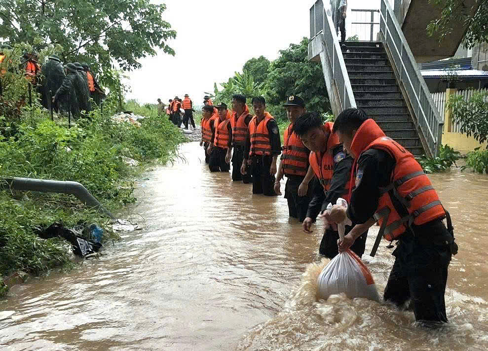 |
Thai Nguyen Police reinforce the Song Cau river dike. *Photo: Thai Nguyen Police*
The aftermath of typhoon Matmo resulted in 8 deaths, including 4 people swept away by floods in Thai Nguyen, 3 fatalities due to landslides, and one person struck by lightning in Bac Ninh. An additional 5 people are missing, with two each from Thai Nguyen and Bac Ninh, and one from Thanh Hoa.
Over 15,700 homes were flooded, primarily in Cao Bang (7,000 homes), Thai Nguyen (5,400), Lang Son (2,000), and Ha Noi (1,000). Furthermore, 14,600 ha of rice and other crops were waterlogged and damaged; over 96,000 poultry and 530 livestock died or were swept away. Flooding, landslides, and traffic congestion occurred at 602 locations across Lang Son, Cao Bang, Thai Nguyen, Ha Noi, Bac Ninh, and Thanh Hoa.
At 3h this morning, the Song Cau river at Gia Bay station (Thai Nguyen) exceeded its historical flood peak of 2024 by over 1,9 m. By 9h, water levels receded slowly but remained 1,03 m above the historical high. At Dap Cau station (Bac Ninh), water levels also surpassed alert level three by 0,17 m. Floodwaters on the Thuong river were 1,48 m above alert level three at Cau Son station and nearly 1 m higher at Phu Lang Thuong. The Trung river in Huu Lung (Lang Son) exceeded its historical flood peak of 1986 by about 1,6 m.
According to meteorological forecasts, over the next 12 hours, water levels on the Song Cau river at Dap Cau will continue to rise, while at Gia Bay, they will recede slowly but remain high. Floodwaters on the Thuong river at Phu Lang Thuong could surpass the 1986 peak; the Trung river is likely to peak by noon or this afternoon before gradually receding, though remaining above historical levels.
Over the subsequent 12-24 hours, floodwaters on the Song Cau and Thuong rivers will remain high. The National Center for Hydro-Meteorological Forecasting warns that widespread flooding will persist for the next 3-4 days in Thai Nguyen, Bac Ninh, Lang Son, and Cao Bang. Low-lying areas and riverside urban centers face risks of deep inundation, riverbank erosion, flash floods, and landslides on slopes.
Gia Chinh


