

According to the recently approved plan, Ca Mau province will implement 29 projects expected to protect over 300 km of dikes and embankments. These projects will focus on three categories: coastline restoration, coastal protection, and riverbank protection.
The chosen solutions are tailored to geological and hydrological conditions, combining hard engineering with soft, ecological approaches. A key focus of the plan is prioritizing the treatment of highly dangerous erosion areas that directly impact residential communities and infrastructure along rivers and coasts.
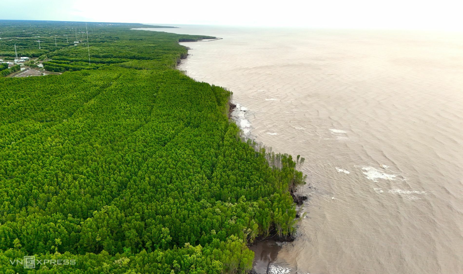 |
Coastal erosion in Ca Mau has led to the loss of significant protective forest areas. *Chuc Ly*. |
In addition to engineering solutions, Ca Mau is also promoting non-engineering measures. These include public awareness campaigns, community disaster preparedness drills, and increased inspection and handling of illegal construction and production activities that exacerbate erosion risks.
Ca Mau has three sides bordering the sea, with a total coastline length of about 310 km, of which over 200 km are currently experiencing erosion. Its low-lying terrain, influenced by two tidal regimes, weak geological foundations, and a dense network of rivers and canals, means the province frequently faces severe flooding and erosion risks.
During the 2011-2025 period alone, coastal erosion resulted in the loss of approximately 6,250 hectares of land and protective forests. This caused extensive damage to various structures, including sea dikes, sluices, roads, and embankments, directly impacting the livelihoods of coastal residents.
Chuc Ly


