

Quang Tri province saw clear skies on August 31st. Floodwaters in rivers and streams receded rapidly, with only the Gianh River at Dong Tam station remaining above warning level 1 at 0.73 m. Other rivers are below warning level 1.
Of the 21 flooded points reported yesterday at fords and submerged roads in the mountainous regions, causing traffic disruptions, only 9 remain flooded as of this morning. Kim Phu commune still has 7 flooded points, Phong Nha commune has one point with floodwaters about 2 m deep, and Truong Son commune at the Khe Ngang ford has 1.2 m deep water stretching for 100 m. Barriers and guards are in place at all these locations to prevent people and vehicles from crossing.
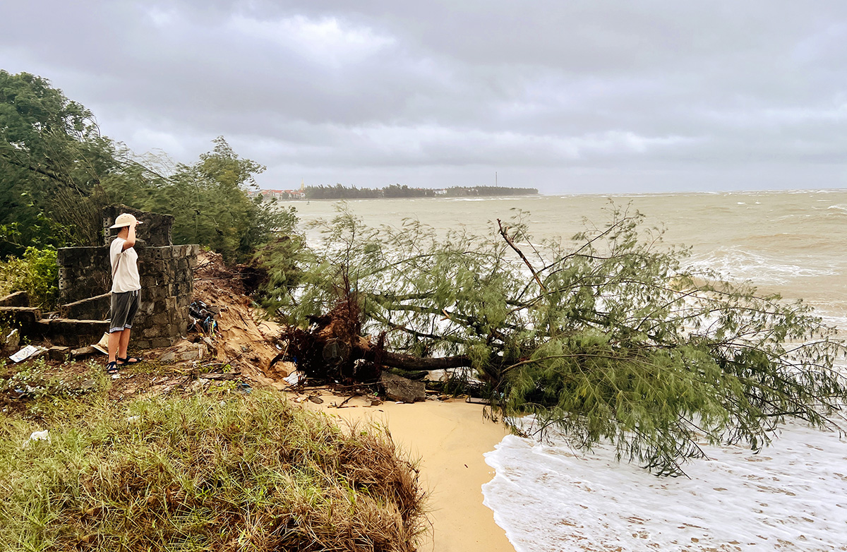 |
The coast of Bac Trach commune, Quang Tri province, suffered from seawater intrusion, with many casuarina trees washed away by waves on the morning of 31/8. Photo: Dac Thanh |
The coast of Bac Trach commune, Quang Tri province, suffered from seawater intrusion, with many casuarina trees washed away by waves on the morning of 31/8. Photo: Dac Thanh
Flooding and landslides have affected provincial road 517 through Ben Quan and Lao Bao communes, disrupting traffic. Thuong Trach commune has 4 hamlets and one school site affected by landslides, impacting 28 households. A wind turbine tower of a business in Huong Phung commune experienced a landslide of about 70 m, with a cross-section of about 40 m wide affected.
Many areas in Ha Tinh province were clear and rain-free this morning. Floodwaters in mountainous communes are receding slowly, with many areas still inundated due to yesterday's heavy rain. In Son Tien commune, roads to An Thinh, Tien Thinh, and Dong Eo hamlets have become waterways, with some sections submerged under nearly half a meter of water. The An Thinh hamlet cultural house is isolated, requiring residents to take detours.
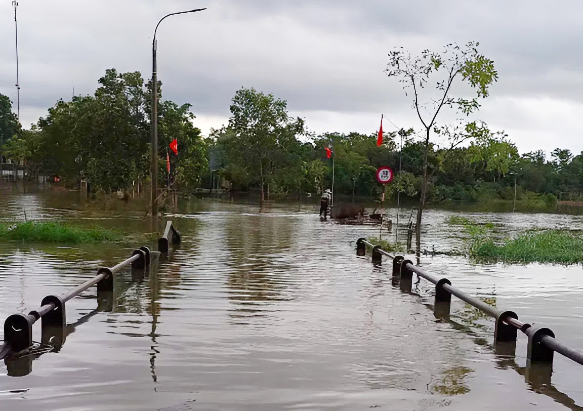 |
Some roads in Son Tien commune remain flooded with 30-50 cm of water, isolating many households, on the morning of 31/8. Photo: Hung Le |
Some roads in Son Tien commune remain flooded with 30-50 cm of water, isolating many households, on the morning of 31/8. Photo: Hung Le
In Son Kim 2 commune, the Duong Dau tea fields in Tien Phong hamlet are flooded, and the Kim Binh bridge is deeply submerged. Authorities have erected barriers and deployed personnel around the clock for warnings. Heavy rains also caused a hillside collapse in Quyet Thang hamlet, with dozens of cubic meters of earth and rock spilling onto the road, creating a potential hazard.
Authorities have dispatched personnel to vulnerable locations, placed warning signs, and guided residents to limit travel. People are advised to secure their belongings, stay away from landslide-prone areas, and not attempt to cross flooded areas.
Some mountainous communes in Nghe An province experienced intermittent light rain, each lasting 5-10 minutes. This morning, a section of a mountain collapsed onto National Highway 7 near Tuong Duong commune. Earth and rock covered a section of the road more than 8 m wide, blocking the main route connecting western Nghe An with the Nam Can border gate in both directions. Earlier, prolonged heavy rain following Typhoon Kajiki caused several landslides on the route, which have not yet been fully addressed.
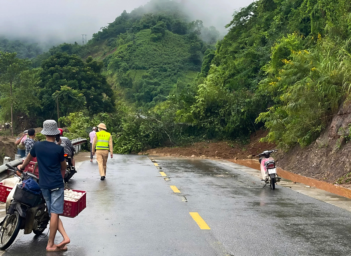 |
National Highway 7, a section passing through the former Tuong Duong district, experienced landslides on the morning of 31/8. Photo: Duc Hung |
National Highway 7, a section passing through the former Tuong Duong district, experienced landslides on the morning of 31/8. Photo: Duc Hung
National Highway 7, spanning 227 km, runs from the former Dien Chau district (intersecting National Highway 1) to the Nam Can international border gate, previously in Ky Son district, bordering Laos. It is a vital artery in North Central Vietnam, playing a strategic role in the socio-economic development of the western region of Nghe An province.
Earlier, on the morning of 27/8, a low-pressure area intensified into a tropical depression over the East Sea, heading towards the central coast. By the morning of 30/8, the tropical depression strengthened into Typhoon Nongfa, making landfall in Ha Tinh - Quang Tri that afternoon, bringing winds of level 7-8 and heavy rain before quickly weakening.
Nongfa is the sixth typhoon in the East Sea this year. Forecasts predict 8-11 typhoons in the East Sea this year, with 3-5 directly impacting Vietnam's mainland.
Dac Thanh - Duc Hung


