

 |
Mangrove trees lie tilted on the eastern coast, battered by years of wave action. *Chuc Ly* |
Ca Mau, Vietnam's southernmost province, is surrounded by water on three sides. Of its 310 km coastline, 204 km are eroding at varying degrees.
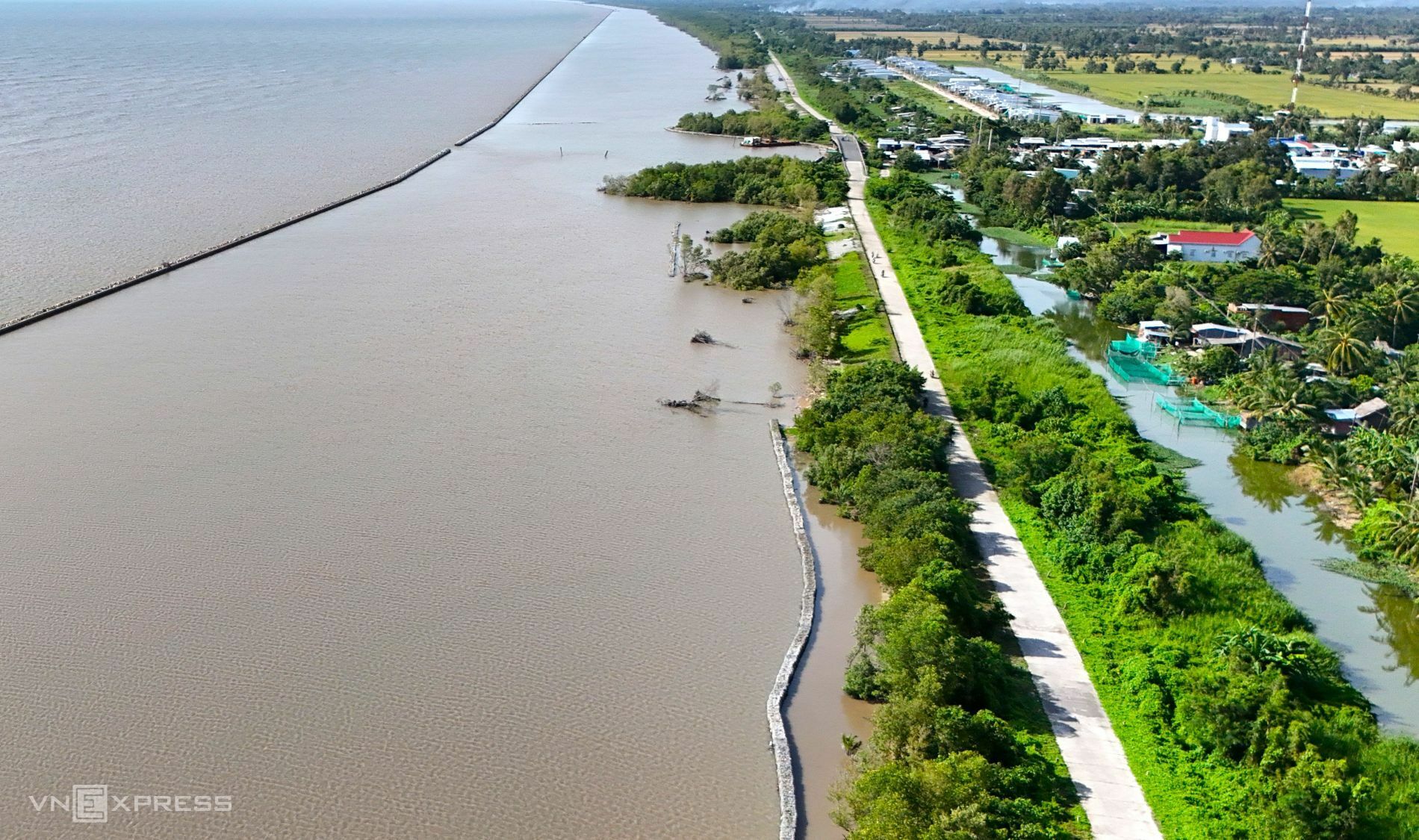
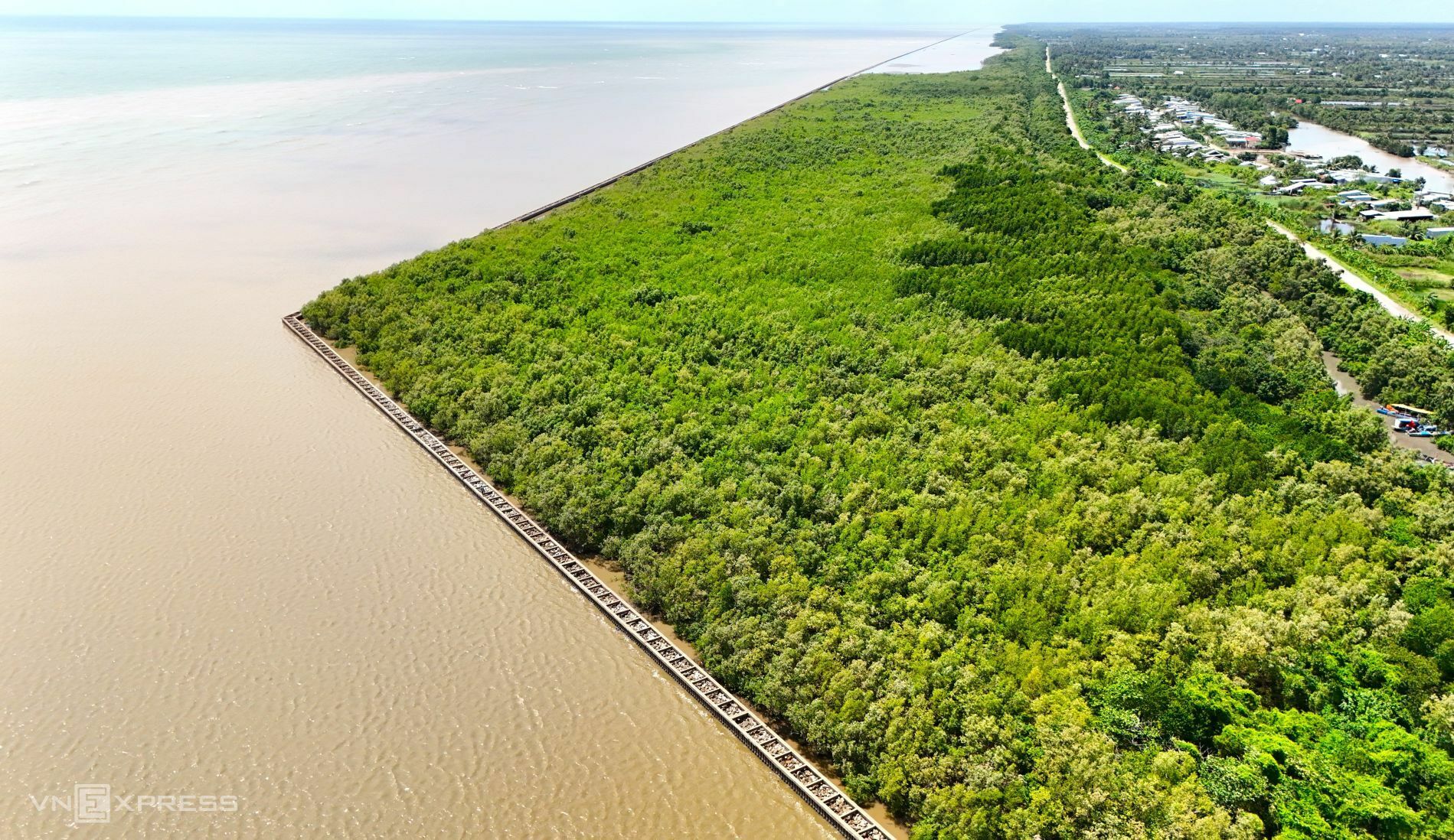
During the rainy and typhoon seasons, erosion and coastal encroachment become more frequent, affecting the lives and livelihoods of tens of thousands of residents. This image shows the western coastline with its sea dike system. Despite sections of seawall, the 1.6 m height allows waves to breach the defenses, damaging protective forests.
 |
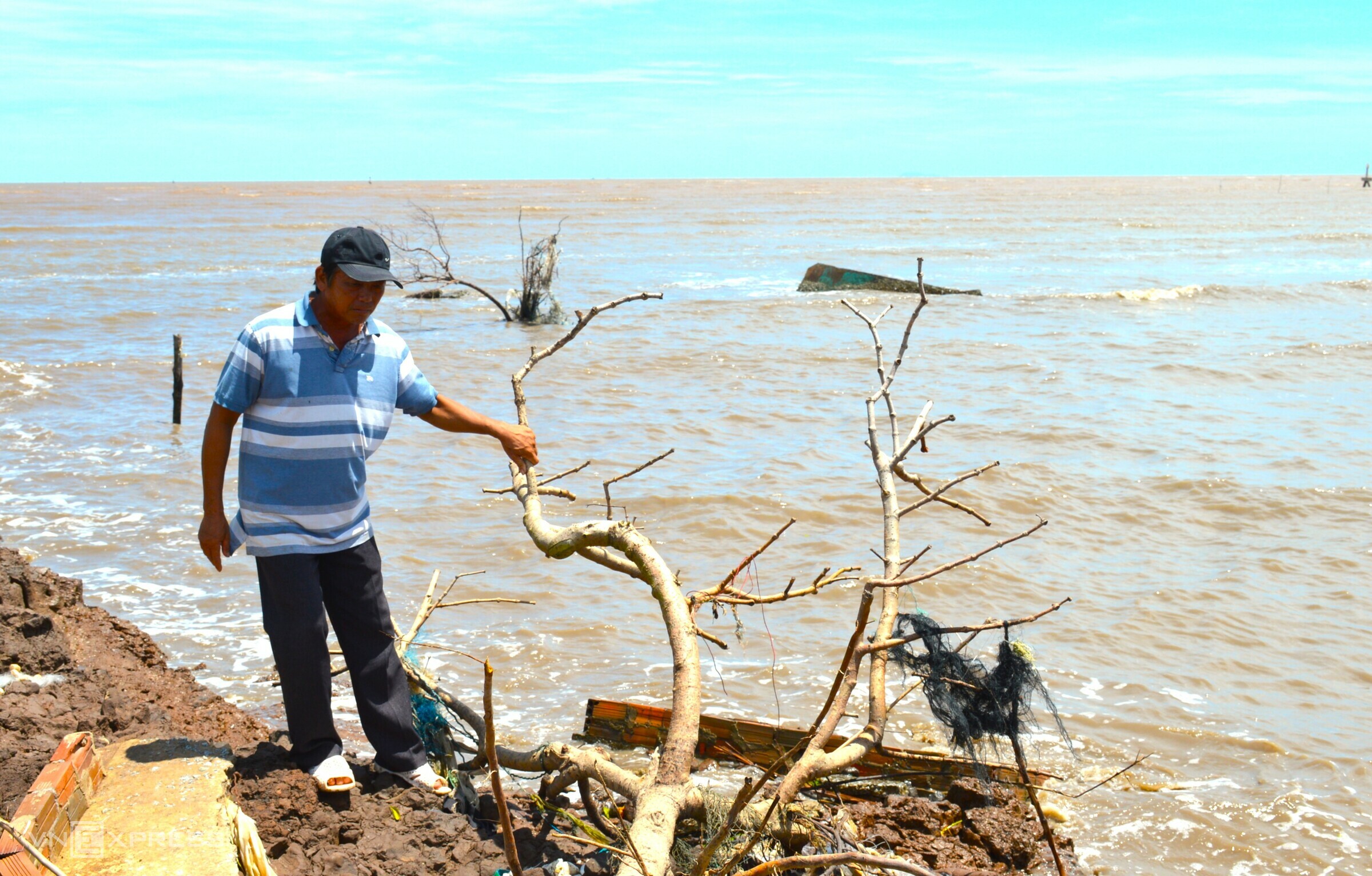
At Rach Goc estuary in Phan Ngoc Hien commune, erosion has significantly impacted residents' lives, forcing many to abandon their homes. *Chuc Ly* |
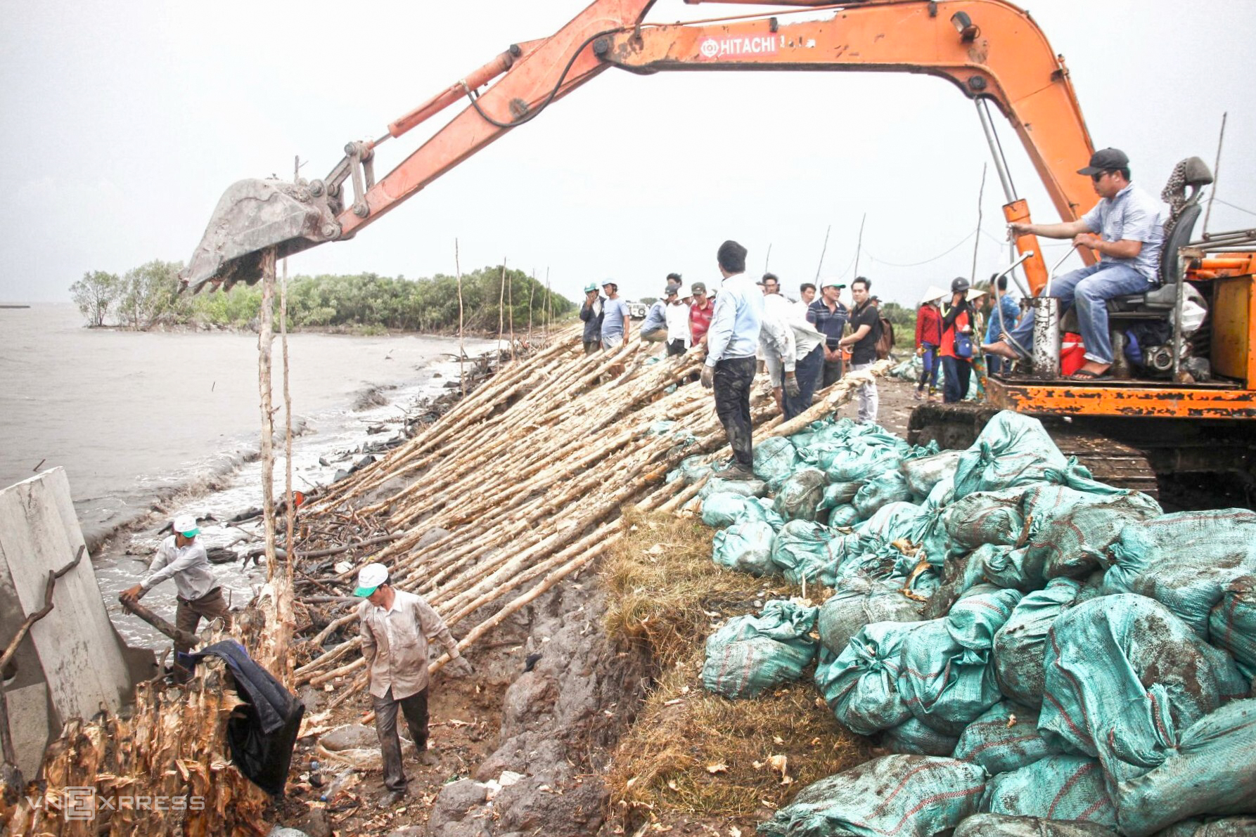
A severely eroded section over 100 m long, just 3 m from the dike, is located in Sao Luoi A hamlet, Da Bac commune, on the western coast. Authorities have reinforced existing seawalls with rock baskets to mitigate the impact of waves.
Ca Mau's 108 km western sea dike plays a crucial role in protecting the lives and livelihoods of tens of thousands of people, as well as freshwater zones and the U Minh Ha mangrove forest. Six erosion points have been identified along the dike, two of which are considered especially dangerous.
 |
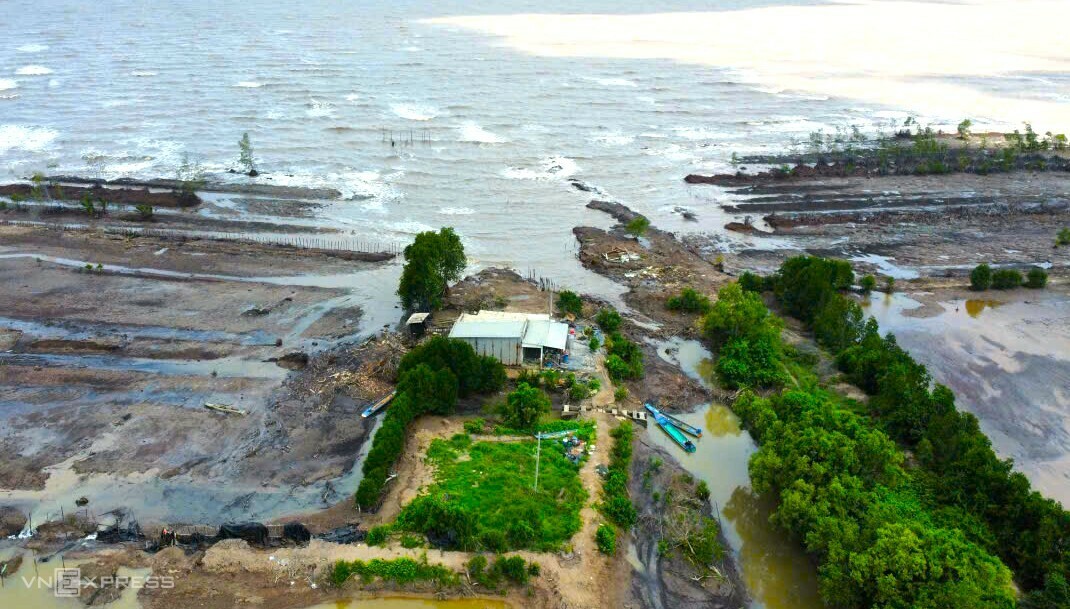
The over 6 km stretch of coastline from Kien Vang to Ong Ta at Vam Lung estuary is experiencing severe erosion, with the protective forest washed away, threatening homes. *Chuc Ly* |
 |
Nguyen Van Cuong stands on the remains of his former home in Cai Doi Vam commune, now reduced to concrete fragments and debris washed ashore. *Chuc Ly* |
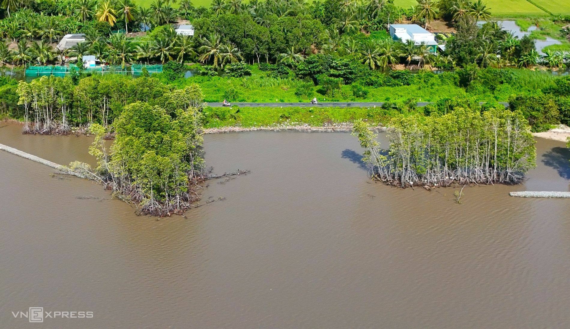
Although a seawall protects the western sea dike section passing through the former Tran Van Thoi district, rising sea levels are eroding the protective forest, bringing the water closer to the dike's base.
In August 2019, Typhoon 3 caused seawater to overflow this section of the western sea dike. Authorities used mangrove trees and soil for temporary reinforcement.
 |
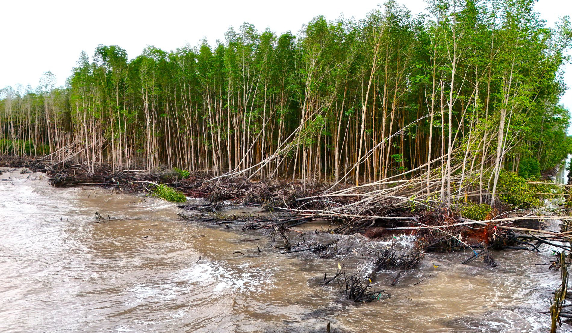
A section of protective forest in U Minh commune shows bare, fallen tree trunks.
Bui Quoc Nam, deputy head of the western sea dike management unit at Ca Mau's Department of Irrigation, said sections without protective forests are highly vulnerable to erosion, especially from August to the end of the year, during the southwest monsoon season. These areas are being reinforced with rock baskets to protect the dike, and additional rock fill will be placed between the seawall and the dike.
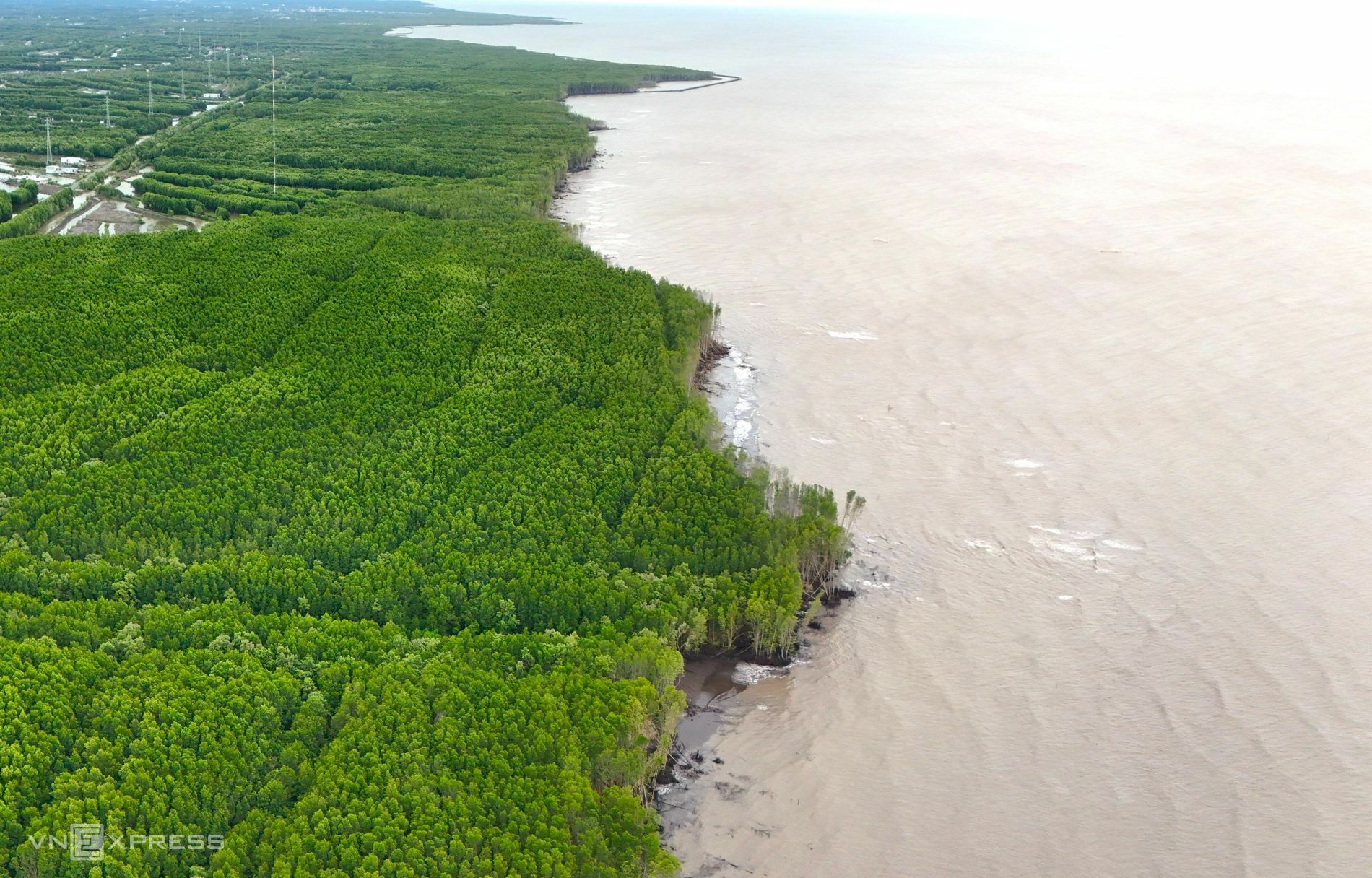 |
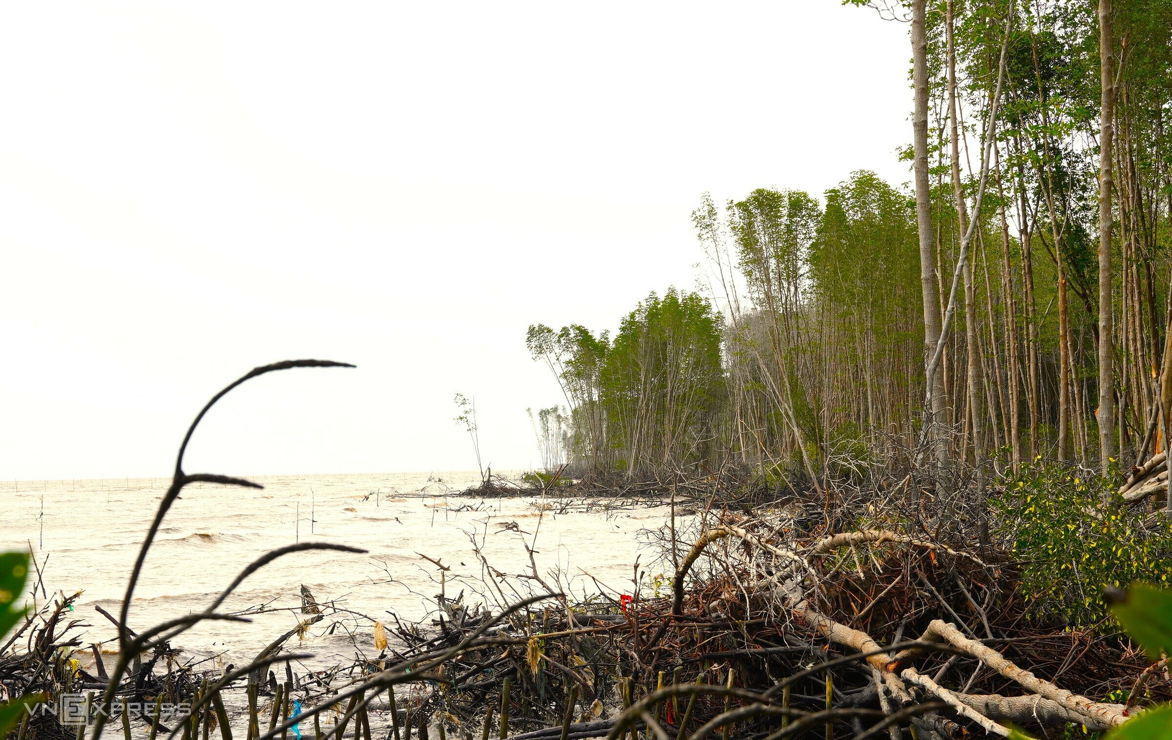
On the eastern coast, nearly 100 km are severely eroded, with significant portions of the protective forest lost, receding inland by tens of meters.
Between 2011 and 2025, coastal erosion in Ca Mau has claimed approximately 6,250 ha of land and protective forest. The province's low-lying topography, influenced by two tidal regimes, weak geology, and dense network of rivers and canals make it particularly susceptible to flooding.
 |
 |
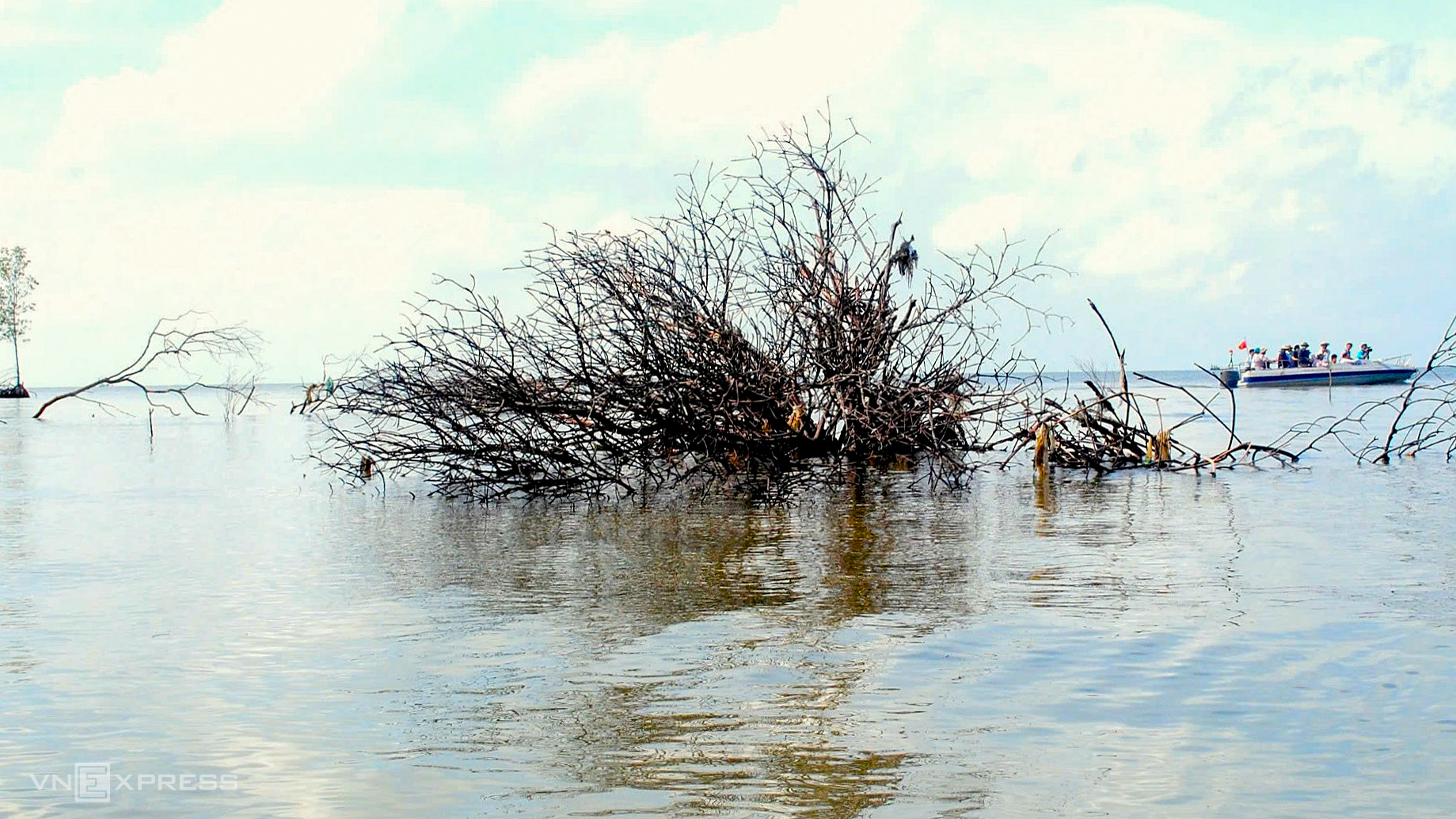
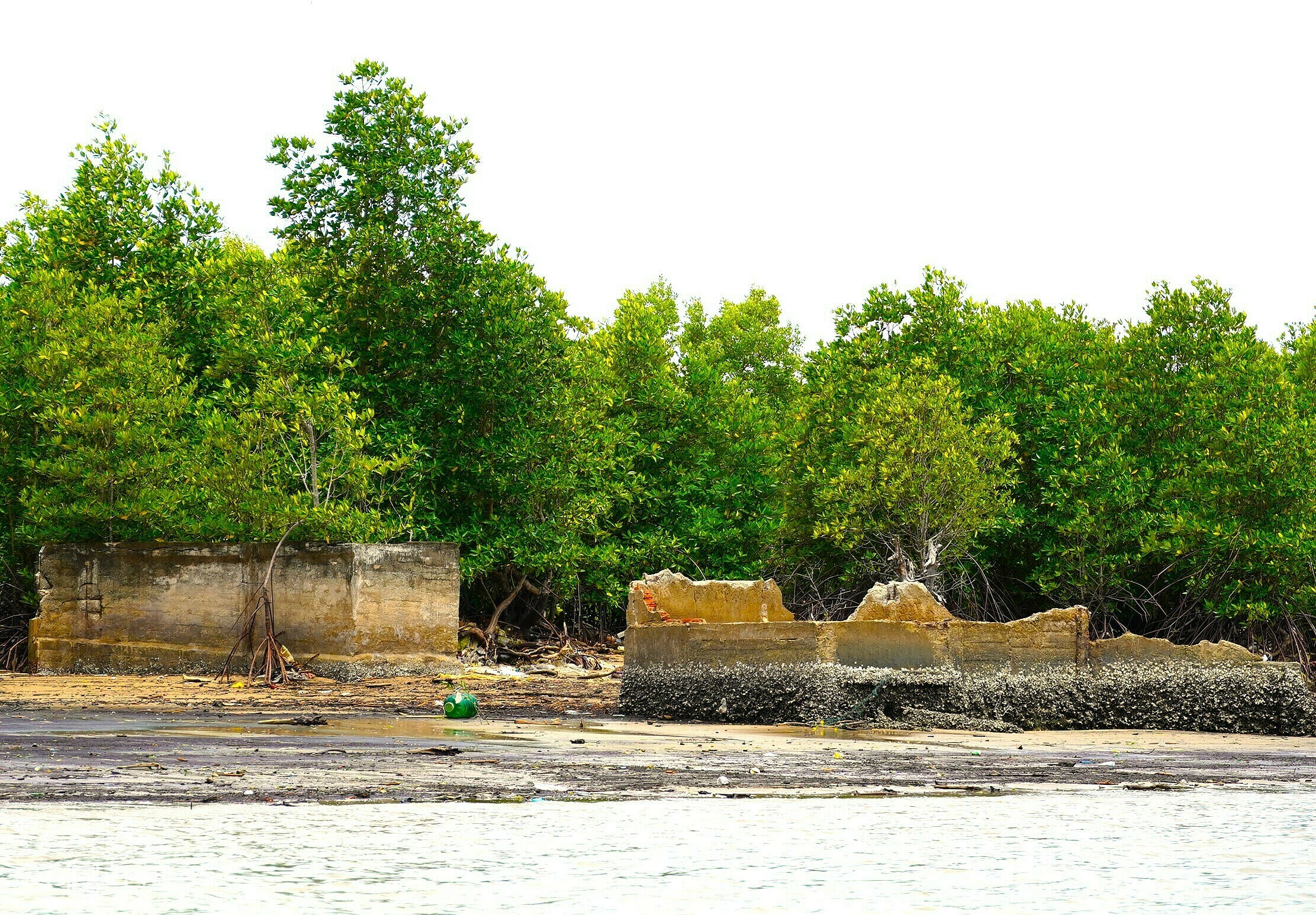
An eroded section of coastline in the former Vien An Dong commune (now Phan Ngoc Hien commune) shows mangrove trees battered by waves.
According to Nguyen Thanh Tung, director of Ca Mau's Department of Irrigation, the eastern coastline is a "hotspot" for erosion due to the lack of a sea dike system. Many residents have lost their homes and livelihoods due to erosion.
 |
 |
 |
 |
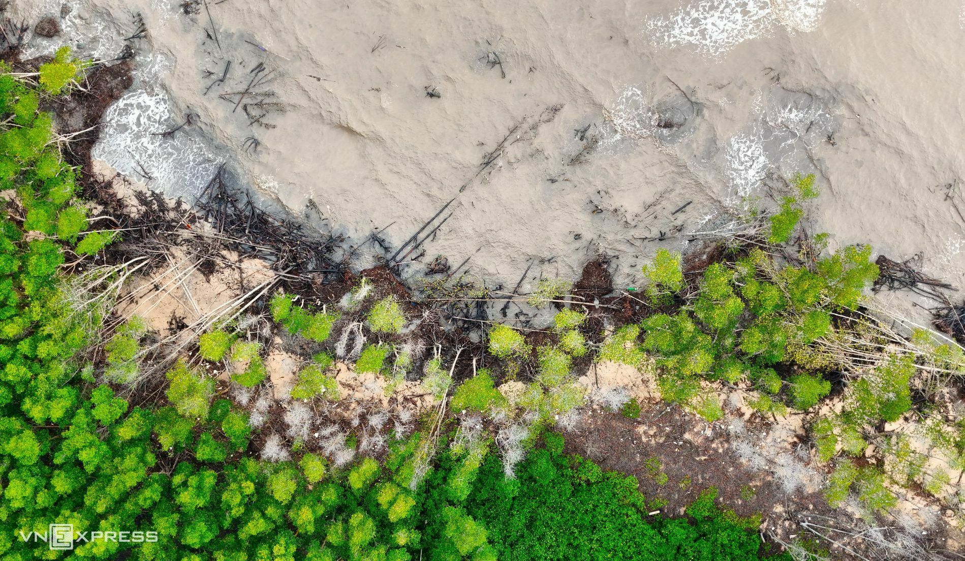
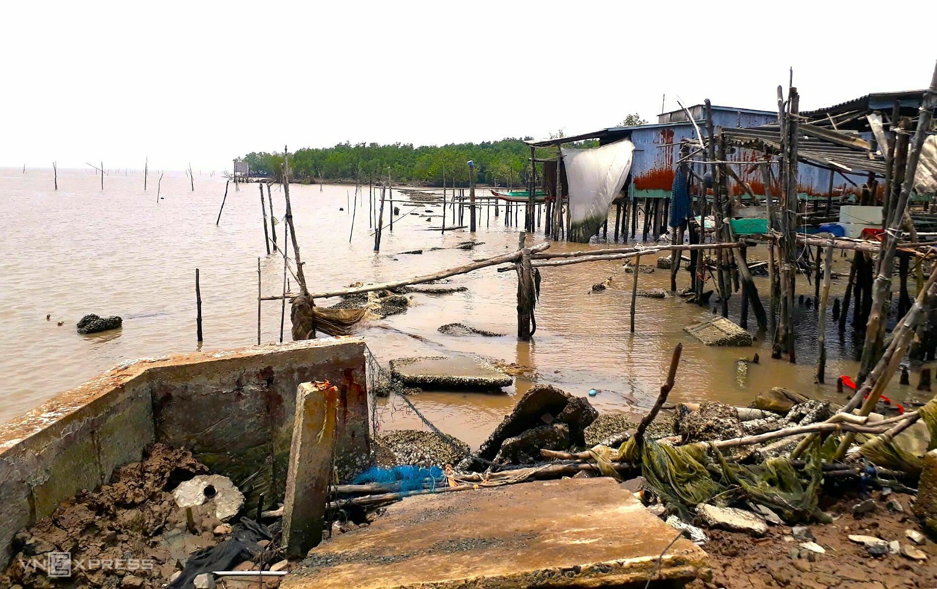
Erosion on the eastern coast not only destroys protective forests but also damages public infrastructure and shrimp farms.
The image shows Nguyen Thi Pho's house in Cho Thu B hamlet, Tan An commune, precariously located near the Bo De estuary, a hotspot for erosion.
Pho said her family built the house near the coast for shrimp farming. In recent years, erosion has intensified. A decade ago, the protective forest extended hundreds of meters from the shore, but it's now gone, leaving the shrimp farm vulnerable to waves.
 |
 |
Ca Mau province has constructed about 93 km of seawalls at a cost of 3,590 billion dong. These structures have effectively reduced wave action and erosion, and have begun to facilitate accretion and restore nearly 1,000 ha of protective forest.
In the former Bac Lieu area, 6.5 km of riverbank protection have been built for 435 billion dong, along with over 12.4 km of submerged breakwaters to reduce wave action and encourage accretion, costing 823.4 billion dong.
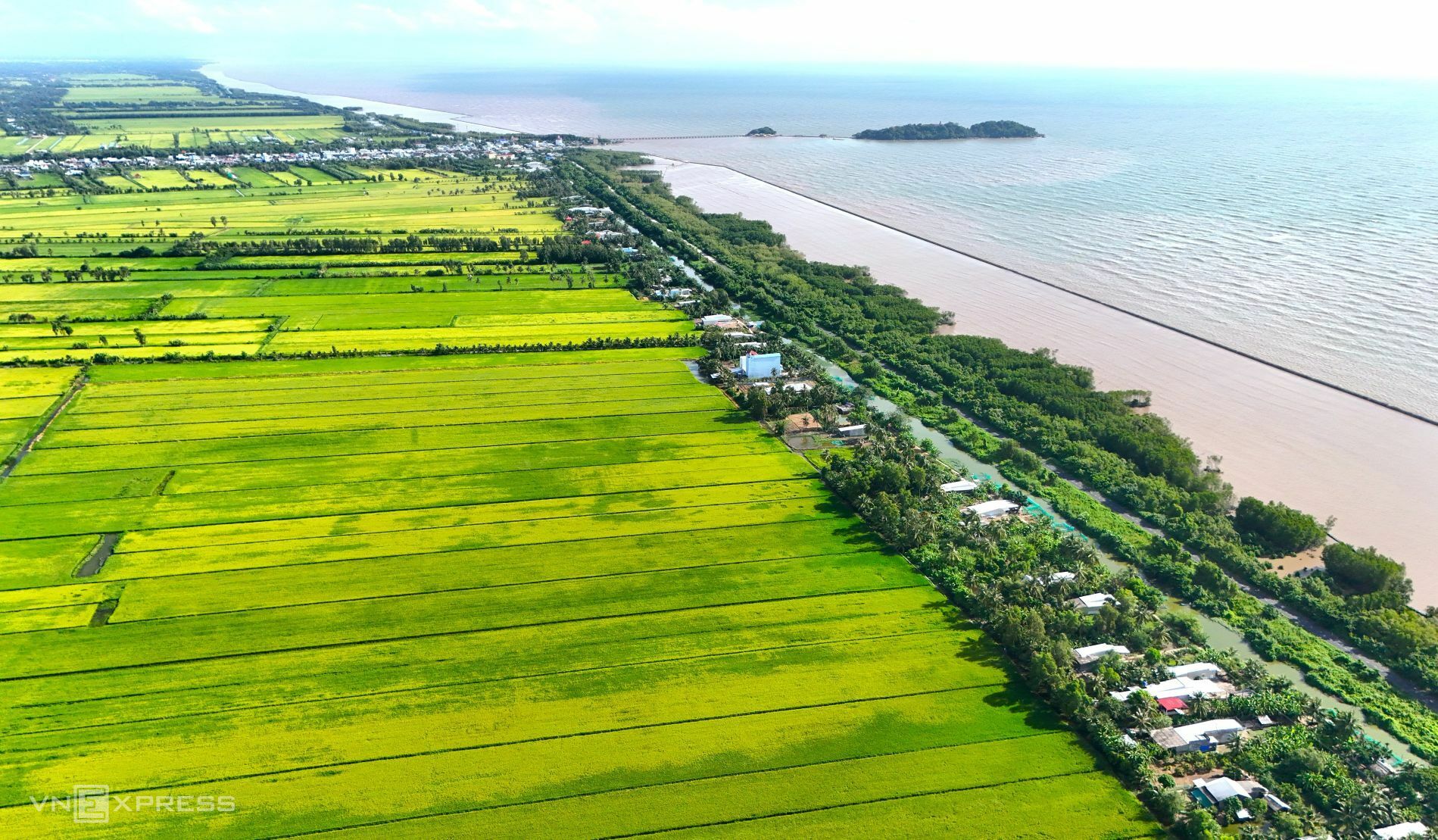 |
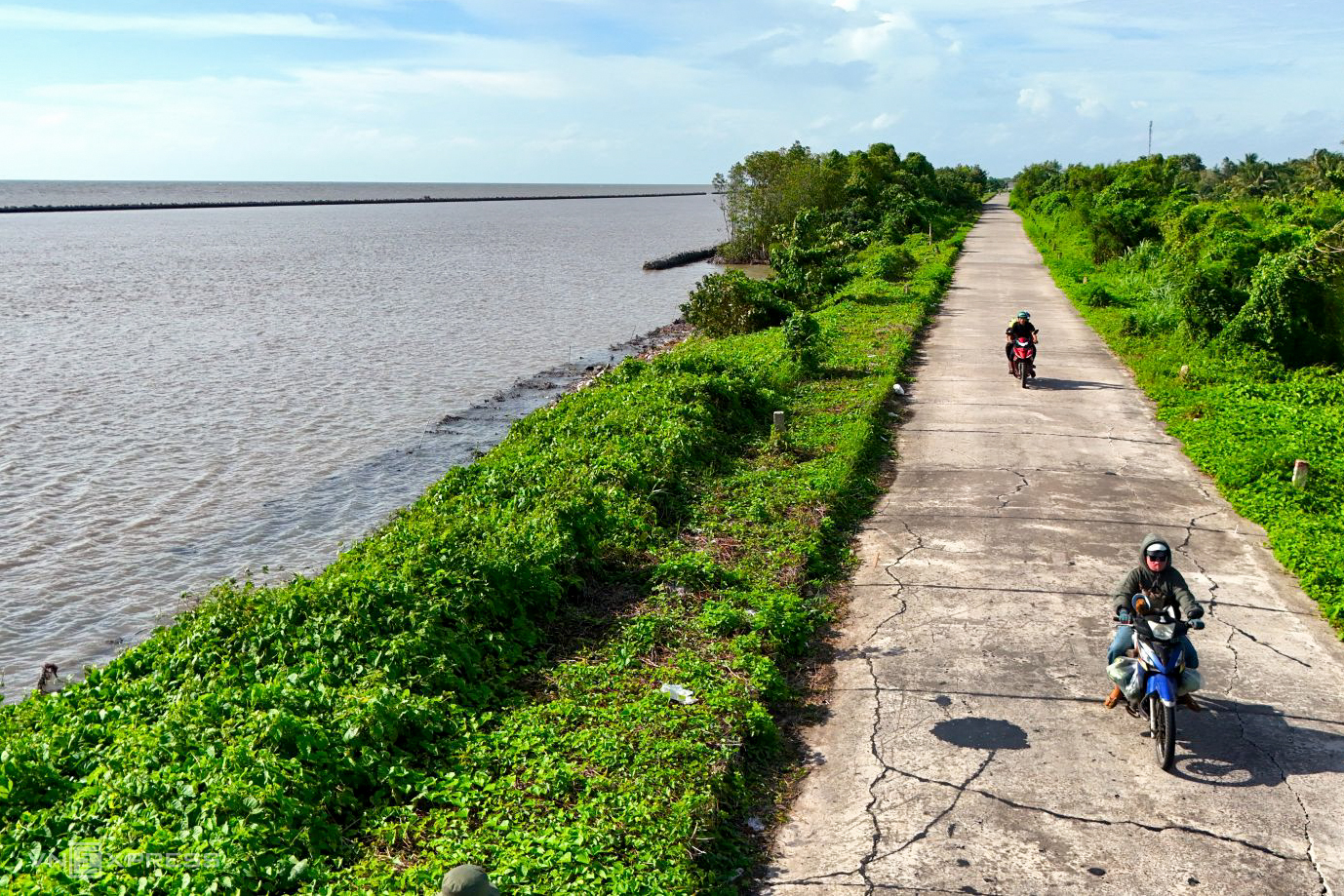
15 km of seawalls in Da Bac commune have enabled stable rice production, freeing residents from the constant threat of encroaching waves.
Ca Mau province requires 235 projects to address coastal and riverbank erosion, improve residential infrastructure, and replant forests, at a total cost of over 35,000 billion dong.
The former Bac Lieu province has identified 50 projects for investment by 2030, totaling over 28,000 billion dong, to mitigate erosion and its impact.
Chuc Ly


