On the afternoon of 5/9, the Phu Tho Department of Agriculture and Rural Development's Sub-department of Irrigation and Water Resources reported that due to high water levels and strong currents in the Thao River (Red River), a centuries-old alluvial deposit used for growing crops in Tam Nong commune has been eroding since August 28.
The total eroded length is about 2 kilometers, spread across several areas. At Ben Got and Dong Sau areas, formerly part of Dan Quyen commune, the erosion has impacted about 200 meters of the riverbank and Cau Trang sluice gate (opposite the Trung Ha industrial park gate). An 8-meter stretch of the dike has also been affected.
The riverbank at Dau Duong, formerly part of Dan Quyen commune, has lost about 10 meters. Cua Lam and Giua Huong Non riverbanks have eroded about 870 meters. In residential area 12, formerly part of Huong Non commune, the erosion has affected about 500 meters of riverbank, including about 200 meters of residential land.
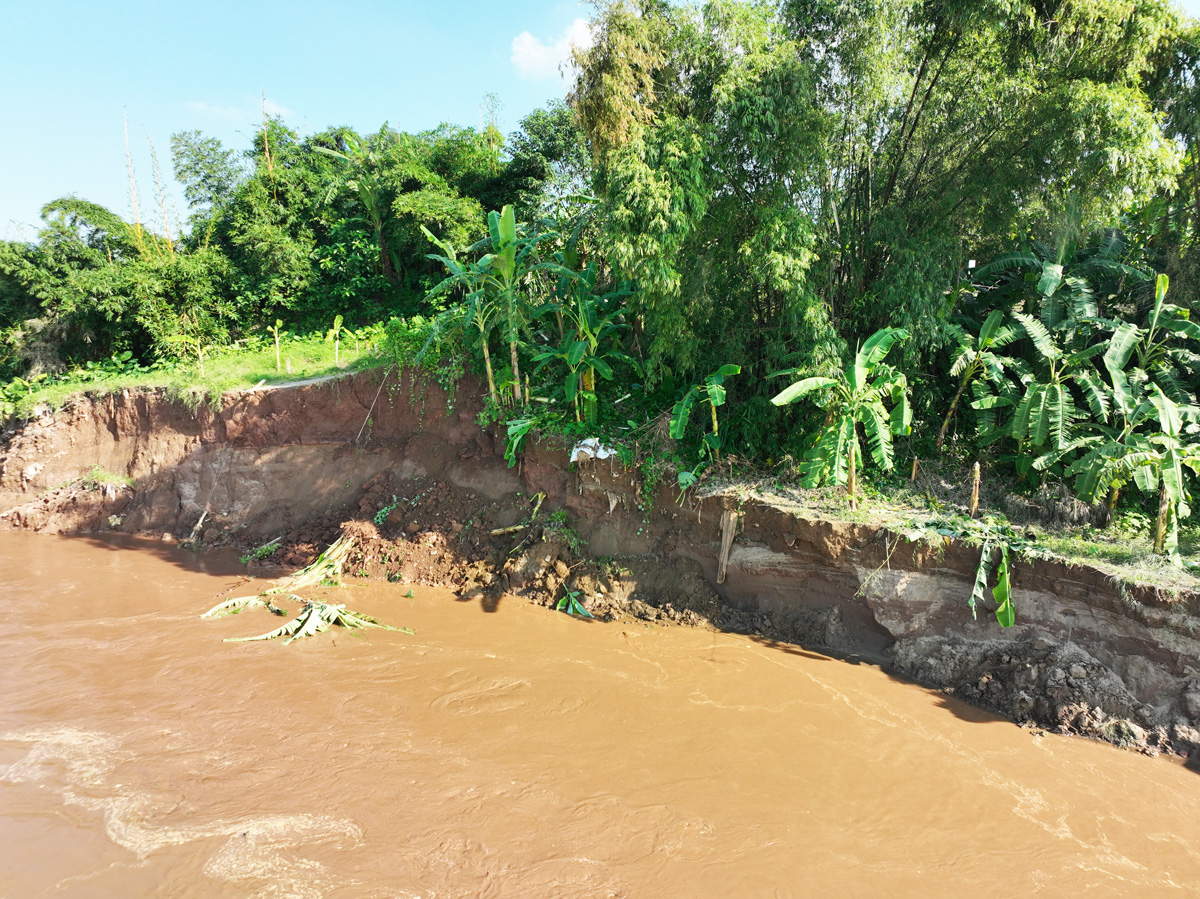 |
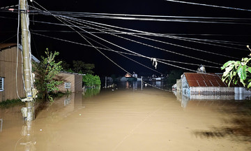
Erosion site in Tam Nong commune. Photo: *Tam Nong Commune People's Committee* |
Phu Tho province has instructed Tam Nong commune to post warning signs and prohibit people and livestock from entering dangerous areas. They have also assigned personnel to assist residents with relocation if necessary, and to coordinate with relevant agencies to survey and propose solutions for severely eroded areas.
Provincial leaders have also tasked the Department of Agriculture and Rural Development to collaborate with local authorities to conduct a comprehensive assessment of the riverbank, reinforce areas at risk of erosion, and promptly submit proposals to the provincial People's Committee for action.
Due to heavy rainfall from Typhoon Kajiki and the tropical convergence zone, at 1 a.m. on 27/8, water levels on the Thao River at the Yen Bai station rose rapidly and peaked at 32.32 meters, 0.32 meters above level three alarm, while the Phu Tho station peaked below level one alarm.
Gia Chinh