

On the afternoon of 28/8, the Ma River's water level in Ham Rong ward dropped more than a meter in 24 hours, falling below alarm level 3. Ward leaders reported the rapid decline is due to reduced rainfall over the past two days.
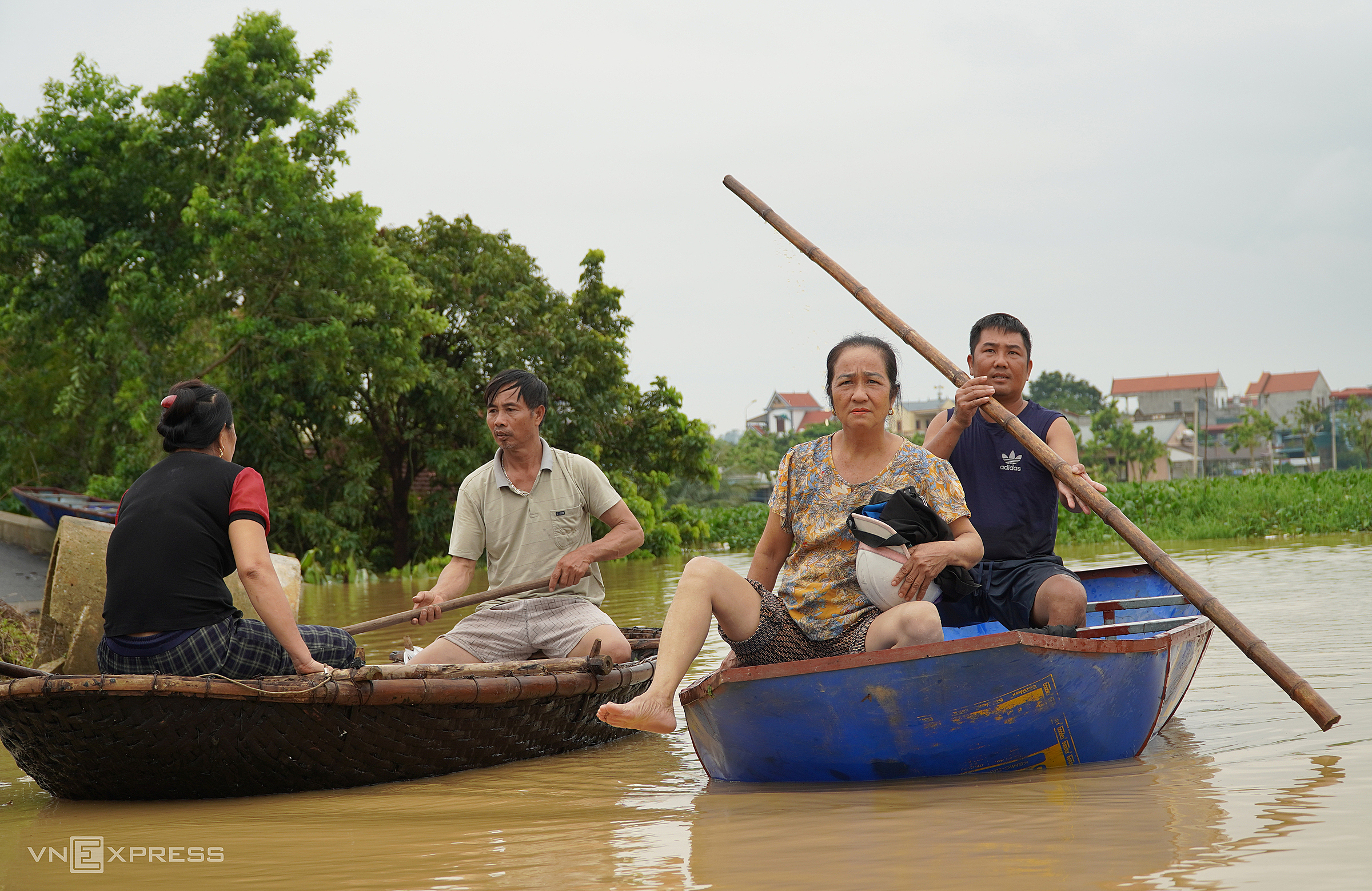 |
Residents of Ham Rong ward use boats to navigate the floodwaters. Photo: Le Hoang |
Ham Rong ward experienced the most flooding in Thanh Hoa province over the past few days, affecting more than 2,100 households and over 7,230 residents. As the water recedes today, some evacuated residents have returned to clean their homes. Roads connecting villages outside the dike system in Ham Rong have reappeared, allowing residents to wade through the water without boats.
Authorities maintain checkpoints along the Ma River dike to provide aid, relief, and guidance to residents navigating deeply flooded and hazardous areas. Police, army personnel, militia, and youth groups are fully mobilized to assist families in cleaning their homes and belongings.
Local authorities estimate that unless there is unusually heavy rainfall upstream, most residents in the seven neighborhoods outside the dike system in Ham Rong ward can return to their normal lives within 3 to 4 days.
Today, floodwaters on most major rivers in Thanh Hoa, including the Chu, Buoi, Len, and Cau Chay, have significantly receded. Only the Buoi River at the Kim Tan station remains more than a meter above alarm level 3; most other areas have dropped to alarm levels 1 or 2. Like in Ham Rong, residents in flooded areas of Cam Thuy, Thach Thanh, and Yen Dinh districts are returning to clean up.
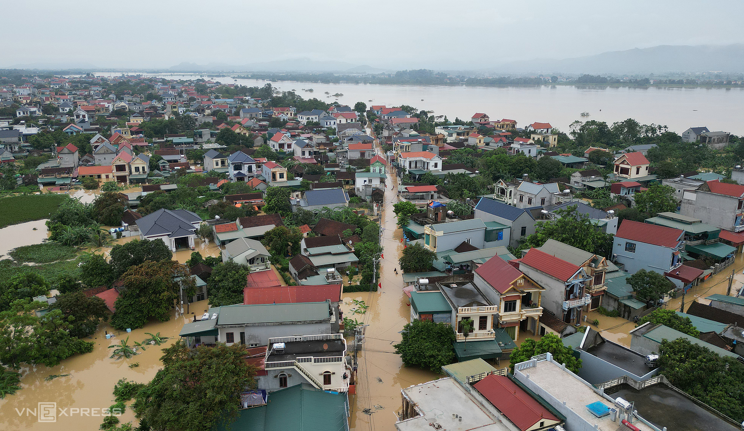 |
Floodwaters inundated over 2,000 houses in the Ma River basin, Ham Rong ward, on 27/8. Photo: Le Hoang |
Floodwaters have mostly receded from deeply flooded sections of National Highways 1, 10, 45, 47, and 217 passing through Thanh Hoa, allowing traffic to resume. However, due to wet road surfaces and remaining mud, traffic police have set up checkpoints and advised drivers to reduce speed for safety.
The most challenging travel conditions in Thanh Hoa are currently on routes to border communes adjacent to Laos, particularly National Highway 47 to Yen Nhan and Bat Mot communes. Pham Van Tuan, Deputy Director of the provincial Department of Construction, reported 15 serious landslides along the 37 km stretch of National Highway 47 from Yen Nhan to Bat Mot, causing local traffic disruptions.
Due to the complex terrain and prolonged heavy rain, authorities have not yet fully accessed the entire route to determine the exact volume of landslide debris. The Department of Construction is collaborating with road management units to mobilize machinery, equipment, and personnel to address the landslides and restore full access as soon as possible.
Severe landslides have isolated many villages in Yen Nhan, Bat Mot, and Tam Thanh communes (formerly in Thuong Xuan and Quan Son districts). In addition to road clearing efforts, police, army, and border patrol personnel are trekking through the forest, carrying instant noodles, drinking water, and essential supplies to the villagers.
Typhoon Kajiki made landfall in Thanh Hoa and Ha Tinh provinces on the afternoon of 25/8, with winds of level 10-11, gusting to level 13, lasting 10 hours and causing heavy rain from North Central Vietnam to several northern provinces. The storm resulted in five deaths, three missing persons, and 47 injuries. It also caused 32 houses to collapse and nearly 31,100 houses to be damaged, mainly in Ha Tinh, with nearly 25,000 houses damaged and almost 4,000 flooded. 407 schools, 48 health facilities, 72 office buildings, and cultural structures were also damaged.
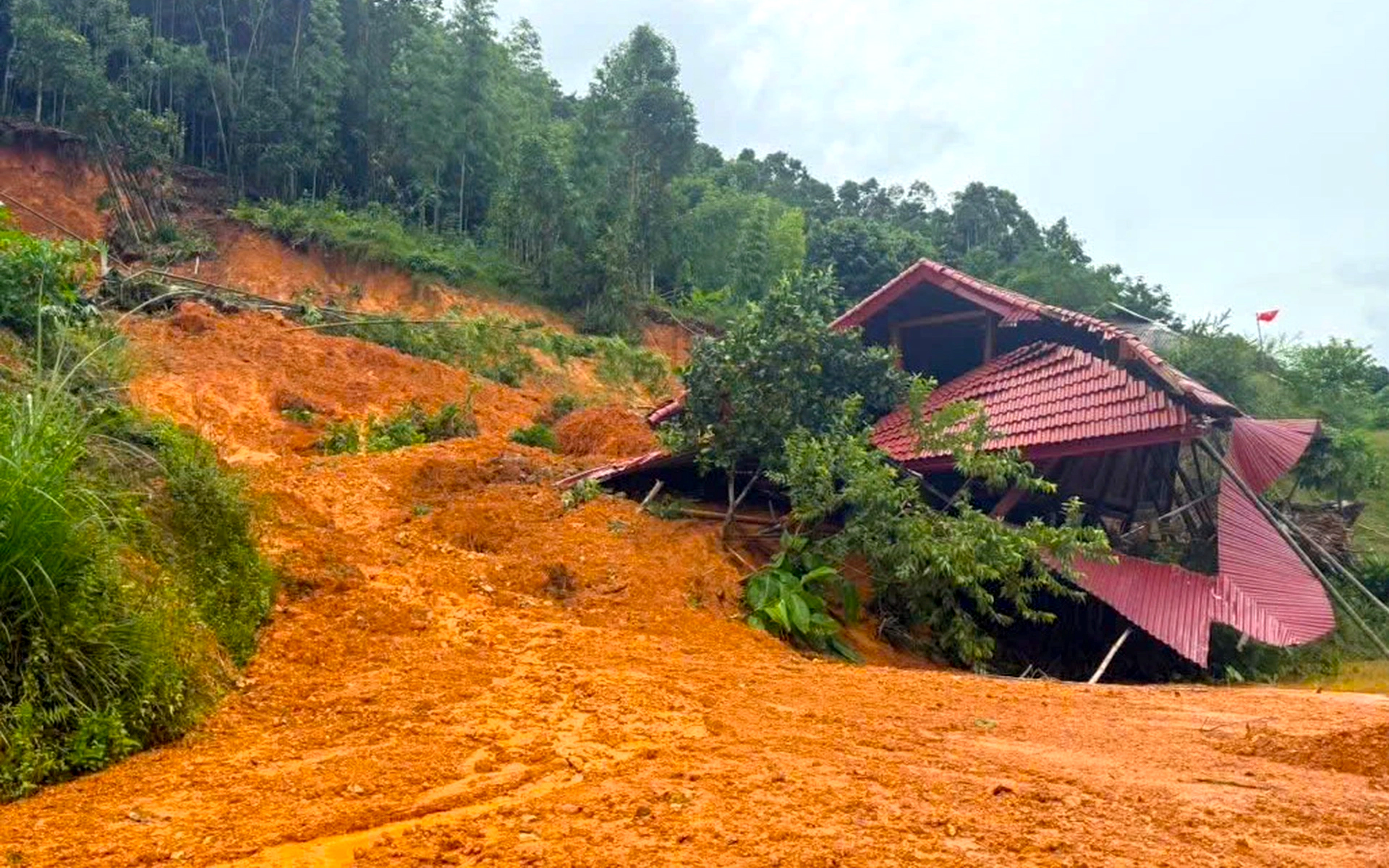 |
A house in Yen Nhan commune buried and damaged by a landslide. Photo: Ha Thuy |
Among the three provinces directly affected by Typhoon Kajiki, Thanh Hoa experienced the most devastating flooding. The storm's circulation brought heavy rainfall. From 24-28/8, average rainfall ranged from 100-300 mm, exceeding 650 mm in some areas, such as Ho Cua Dat (680 mm) and Van Xuan (660 mm).
According to the provincial Department of Agriculture and Rural Development, the heavy local rainfall combined with floodwaters from upstream mountain rivers and streams, and from upper Laos, caused water levels in the Ma, Chu, Buoi, and Cau Chay rivers to rise significantly, exceeding alarm level 3 in many areas. Tens of thousands of households in downstream areas like Cam Thuy, Vinh Loc, Thach Thanh, and Ham Rong were submerged.
Le Hoang


