

 |
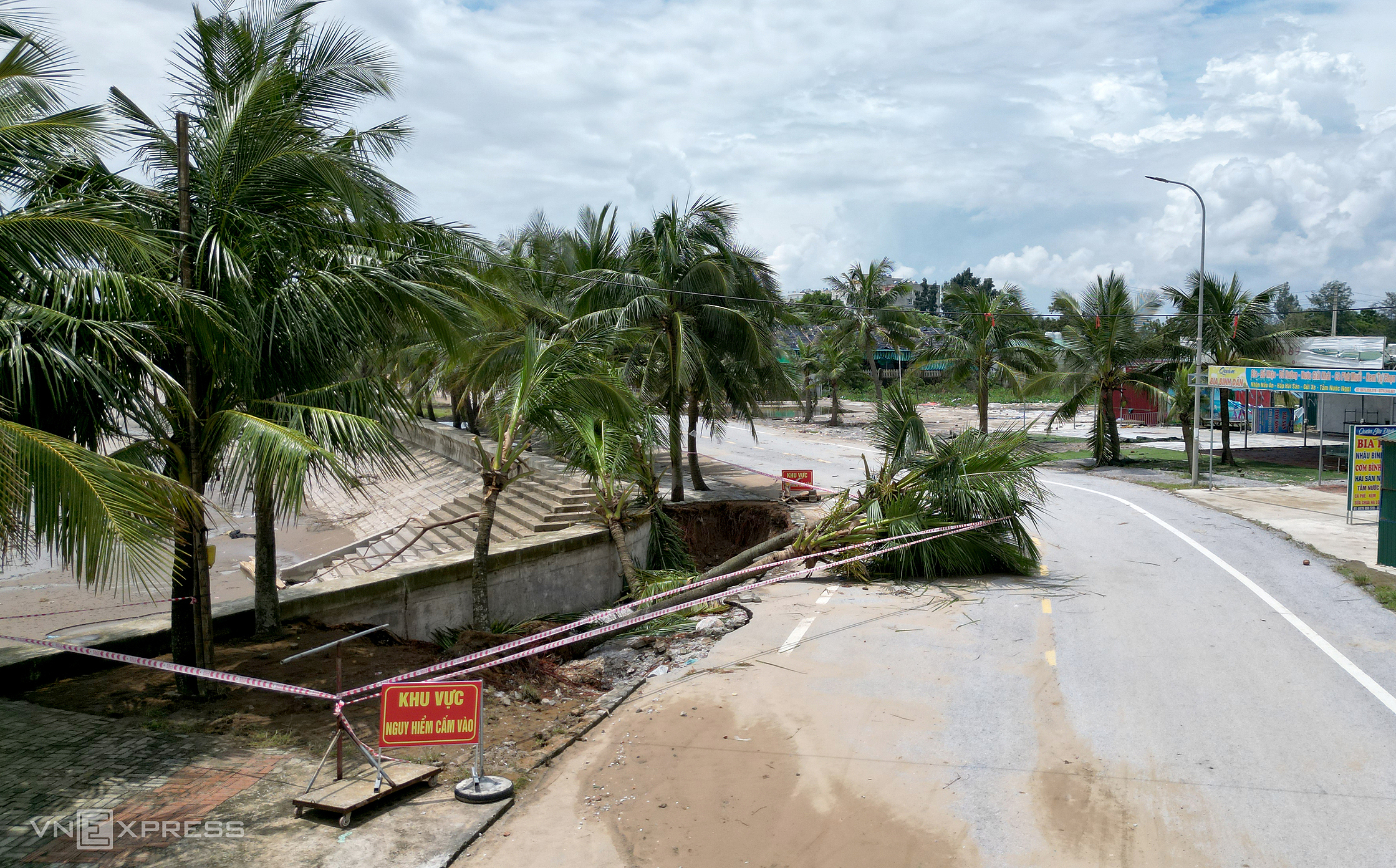
Numerous coconut trees planted along the Hoang Tien coast (formerly Hoang Hai commune) have been uprooted by waves, lying scattered on the seawall or along the coastal road, yet to be cleared. |
Typhoon Kajiki made landfall on 25/8 during high tide, causing severe damage to the seawall at the Hai Tien tourist area in Hoang Tien commune.
Local authorities have cordoned off the area and posted warning signs to restrict access and ensure public safety.
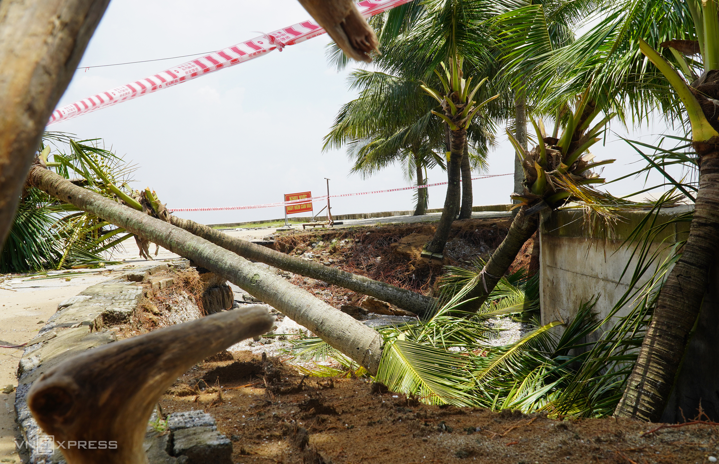 |
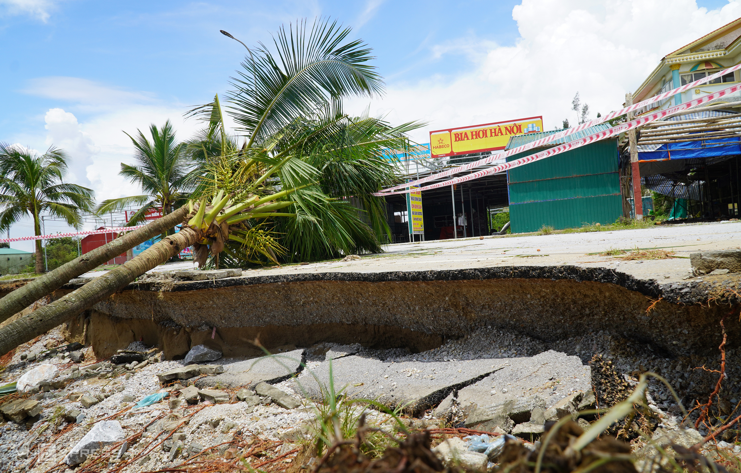
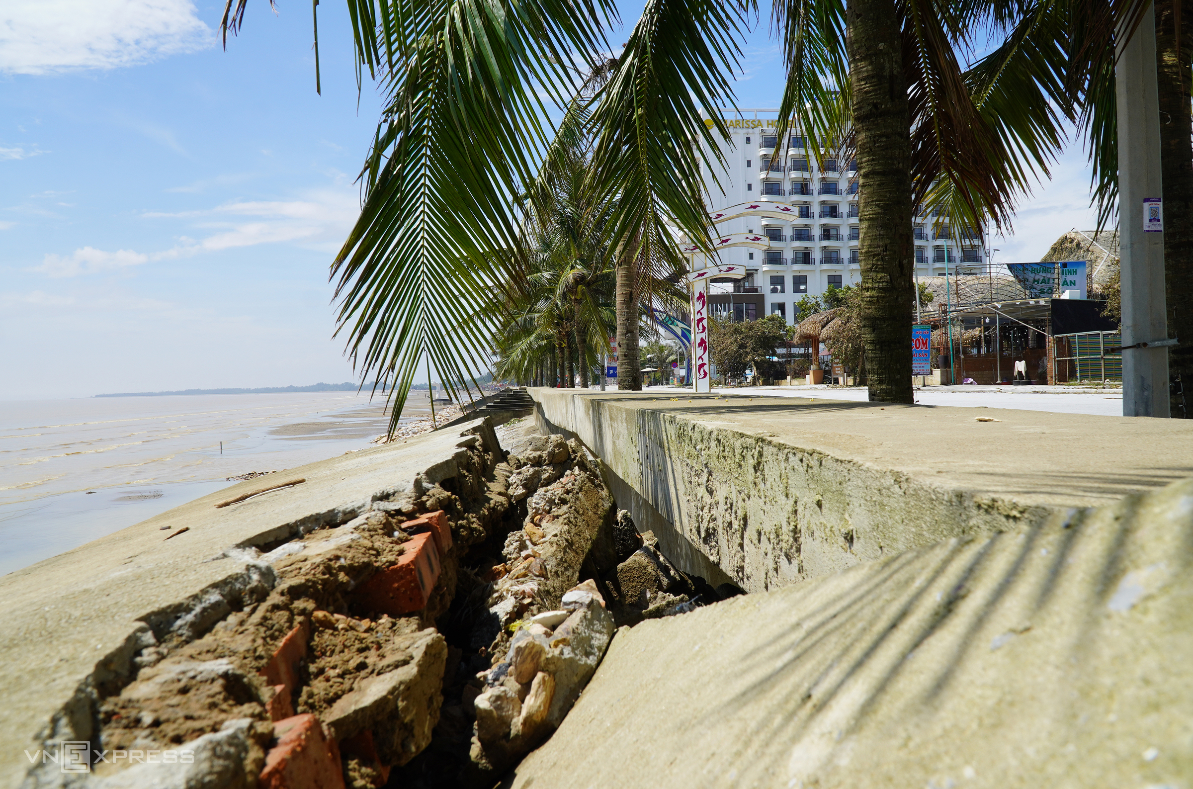
The most severe landslide, covering over 100 m2, was recorded in Thanh Xuan village. Here, in addition to the damaged seawall, large waves caused a third of the coastal road to collapse, encroaching upon houses, only 20-30 meters away at the closest point. The exposed foundation beneath the road has broken apart asphalt sections, leaving them scattered. |
 |
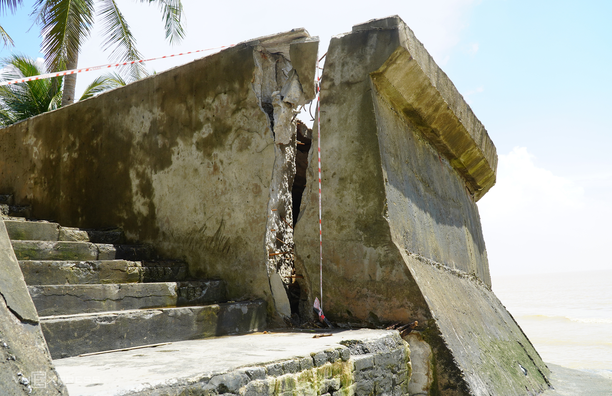
The 2-3 m high seawall is cracked and precariously positioned, revealing rusted steel bars within. |
 |
Concrete slabs near the water's edge have also been torn apart, exposing the reinforcing steel. The base of the Hai Tien seawall has been eroded by waves. |
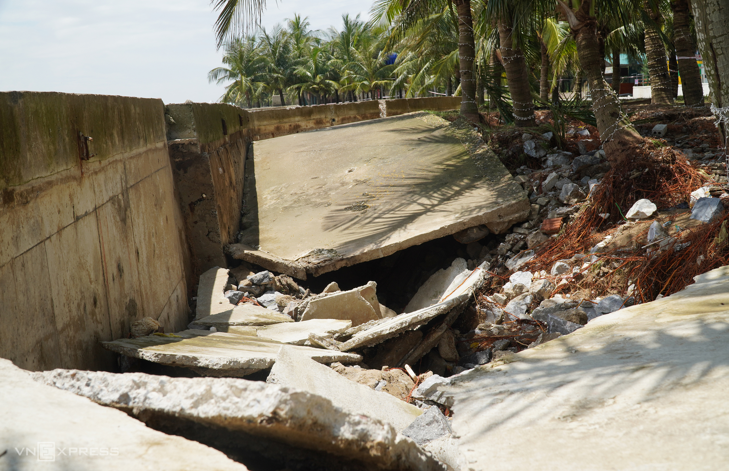
Near one of Hai Tien's largest resorts, a landslide has created a hole more than two meters deep and about 20 m long, filled with broken concrete slabs.
Nguyen Thi Thu Ha, Chairwoman of the Hoang Tien Commune People's Committee (UBND), reported that Typhoon Kajiki caused approximately 300 m of the seawall to collapse in various locations across the commune.
 |
Large cracks have also appeared in the seawall near the main stage in Hai Tien (to the southeast). |
 |
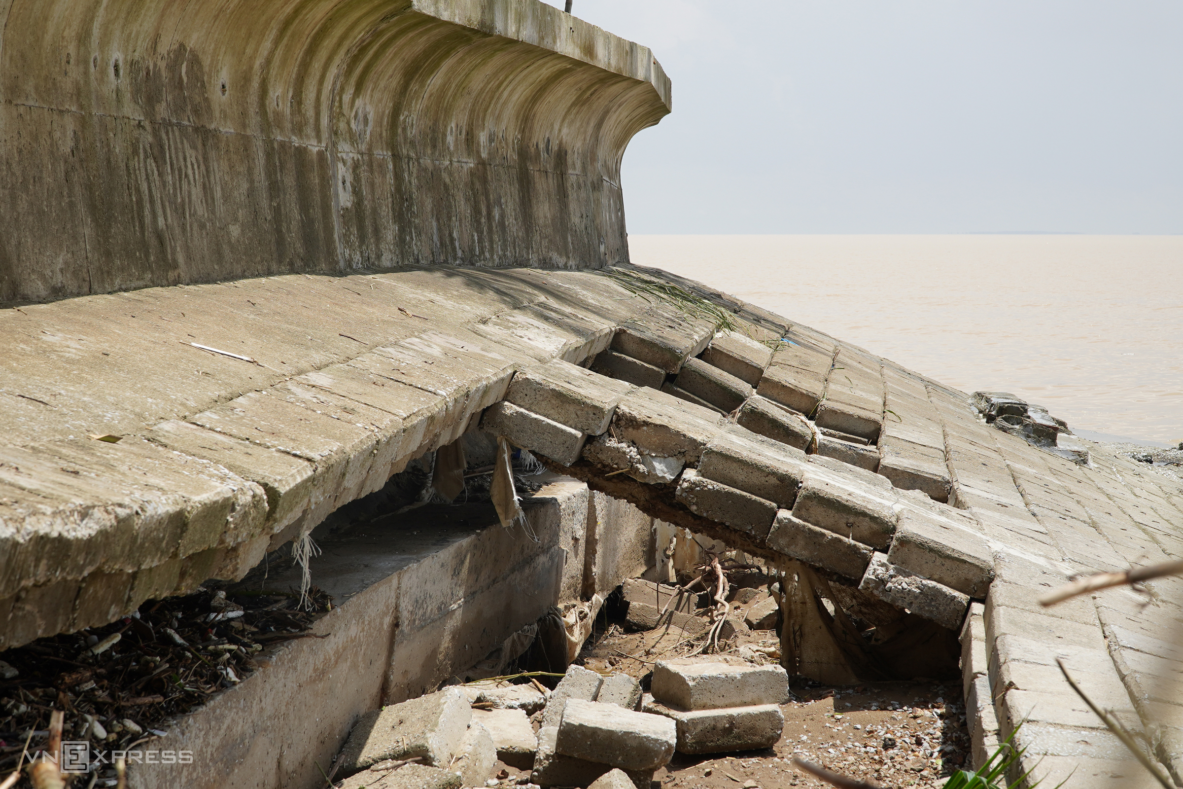 |
The seawall's top, composed of prefabricated concrete slabs, has been swept out to sea, with the remaining slabs dislodged.
According to local authorities, the damaged section of the Hai Tien seawall was recently constructed in 2018 at a total cost of over 140 billion VND and spans over 3 km.
 |
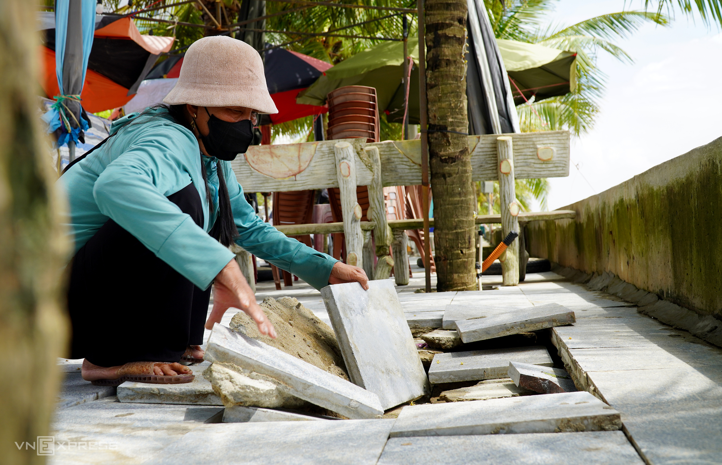 |
Numerous pavement stones have been dislodged by the waves, particularly around the drainage outlets.
"The loose stones create hazardous traps for residents and tourists," said Hong, 55, noting that this is the most destructive storm the area has seen in decades.
 |
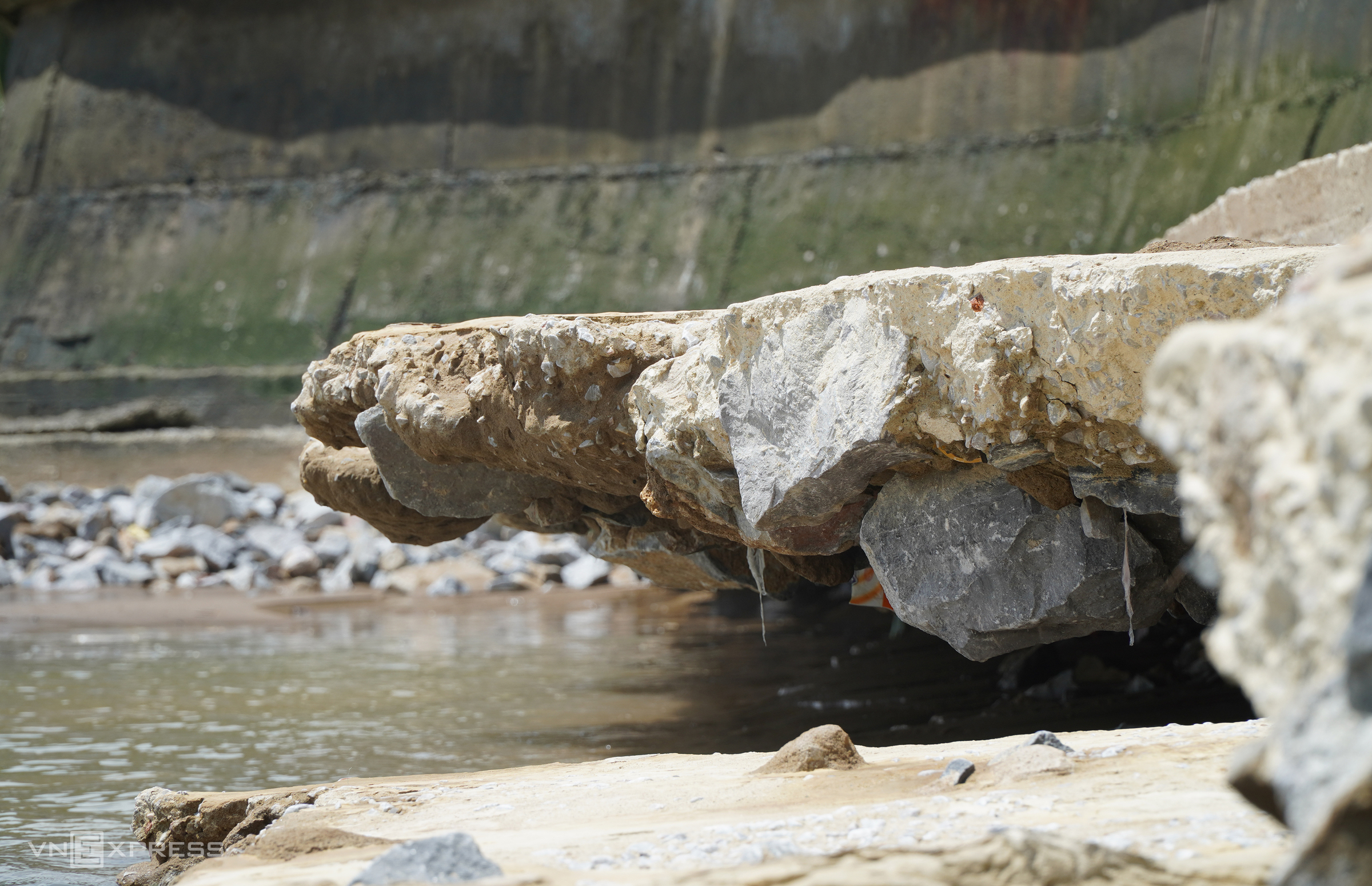
Large waves have also washed away the sand along Hai Tien's beaches, exposing large rocks. These rocks were originally placed by the construction team for reinforcement during the seawall's construction 7 years ago. Among the sharp rocks are concrete blocks with protruding steel rods, posing a significant risk to swimmers.
In response to this situation, the Hoang Tien Commune UBND has requested that the Thanh Hoa Provincial UBND direct relevant departments to assess the situation and consider declaring a state of emergency due to the seawall collapse. This will allow for the implementation of measures to ensure the safety and property of residents and tourists.
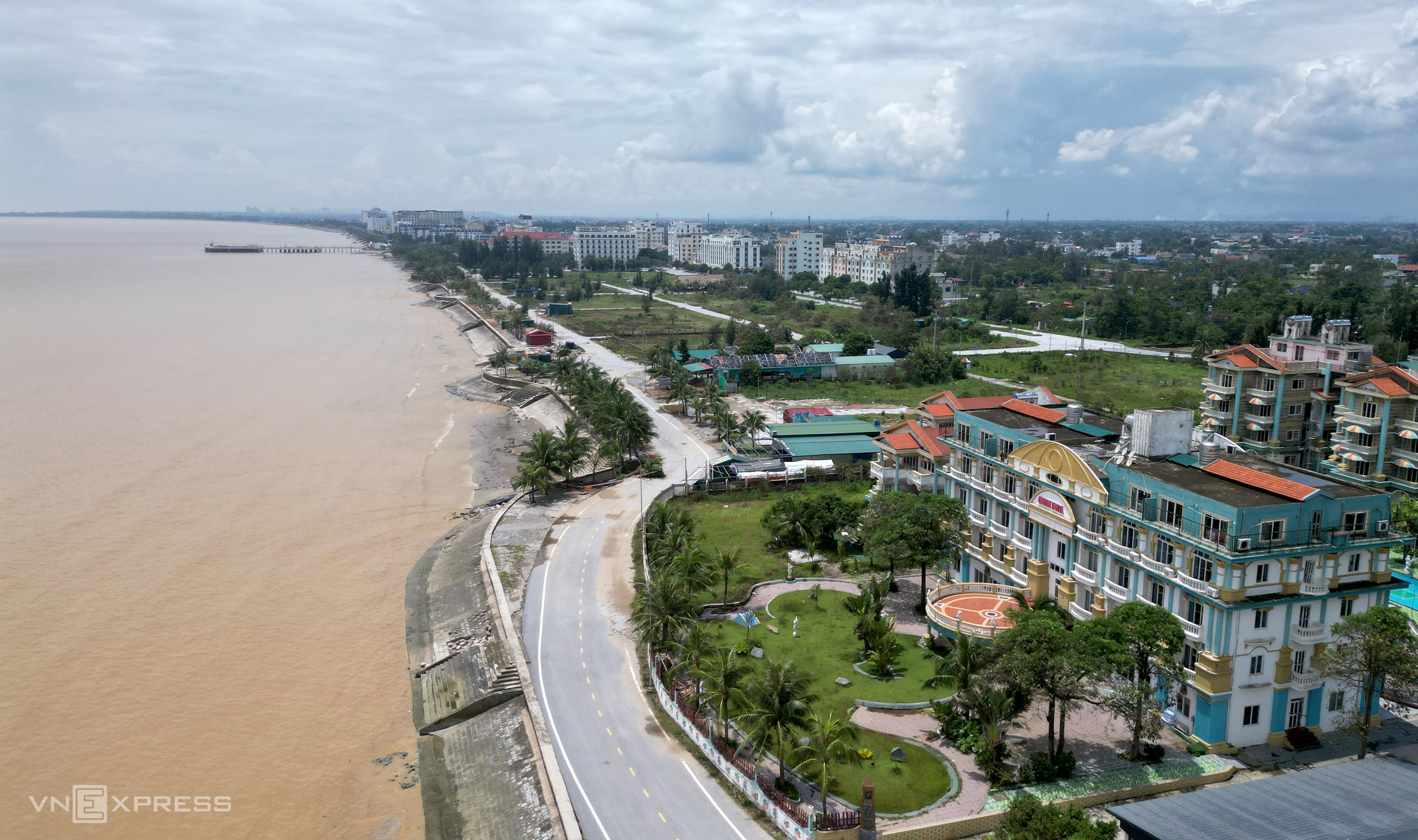 |
With a coastline exceeding 12 km, Hai Tien is one of Thanh Hoa's major tourist destinations, attracting many visitors for sightseeing and vacations, especially during the summer.
Typhoon Kajiki made landfall on the afternoon of 25/8 in the Thanh Hoa - Ha Tinh region with winds of level 10-11, gusting to level 13. The storm brought over 10 hours of heavy rain from North Central Vietnam to several northern provinces. Of the three directly affected localities, Thanh Hoa experienced the most severe flooding.
According to Thanh Hoa's Department of Agriculture and Environment, the heavy rainfall combined with flooding from upstream rivers and streams in the mountainous areas and upper Laos caused water levels in the Ma, Chu, Buoi, and Cau Chay rivers to exceed alarm level three. Tens of thousands of households in downstream areas like Cam Thuy, Vinh Loc, Thach Thanh, and Ham Rong were submerged, and several national highways were paralyzed for hours.
Le Hoang


