

 |
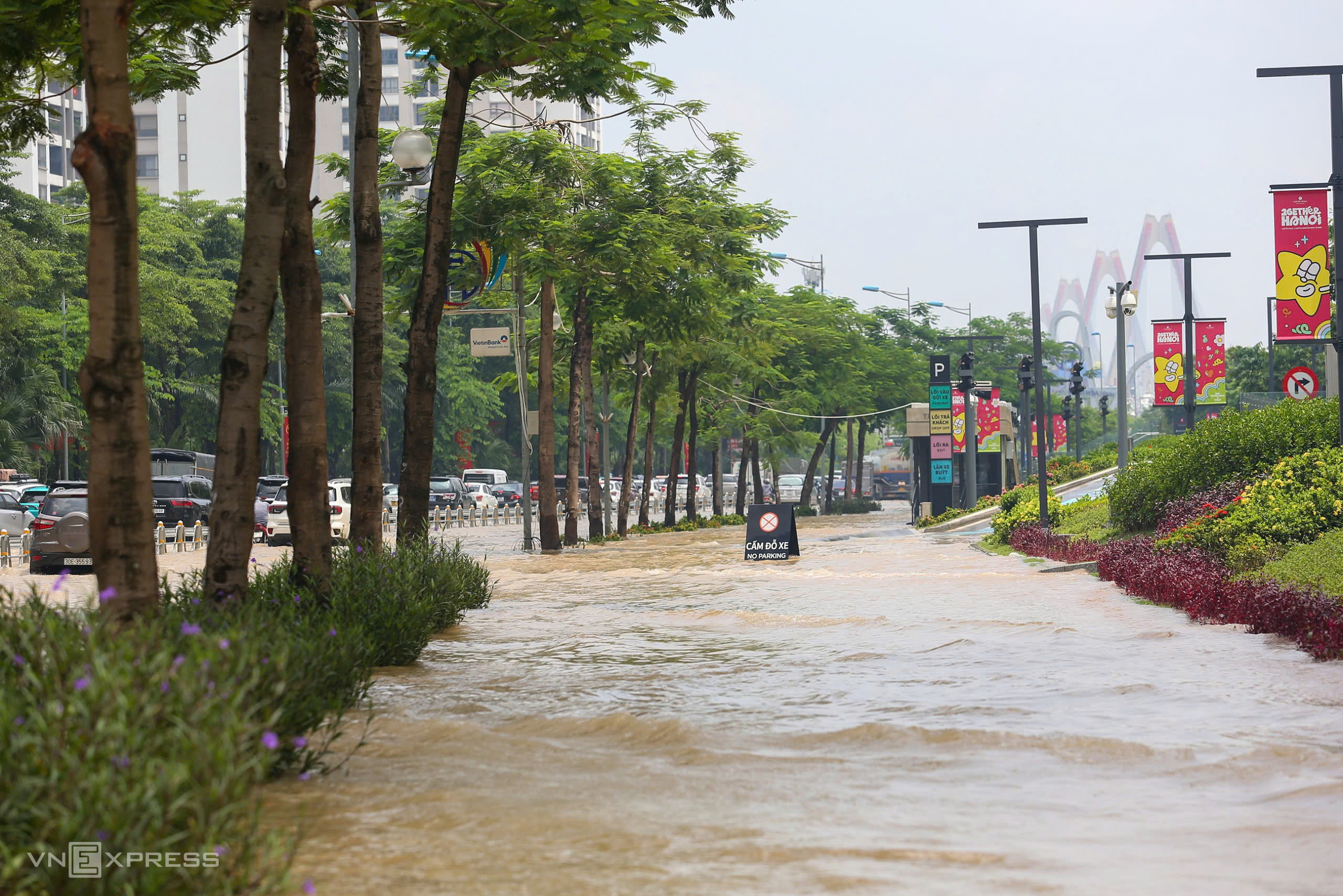
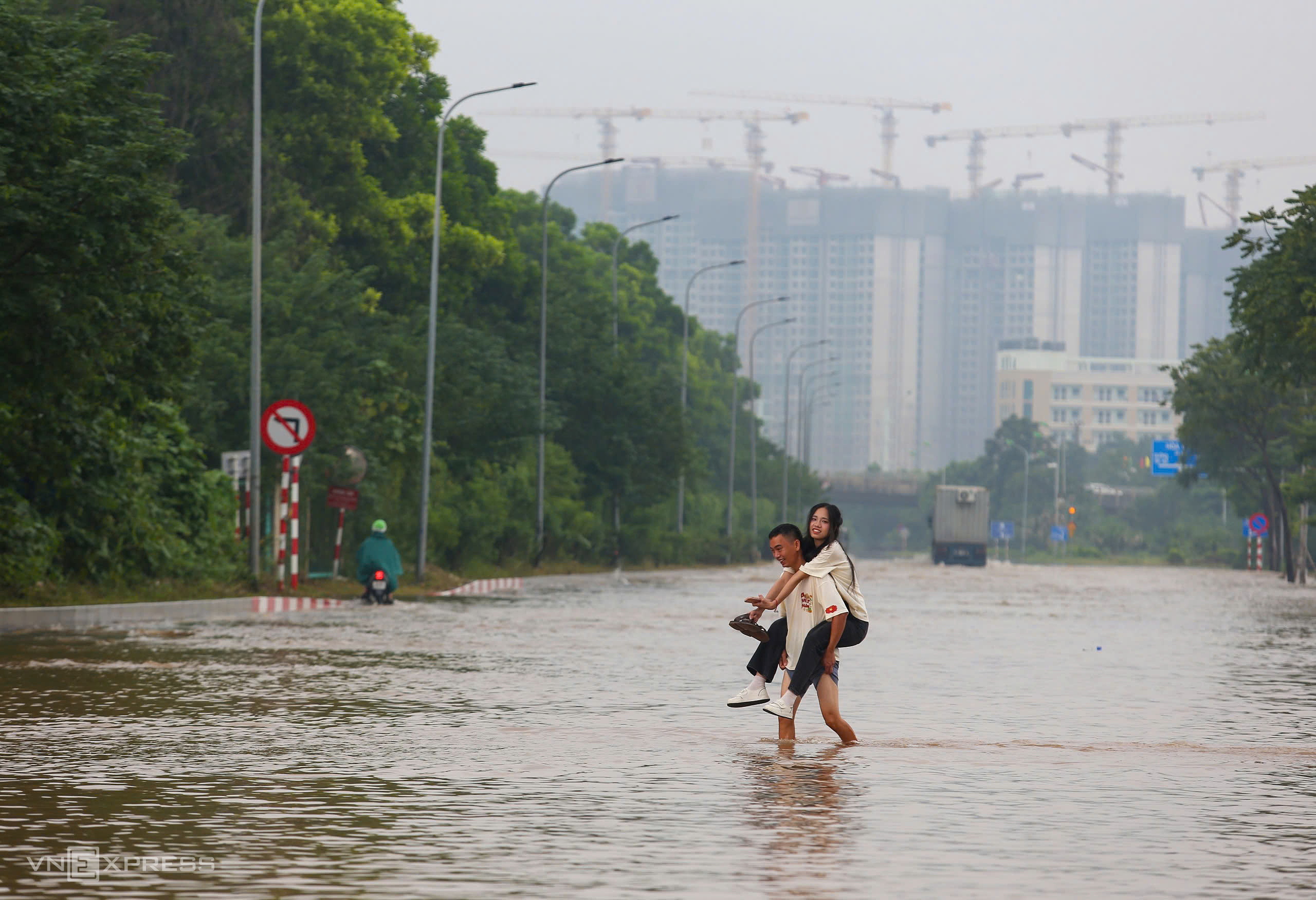
At noon on 28/8, a 400 m section of Vo Chi Cong Street, opposite Lotte Mall Tay Ho, was flooded up to half a meter deep in both directions. (Photo: Pham Chieu) |
At noon on 28/8, a 400 m section of Vo Chi Cong Street, opposite Lotte Mall Tay Ho, was flooded up to half a meter deep in both directions. (Photo: Pham Chieu)
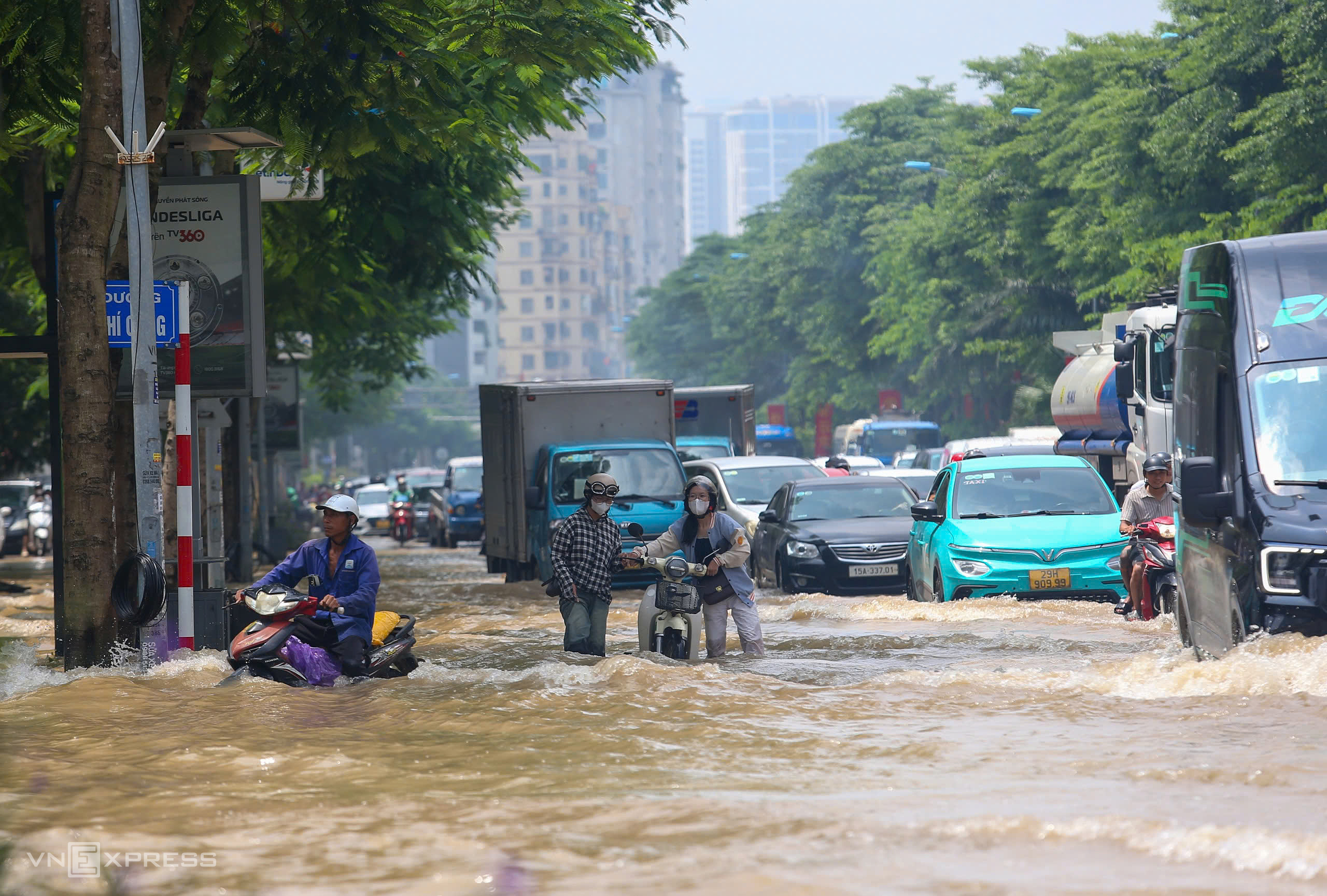 |
With no warning signs or guides, many people attempted to drive through the flooded area, resulting in stalled vehicles. (Photo: Pham Chieu) |
With no warning signs or guides, many people attempted to drive through the flooded area, resulting in stalled vehicles. (Photo: Pham Chieu)
 |
More than ten kilometers from the flooded area on Vo Chi Cong Street, water levels remain high on the Thang Long Boulevard service road. The flooding starts near the Vietnam Military History Museum and extends for about 4 km through the An Khanh urban area, reaching depths of one meter in some sections. (Photo: Pham Chieu) |
Cars also stalled, forcing drivers to abandon their vehicles and wait for assistance. Yesterday, two buses experienced the same fate on this stretch of road.
A security guard at Lotte Mall Tay Ho reported that the water level had receded since yesterday, but slowly. The flooded area appears to have only one drainage outlet.
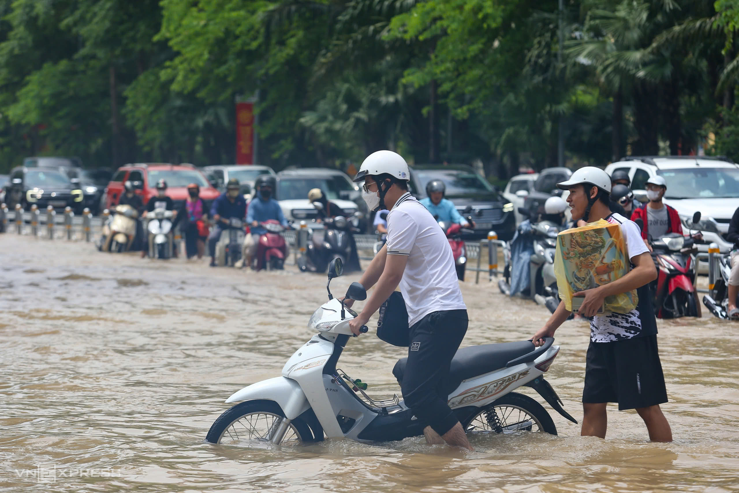 |
People helped each other push their vehicles through the flooded section. Many motorbikes stalled while trying to navigate the deep water. (Photo: Pham Chieu) |
According to the Hanoi Drainage Company, Vo Chi Cong Street is one of 8 areas still flooded after the downpour from 25/8 to 27/8. Other affected locations include: the Phu Xa - Phuc Hoa intersection, Ngoc Lam Street, Dam Quang Trung Street, Co Linh Street, underpasses 3, 5, and 6, km9+656 on Thang Long Boulevard, Trieu Khuc, and Yen Xa.
Influenced by Typhoon Kajiki, Hanoi experienced heavy rainfall, with 30 out of 126 communes and wards receiving 300-400 mm of rain. Nearly 100 flooded locations were recorded across the city, some with depths reaching one meter, such as Duong Dinh Nghe Street.
 |
At the flooded areas, people offer rides on trailers through the water for 20,000 VND per trip. (Photo: Pham Chieu) |
More than ten kilometers from the flooded area on Vo Chi Cong Street, water levels remain high on the Thang Long Boulevard service road. The flooding starts near the Vietnam Military History Museum and extends for about 4 km through the An Khanh urban area, reaching depths of one meter in some sections. (Photo: Pham Chieu)
 |
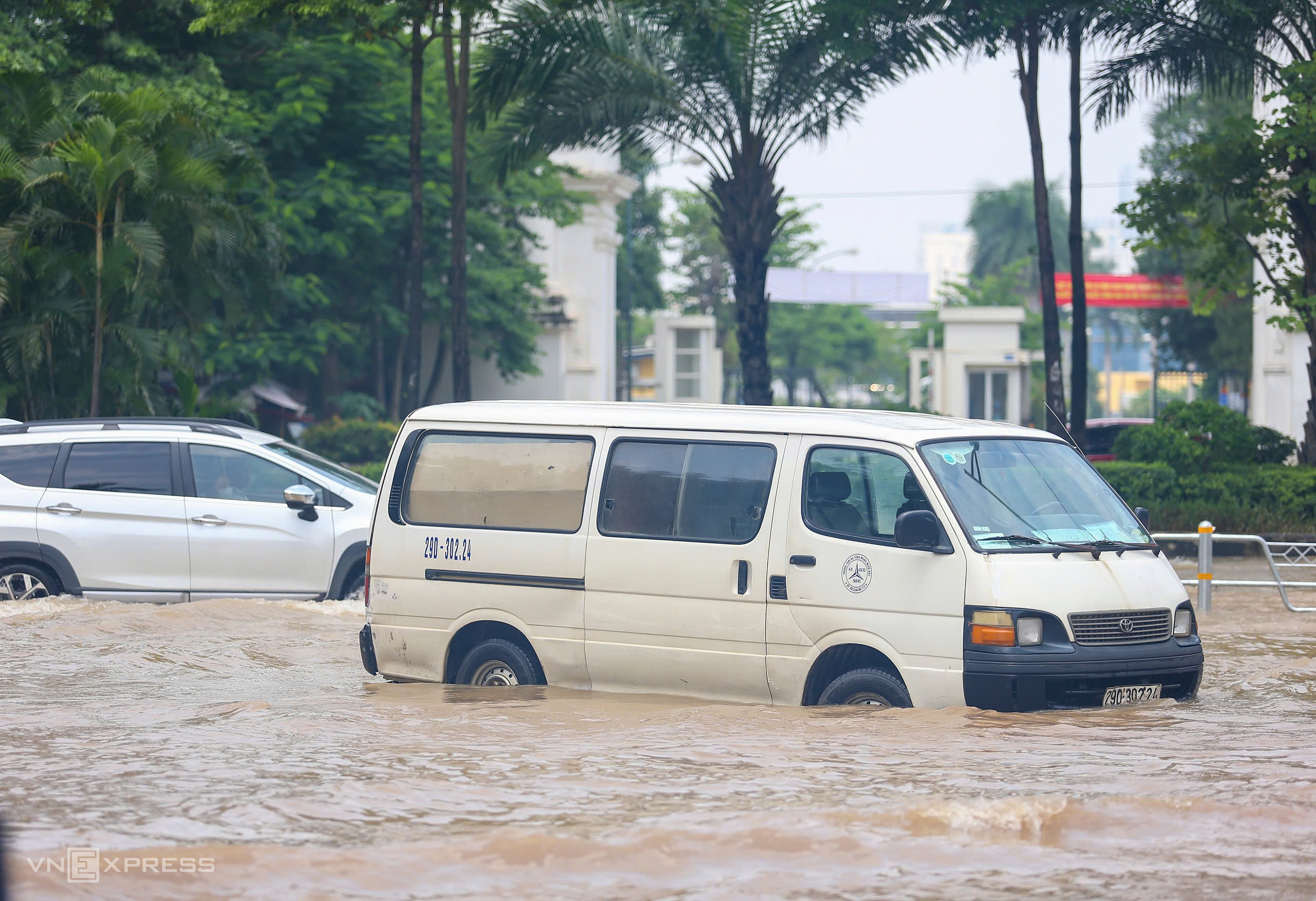
Many residents were stranded, unable to travel by either electric or gasoline-powered vehicles due to the widespread flooding. (Photo: Pham Chieu) |
People helped each other push their vehicles through the flooded section. Many motorbikes stalled while trying to navigate the deep water. (Photo: Pham Chieu)
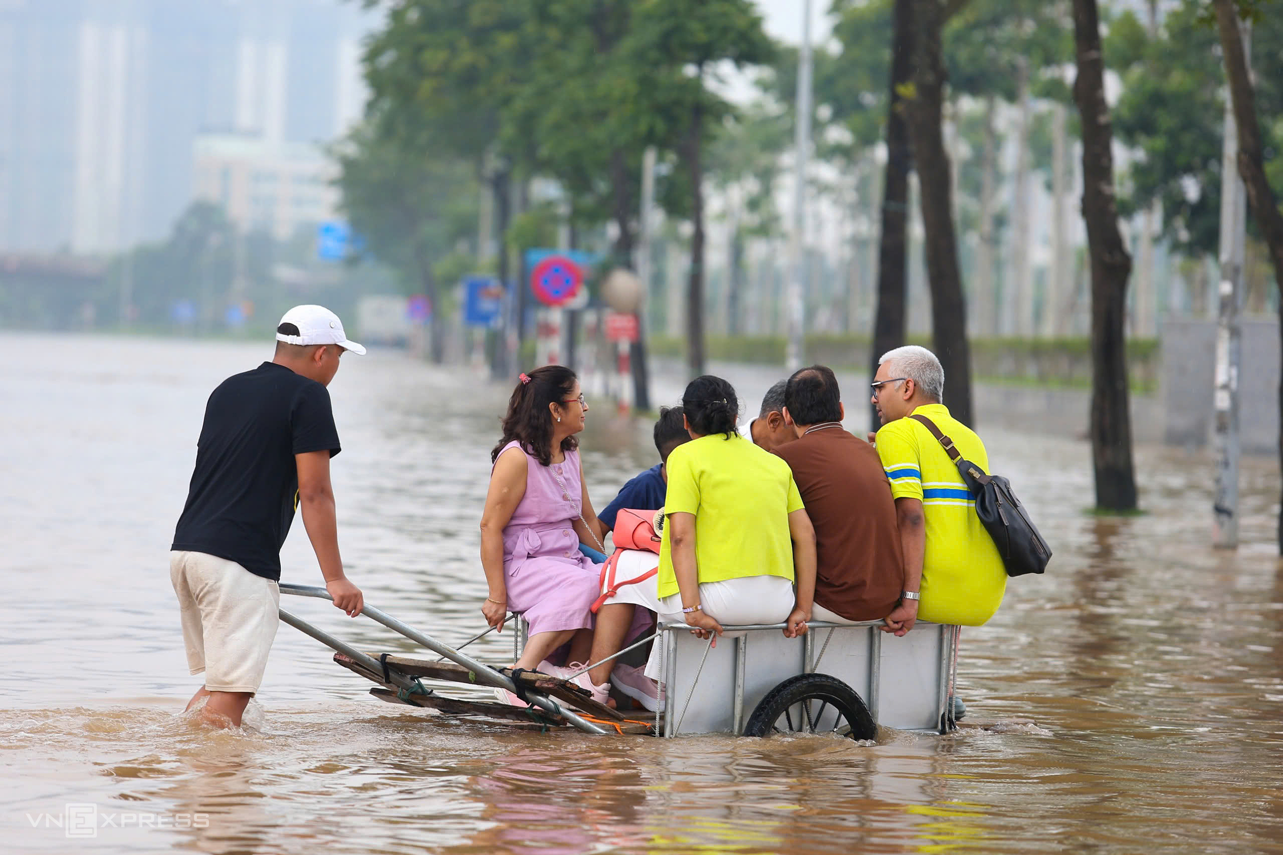 |
At the flooded areas, people offer rides on trailers through the water for 20,000 VND per trip. (Photo: Pham Chieu)
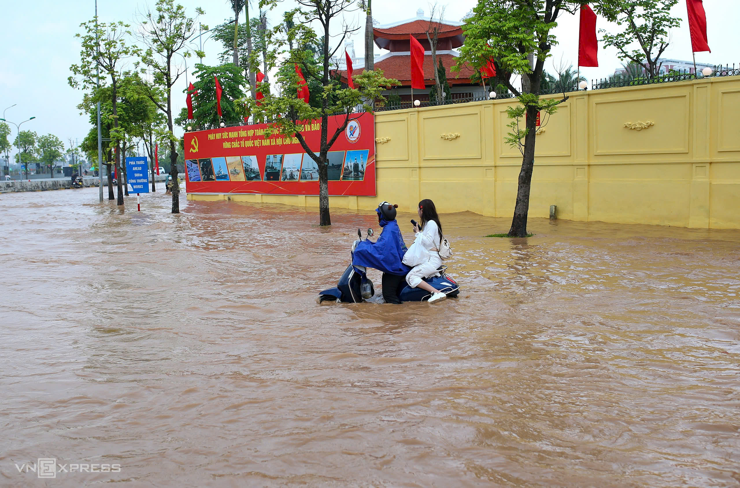 |
Many residents were stranded, unable to travel by either electric or gasoline-powered vehicles due to the widespread flooding. (Photo: Pham Chieu)
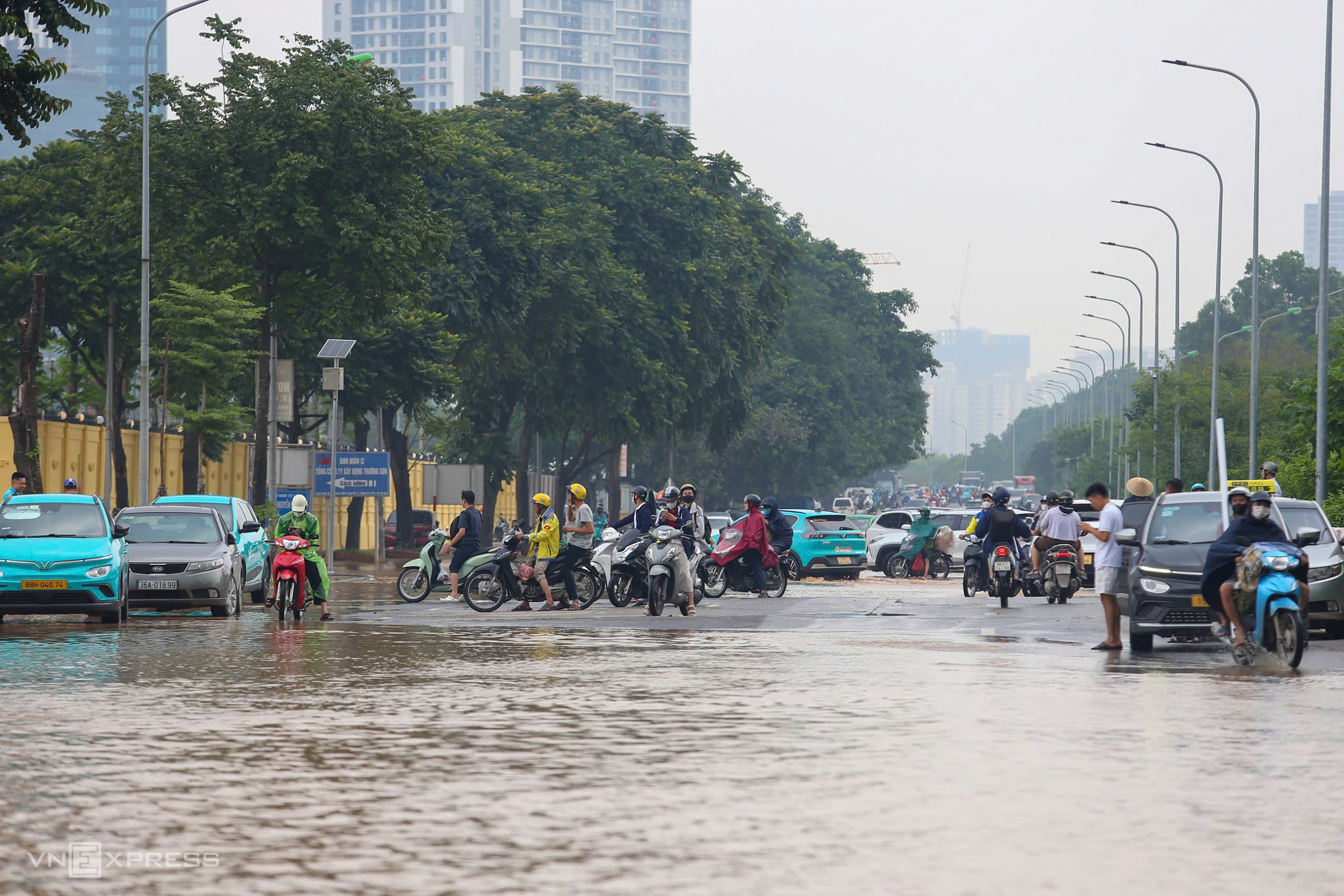 |
Cars and motorbikes reaching this area are forced to turn back and find alternate routes.
Explaining the persistent flooding on Thang Long Boulevard despite the rain having stopped, a representative from the Hanoi Drainage Company stated that drainage projects in West Hanoi are largely incomplete, leaving the area able to handle only rainfall below 50 mm. However, Tay Mo, Dai Mo, and Dan Phuong wards, through which the boulevard passes, all received over 200 mm of rain.
The foundation of Thang Long Boulevard's pedestrian underpasses is low, at only 4.9-5.2 m, while the Nhue River (the natural drainage outlet for the boulevard) reached 5.63 m in Ha Dong on 27/8, exceeding the first warning level. The high water level in the Nhue River prevents natural drainage from the boulevard.
The flooded section of Vo Chi Cong Street also has a low foundation, formerly a rice paddy, and its incomplete drainage system makes it a "water pocket."
Pham Chieu


