 |
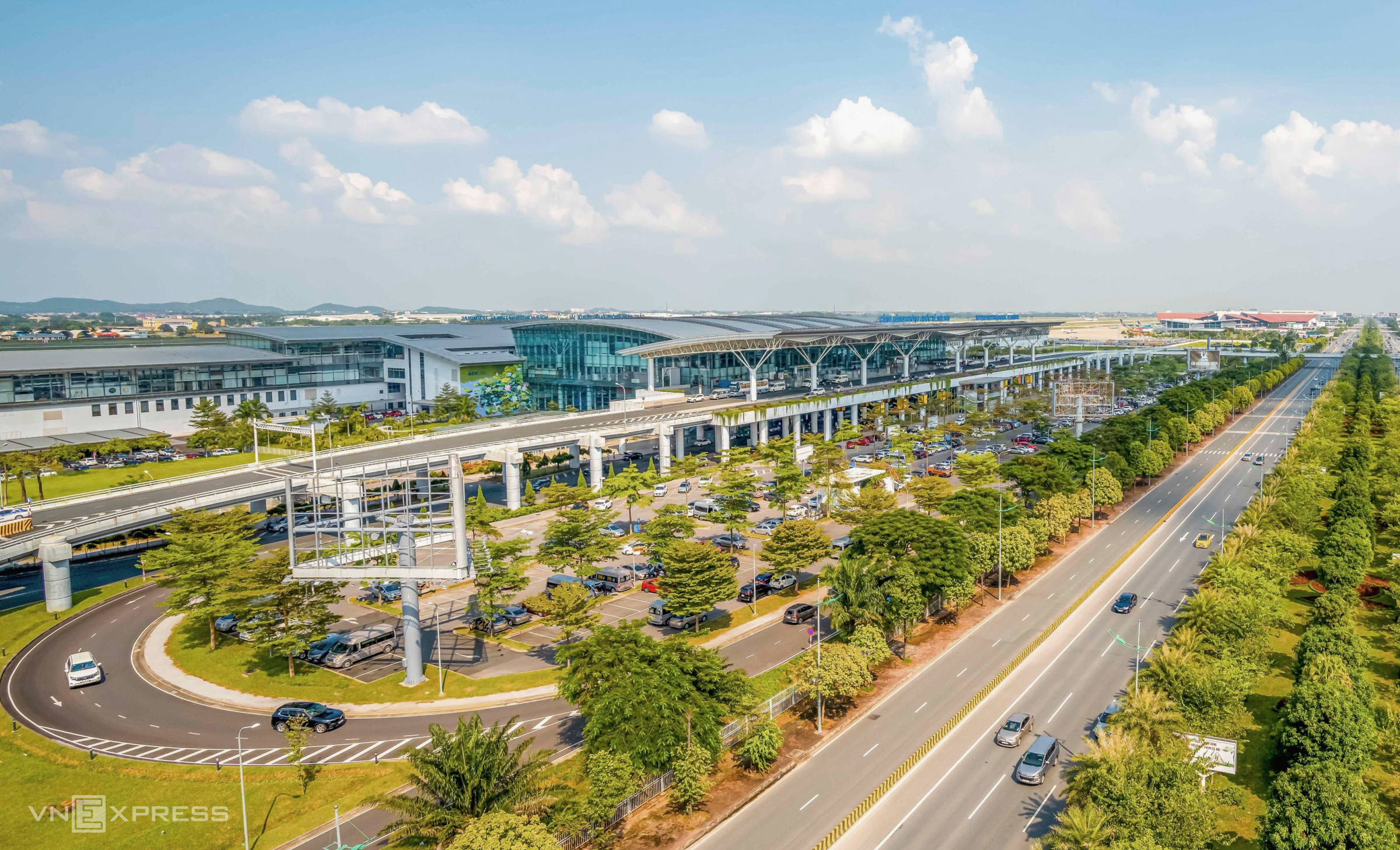
Noi Bai International Airport's Terminal 2, which opened in 12/2014, is Vietnam's largest air terminal. The 139,000 m2, wing-shaped structure, built with an investment of 75.5 billion yen, maximizes natural light. The four-story main building extends two wings, each nearly one kilometer long.
The terminal features 17 boarding gates, 22 escalators, 283 information displays, and an internet network capable of handling over 32,000 users simultaneously. With its modern facilities, Terminal 2 is considered the most convenient airport terminal in Vietnam. Photo: Giang Huy
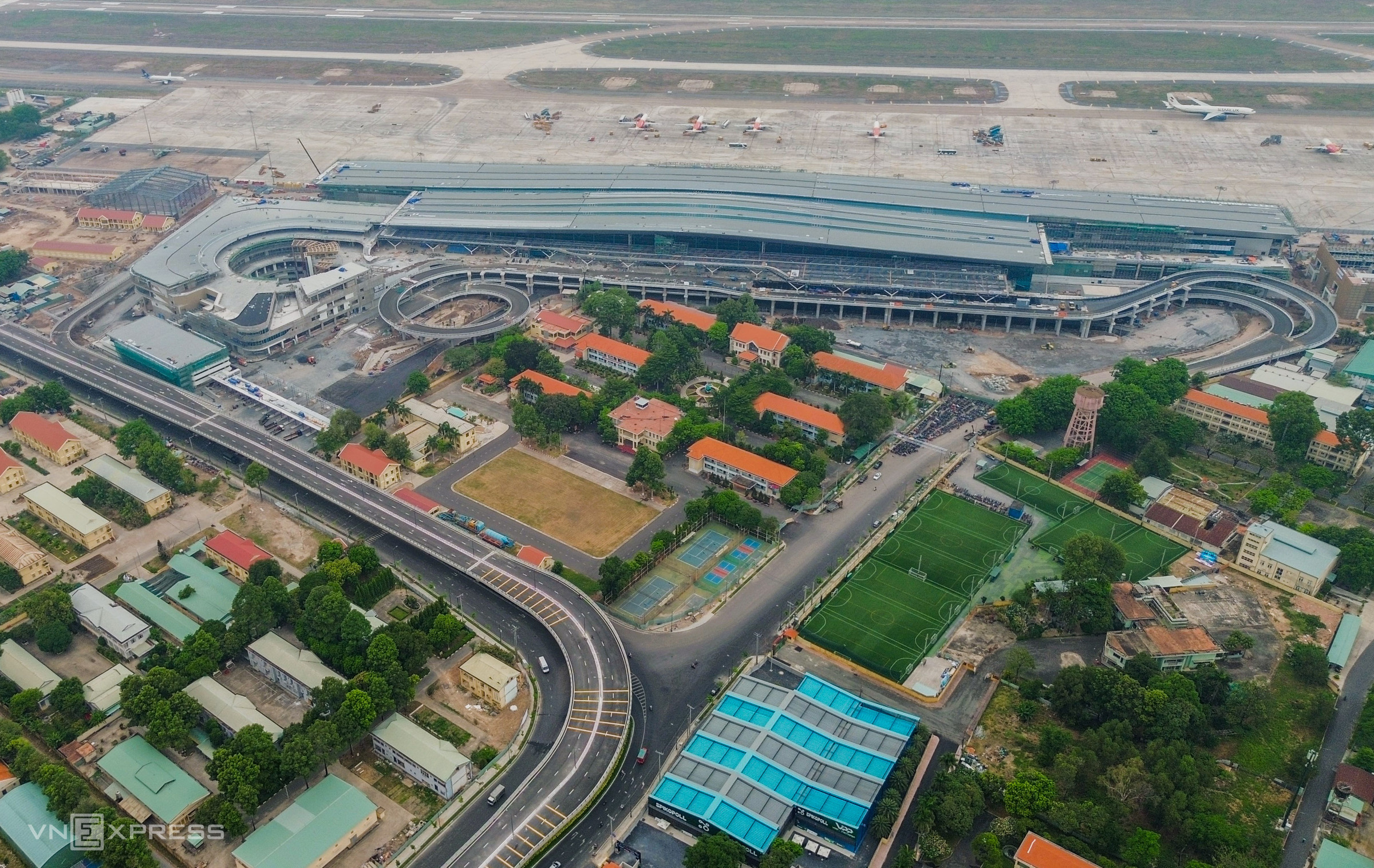 |
Tan Son Nhat International Airport's Terminal 3, a project with a nearly 11,000 billion VND investment that began construction in late 2022, was completed and opened on 30/4/2025. As Vietnam's largest domestic terminal, it has a capacity of 20 million passengers per year, increasing the airport's total capacity to 50 million.
The 112,500 m2 structure includes a basement level and four above-ground floors, encompassing four main components: the passenger terminal, a multi-story parking garage with integrated services, an elevated roadway leading to the terminal, and an aircraft parking apron. The terminal is equipped with 25 security checkpoints, 90 check-in counters, 20 self-service bag drop stations, and 42 self-check-in kiosks.
Tan Son Nhat currently has two terminals: T1 (domestic) and T2 (international). Although designed for 28-30 million passengers annually, they consistently handle over 40 million, putting a significant strain on the existing infrastructure. Terminal 3 is expected to handle about 80% of domestic passengers, alleviating pressure on the overloaded T1. Photo: Tran Quynh
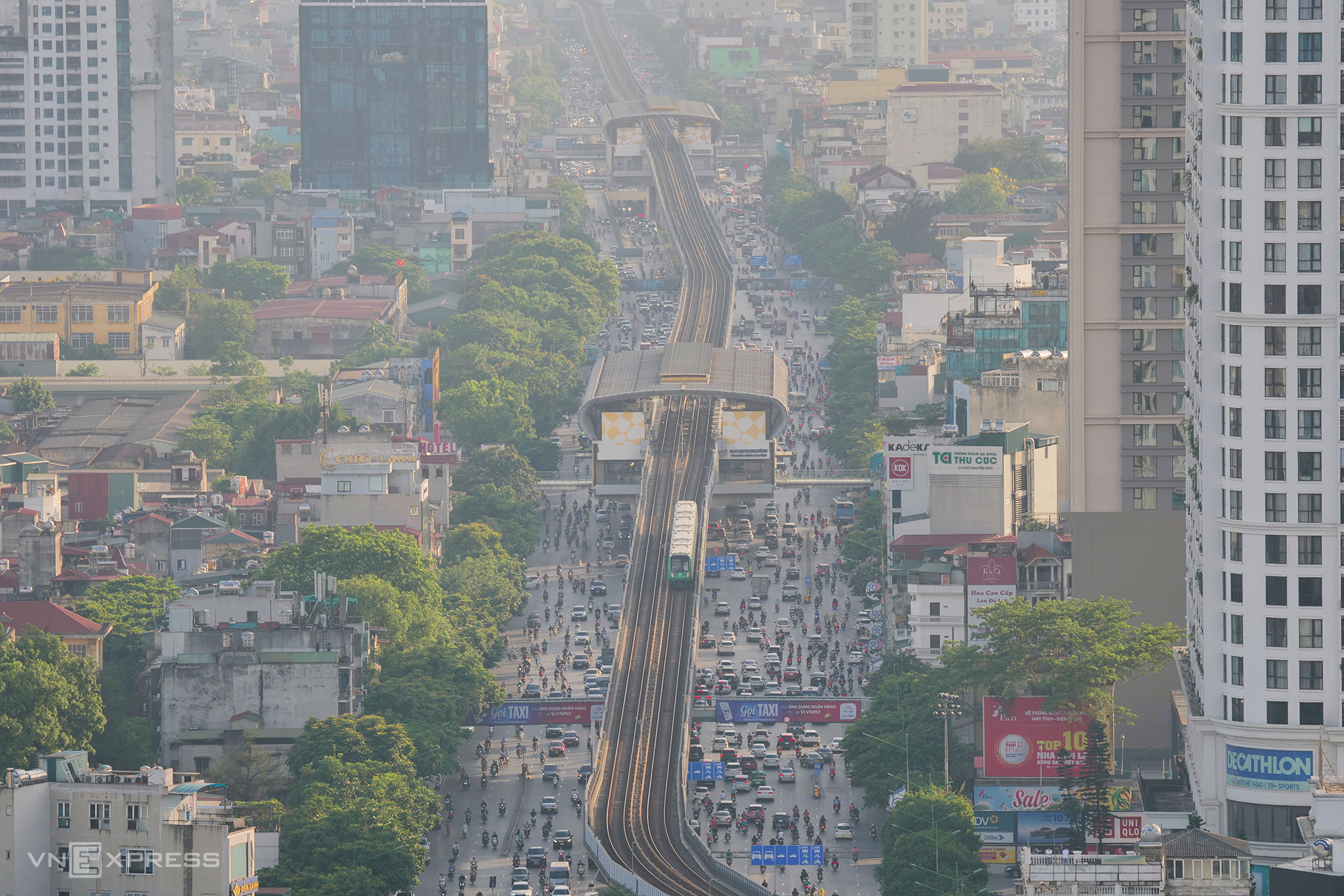 |
The 13-kilometer Cat Linh-Ha Dong elevated urban railway line, with its 12 stations, began commercial operation in 11/2021. Each four-car train carries nearly 1,000 passengers at an operating speed of 35 km/h, completing the entire route in 23 minutes. Trains run every 10 minutes, increasing to every 6 minutes during peak hours.
Hanoi's first metro line reduces commute times for students and office workers, contributing to reduced traffic congestion within the city center. Photo: Ngoc Thanh
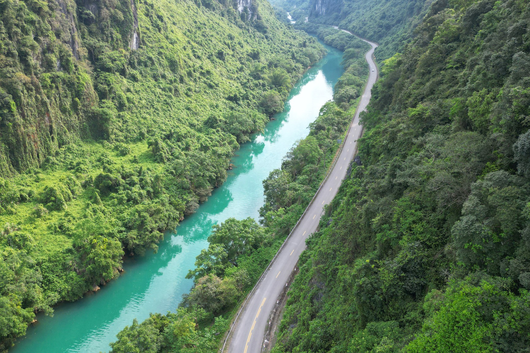 |
In late 1959, the Truong Son (Ho Chi Minh) Trail, a military supply route, was established, connecting North Vietnam with the battlefields in the South. Initially a network of challenging trails, it evolved into a system spanning over 20,000 kilometers, with five longitudinal and 21 transverse routes, covering the Truong Son mountain range from east to west.
Over 22,000 soldiers and volunteers lost their lives on the trail. More than 30,000 people were affected by Agent Orange, and tens of thousands suffered injuries. The US dropped over 4 million tons of bombs and 80 million liters of chemicals on the area in an attempt to disrupt the supply line.
The Truong Son Trail, considered a lifeline during the war, now passes through Phong Nha-Ke Bang National Park (Quang Binh, Quang Tri). Photo: Vo Thanh
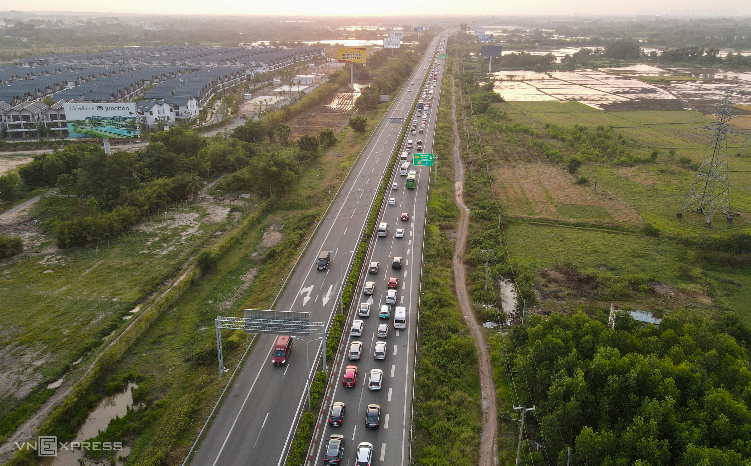 |
Opened in 2015, the 55-kilometer, four-lane Long Thanh-Dau Giay Expressway serves as a vital link connecting Ho Chi Minh City with Dong Nai Province and the southeastern region. After 10 years of operation, the expressway has become congested, handling 45,000-50,000 vehicles daily, with traffic exceeding 60,000 during holidays, surpassing its design capacity by 25%.
On 19/8, the expressway expansion project commenced, with an investment of nearly 16,400 billion VND. The 22-kilometer section from Ho Chi Minh City's Ring Road 2 to the intersection with the Bien Hoa-Vung Tau Expressway will be widened from four to eight to ten lanes. Long Thanh Bridge, a major bottleneck, will have a new 23-meter-wide, five-lane branch added. Designated an "urgent" project, it aims to alleviate congestion and provide direct access to Long Thanh International Airport, scheduled to open in 2026. Photo: Phuoc Tuan
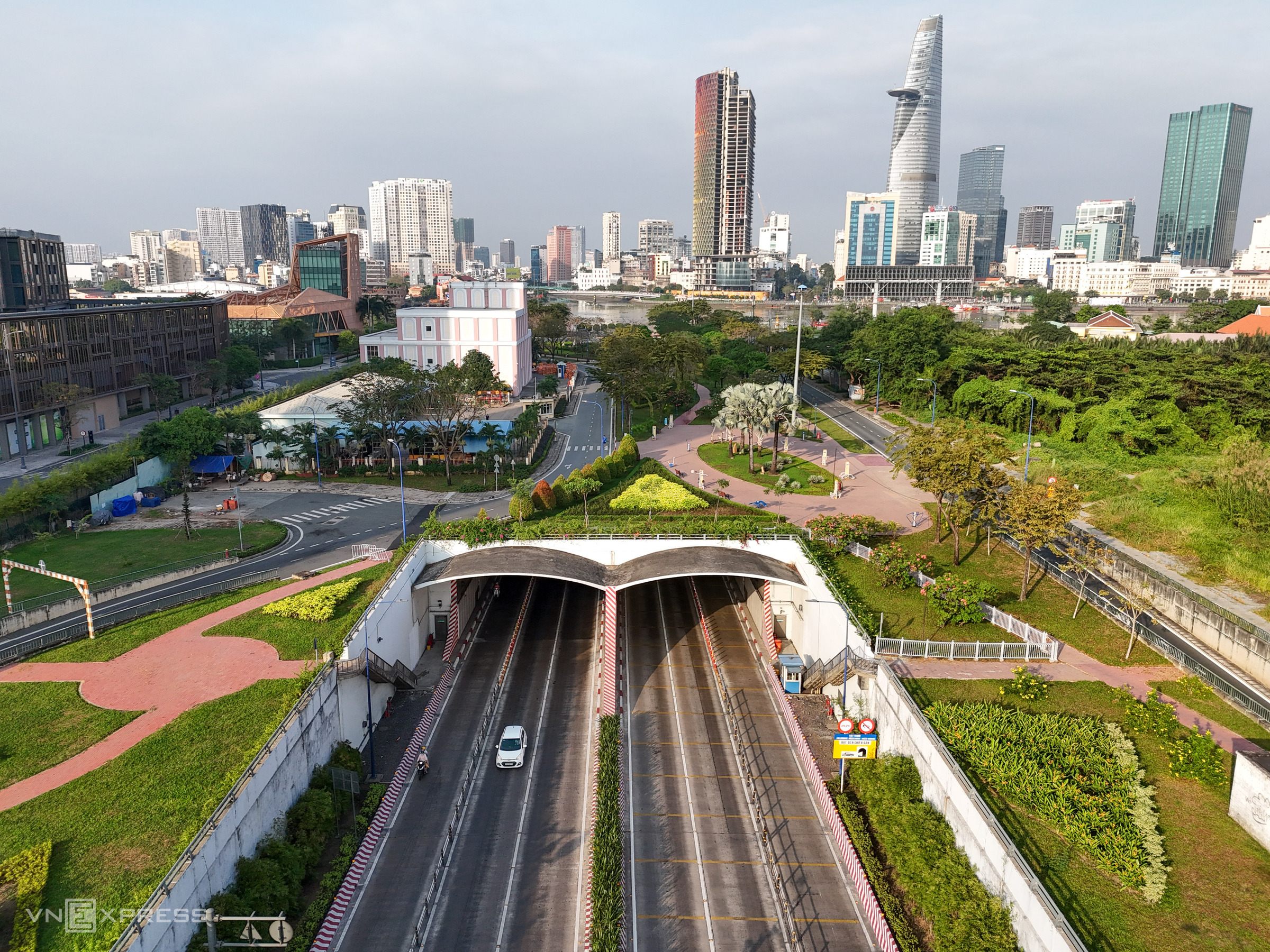 |
Opened in 2011, the 1.49-kilometer-long, 33-meter-wide, and 9-meter-high Thu Thiem Tunnel is Vietnam's only immersed tube tunnel, situated along the East-West Highway. With six lanes and a design speed of 60 km/h, the tunnel accommodates over 270,000 motorbikes and 47,000 cars daily.
The tunnel's four sections, each 93 meters long and weighing 27,000 tons, were transported 22 kilometers from Dong Nai to Thu Thiem, then immersed and assembled 23-27 meters below the Saigon River, with an allowable installation tolerance of only 10 mm.
Globally, there are over 30 immersed tube tunnels, commonly found in Japan, Hong Kong, Australia, and the US. In Southeast Asia, the Thu Thiem Tunnel in Saigon is the largest of its kind. Photo: Quynh Tran
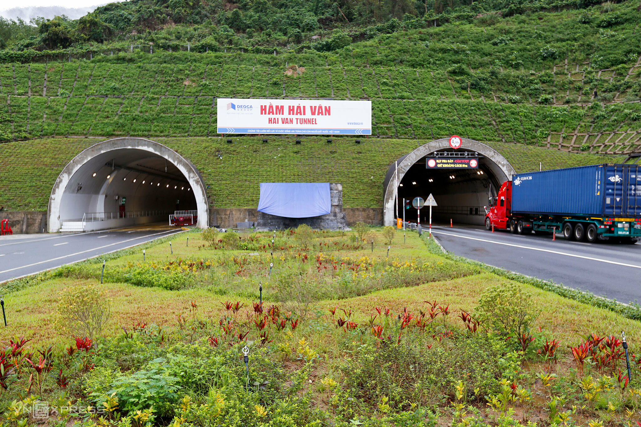 |
The 6.3-kilometer Hai Van Tunnel 1, connecting Hue City with Da Nang, opened in 6/2005, funded by a loan of over 150 million USD from JBIC (Japan). This national key project ranks among the world's 30 largest and most modern road tunnels and is the largest in Southeast Asia.
The tunnel eliminates the challenges of traversing the treacherous, over 22-kilometer-long Hai Van Pass, driving economic development in central Vietnam. It serves as a vital link on the East-West Economic Corridor connecting Vietnam, Laos, Thailand, and Myanmar.
In 2021, the 6.2-kilometer Hai Van Tunnel 2 (with a total route length of 12.4 kilometers including access roads) was completed alongside Tunnel 1, with an investment of 8,516 billion VND, helping to alleviate traffic through the original tunnel. Photo: Nguyen Dong
 |
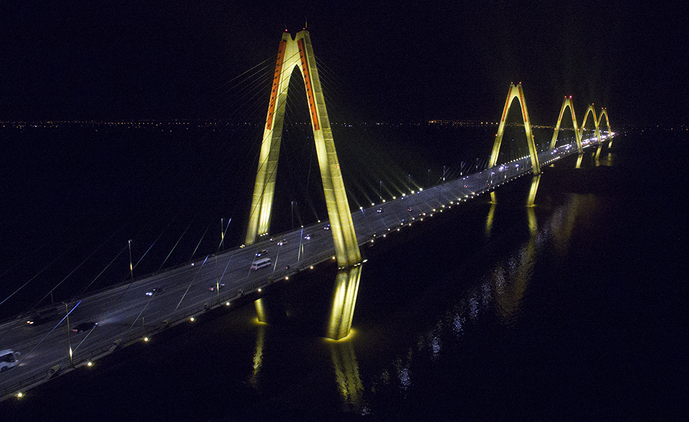 |
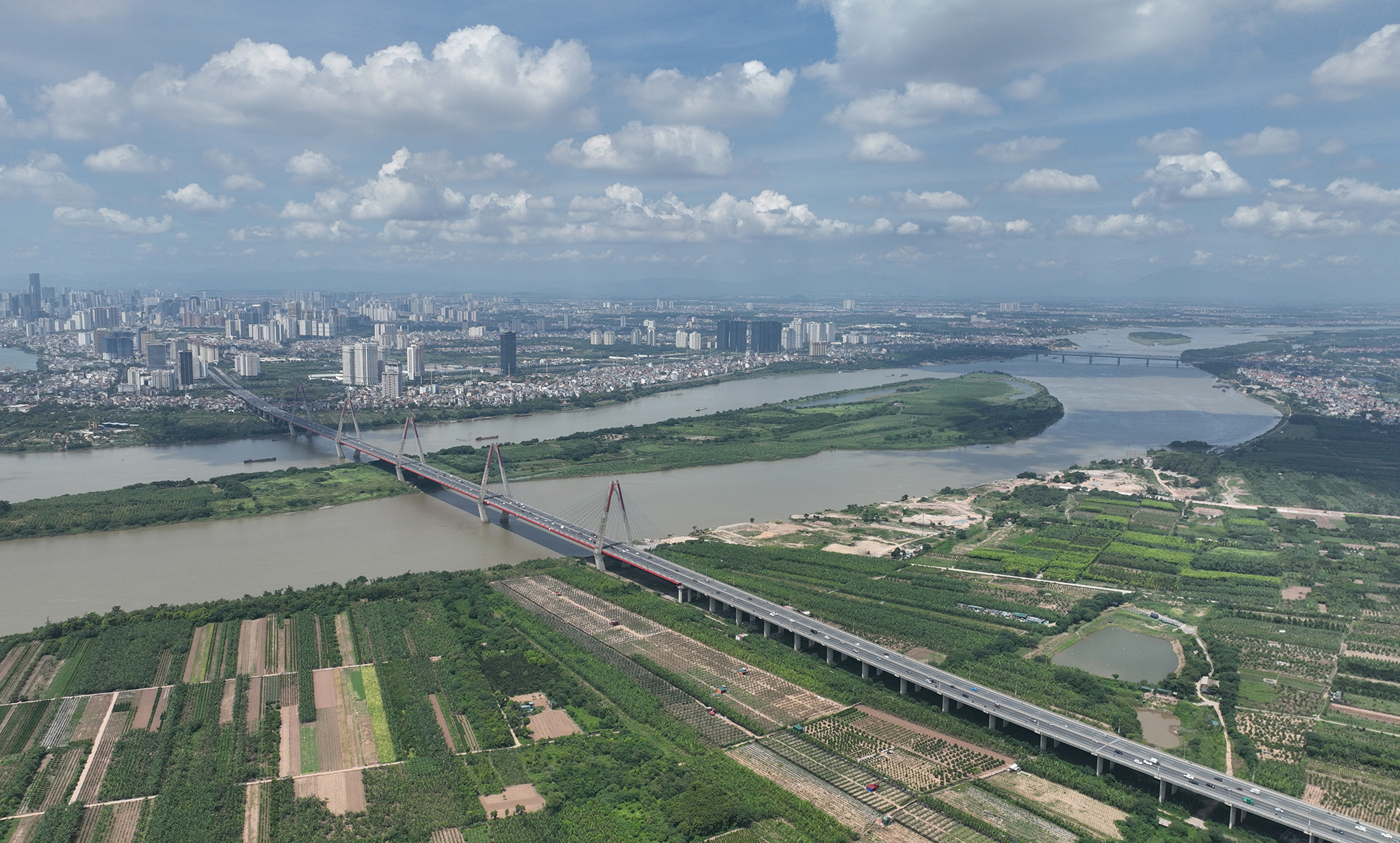
The Nhat Tan Bridge, a cable-stayed bridge spanning the Red River and connecting Dong Anh and Tay Ho districts of Hanoi, had a total investment of 13,626 billion VND. The main bridge is 3.7 kilometers long with five towers, and the access roads extend 5.1 kilometers. The bridge is 60 meters wide with four lanes.
Nhat Tan is among the few multi-span cable-stayed bridges worldwide, utilizing cable tension and rebar stress measurement technology for the first time in Vietnam. Serving both transportation and aesthetic purposes, the bridge is an architectural landmark at Hanoi's northern gateway. Photo: Ngoc Thanh
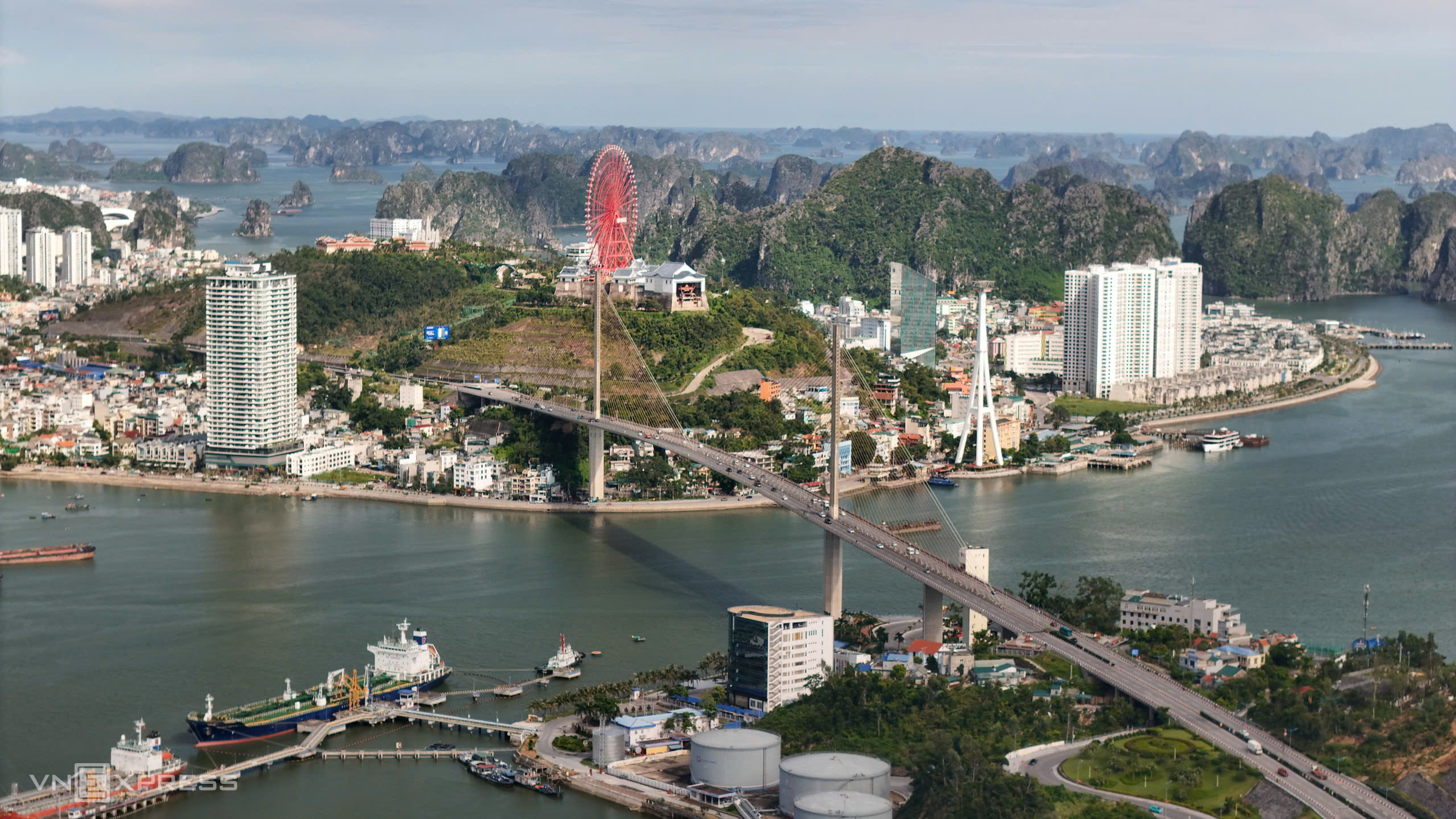 |
Bai Chay Bridge, Vietnam's first single-plane cable-stayed bridge, connects Hon Gai and Bai Chay in Ha Long City. Construction began on 18/5/2003, and the bridge opened on 2/12/2006, with a total investment of approximately 184 million USD from Japanese ODA and Vietnamese counterpart funding.
The 903-meter-long bridge has a main span of 435 meters and a width of 25.3 meters, accommodating four lanes for motor vehicles, two lanes for non-motorized vehicles, and pedestrian walkways. With a navigational clearance of 50 meters, the bridge allows passage for vessels up to 50,000 tons. Replacing the old ferry service, it reduces travel time, alleviates traffic on National Highway 18, and promotes tourism and economic growth in Quang Ninh Province and the northern key economic zone. Photo: Le Tan
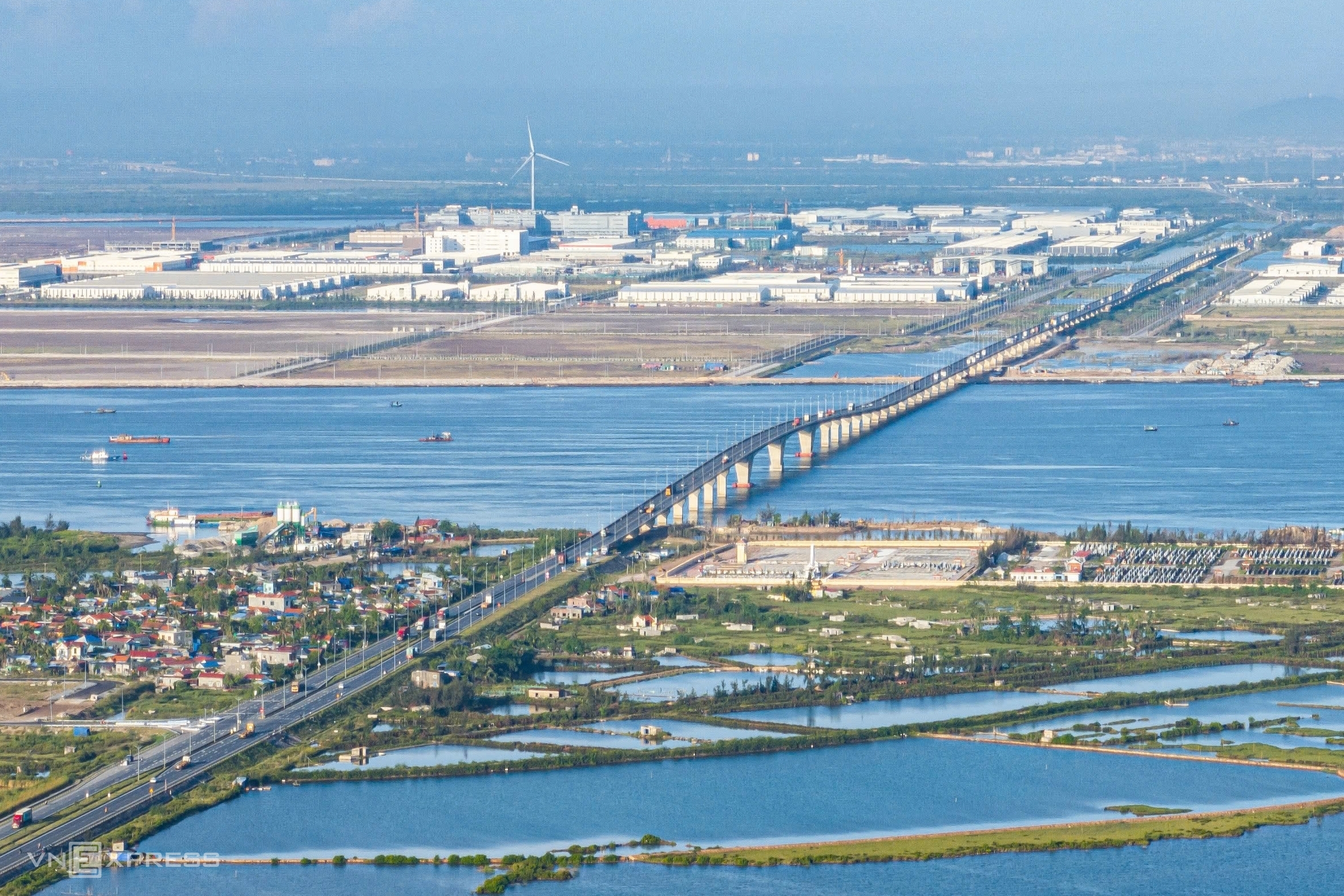 |
The 5.44-kilometer Tan Vu-Lach Huyen Bridge, opened in 2017, is Vietnam's longest sea-crossing bridge and one of the longest in Southeast Asia, with a total investment of nearly 12,000 billion VND. Previously, reaching Cat Hai Island took an hour by ferry; now it takes less than 30 minutes.
Due to the significant increase in traffic volume, Hai Phong City plans to construct a parallel Tan Vu-Lach Huyen 2 Bridge, also 5.44 kilometers long, and expand the 9.86-kilometer access road to six lanes for motor vehicles and four mixed lanes. The total investment is over 8,710 billion VND, funded by South Korean loans and local budget. Photo: Le Tan
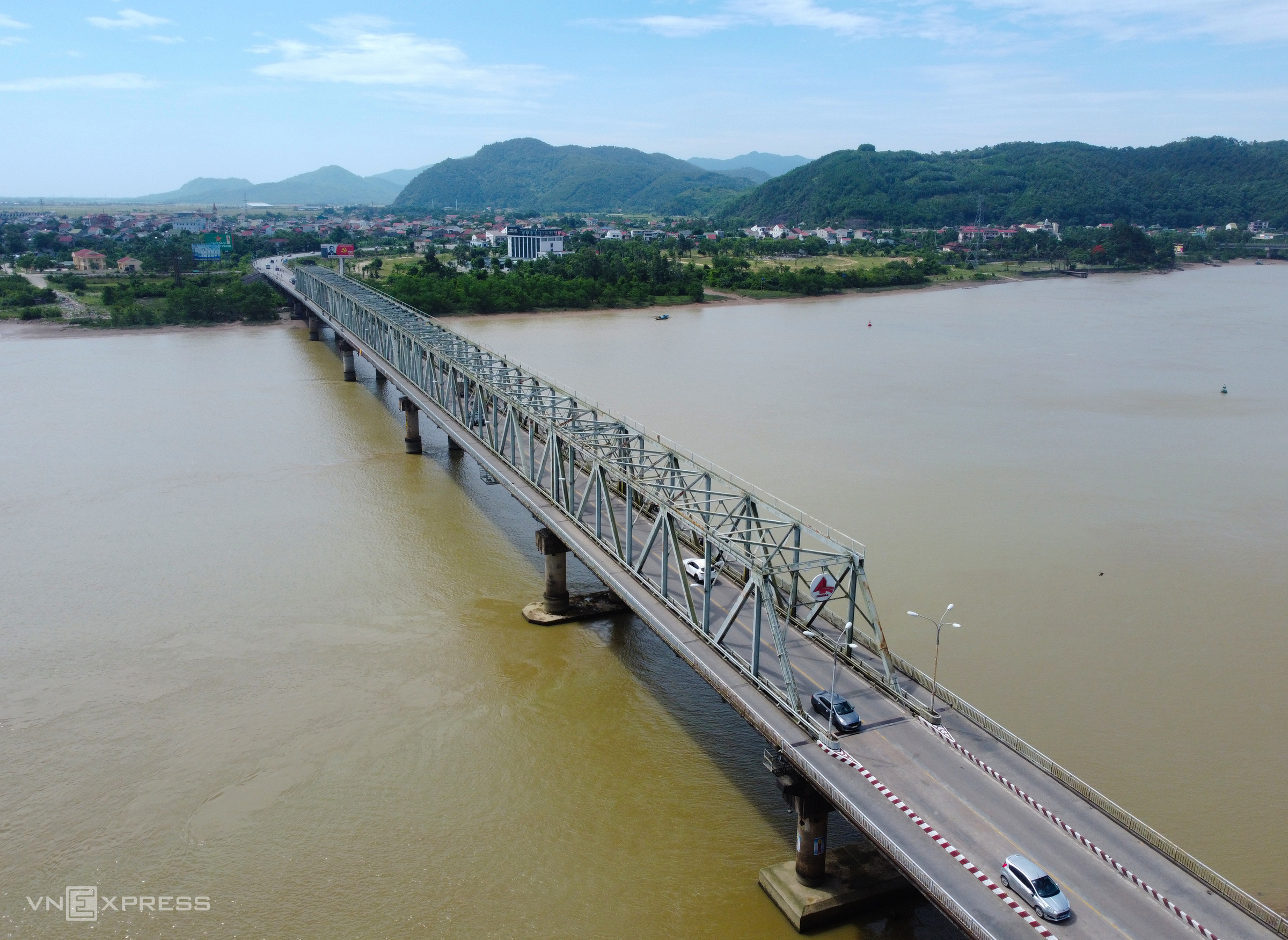 |
Ben Thuy was once a bustling trading hub, but the Lam River divided Vinh City's prosperity from Nghe Xuan's relative isolation. Construction on Ben Thuy 1 Bridge began in 1986, and it opened in 1990. At 630 meters long and 12 meters wide, it was the first road bridge over the Lam River and the second largest in the country after Hanoi's Thang Long Bridge, both built after 1975.
The transportation sector and successive generations of leaders in Nghe An and Ha Tinh provinces consider Ben Thuy 1 Bridge a landmark achievement, instrumental in driving socioeconomic development in the former Nghe Tinh Province and other central provinces during that era.
Currently, both Ben Thuy bridges collect tolls to recover the investment in the South Ben Thuy-Ha Tinh City Bypass National Highway project, which cost over 2,430 billion VND. Photo: Duc Hung
 |
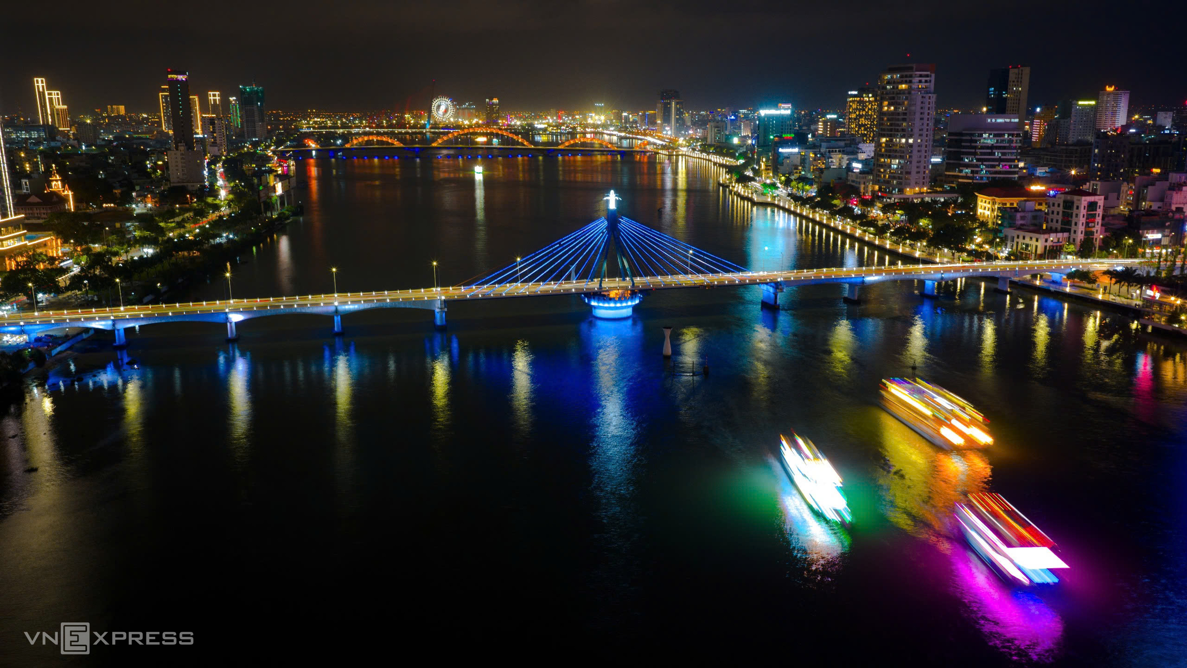 |
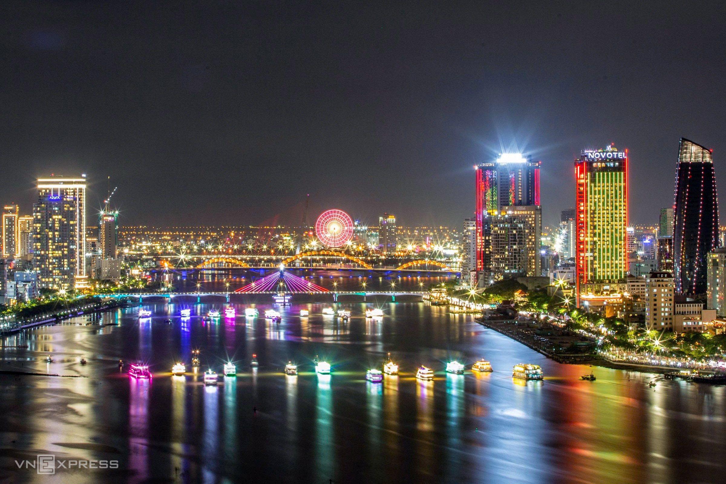
Construction of the Song Han Bridge commenced on 2/9/1998, and it opened on 29/3/2000. The 487.7-meter-long, 12.9-meter-wide prestressed concrete bridge features two 122.7-meter cable-stayed spans. Uniquely, the bridge can rotate 90 degrees to allow ships to pass, serving both transportation and tourism. Designed and built by Vietnamese engineers, the bridge marked a turning point in urban development and contributed to Da Nang's branding as the "City of Bridges." Photo: Nguyen Dong
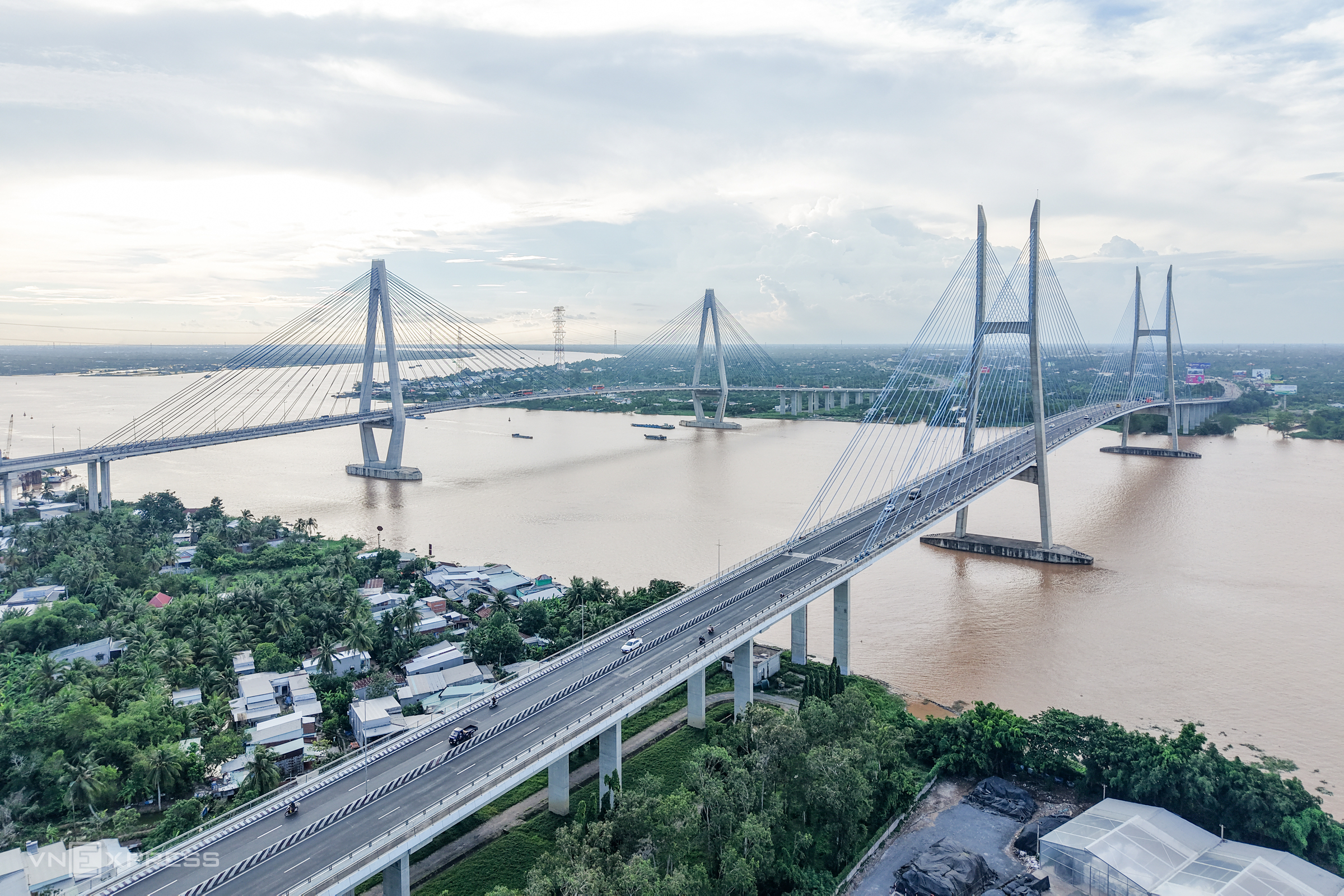 |
My Thuan Bridge, whose construction started in 1997 and completed in 2000, was Vietnam's first cable-stayed bridge. Spanning the Tien River, it connects Tien Giang and Vinh Long provinces (now Dong Thap and Vinh Long). The 1.53-kilometer bridge, with a 23-meter-wide deck, features four lanes for motor vehicles and two pedestrian walkways. Built in collaboration between Vietnam and Australia, the project cost over 90 million USD. The bridge has 128 cables divided into eight groups of 16.
My Thuan 2 Bridge, started in 2020 and finished in 2023, is nearly two kilometers long with six lanes, connecting the Trung Luong-My Thuan and My Thuan-Can Tho expressways. With a total investment exceeding 5,000 billion VND, the bridge completes the Ho Chi Minh City-Can Tho Expressway, relieving traffic on the original My Thuan Bridge and National Highway 1. It is the fourth cable-stayed bridge across the Tien River, following My Thuan, Rach Mieu (2009), and Cao Lanh (2018). Photo: Huy Phong
Reporting team


