

In Nghe An province, the provincial Steering Committee for Natural Disaster Prevention, Search and Rescue, and Civil Defense ordered the Ban Ve Hydropower Plant (the largest in north-central Vietnam, located in Yen Na commune) to discharge water at a total flow rate of 473 m3/s at 3:30 p.m. on 23/8. The reservoir's water level was at 191.84 m, 8.18 m below the normal flood level.
If the inflow to the Ban Ve reservoir reaches 1,000-1,200 m3/s or the water level at the Con Cuong station exceeds alert level 1, the plant will discharge water at the same rate as the inflow to maintain the water level. In case of major floods with a flow rate exceeding 1,200 m3/s or water levels at Con Cuong and Cho Trang exceeding alert level 2, the Ban Ve hydropower plant will reduce flood levels downstream. If the reservoir's water level threatens to reach 200 m, the discharge rate will be adjusted to ensure the safety of the structure and downstream areas.
Ban Ve Hydropower Plant releasing water on the afternoon of 23/8. Video: Hung Le
In Ha Tinh province, starting at 9 a.m. on 24/8, the Nam Ha Tinh Irrigation Company began releasing water from seven large reservoirs: Boc Nguyen, Thuong Song Tri, Da Han, Khe Xai, Song Rac, Kim Son, and Tau Voi. The expected discharge rate is 5-120 m3/second, with the end time dependent on rainfall and reservoir levels. This action is in response to Typhoon Kajiki, which is forecast to bring heavy rainfall of 150-300 mm to the area, with some places exceeding 600 mm.
Tran Manh Cuong, Director of the Nam Ha Tinh Irrigation Company, explained that proactive early discharge reduces pressure on the reservoirs, limits flooding, and protects lives and property. Several smaller reservoirs, such as Da Cat, Khe Lau, Khe Nay, and Dap Mung, are also nearing their overflow levels and will naturally discharge water at 1-90 m3/second during heavy rain.
Current water levels are: Tau Voi reservoir at 14.13 m (5.43 million m3), Boc Nguyen at 17.39 m (14.94 million m3), Song Rac at 19.88 m (71.13 million m3), Khe Xai at 22 m (7.1 million m3), Thuong Song Tri at 28.18 m (12.64 million m3), Da Han at 34.57 m (12.47 million m3), and Kim Son at 94.85 m (13.31 million m3).
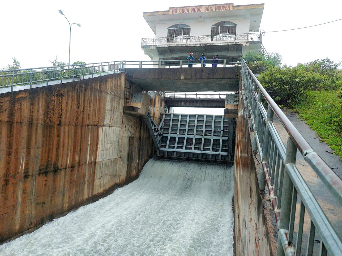 |
Boc Nguyen Reservoir during a flood discharge in 2024. Photo: Duc Hung |
Boc Nguyen Reservoir during a flood discharge in 2024. Photo: Duc Hung
In Quang Tri province, the Vinh Linh Irrigation Company is releasing water from the Bao Dai reservoir in Vinh Linh commune, which has a capacity of over 25.5 million m3, with the water level approximately 30 cm above the normal level. At 8 a.m. on 23/8, despite sunny weather, the reservoir was discharging water at 100 m3/s, while the inflow was over 11 m3/s.
Le Van Ty, Director of the company, said that the discharge will be adjusted based on rainfall, flood conditions, and inflow to ensure the safety of the structure and mitigate downstream flooding. The province has 272 irrigation reservoirs and 413 dams, currently at 48-59% of their designed capacity. Reservoirs with discharge gates will regulate water flow through these gates and spillways during heavy rain.
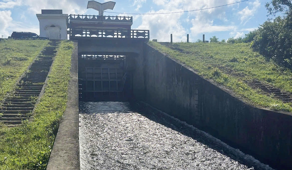 |
Bao Dai Reservoir releasing water in anticipation of floods on the morning of 23/8. Photo: Anh Long |
Bao Dai Reservoir releasing water in anticipation of floods on the morning of 23/8. Photo: Anh Long
Hue City also issued an urgent dispatch requesting reservoirs and hydropower plants upstream of the Huong, Bo, and Truoi rivers, especially the Huong Dien reservoir, to regulate and lower water levels in preparation for floods. Irrigation units are coordinating with local authorities to open drainage systems to protect summer-autumn rice crops and low-lying areas.
Hue City and Quang Tri province have issued sea bans. Hue City's ban started at 7 p.m. on 23/8, requiring all vessels to seek shelter before that time. Quang Tri's ban began at 7 a.m. on 24/8, with the evacuation of residents and relocation of assets from dangerous areas completed by 7 p.m. the same day.
Nghe An and Ha Tinh have not yet issued sea bans but have asked local authorities to prepare for Typhoon Kajiki. Districts and communes must identify areas at risk of flash floods, landslides, and inundation to warn and guide residents, and deploy forces to evacuate people from dangerous areas.
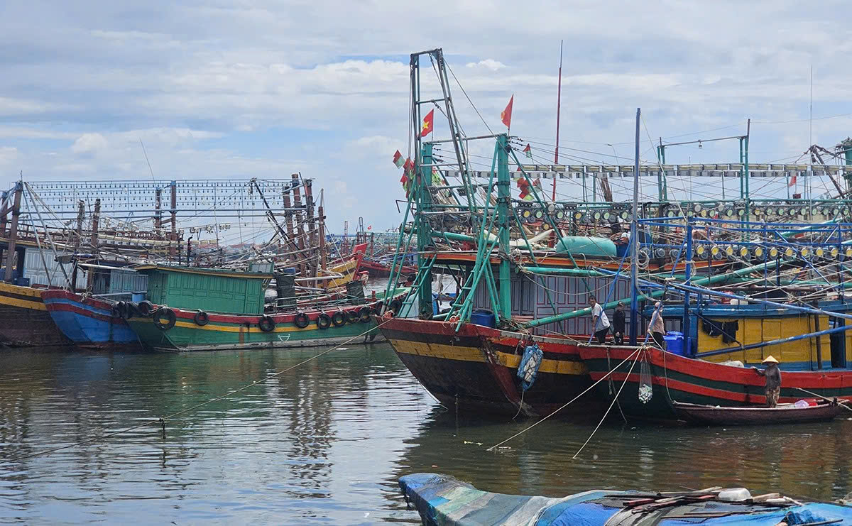 |
Boats seeking shelter in Gianh estuary on the morning of 23/8. Photo: Dac Thanh |
Boats seeking shelter in Gianh estuary on the morning of 23/8. Photo: Dac Thanh
Quang Tri province required all vessels to be anchored by 10 a.m. on 24/8. As of noon, the province had 517 vessels with 2,136 crew members at sea: 116 vessels and 241 crew members in coastal waters; 226 vessels and 870 crew members in the Gulf of Tonkin; 169 vessels and 984 crew members in the waters from Quang Tri to Quang Ngai; two vessels and 11 crew members in the waters from Lam Dong to Ca Mau; and 4 vessels and 30 crew members in the waters from Binh Dinh to Binh Thuan.
The National Center for Hydro-Meteorological Forecasting reported that at 1 p.m., Typhoon Kajiki was 300 km from the Paracel Islands with winds of level 9, gusting to 11, moving west-northwest at 25 km/h. On 25/8, the typhoon is predicted to strengthen to level 12, gusting to 15, over the sea from Thanh Hoa to Quang Tri before making landfall and weakening into a low-pressure area in Laos.
Some international forecasts predict the typhoon could reach a maximum intensity of 126-130 km/h, with its center making landfall in Nghe An.
Duc Hung - Dac Thanh - Vo Thanh


