

 |
Dan Hai commune authorities set up six evacuation centers. From 3 PM, many elderly residents were transported to the local kindergarten by relatives and authorities on motorbikes. |
In Ha Tinh, on the afternoon of 23/8, a 200-meter section of the Hoi Thong sea dike in Dan Hai commune, formerly Nghi Xuan district, collapsed. Authorities mobilized 400 people to reinforce the dike with steel mesh, sandbags, and rocks to protect against rising sea levels.
Dan Hai commune People's Committee planned to evacuate 655 households, comprising 1,593 people, to safety on 24/8 in anticipation of Typhoon Kajiki's landfall the next day.
 |
Evacuees at the kindergarten received essential supplies such as food and water from the authorities. |
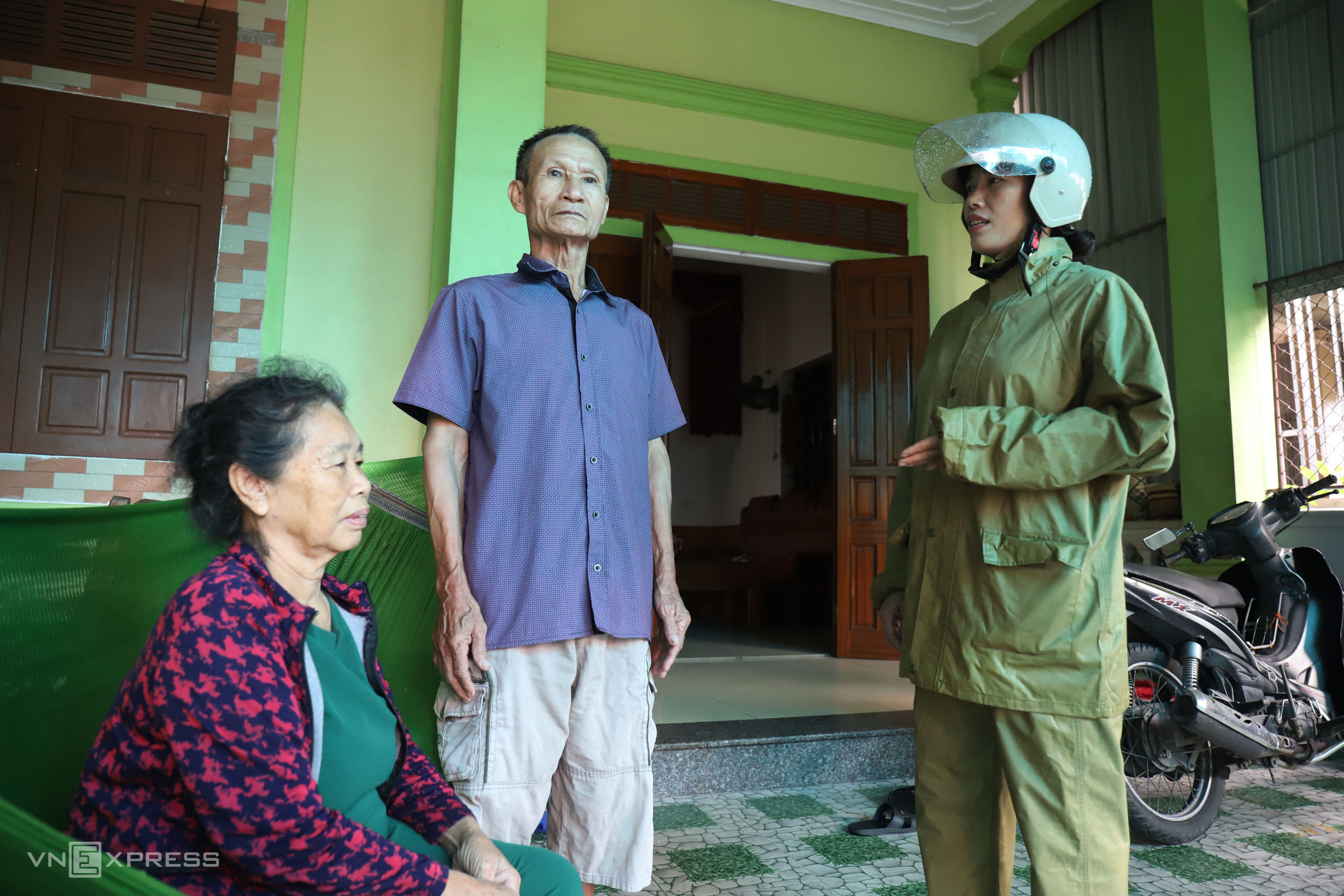
Starting at 2 PM, village heads visited households scheduled for evacuation, explaining the situation and urging them to move to the homes of relatives in safer locations, or to schools and community centers.
Tran Thi Thanh Xuan, head of Hoi Tien village, reported that 7 village officials visited 165 households on that day, and most residents complied with the evacuation order.
 |
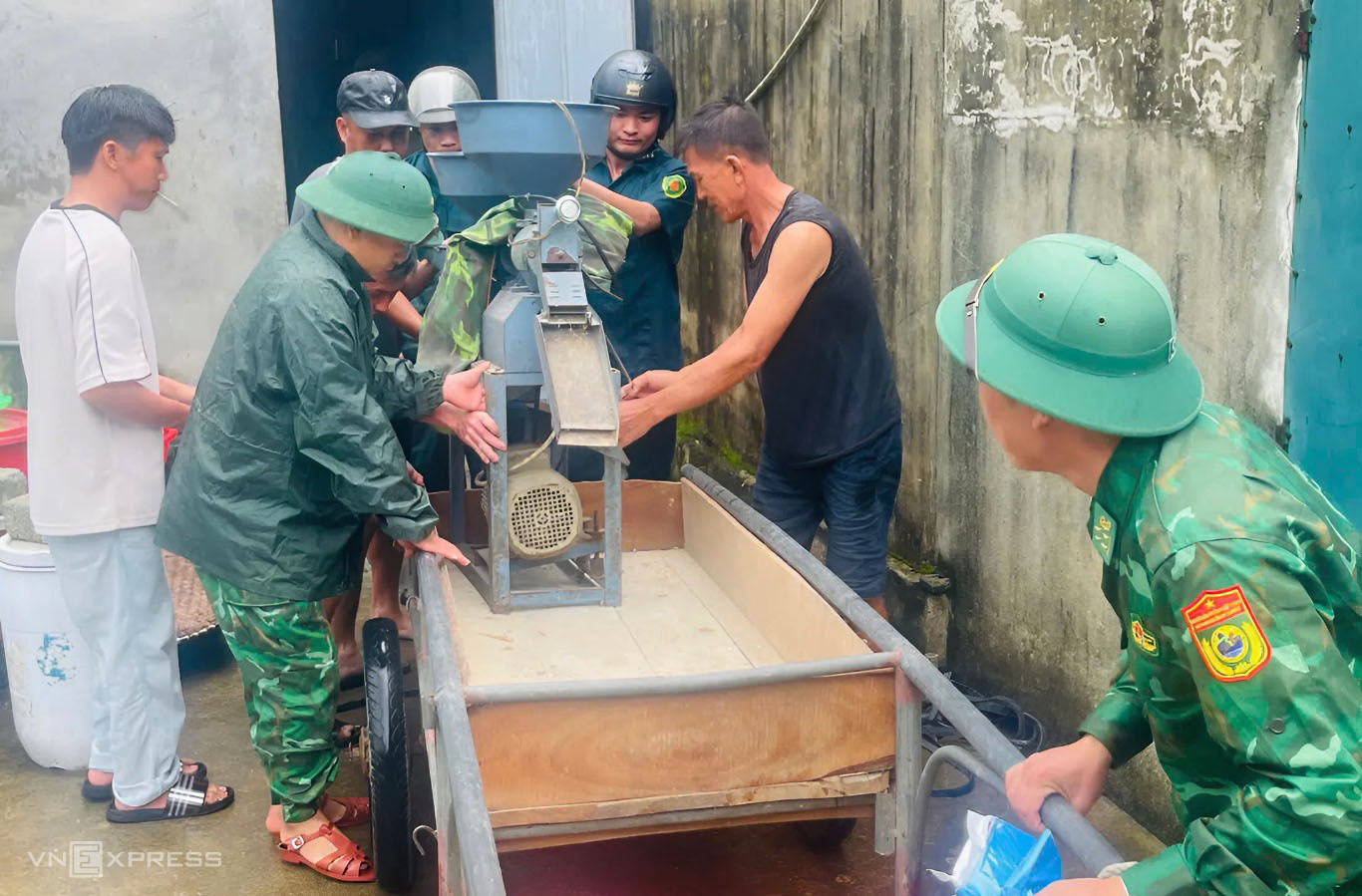
In Co Dam commune, also formerly in Nghi Xuan district, 30 officers from the Lach Ken Border Guard station helped coastal residents move their valuables to the homes of relatives at higher elevations to protect them from potential rain damage. The commune planned to evacuate over 3,500 households with more than 11,000 residents. |
 |
In Nghe An, starting in the early afternoon of 24/8, the militia of Thanh Vinh ward, formerly part of Vinh City, held an urgent meeting at the Hao Thanh Co collective area and Quang Trung apartment building to plan the evacuation of approximately 1,300 households living in the buildings. |
 |
Nguyen Thi Cuc said most apartments in the old Quang Trung building have been damaged for years. "Hearing about the strong typhoon, we immediately complied with the evacuation order for safety," Cuc said. |
 |
Many parts of the building are severely deteriorated, with peeling walls exposing the steel frame. |
 |
The apartment buildings, constructed 50 years ago, are now dilapidated.
 |
 |
 |
From early afternoon, authorities visited each apartment, urging residents to evacuate and prioritizing the elderly and frail.
Thanh Vinh ward authorities arranged for evacuees to stay at the Lam Giang hotel, CT1B apartment building, community centers, or with relatives. The ward mobilized militia, police, and local security forces to assist with the evacuation and protect property.
 |
In mountainous communes formerly in Tuong Duong, Ky Son, and Con Cuong districts, where there is a risk of flash floods and landslides due to heavy rain after the typhoon, authorities also evacuated residents living near the mountains.
As of the afternoon of 24/8, Typhoon Kajiki was 470 km from Nghe An and 450 km from Ha Tinh, with winds of 134-166 km/h (category 13-14), gusting to category 16, two categories higher than in the morning. The typhoon was moving west at 20 km/h and could intensify further. It was forecast to approach the coast from Nghe An to Quang Tri early on 25/8, maintaining category 13-14 winds with gusts to 16, posing a level 4 disaster risk to the coastal areas from Thanh Hoa to Quang Tri. By the afternoon of 25/8, the typhoon was expected to make landfall, weakening to category 11-12 before dissipating into a low-pressure system over Laos on 26/8.
An estimated 586,000 people were expected to be evacuated in the provinces affected by Typhoon Kajiki.
Duc Hung


