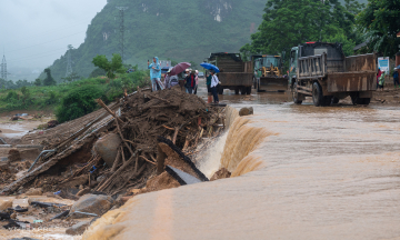
Residents of Ban Hong hamlet, Truong Ha commune, reported that two days ago (3/6), a farmer operating a harrowing machine in a field suddenly found one leg sinking into a hole. Fortunately, the machine pulled them away, preventing a serious accident.
The sinkhole's opening is only about 50 cm wide, yet it expands to a diameter of over 9 meters below the surface. Locals attempted to measure its depth with a 5-meter stick, but it did not reach the bottom. The sinkhole is located over 200 meters from residential areas, flanked by mountains.
Water from the rice field is continuously draining into the sinkhole, forcing a halt to all cultivation activities in the vicinity for safety reasons.
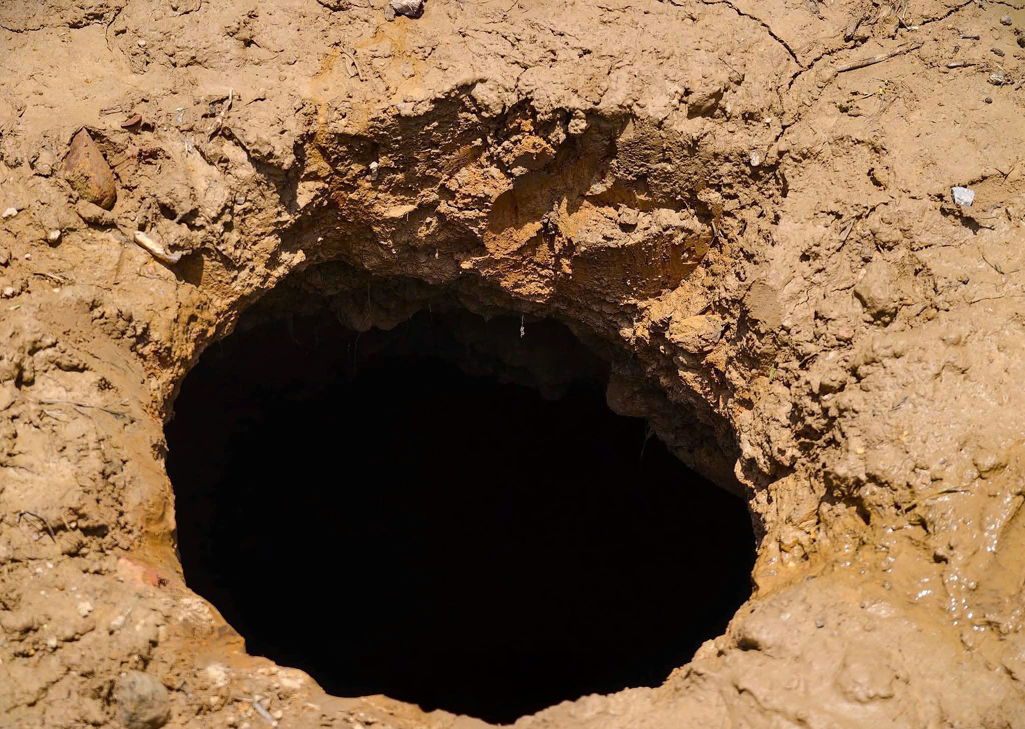 |
The sinkhole appeared in Cao Bang. Photo by *Ha Cuong*. |
The People's Committee of Truong Ha commune has advised residents to avoid the sinkhole area while awaiting surveys by specialized agencies to determine its cause.
Truong Ha is situated within the Non nuoc Cao Bang UNESCO Global Geopark, an area renowned for its limestone mountains, lakes, and subterranean streams, which have formed over hundreds of millions of years of geological evolution.
Geological studies indicate that limestone in Northeast Vietnam undergoes significant dissolution from rainwater and groundwater, leading to the formation of extensive cave systems, fissures, and subsurface voids. These conditions are conducive to localized subsidence or sinkhole formation when the overlying ground becomes unstable.
Cao Bang stands as one of Vietnam's most prominent karst regions, boasting numerous renowned geological heritage sites. These include the Thang Hen lake system, Nguom Ngao cave, Ban Gioc waterfall, and valleys with extensive underground caves carved within ancient limestone formations.
Gia Chinh