

On the morning of 1/9, following heavy rainfall, thousands of cubic meters of debris tumbled from a mountainside onto Highway 47 in the border commune of Yen Nhan, striking three passing vehicles, according to the head of Road Management Unit No. 8 (under Thanh Hoa Road Management Joint Stock Company No. 2). The drivers had no time to react and were pushed toward the downslope embankment.
 |
The scene where three vehicles were nearly buried by the landslide this morning. Photo: Lam Son |
The scene where three vehicles were nearly buried by the landslide this morning. Photo: Lam Son
At the scene, the pickup truck lay tilted on a mound of debris over 4 m high, while the other two vehicles were partially buried. Fortunately, no one was injured.
The landslide is estimated to have involved 2,000-3,000 m3 of debris. This is the third landslide on Highway 47 since Typhoon Kajiki made landfall. Road Management Unit No. 8 is mobilizing equipment to clear the road and rescue the affected vehicles.
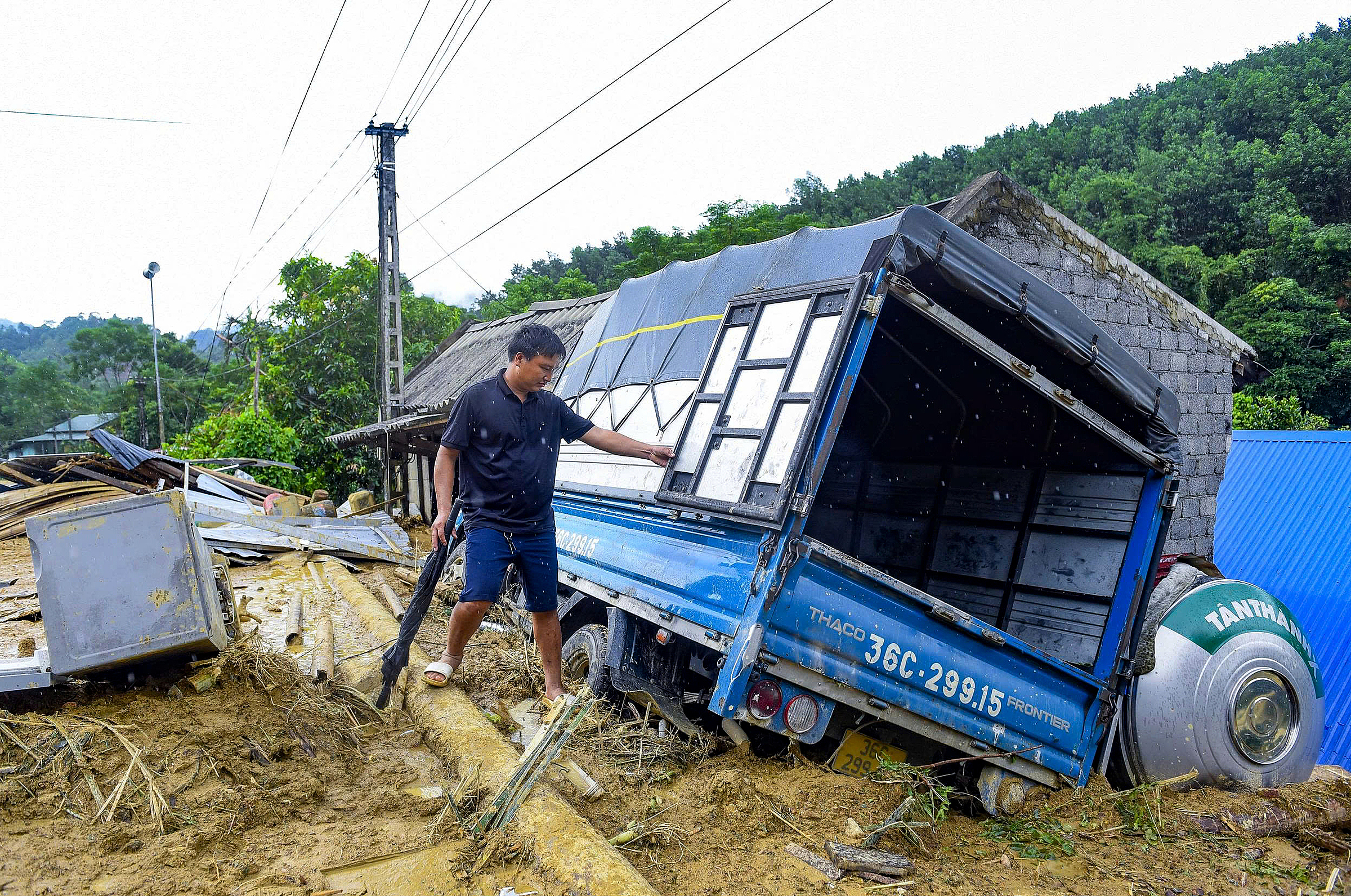
Previously, on 26/8, Typhoon Kajiki caused flash floods and landslides in Yen Nhan and Bat Mot communes, burying dozens of houses completely and damaging or unroofing many others.
 |
Highway 47 to Yen Nhan commune is currently blocked due to a major landslide. Photo: Lam Son |
Highway 47 to Yen Nhan commune is currently blocked due to a major landslide. Photo: Lam Son
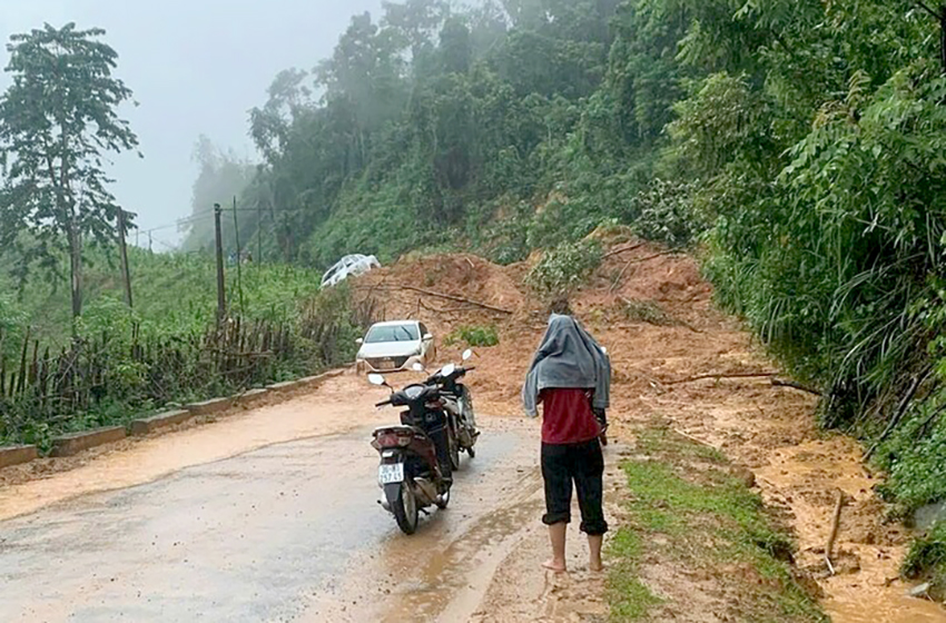
Heavy rain has also triggered nearly 20 landslides on both upslope and downslope embankments along Highway 47 in Yen Nhan commune, severely hampering relief efforts. The People's Committee of Thanh Hoa province has declared a state of emergency in Yen Nhan and Bat Mot communes to address the aftermath.
Typhoon Kajiki made landfall on the afternoon of 25/8 in the Thanh Hoa - Ha Tinh region with winds of level 10-11, gusting to level 13, causing over 10 hours of heavy rain from North Central Vietnam to several northern provinces. Of the three localities directly affected, Thanh Hoa experienced the most severe flooding.
According to Thanh Hoa’s Department of Agriculture and Rural Development, the heavy local rainfall, combined with flooding from upstream rivers and streams in the mountainous regions and upper Laos, caused water levels in the Ma, Chu, Buoi, and Cau Chay rivers to exceed alarm level three. Tens of thousands of households in downstream areas like Cam Thuy, Vinh Loc, Thach Thanh, and Ham Rong were submerged, and many national highways were paralyzed for hours.
Le Hoang


