

Typhoon Kajiki, which struck on the afternoon of 25/8, has left a trail of destruction, including three deaths, 13 injuries, damage to over 6,800 houses, and thousands of hectares of agricultural land and infrastructure. According to the Steering Committee for Natural Disaster Prevention and Control, as of the morning of 26/8, three fatalities were reported in Ninh Binh, Nghe An, and Ha Tinh provinces. Thirteen people were injured, with five each in Ha Tinh and Quang Tri provinces.
The typhoon caused eight houses to collapse and damaged the roofs of over 6,800 others, primarily in Ha Tinh province (6,340 houses). Nearly 3,100 houses were flooded, mostly in Thanh Hoa province (over 1,900 houses). Heavy rainfall in Thanh Hoa also isolated 27 villages in Xuan Chinh, Van Xuan, and Tan Thanh communes. Authorities reported a 25-meter breach in the Chu dyke in Thanh Hoa and a malfunctioning sluice gate at the Hoi Thong sea dyke in Ha Tinh, leading to flooding in the surrounding fields.
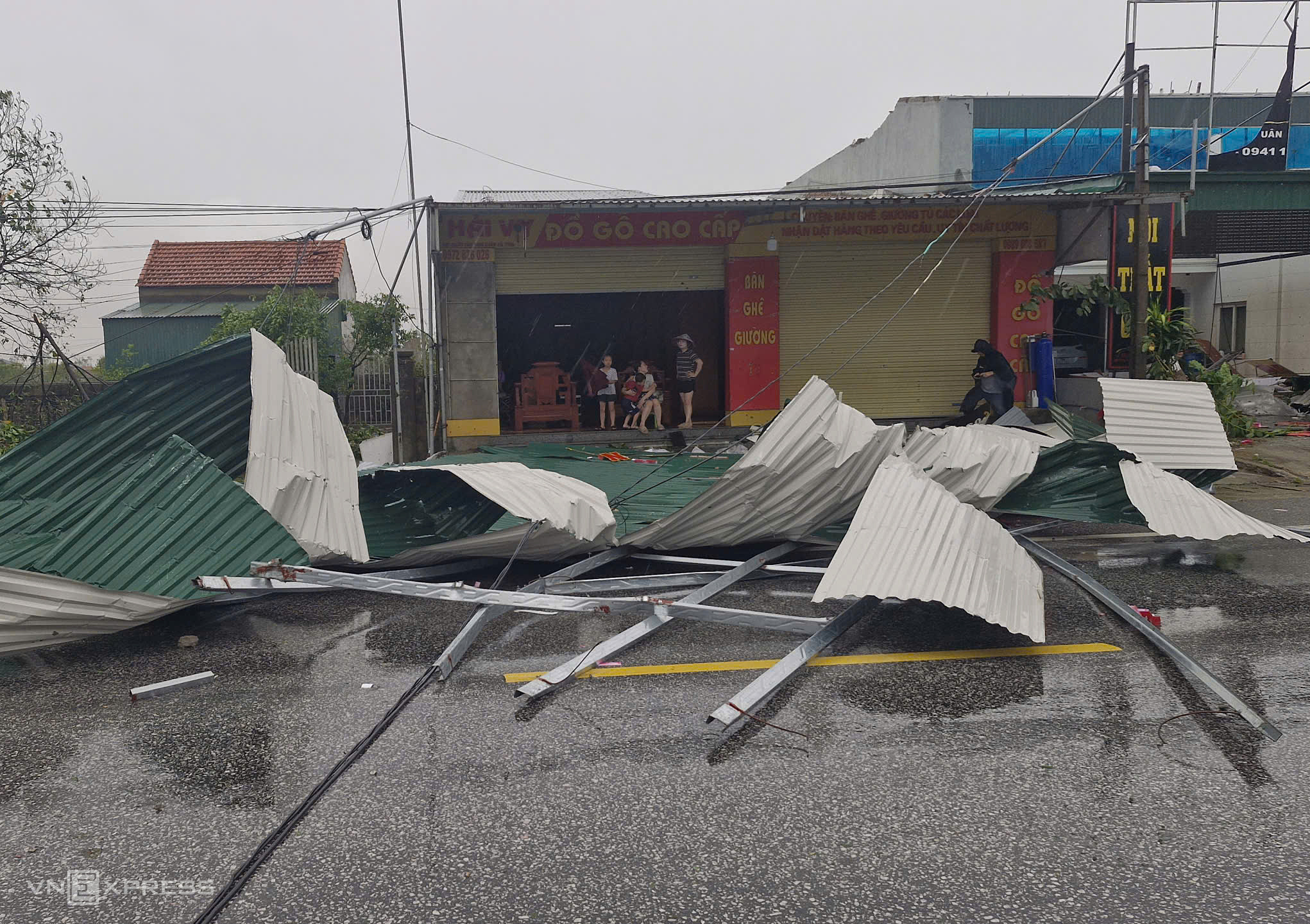 |
Roofing sheets blown off houses in Co Dam, Ha Tinh. Photo: Duc Hung |
Roofing sheets blown off houses in Co Dam, Ha Tinh. Photo: Duc Hung
Agricultural damage extends to over 31,300 hectares of rice paddies, with nearly 21,000 hectares affected in Ha Tinh and 7,000 in Nghe An. Over 2,700 hectares of vegetable crops, over 2,200 hectares of fruit trees, and 160 hectares of aquaculture were also flooded or damaged.
Regarding transportation, six landslides occurred in Thanh Hoa and Quang Tri, with localized flooding in Thanh Hoa, Nghe An, and Quang Tri. On 25/8, 30 flights were rerouted, and 35 others were canceled. Dong Hoi and Tho Xuan airports temporarily suspended operations.
Power outages affected over 1.7 million customers, with the highest numbers in Nghe An (nearly 870,000), Thanh Hoa (over 395,000), and Ha Tinh (almost 350,000). Additionally, 742 power poles collapsed, mainly in Nghe An and Ha Tinh.
Kajiki, the fifth typhoon to form in the East Sea this year, originated on 23/8 and was characterized by its intensity, complex trajectory, and rapid, erratic movement. The typhoon reached a maximum intensity of Category 14, with gusts up to Category 17, comparable to Typhoon Yagi in 2024. On the afternoon of 25/8, the typhoon made landfall in Nghe An and Ha Tinh provinces with winds of Category 11-12 and gusts of Category 13. It then slowed significantly, remaining almost stationary for three hours, extending its time over land to approximately 10 hours. This prolonged period of strong winds increased the danger. By the morning of 26/8, the typhoon weakened and dissipated over central Laos.
The typhoon brought strong winds to various areas: Bach Long Vi (Category 7 with gusts of Category 9), Co To (Category 7 with gusts of Category 10), Hon Ngu (Category 8 with gusts of Category 11), Dien Chau (Category 10 with gusts of Category 12), Do Luong (gusts up to Category 15), Ky Anh (Category 8 with gusts of Category 11), and Cam Nhuong (Category 10 with gusts of Category 13). Rainfall from 6 PM on 24/8 to 7 AM on 26/8 in the midlands, northern delta, and coastal areas from Hung Yen to northern Quang Tri ranged from 100 to 300 mm, with Ha Tinh receiving 200 to 400 mm and some areas over 500 mm. Several weather stations recorded exceptionally high rainfall: Ho Thuong Tuy (Ha Tinh) 703 mm, Ky Phong 674 mm, Ho Song Rac 567 mm, Van Xuan (Thanh Hoa) 554 mm, Hua Na (Nghe An) 517 mm, Dong Tam (Quang Tri) 425 mm, and Van Mai (Phu Tho) 465 mm.
Gia Chinh


