Floods have claimed 41 lives, according to the Vietnam Disaster Management Authority on the evening of 20/11. Dak Lak suffered the heaviest losses with 16 fatalities, followed by Khanh Hoa with 14, Lam Dong with four, Gia Lai with three, and Hue and Da Nang with two each. Additionally, 9 people remain missing.
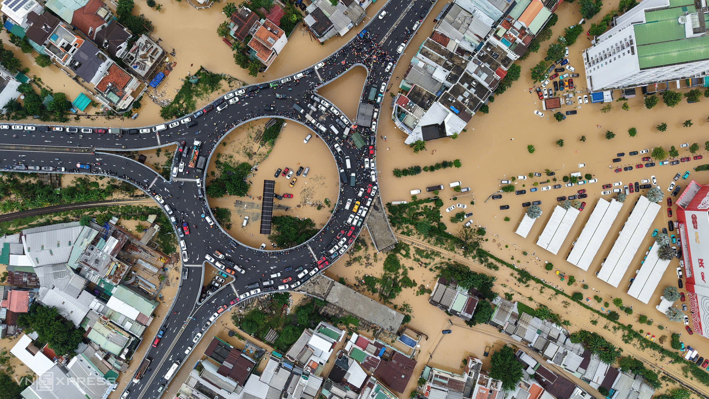
The heavy rainfall and subsequent flooding damaged 167 homes and submerged over 52,000 others. The most affected provinces are Dak Lak (nearly 23,000 homes), Gia Lai (19,200), and Khanh Hoa (9,000). Agricultural damage includes over 13,000 hectares of crops, nearly 2,100 hectares of perennial trees, 88 hectares of aquaculture, and over 30,700 livestock and poultry lost.
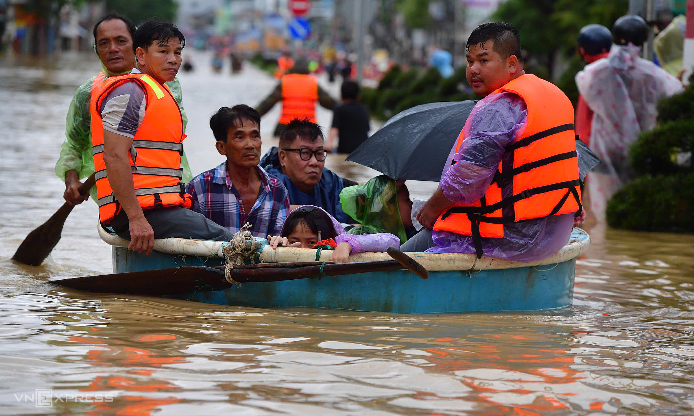 |
Flooding remained high in Nha Trang, Khanh Hoa province, on the afternoon of 20/11. Thanh Tung |
Flooding remained high in Nha Trang, Khanh Hoa province, on the afternoon of 20/11. Thanh Tung
More than 30 locations along national highways 1, 14, 14E, 14H, 40B, 20, and Truong Son Dong Road experienced landslides and deep flooding, causing traffic disruptions. Provincial roads recorded over 140 landslide points. In Lam Dong province, the Prenn Pass and a fault line at Mimosa Pass necessitated an emergency declaration.
Over the past two days, the railway sector halted 14 passenger train services. Tuy Hoa Airport temporarily suspended operations from 10h until tomorrow noon. More than one million customers experienced power outages, with nearly 615,000 households having power restored to date.
To address the floods, the Prime Minister issued five official dispatches, and the National Civil Defense Steering Committee issued four. Deputy Prime Minister Ho Quoc Dung personally inspected response and recovery efforts in Khanh Hoa.
The Ministry of Defense deployed 18,000 personnel and 441 vehicles to assist residents. Four helicopters are on standby with two tons of food and essential supplies for isolated areas. Provincial police forces mobilized nearly 42,000 officers and soldiers with over 3,200 vehicles for rescue operations.
Dak Lak requested national reserve aid including: 2,000 tons of food, three tons of Cloramine B chemicals, 1,000 liters of water treatment chemicals, 1,000 first aid kits, 60 inflatable boats, 30 canoes, four high-capacity boats, 500 life jackets, and 150 high-pressure flashlights.
Lam Dong requested 600 billion dong for recovery efforts and asked the Military Region 7 Engineer Corps to help repair damaged roads. Khanh Hoa requested: one DT3 boat, two generators, 6,000 lifebuoys, 3,000 life jackets, and 50 light rafts.
The Ba River's water level is receding.
Heavy rain persisted in Dak Lak, Gia Lai, and Khanh Hoa from last night until today. Rainfall measured from 19h on 19/11 to 17h today included: Hoa Tam (Dak Lak) 268 mm; Song Hinh (Dak Lak) 307 mm; My Thuan Lake (Gia Lai) 220 mm; Hoa Son Lake (Khanh Hoa) 665 mm; Dong Trang 328 mm; Da Den Lake 325 mm.
Rainfall in the provinces decreased from 13h, generally below 50 mm. The Ba River at Cung Son station (Dak Lak) is currently 2,3 m above alert level three, a decrease of 4,19 m from its peak at 1h this morning (exceeding the historic flood of 1993 by approximately 1,09 m). At Phu Lam station, the water level is 0,8 m above alert level three, about 0,9 m lower than its 3h peak.
 |
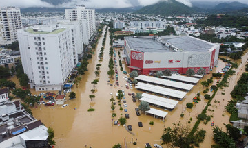
Flooding submerged thousands of homes in Quy Nhon Bac ward (formerly Quy Nhon City) on 20/11. Dinh Van |
Flooding submerged thousands of homes in Quy Nhon Bac ward (formerly Quy Nhon City) on 20/11. Dinh Van
The Krong Ana River at Giang Son station (Dak Lak) remains 0,84 m above alert level three. The Kon River at Thach Hoa (Gia Lai) is 0,33 m below alert level three, a decrease of 1,42 m from its peak at 20h yesterday.
In Khanh Hoa, the Dinh Ninh Hoa River is 1,04 m above alert level three, surpassing the historic flood of 1986 by approximately 0,16 m. The Cai Phan Rang River is 0,19 m above alert level three, while the Cai Nha Trang River is 0,64 m below alert level three.
Meteorological agencies forecast 70-150 mm of rain from this evening until tomorrow evening in eastern Da Nang – Dak Lak and northern Khanh Hoa, with localized amounts up to 250 mm. From tomorrow night until 22/11, the same area will experience 50-100 mm of rain, with higher elevations receiving over 200 mm.
Over the next 12 hours, the Ba River's water level will continue to drop but remain around alert level three. The Kon River will fall below alert level two, while the Krong Ana River will stay above alert level three. In the subsequent 24 hours, the Ba River will decrease to alert level two to just above alert level two. The Kon River will reach alert level one, and the Krong Ana River will continue above alert level three.
Heavy rainfall caused by rare weather combination
Doctor Truong Ba Kien, Deputy Director of the Center for Meteorological and Climate Research, explained that the heavy rainfall in the South Central Coast and Central Highlands resulted from a rare combination of extreme factors occurring simultaneously.
First, a strong cold air mass intensified, arriving earlier and penetrating deeper than usual. Upon encountering the southern Truong Son mountain range, this air current was deflected to become northeast then easterly winds, causing widespread heavy rain. Concurrently, the region was affected by very strong easterly winds blowing from the sea inland, carrying abundant moisture that was then blocked by the terrain.
 |
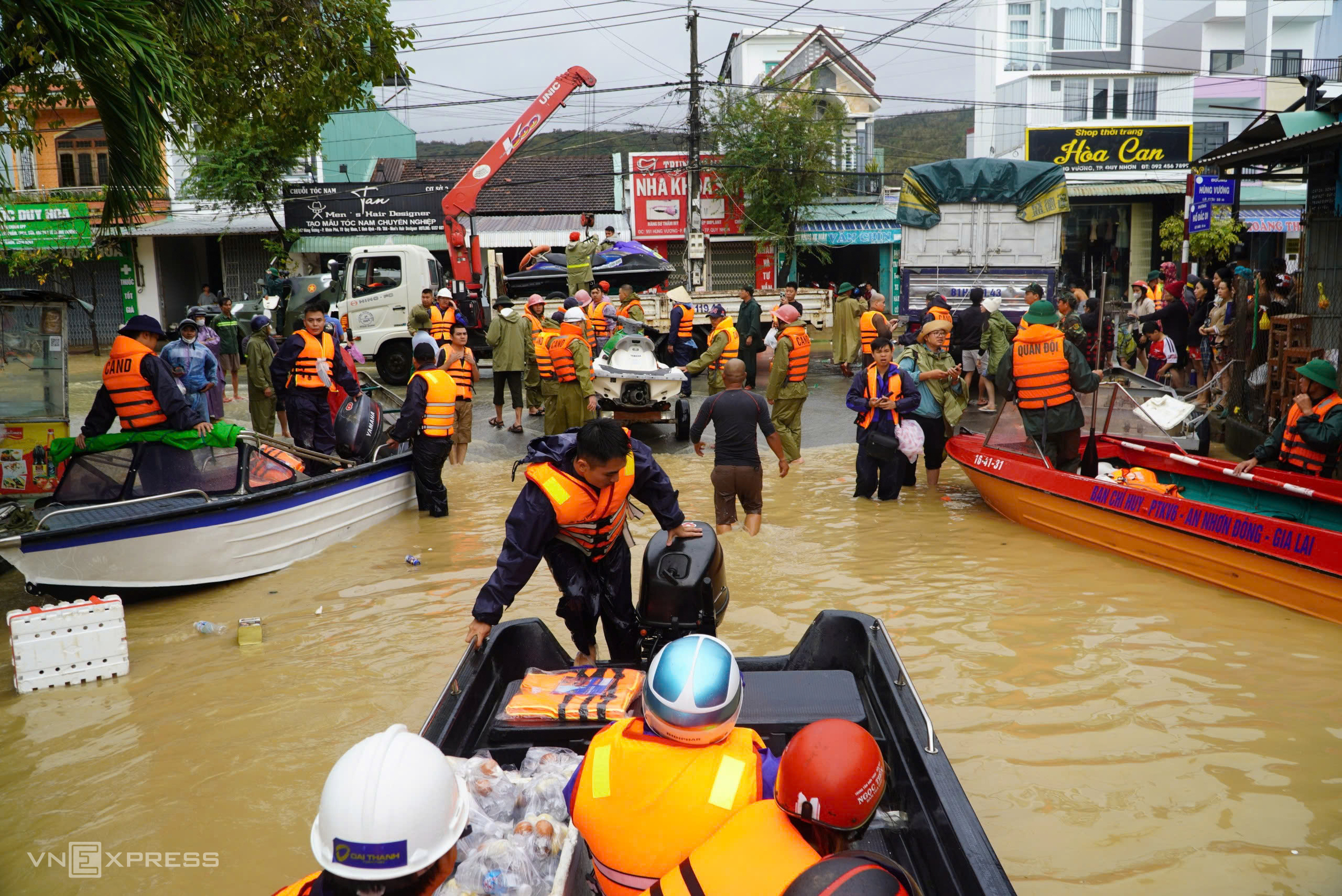
A residential area in Tay Nha Trang ward heavily flooded on 20/11. Thanh Tung |
A residential area in Tay Nha Trang ward heavily flooded on 20/11. Thanh Tung
"This created a large-scale wind convergence zone, leading to concentrated and prolonged rainfall", Doctor Kien stated, adding that this air mass was further strengthened by a powerful high-pressure system over the Pacific Ocean.
A notable anomaly of this rainfall event, according to Doctor Kien, is the unusually high sea surface temperature in the East Sea, 1-1,5 degrees Celsius above average, despite being in the cold air season. Warmer seas mean that north and east winds carry more moisture, providing additional "fuel" for intensified rain when encountering land. Previous years saw similar wind convergence but not such heavy rainfall, primarily due to the absence of such high sea temperatures.
Additionally, the equatorial cloud band has been highly active and extended northward in recent days, increasing atmospheric disturbances and sustaining many days of rain in the South Central Coast and Central Highlands.
Doctor Kien noted that the underlying impact of climate change, which warms the atmosphere and oceans, causes the air to hold more moisture. This will increase the frequency and intensity of extreme rainfall events, making them stronger and longer-lasting than before.
Gia Chinh