In april, the country recorded four widespread rain events, accompanied by nine thunderstorms and hail occurrences across all three regions. Specifically, from the evening of 2/5 to the morning of 4/5, eleven provinces and cities from the northern mountains to the north central region experienced strong thunderstorms, hail, and lightning. The natural disasters injured twelve people; damaged over 3,100 homes; affected nearly 15,800 hectares of rice and crops; and caused over 100 power poles to break. A lightning strike also ruptured a storage tank, spilling about 2,000 liters of molasses in Nghe An.
Many hail events featured large hailstones (4-5 cm), falling densely and accompanied by strong wind gusts, indicating powerful and potentially destructive storm cells.
 |
Recovery efforts after a thunderstorm in Thai Nguyen on 3/5. *Photo: Thai Nguyen Provincial Military Command* |
Explaining this phenomenon, Truong Ba Kien, deputy director of the Center for Meteorological and Climate Research (Institute of Meteorology, Hydrology, Environment and Sea, Ministry of Agriculture and Environment), stated that april-may is a transitional period in the northern and north central regions, which are prone to strong thunderstorms, squalls, lightning, and hail. This year, an additional factor is the earlier-than-average increase in baseline temperatures, making the air layer near the ground hotter and more humid, accumulating more energy.
Concurring, Nguyen Van Huong, head of the Weather Forecasting Department (National Center for Hydro-Meteorological Forecasting), attributed the development of strong thunderstorms to the combination of previously high temperatures and late-season cold air fronts. When cold air descends, even if its intensity is not as strong as in winter, encountering the existing hot and humid air mass creates significant atmospheric disturbance, activating thunderstorms, squalls, and hail.
Delving deeper, Kien explained that the interaction between two contrasting air masses—cold and dry, and hot and humid—creates significant differences in temperature and humidity, leading to strong atmospheric instability. This instability forms rapidly developing updrafts (strong rising air currents) that create vertically expanding cumulonimbus clouds. These updrafts are powerful enough to keep ice particles suspended in sub-zero temperatures, causing them to be swept up and down multiple times, accumulating additional layers of ice before falling to the ground as hail.
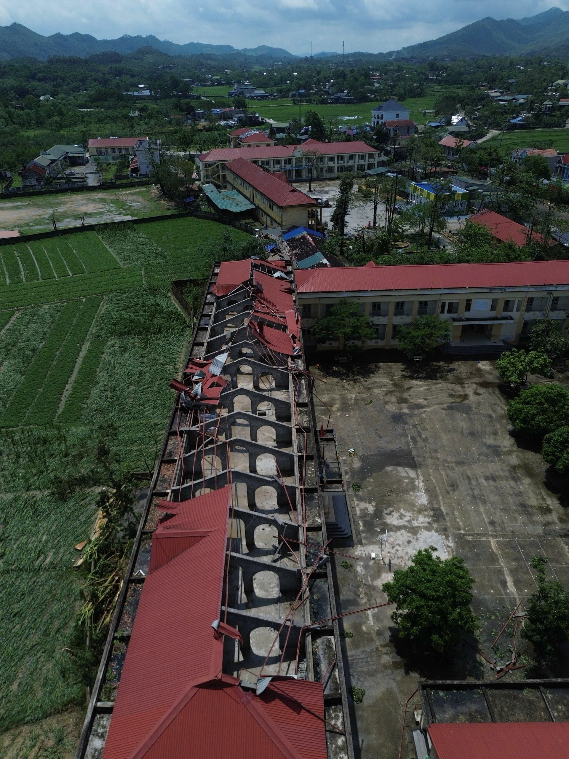 |
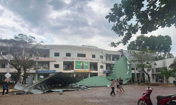
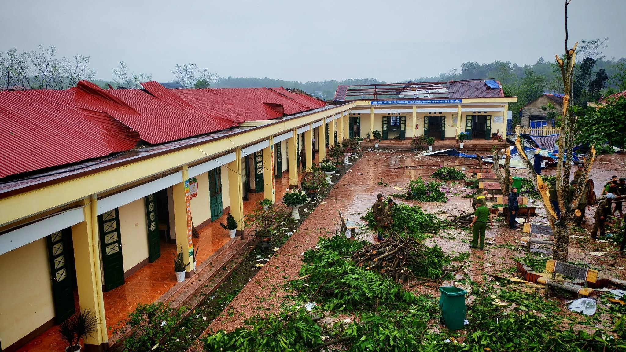
A thunderstorm on 2/5 blew off the roof of a school in Phu Luong commune, Tuyen Quang. *Photo: Van Toan* |
Thunderstorms often erupt rapidly in the evening, when daily heat accumulation peaks, leading to a sense of "suddenness" and unpredictability. Indeed, on the evening of 2/5 (approximately 16h30 to 21h), many provinces from Dien Bien and Lai Chau to Hanoi experienced hail, causing damage to homes, crops, and infrastructure.
Kien assessed that evening thunderstorms are not an unusual phenomenon, as they follow the pattern of seasonal transition. However, considering their intensity, continuous occurrence, and damage level, recent storm events show clearer signs of extreme weather.
Why this extreme nature? Kien suggested it is related to climate change. While this factor does not directly create specific hail events, it is altering the overall climate. As average temperatures rise, the atmosphere can hold more water vapor, and convective energy also increases, allowing storm cells to develop faster, deeper, and more powerfully when triggered by conditions such as cold air, low-pressure troughs, wind convergence, or upper-level disturbances.
From a forecasting perspective, Huong noted that squalls and hail do not only occur during the transitional period but can also appear in summer when temperatures are high and convection is strong, or before typhoons and tropical depressions make landfall. This means the risk of strong thunderstorms could emerge in many areas across the country if atmospheric conditions are favorable.
In the coming period, the northern and north central regions will remain areas requiring close monitoring as they are still in the transitional phase. In the long term, as the peak storm season approaches, hazardous weather patterns may shift to widespread heavy rain, floods, inundation, flash floods, landslides, and strong winds at sea and along the coast. During the next transitional period in 9-10/2026, strong thunderstorms, squalls, lightning, and hail may re-intensify.
 |
Hailstones in Bac Ha on the night of 16/4 were as large as chicken eggs. *Photo: Bac Ha Commune* |
Given increasingly extreme weather developments, both experts emphasized the need to shift from a reactive to a proactive prevention mindset. Due to the small scale and rapid changes of thunderstorms and hail, precise forecasting down to specific locations and times remains a significant challenge. Therefore, the core solution is: early warning by risk zone, continuous real-time updates, and effective dissemination of information to the right people in the right places.
At the local level, it is essential to develop response scenarios and review vulnerable areas such as temporary housing, tin roofs, schools, power grids, and urban trees. Residents should actively monitor information, reinforce their homes, and seek safe shelter during strong thunderstorms.
Gia Chinh