 |
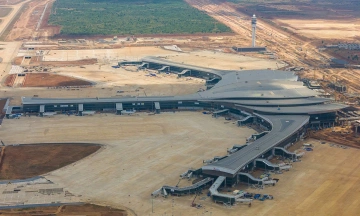
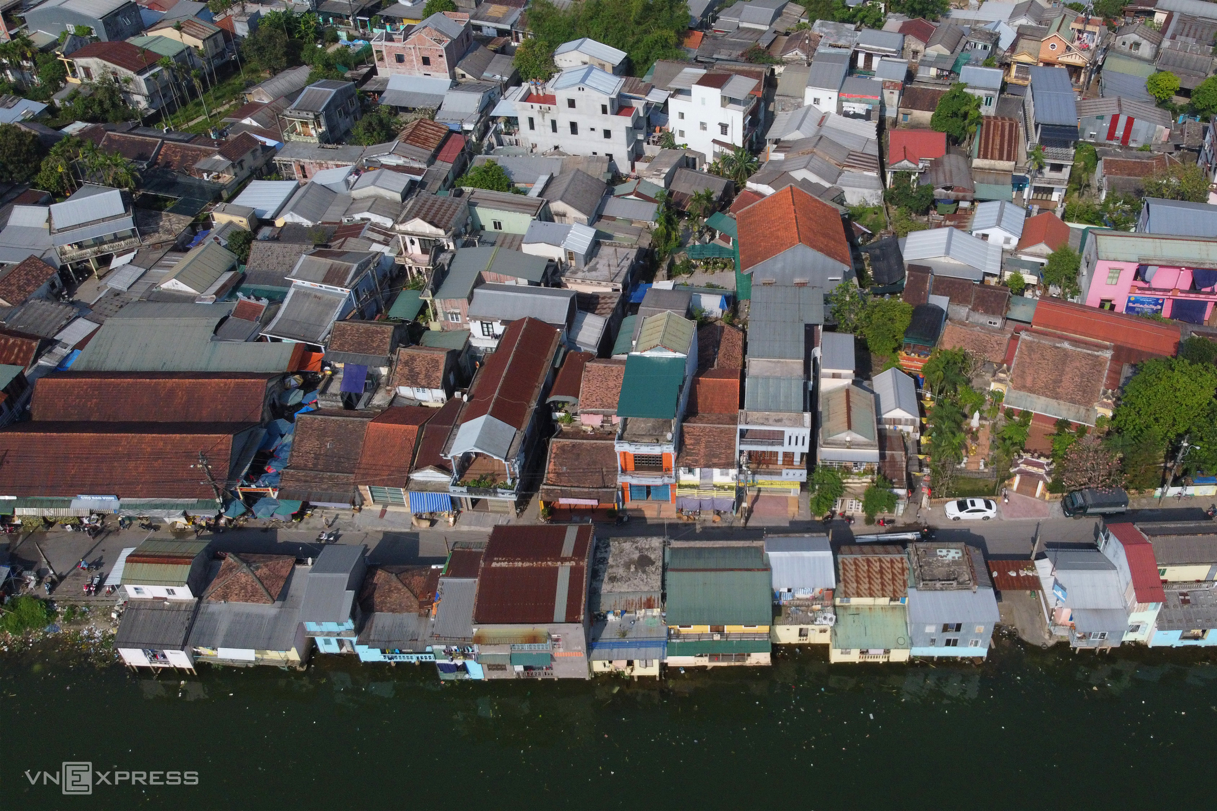
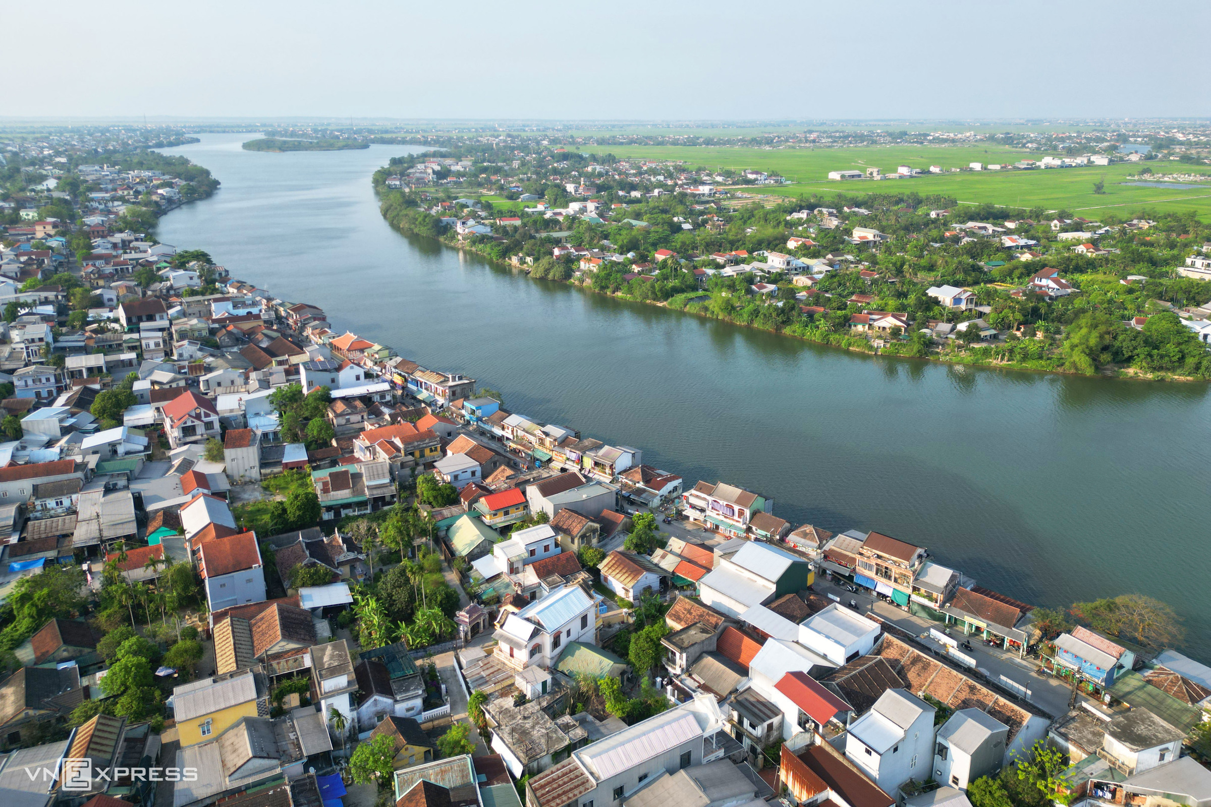
Bao Vinh ancient town, established during the Nguyen lords' era, was once an important trading port for the Thuan Hoa - Phu Xuan region. After five years of planning, five new boat docks have been built in the ancient town to develop river tourism. |
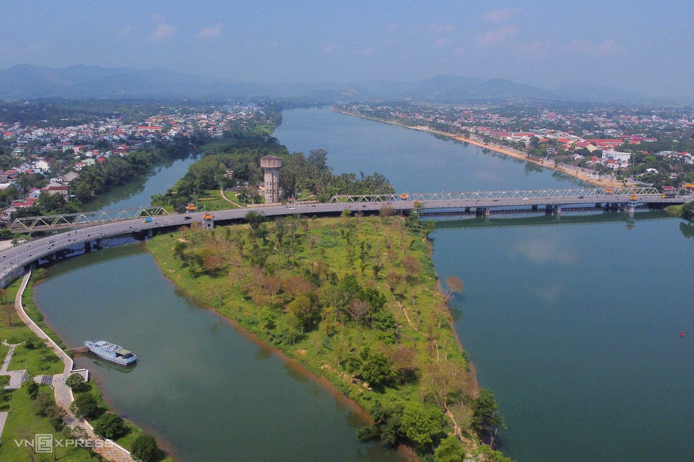
In 4/2021, Thua Thien Hue province (now Hue City) approved the detailed master plan for the two banks of the Huong River, covering the section from Vong Canh hill to Bao Vinh ancient town, spanning approximately 15 km. The total planned area is about 855 hectares, with the water surface accounting for over 503 hectares.
According to the plan, 101,7 hectares are designated for public land, including parks, green spaces, thematic parks, and squares. The two riverbanks are organized into 5 central clusters, with a development orientation towards open spaces, serving tourism and community activities.
The urban center area, from Da Vien islet to Hen islet, is planned as a cultural tourism hub. Here, authorities prioritize planting broad-leaf trees and arranging amenities such as squares, benches, water kiosks, and public restrooms.
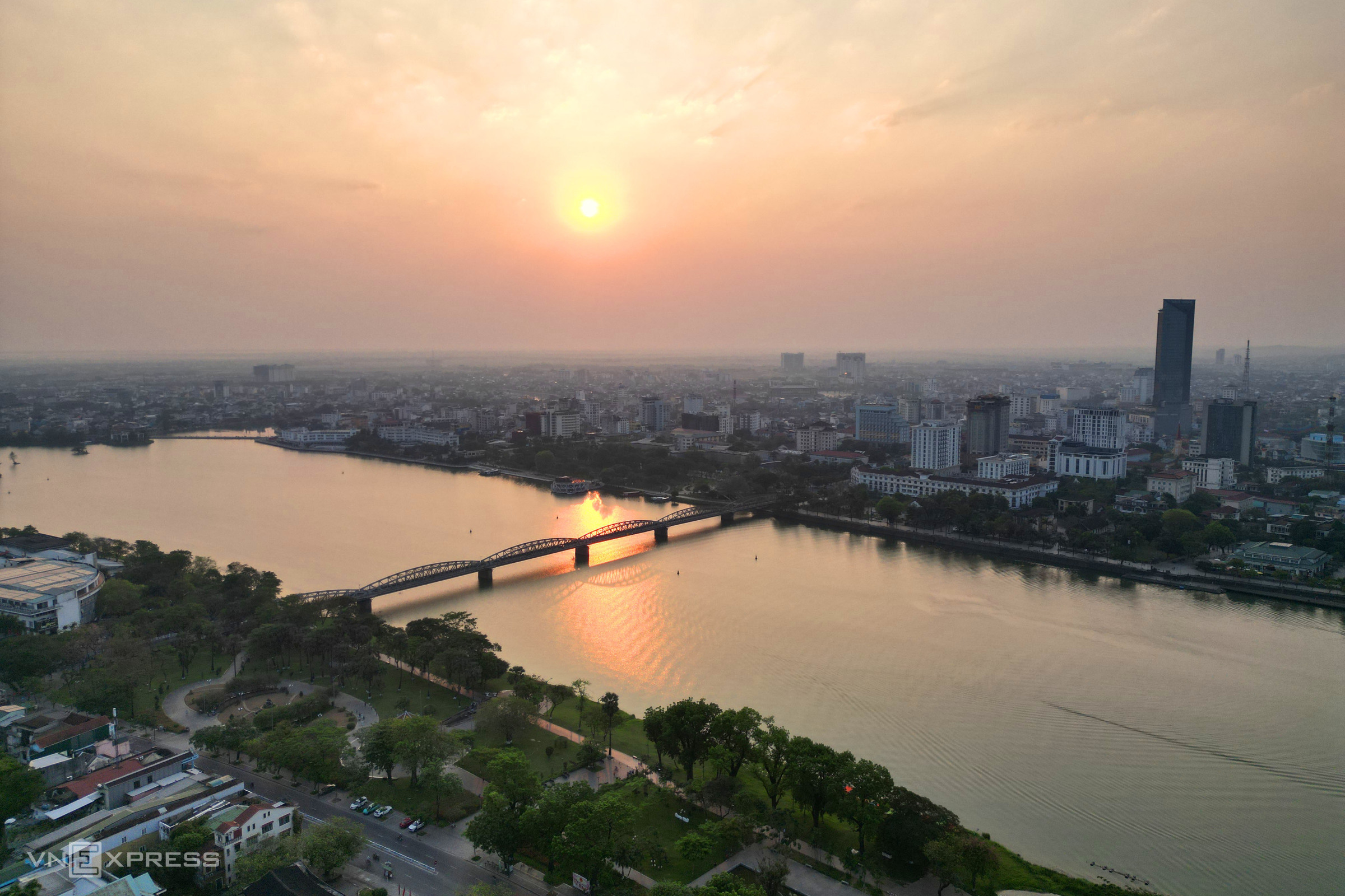
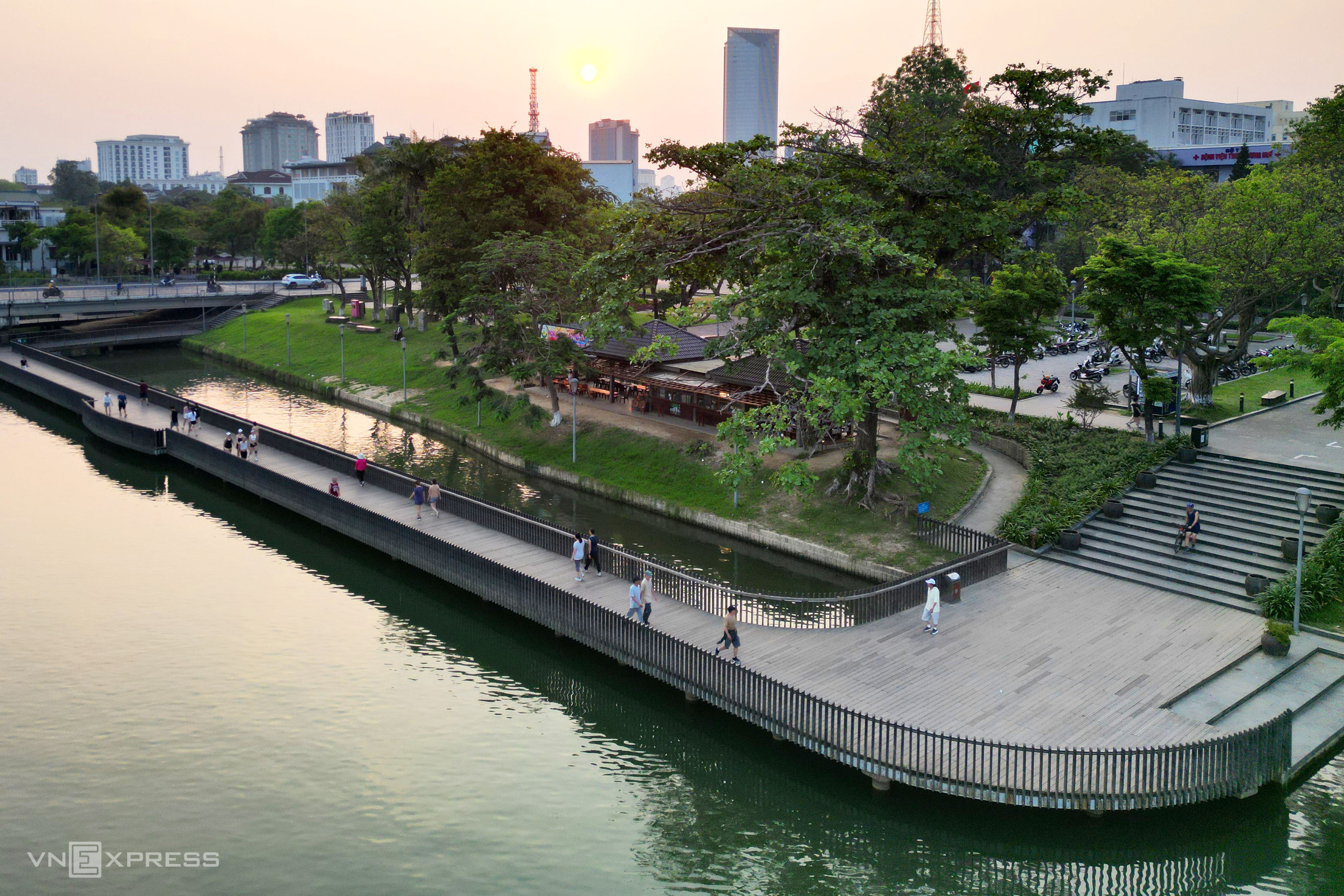
{"caption_all":null,"caption_items":"["After five years of implementation, the landscape of the Huong riverbanks passing through the center of Hue City has changed significantly. Many riverside walking paths, bathing areas, and service points have been established. The public restroom system has also been newly built and upgraded, meeting the needs of residents and tourists. Pictured is the grassy area on the north bank of the Huong River from Truong Tien bridge to Phu Xuan bridge, which has become a destination for residents at sunset.","The walking and cycling paths on both sides of the Huong River are increasingly extended, creating public spaces for residents and tourists."]"}
 |
A walking path paved with lim wood, over 380 m long and 4 m wide, was constructed on the south bank of the Huong River with a total cost of over 64 billion dong. This is a pilot project within the detailed master plan for the Huong riverbanks, funded by the Korea International Cooperation Agency (KOICA) with 6 million USD.
Since its opening, this walking path has become a popular spot for residents and tourists to stroll and admire the Huong River at sunset.
 |
An outdoor stage combined with a promenade along the south bank of the Huong River was completed in 4/2025, with a total cost of over 28 billion dong.
The structure includes a semi-circular stage, approximately 430 square meters. The spectator area is mounded with earth, planted with seasonal grass and flowers over 3.000 square meters, featuring monolithic stone seating steps and an integrated lighting system.
The riverside promenade is 432 m long and 3 m wide, with a retaining wall structure and reinforced concrete slab, topped with lim wood, covering a total area of 1.290 square meters.
 |
 |
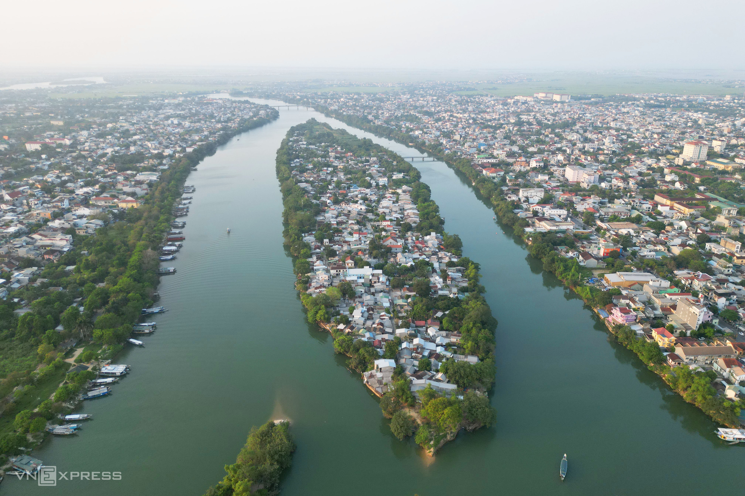
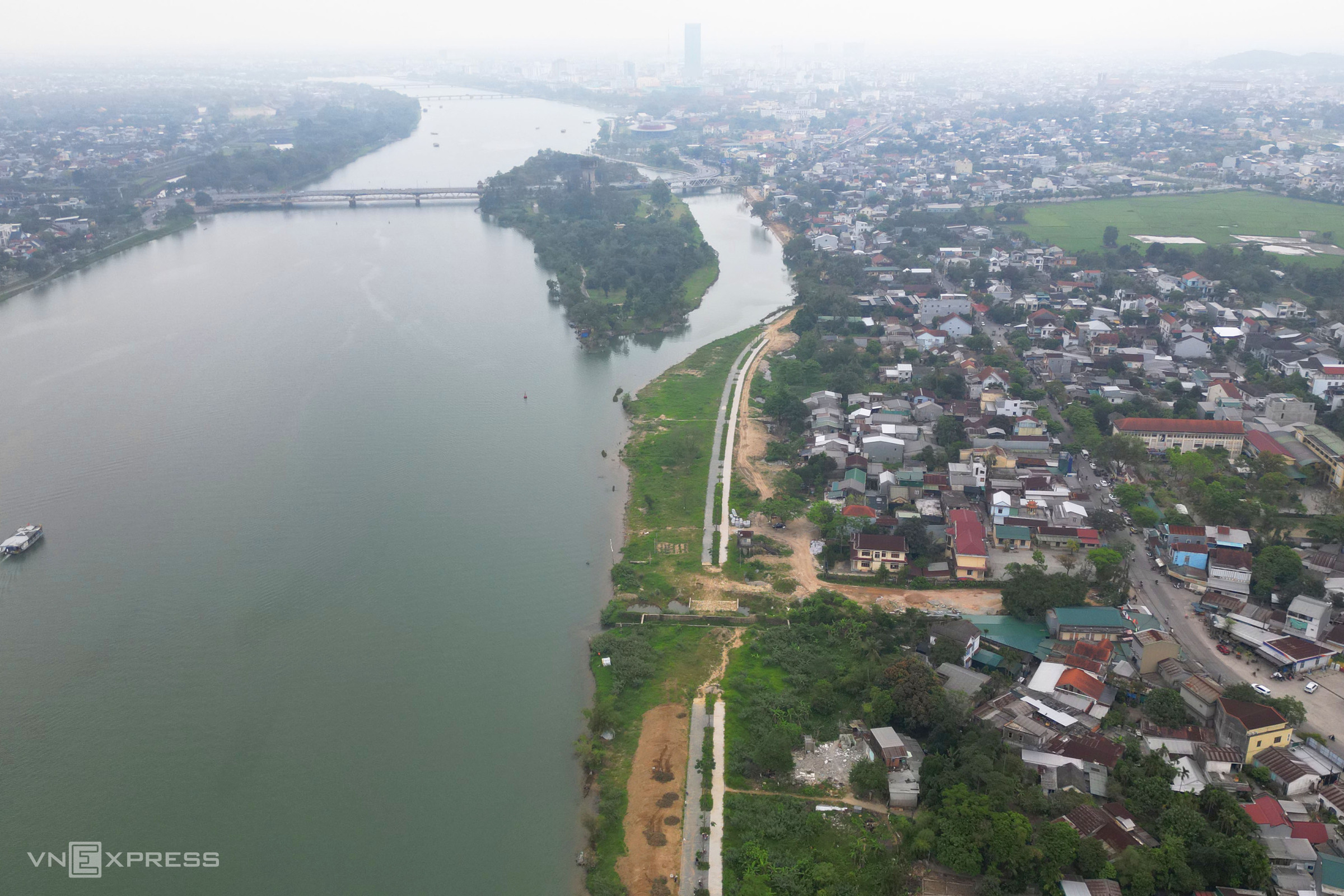
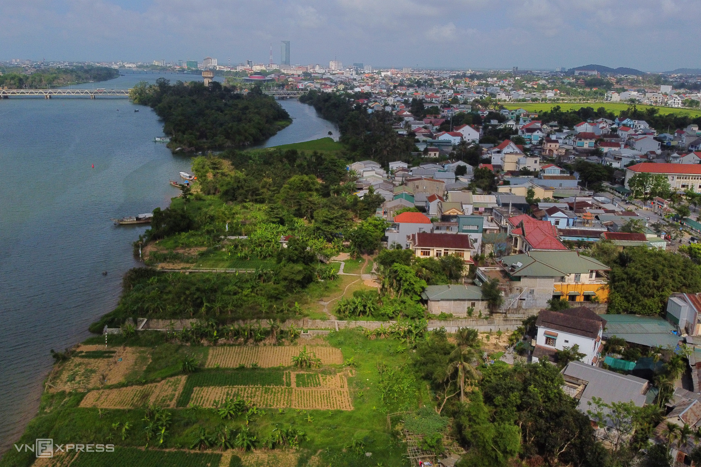
Da Vien islet, located on the Huong River, covers an area of approximately 10,5 hectares and is planned to become a multi-functional cultural area, hosting art performances, entertainment, commercial services, for tourists and local residents.
Following the planning, the Hue Green Park Center has renovated the eastern side of Da Vien islet at a cost of over 13 billion dong. After the renovation, it has become a public space with recreational and sports facilities for residents and tourists.
Soon, Da Vien islet will see the construction of a cultural complex with a total cost of over 370 billion dong, of which KOICA will fund 330 billion dong. The project includes building creative spaces, exhibition areas, and an information counter. The structures of the old Da Vien water plant will be preserved or upgraded for water drainage.
 |
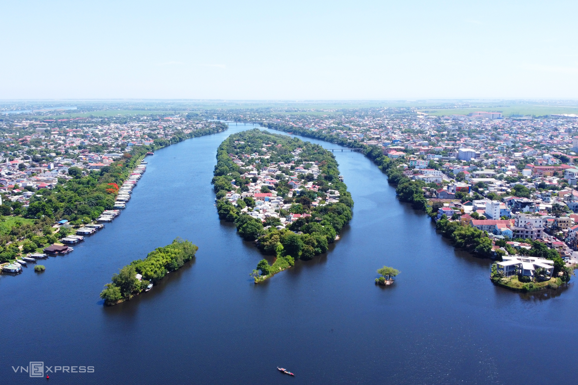 |
According to the detailed master plan for the Huong riverbanks, Hen islet will be a cultural tourism center with open spaces. Authorities will prioritize investment in infrastructure development and functional areas of Da Vien islet, along with land clearance and resettlement for residents. Pictured are Hen islet in 4/2026 and 7/2020.
However, in 2022, Hue City authorities assessed that the plan to develop high-end tourism services on Hen islet was not feasible due to the extensive land clearance required. The authorities agreed that the residential area of Hen islet is closely linked to its cultural life and unique traditional occupations, thus it is necessary to preserve and upgrade the downstream residential area, while developing a suitable portion of the upstream land for public services, squares, and open spaces.
In 1/2026, Nguyen Khac Toan, Chairman of Hue City, approved the investment policy for a bridge project connecting Hen islet in the middle of the Huong River, along with its approach roads, with a total cost of over 2.200 billion dong.
 |
 |
 |
 |
The former Duc Ward, famous for its bronze casting craft, was planned as a scenic area based on traditional culture. Hue City authorities are currently implementing a walking path project along the Huong River alluvial bank in the former Duc Ward, with a total cost of over 220 billion dong.
According to the design, the path begins at the Bui Thi Xuan park walking path and ends at the intersection of Bui Thi Xuan street and Huyen Tran Cong Chua street. The total length of the route is over 1,9 km, with a cross-section width of 10,5 m, including a 5,5 m wide road, a 3 m wide sidewalk on the residential side, and a 2 m wide sidewalk on the riverside. The road surface will be paved with 5 cm thick granite.
 |
 |
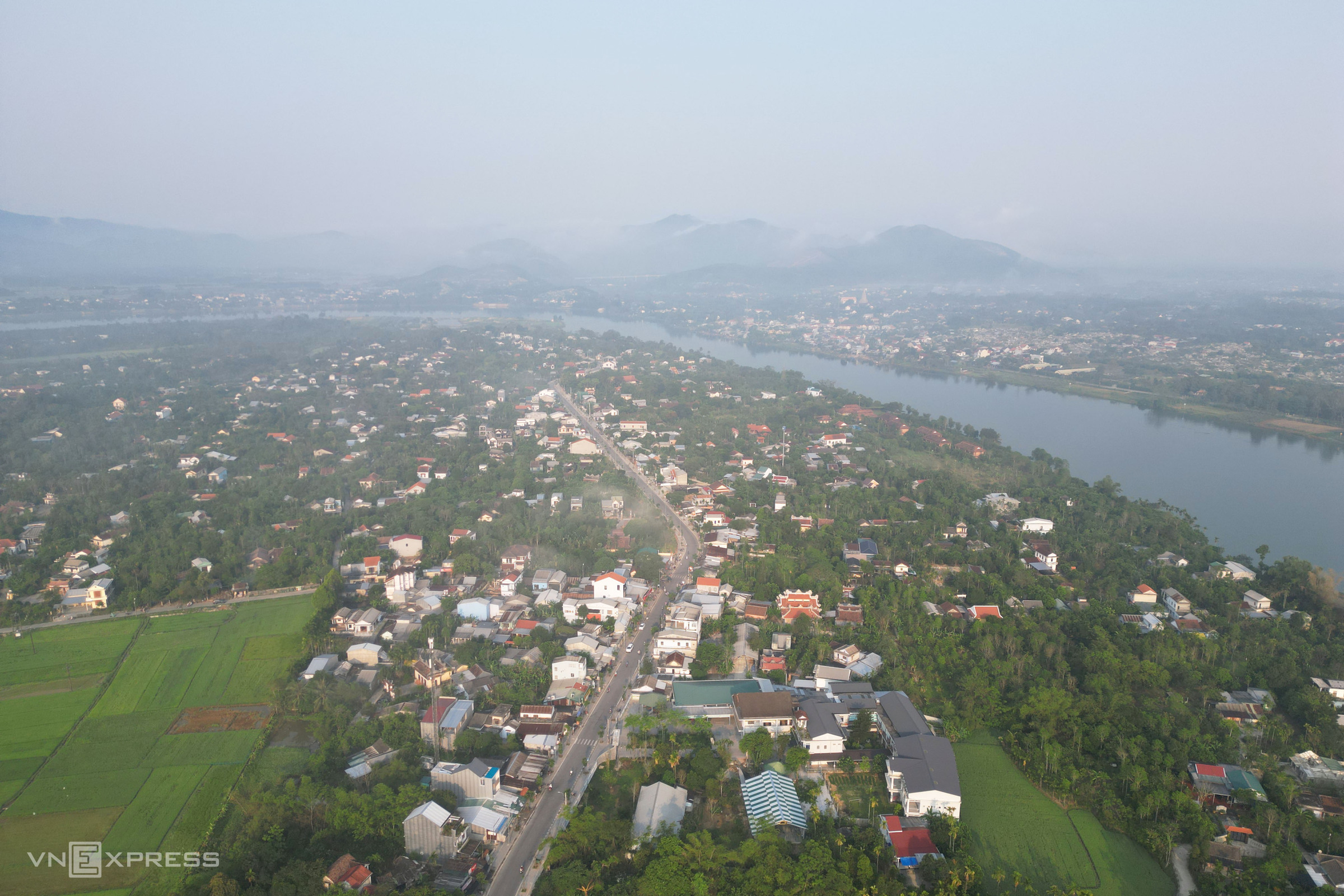
The area of the former Thuy Bieu Ward, with its pomelo gardens along the Huong River, is planned as an auxiliary cluster for the center of Hue City.
The orientation dictates that constructions here must have tiled roofs, with a maximum height of 18 m; some areas are restricted to not exceed 11 m to preserve the landscape.
After five years of planning implementation, the garden house area and pomelo gardens have largely maintained their original state. The locality aims to develop community tourism associated with the garden house model.
Bui Thi Xuan street, the section from Thuy Bieu village to Luong Quan village, has been expanded, improving connectivity and fostering tourism development.
{"caption_all":"nTheo quy hou1ea1ch chi tiu1ebft hai bu1edd su00f4ng Hu01b0u01a1ng, u0111u1ed3i Vu1ecdng Cu1ea3nh u0111u01b0u1ee3c u0111u1ecbnh hu01b0u1edbng lu00e0 khu vu1ef1c phu1ee5 tru1ee3 cu1ee7a trung tu00e2m TP Huu1ebf.nnSau 5 nu0103m triu1ec3n khai, khu vu1ef1c nu00e0y u0111u00e3 u0111u01b0u1ee3c Trung tu00e2m Cu00f4ng viu00ean cu00e2y xanh Huu1ebf chu1ec9nh trang vu1edbi kinh phu00ed hu01a1n 13 tu1ef7 u0111u1ed3ng, tru1edf thu00e0nh u0111iu1ec3m u0111u1ebfn cu1ee7a ngu01b0u1eddi du00e2n vu00e0 du khu00e1ch.nnnnnnnu0110iu1ec3m nhu1ea5n lu00e0 vu1ecdng gu00e1c ngu1eafm cu1ea3nh cao hu01a1n 15 m, ku1ebft cu1ea5u khung su1eaft, mu1eb7t su00e0n lu00e1t gu1ed7, su01a1n mu00e0u tu00edm. Xung quanh u0111u1ed3i u0111u01b0u1ee3c bu1ed1 tru00ed lu1ed1i u0111i bu1ed9 lu00e1t u0111u00e1 nguyu00ean khu1ed1i. u0110u01a1n vu1ecb quu1ea3n lu00fd cu0169ng tru1ed3ng bu1ed5 sung thu00f4ng, sim vu00e0 nhiu1ec1u lou1ea1i hoa, gu00f3p phu1ea7n cu1ea3i thiu1ec7n cu1ea3nh quan.nnnnnnnnn nnn","caption_items":"["The highlight of Vong Canh hill is a viewing tower made of an iron frame, with a wooden floor, standing over 15 m high and painted purple. From the tower, residents and tourists can easily admire the sunset over the Huong River.","Walking paths around Vong Canh hill are paved with monolithic stone for residents and tourists to visit and stroll."]"}
 |
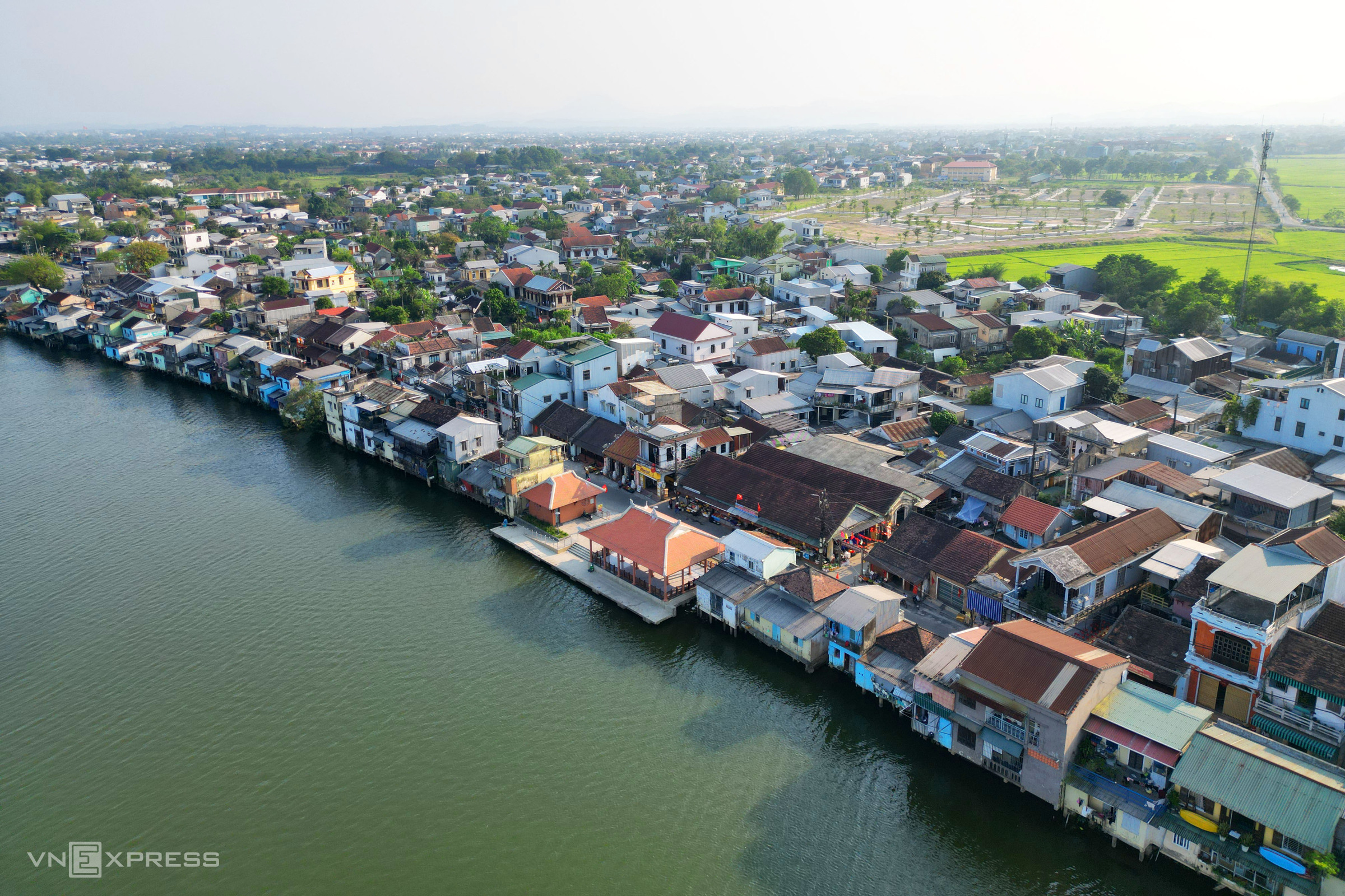
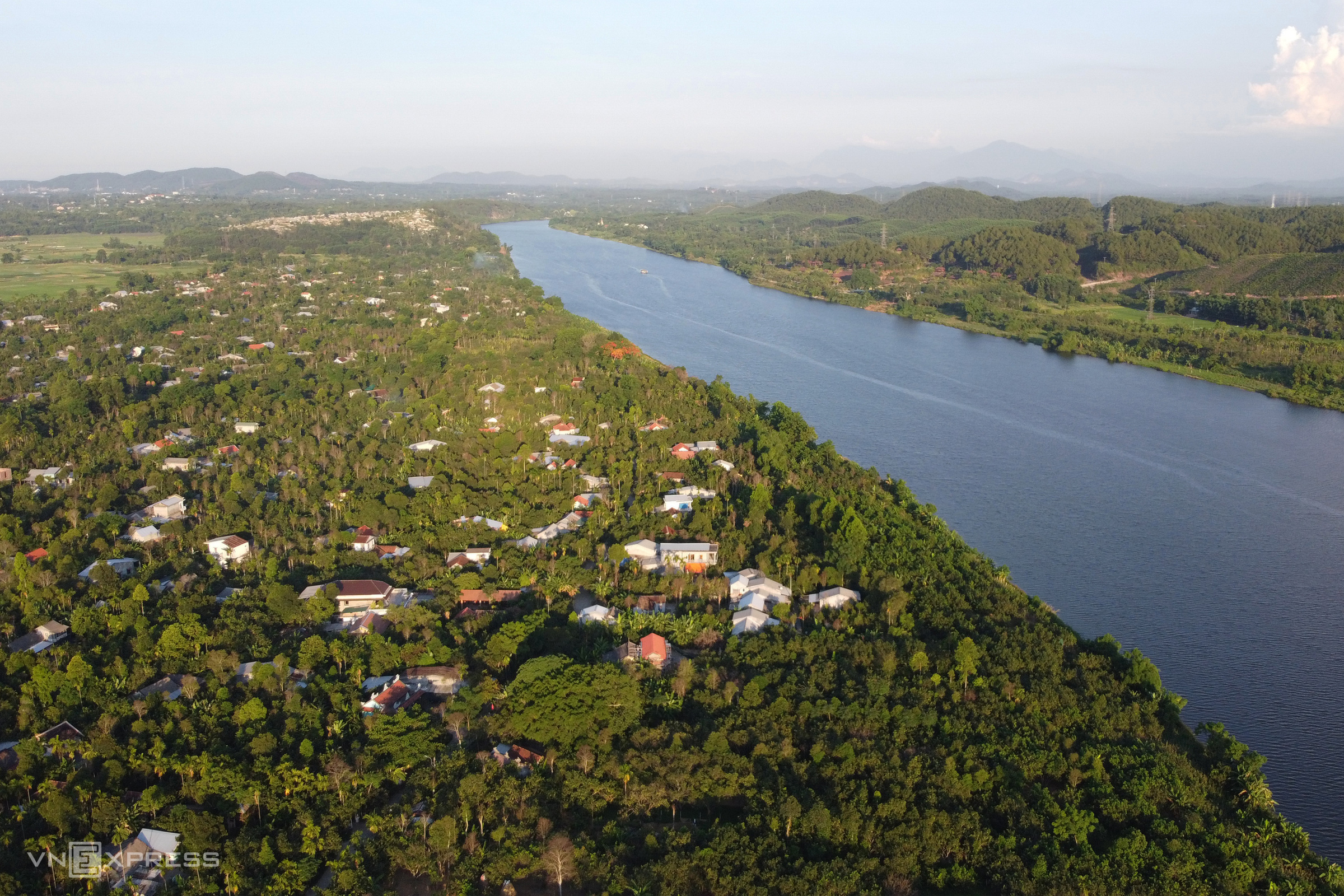
The Huong River section passing through Tien Non village in Duong No Ward and Bao Vinh ancient town in Hoa Chau Ward. According to the master plan, this is a traditional cultural preservation area; constructions must have tiled roofs, with height limits not exceeding 18 m, and 11 m in some areas. After five years of planning, this area has not seen major changes in infrastructure.
Vo Thanh