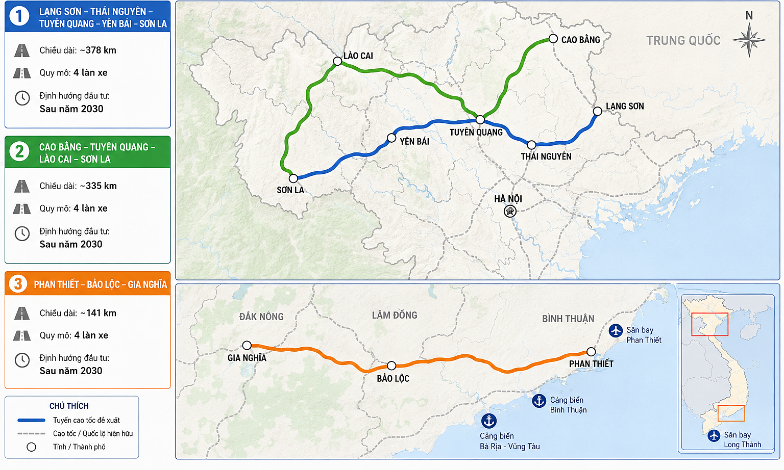
 |
Ongoing construction projects in the capital's center. *Graphics: Tung Chi* |
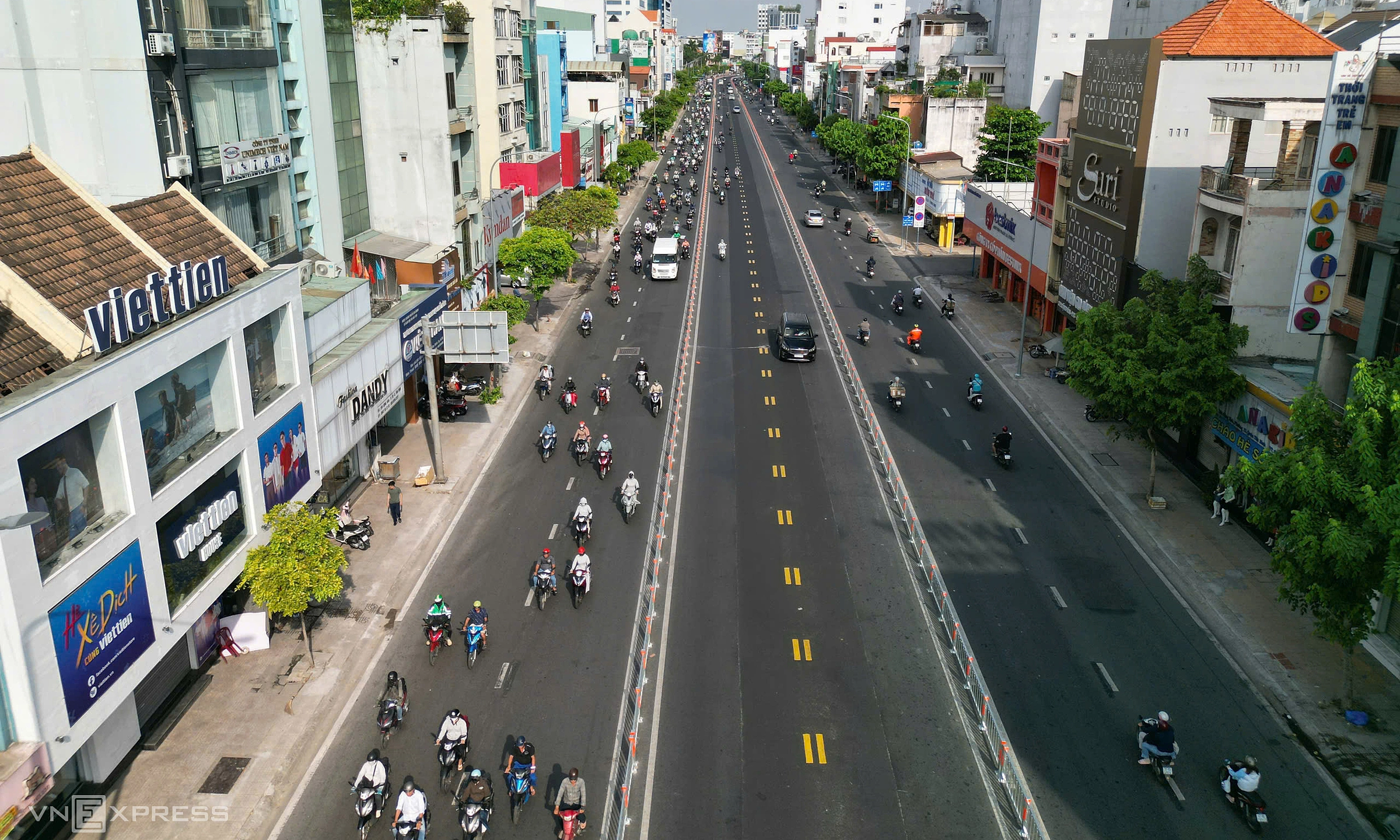
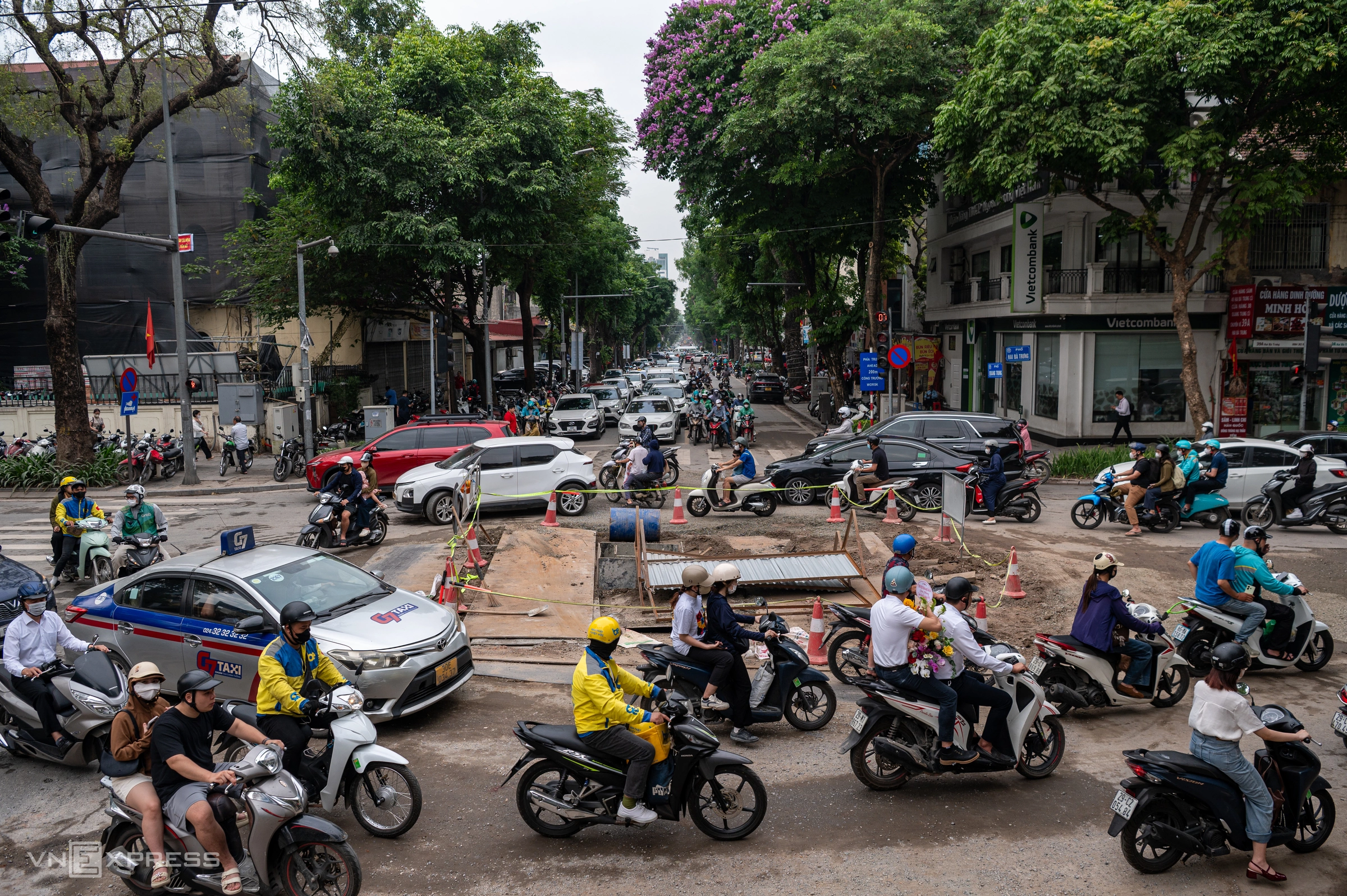
The intersection of Quang Trung and Hai Ba Trung streets is currently fenced off, narrowing the roadway. According to the Hanoi Department of Construction, this section is part of a local anti-flooding program. The project involves constructing new drainage pipes along Quang Trung and Quan Su streets, with dimensions ranging from 1,2x0,6 m to 2x2 m, passing through Hai Ba Trung, Hoan Kiem, and Cua Nam wards.
This project aims to resolve flooding in the Phan Boi Chau - Ly Thuong Kiet area and the Old Quarter. It began on 14/3 and is scheduled to conclude on 31/5. On Quang Trung street, barricades are set up in sections 30-50 m long along the median, leaving approximately 3,2-3,8 m of road width for traffic.
 |
At intersections, vehicles are directed to make continuous right turns, and U-turns are prohibited on Quang Trung street to mitigate congestion.
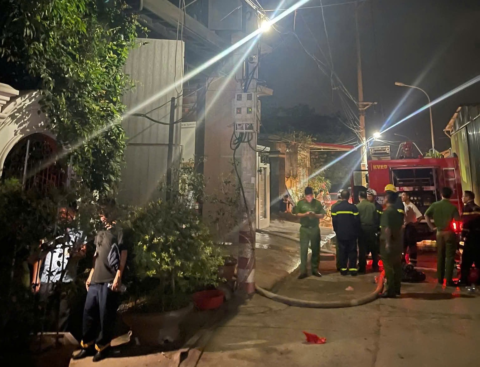
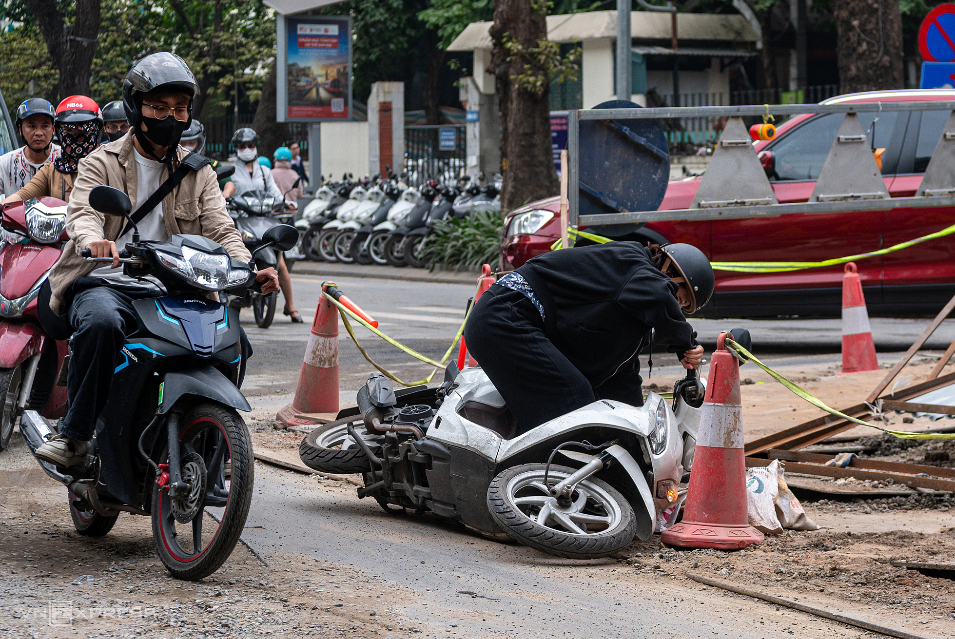
However, the road surface in the construction area is scattered with gravel and sand. Many temporary steel plates covering manholes are slippery, causing some motorcyclists to fall during the morning rush hour on 15/5.
 |
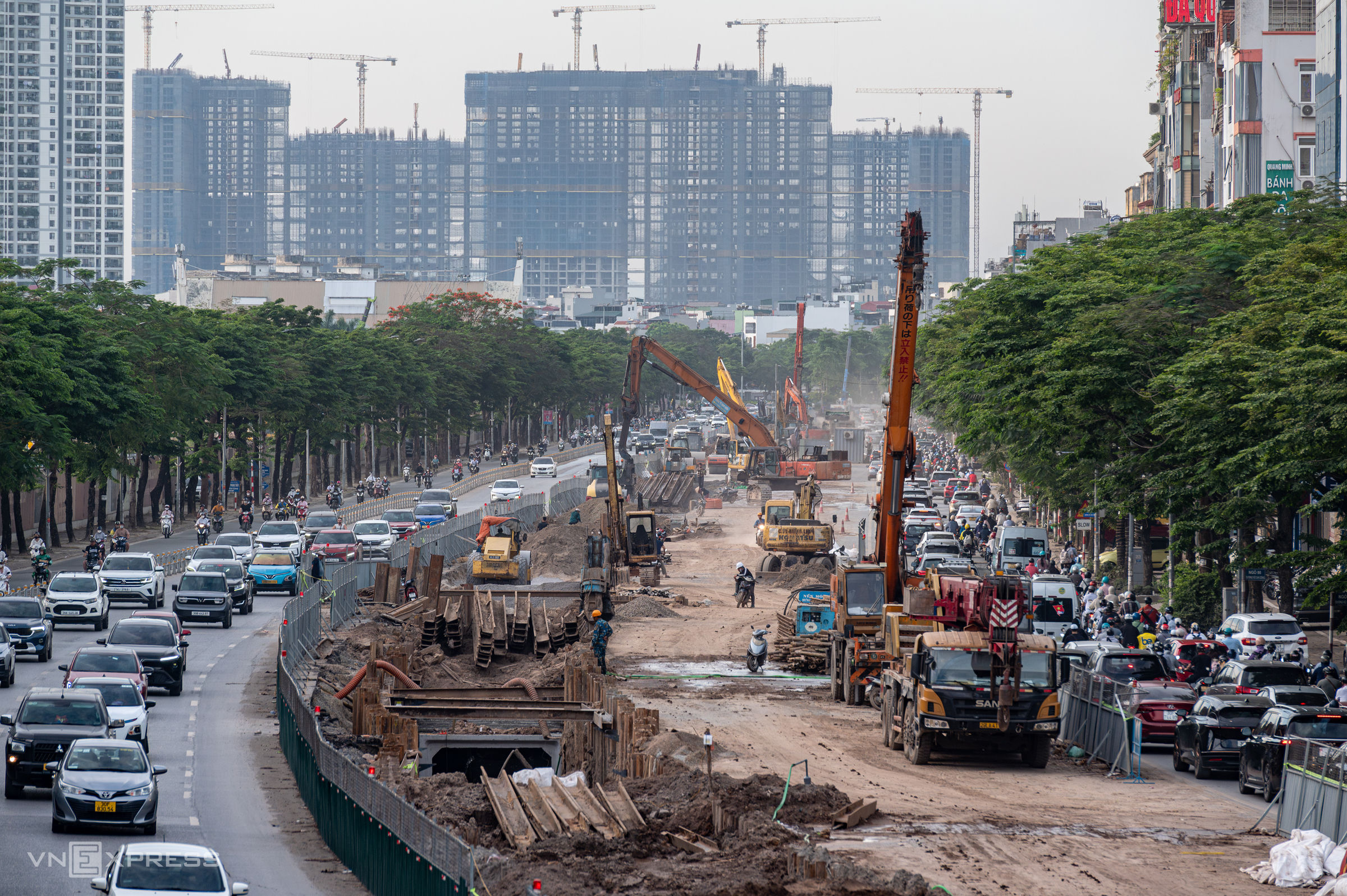
The ring road 1 project, specifically the Hoang Cau - Voi Phuc section, spans 2,2 km and traverses many of Hanoi's important transport axes. Site clearance was completed on 15/12/2025, and the technical route opened on 15/1.
On the construction site, units are building the roadbed, aiming to complete this part before 2/9. The Lang Ha and Nguyen Chi Thanh overpasses are targeted for completion by year-end, to bring the project into operation early.
The Nguyen Chi Thanh overpass, over 220 m long with six spans, is currently undergoing construction of its main pillars. During rush hour, a long line of vehicles passes through the dusty construction site. The contractor is expediting the overpass's completion to alleviate traffic congestion on De La Thanh and surrounding routes.
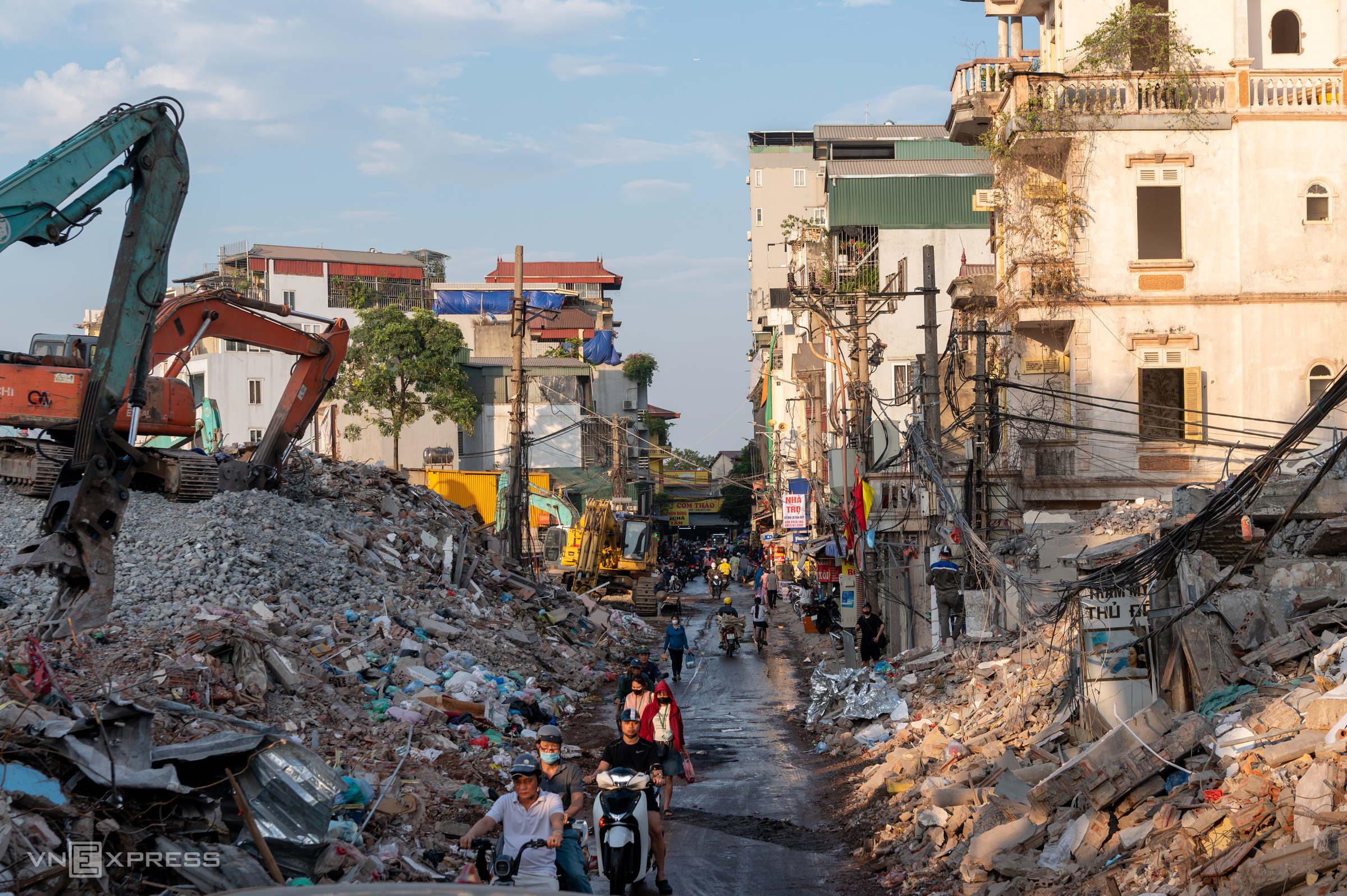 |
The Tran Hung Dao bridge project commenced on 9/10/2025, with a total investment exceeding VND 15,960 billion. The starting point of the route is at the Tran Hung Dao - Tran Thanh Tong - Le Thanh Tong intersection (Cua Nam and Hai Ba Trung wards), and the end point connects to Nguyen Son street (Long Bien and Bo De wards).
The entire route, including the bridge and access roads, is 4,18 km long and is expected to be completed in 2027.
The Tran Hung Dao bridge project is a key transportation infrastructure project in Hanoi, contributing to connecting the two banks of the Red River and reducing traffic pressure in the central area. Authorities are currently accelerating the clearance of houses in the Van Kiep and Bach Dang neighborhoods to hand over the site to the contractor. A series of houses have been demolished, leaving behind only reinforced concrete frames, brick wall sections, and scattered piles of building materials. Along Van Kiep street, demolished houses and piles of earth, broken bricks, and construction materials are stacked high, creating the scene of a major construction site right in the middle of a long-established residential area.
 |
Situated between ring roads one and two, the Tu Lien bridge project and its access roads span 5,15 km, with a total investment of nearly VND 20,000 billion. This is the first Red River crossing bridge to commence construction in Hanoi in 2025.
The project's starting point connects Nghi Tam street (former Tay Ho district), and its end point links to Truong Sa street (former Dong Anh district). The Nghi Tam access road is 48 m wide, the Dong Anh side is 60 m wide, and the main Tu Lien bridge is a cable-stayed bridge 43 m wide.
In Hong Ha ward, to serve the project, authorities plan to reclaim nearly 294,000 square meters of land, affecting 732 plots. This includes 339 residential plots with houses, 233 agricultural plots, 151 plots in alluvial and mid-river areas, and 9 plots managed by organizations. The Tu Lien bridge project is expected to be operational in Quarter II/2027, contributing to the formation of an additional connection axis between the inner city and the north of the Red River.
 |
The Thuy Phuong canal project, part of ring road 2, has a total investment of approximately VND 920 billion. The structure begins at the Thuy Phuong pumping station (Thuy Phuong ward) and concludes at the Vo Chi Cong - Hoang Quoc Viet intersection (Nghia Do ward).
The canal route is about 7 km long, with approximately 3 km as an open canal and the remainder underground. In addition to supplementing water for the To Lich River, the Thuy Phuong canal project also helps reduce flooding for urban areas such as Ecohome, Diplomatic Corps, Tay Ho Tay, and Ciputra, covering a drainage area of about 350 ha.
Currently, two-thirds of the road remains barricaded for construction.
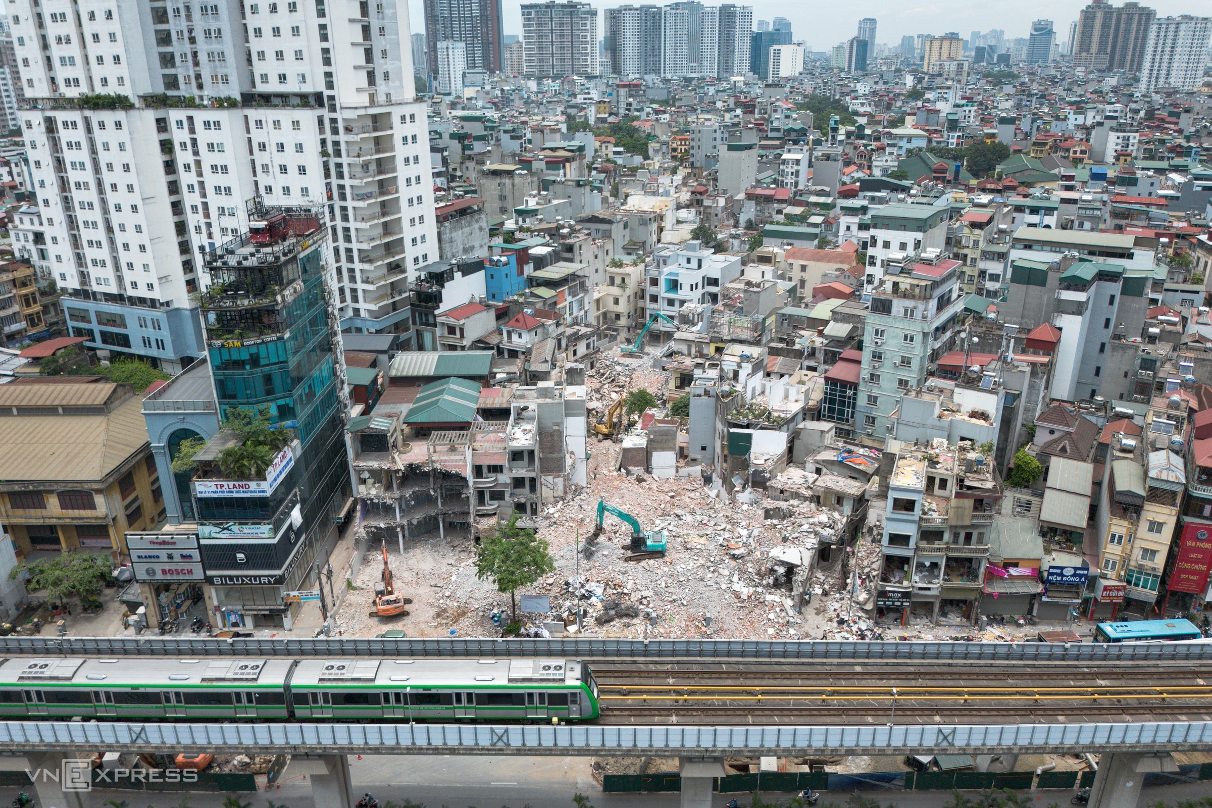 |
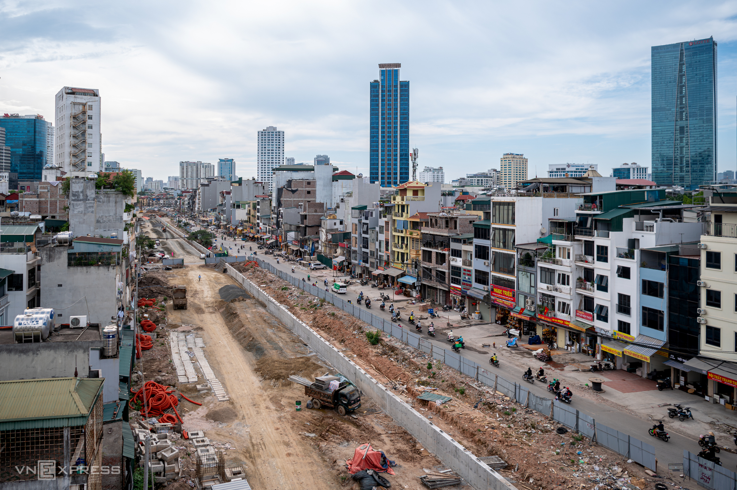
The ring road 2.5 project, 19,64 km long, starts at the new Ciputra urban area and connects to ring road 3 near Thanh Tri bridge, with completion anticipated in 2026.
In the section passing through Thanh Xuan ward, demolition work is being carried out urgently, with machinery operating continuously.
Hanoi plans to spend over VND 8,400 billion from the city budget on the ring road 2.5 project, with most of it allocated for site clearance. Many houses along Nguyen Trai street have had their roofs removed, revealing the interior space after the site was handed over for the project. Demolished building materials are piled higher than a person's head at the ring road 2.5 - Nguyen Trai intersection. The construction unit has strung soft ropes and created traffic diversions to keep residents away from the hazardous area, ensuring traffic safety.
For several weeks, sections of Nguyen Trai street towards Ha Dong have been fenced off with corrugated iron for the construction of an anti-flooding drainage system. Despite using a rolling construction method to restore the road surface as quickly as possible, the road remains covered with dust for about 500 m. The project is expected to improve urban infrastructure and address flooding on Nguyen Trai street, a major traffic artery in Hanoi during every rainy season.
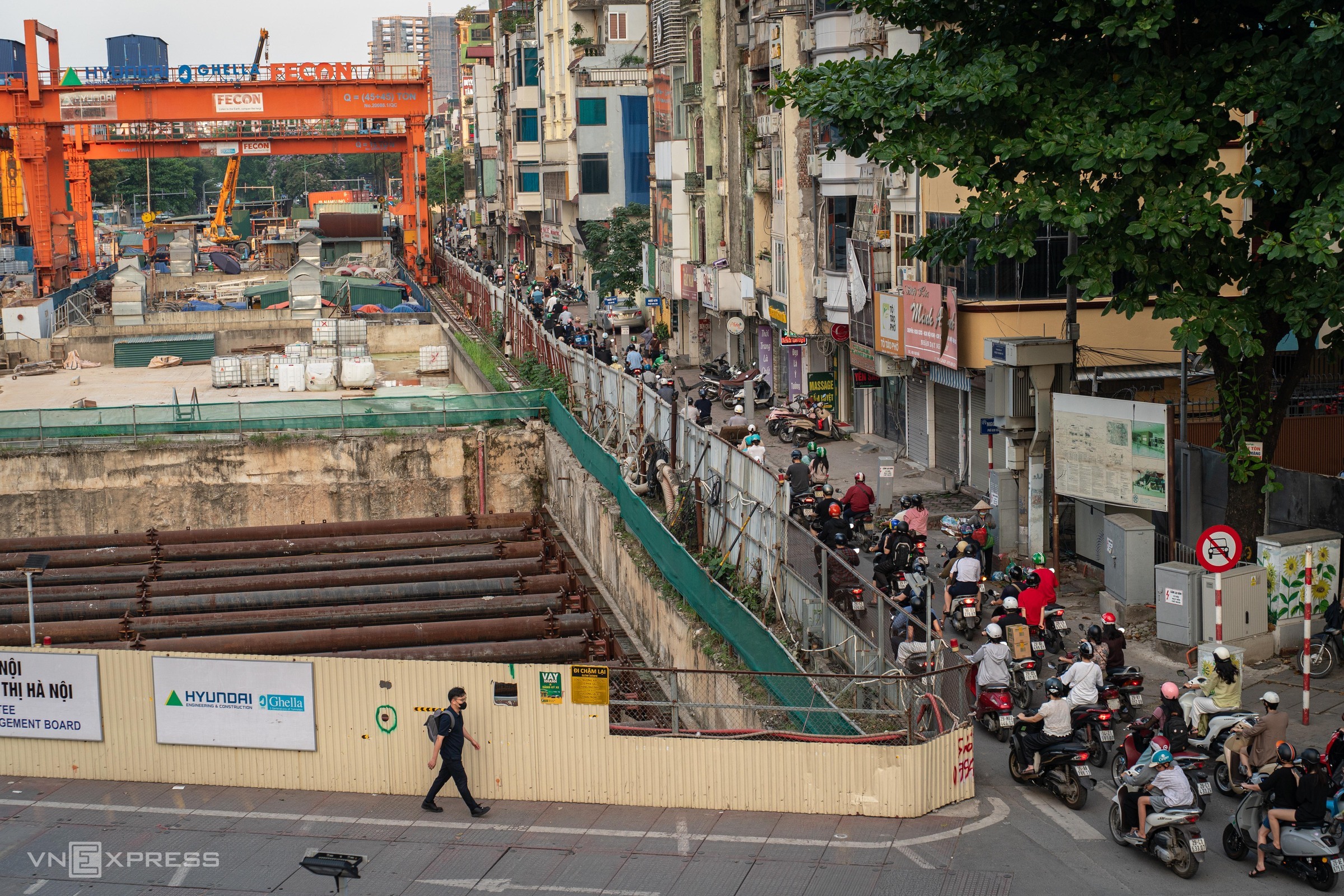 |
The Kim Ma (S9) underground station is one of four underground stations on the Nhon - Hanoi urban railway project. In late 2018, to construct the S9 station along with its diaphragm walls and station roof slab, the contractor barricaded a portion of Kim Ma street. After several years of implementation, the 4 km long tunnel section from S9 to S12 station has now been excavated, but the road surface has not yet been restored.
The construction area occupies most of the median strip on Kim Ma street, causing frequent congestion, especially during rush hour.
 |
Located over 500 m from ring road 2.5, the Nguyen Tuan road widening project has remained unfinished for several years. Currently, the beginning of the route, adjacent to Nguyen Trai street, continues to be excavated and fenced with corrugated iron.
After multiple delays due to site clearance issues, the Nguyen Tuan road renovation and widening project is now approximately 85% complete. Sidewalks, greenery, and lighting systems are still being finished. Upon completion, the road is expected to change the urban landscape and reduce traffic pressure in the Thanh Xuan area.
 |
The Bang - Hoang Giang - Thanh Hai