 |
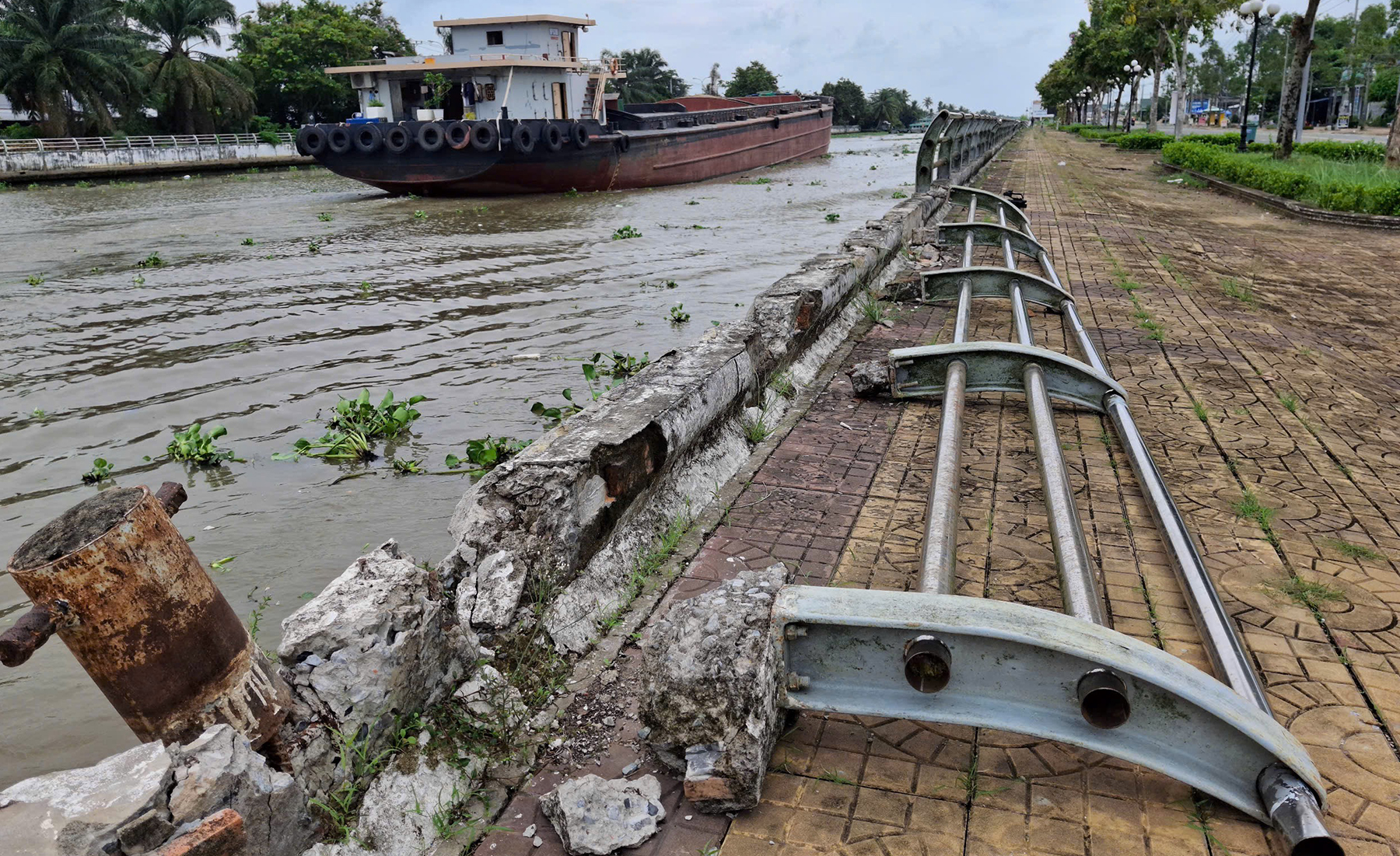
A section of the embankment handrail in Vi Tan ward has detached from the embankment wall, lying on the sidewalk for many days.
The Xa No canal embankment, a critical infrastructure, is experiencing widespread subsidence and damage along its nearly 20 km length. This embankment, featuring an 8-12 m wide sidewalk, traverses Tan Hoa, Vi Thanh 1 communes, and Vi Tan, Vi Thanh wards in Can Tho city. The most severe damage is observed along a 7 km stretch through Vi Thanh 1 commune and Vi Tan ward, where the integrity of the structure is significantly compromised.
Connecting Can Tho with An Giang, the Xa No canal has served as the Mekong Delta's vital waterway for rice transport for over a century, earning its moniker as the region's "rice road". Its degradation poses a direct threat to both residents and the economic lifeline it represents.
In Vi Tan ward, a handrail post has detached from the embankment wall. Many handrail posts here have slipped from the embankment wall, their bases exposed, hanging 10-20 cm above the ground. The embankment sidewalk also sags and has subsided about 5 cm.
In another location in Vi Thanh 1 commune, the embankment wall is broken for over one meter, with a handrail post hanging precariously. Nearby, about 5 m of handrail is also broken and warped. Nguyen Minh Nhut, permanent vice chairman of Vi Thanh 1 commune People's Committee, stated that local authorities have noted the embankment's degradation, primarily due to the structure being in use for many years, leading to natural wear over time.
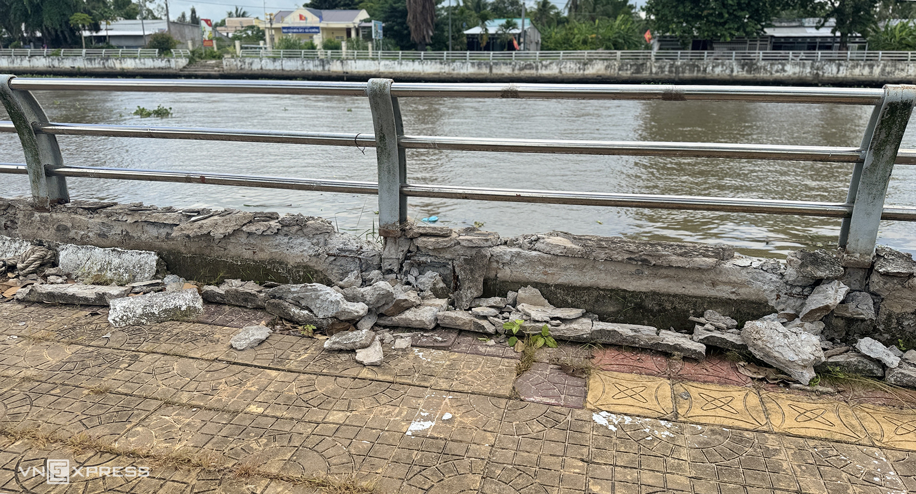 |
A section of the embankment wall is shattered, exposing internal rebar. Local residents report that barges frequently anchor by tying ropes to the embankment handrails for stability, exacerbating the damage.
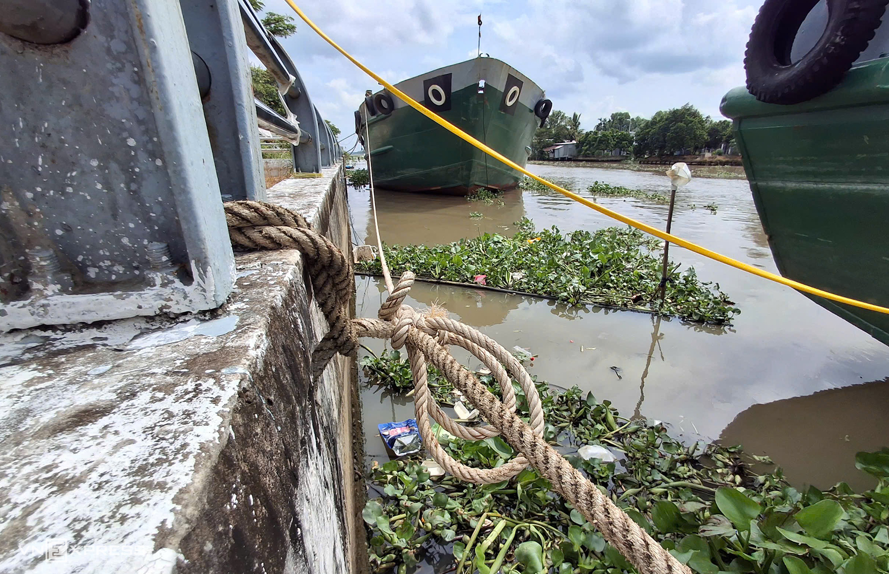 |
Many barges are anchored, with ropes tied to the embankment handrails for stability. Leaders of Vi Tan ward People's Committee stated they will coordinate with functional agencies to address the issue of anchored barges, which compromises the safety of the embankment handrail system.
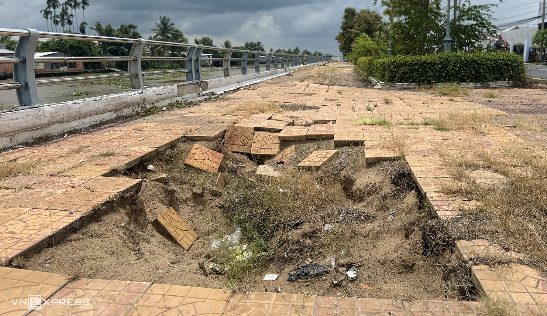 |
Along the route, numerous sections of the post-embankment sidewalk have deeply subsided. Pham Thi Oanh, a resident of Vi Thanh 1 commune, expressed concern over the increasing number of subsided and damaged spots on the embankment, noting that many residents exercising have tripped at these damaged locations.
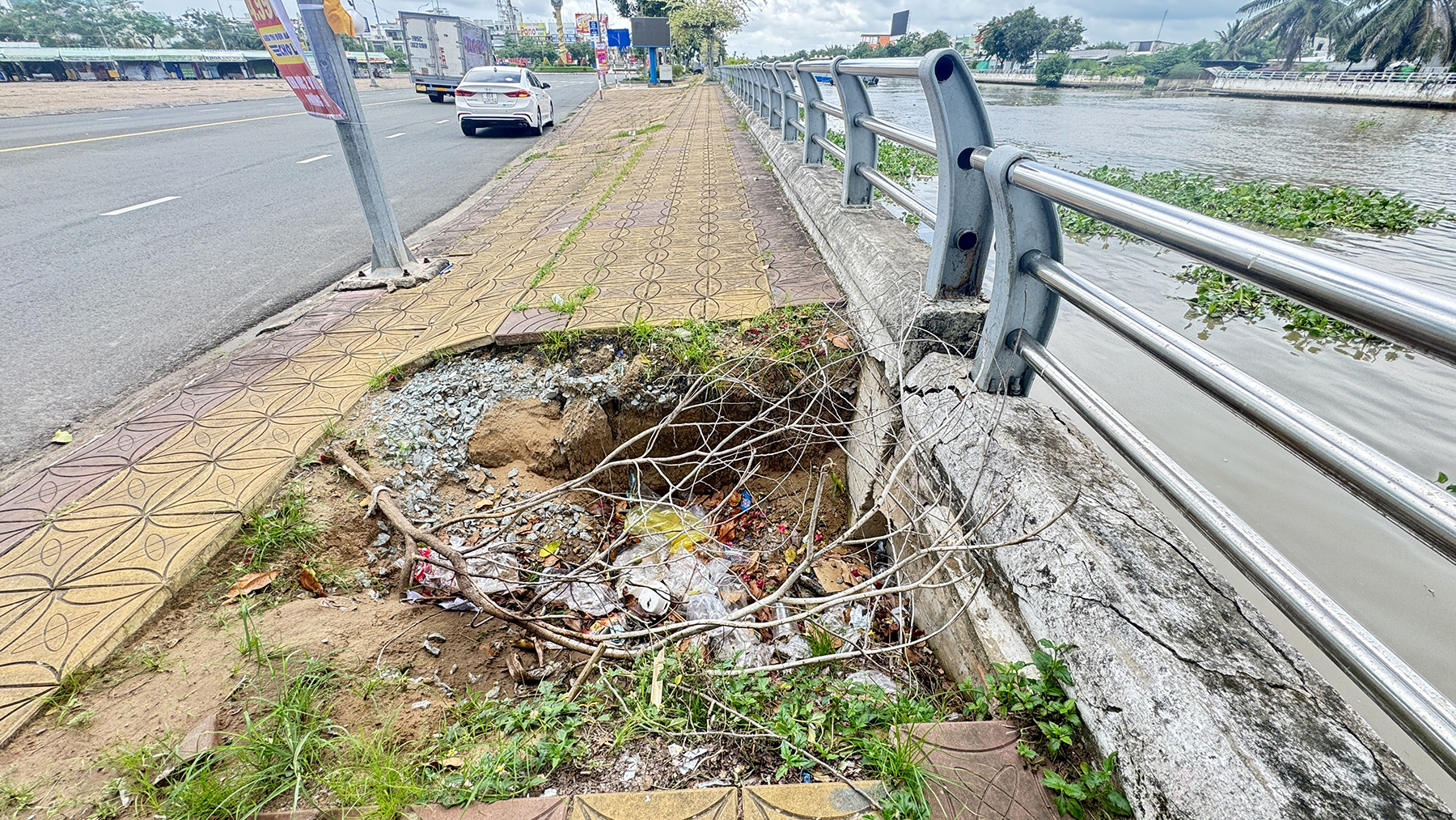 |
Residents use dry branches to mark subsidence holes along the embankment as warnings.
According to local authorities, due to limited public investment, embankment repairs will follow a phased approach, prioritizing severely damaged sections. They anticipate that in 2027, once funding is allocated, the degraded embankment sections will be repaired to ensure safety and improve urban aesthetics.
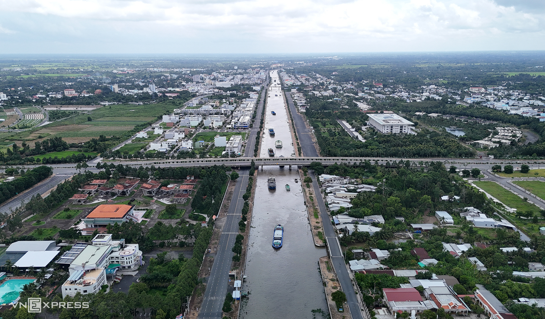 |
The Xa No canal embankment, with an investment of approximately 550 billion VND, was put into use over 15 years ago. The structure serves to prevent erosion, enhance urban appearance, and create a scenic route along the canal.
The Xa No canal, approximately 45 km long, 60 m wide, and 2,5-9 m deep, was excavated over 120 years ago. Connecting the Can Tho River with the Cai Lon River in An Giang, it has long been the Mekong Delta's vital waterway for rice transport.
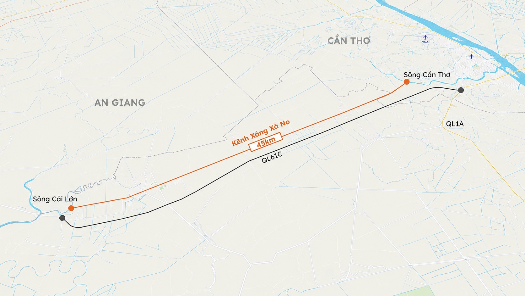 |
Location of Xa No canal. Graphics: Khanh Hoang
An Binh
No issues encountered.