 |
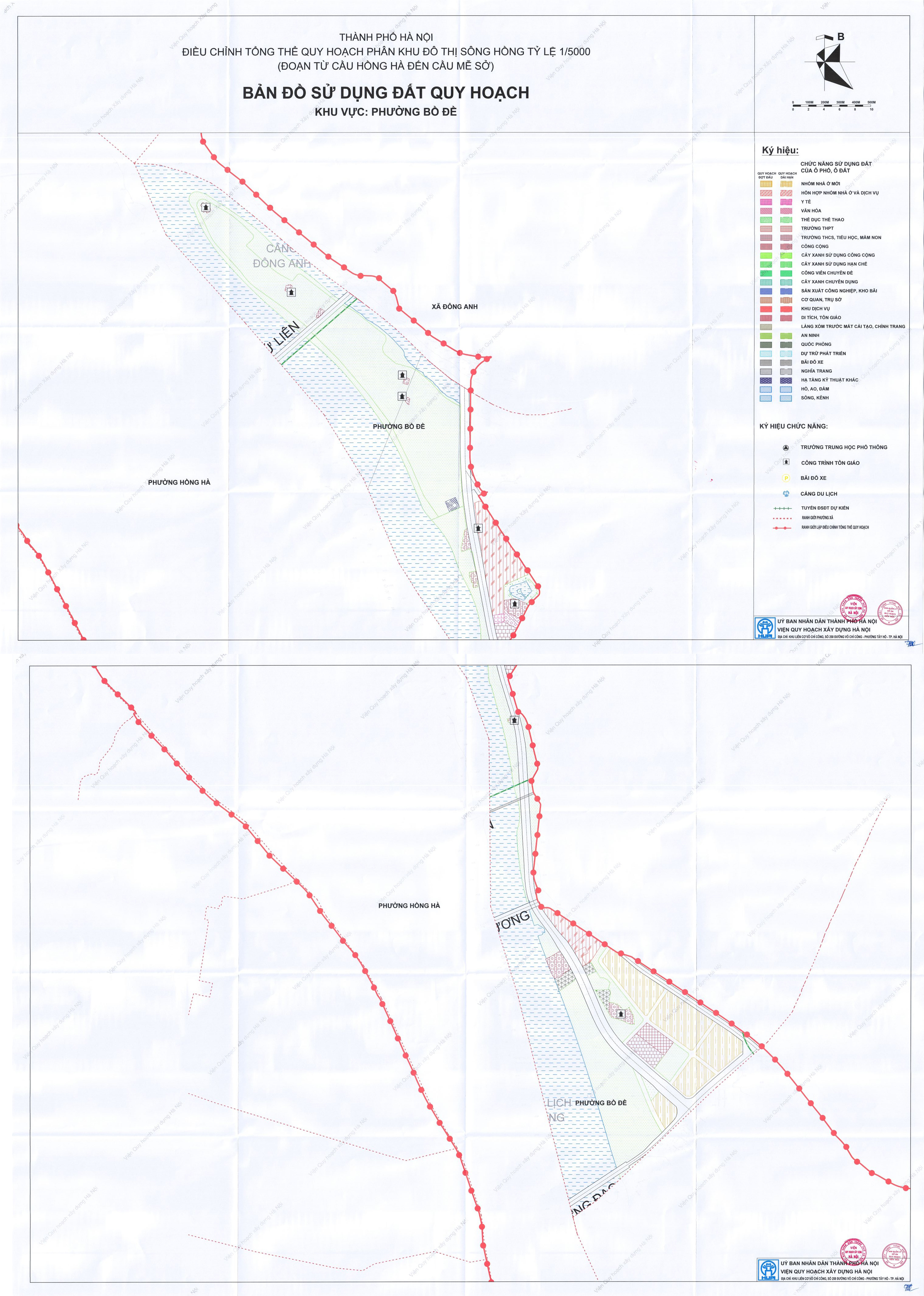
Bo De ward borders Long Bien, Viet Hung, and Hong Ha wards, as well as Vinh Thanh and Dong Anh communes. It covers 12,94 km2 with a population of 120,028. The ward's plan allocates most of its space for the riverside green corridor, while construction and transport functions are concentrated along the main road, linked to key connection points and urban development areas. |
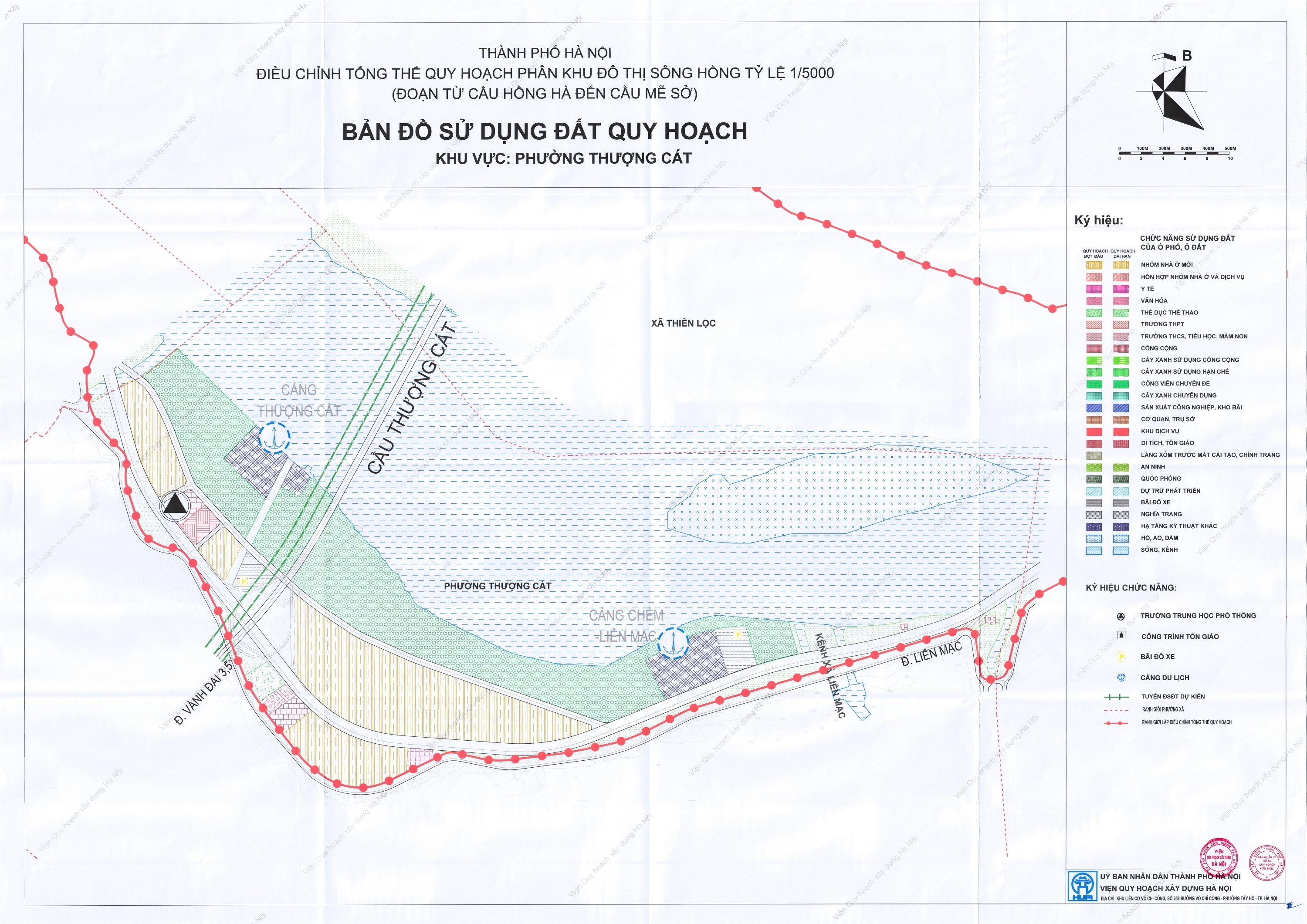
Thuong Cat ward borders Dong Ngac and Tay Tuu wards, along with O Dien, Thien Loc, and Me Linh communes. It covers an area of 14,77 km2 and has a population of 24,692. According to the planning map released by Hanoi People's Committee on 7/9, land along the river is primarily allocated for green spaces, water bodies, and ecological areas. Inner land plots are designated for transportation, public works, and urban functions. This structure aligns with the plan's ecological and conservation focus, integrating urban agriculture, parks, sports, and service activities.
 |
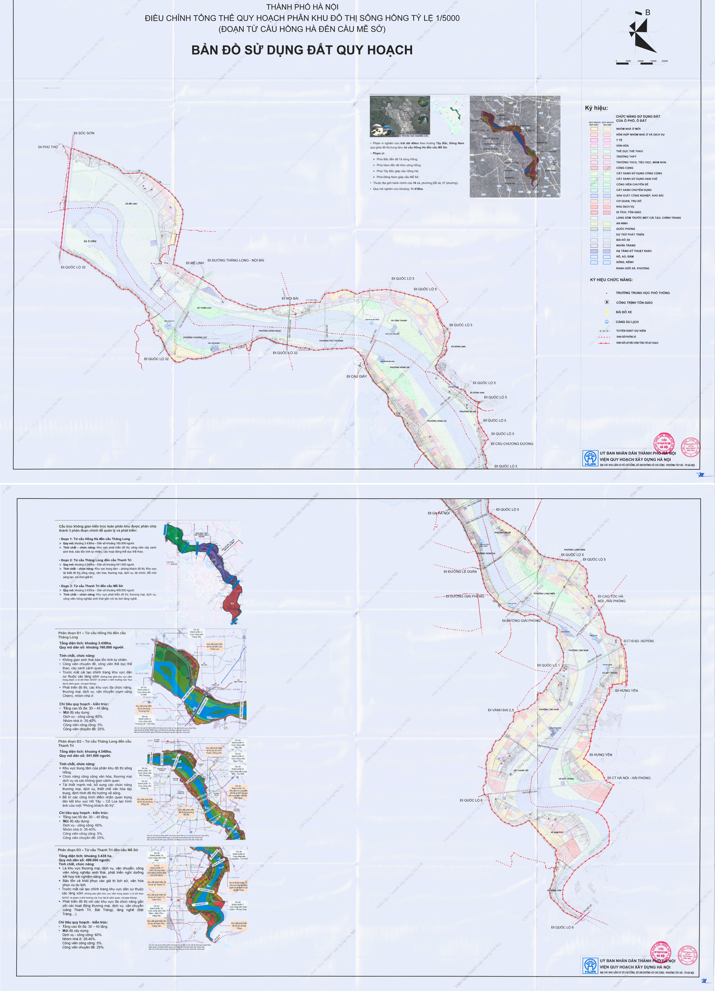
Overall map of communes and wards in the Red River urban subdivision. |
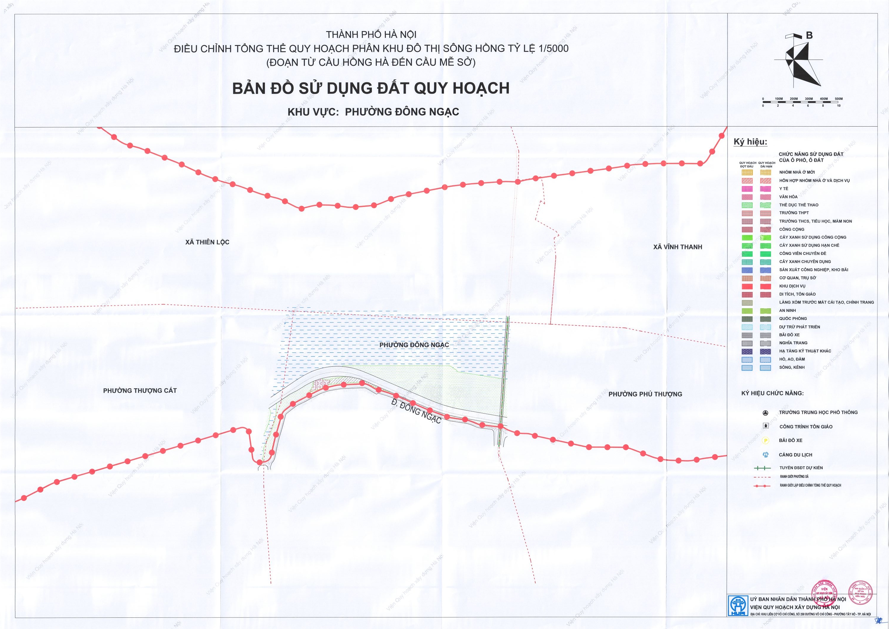
Dong Ngac ward borders Phu Thuong, Xuan Dinh, Thuong Cat, Phu Dien, Tay Tuu, Nghia Do wards, and Thien Loc commune. It spans 8,85 km2 with a population of 83,544. The ward is mainly situated within the Red River green corridor, with substantial land allocated for green spaces and ecological areas. The area is planned with an ecological and conservation approach, integrating parks, sports, recreation, and service functions.
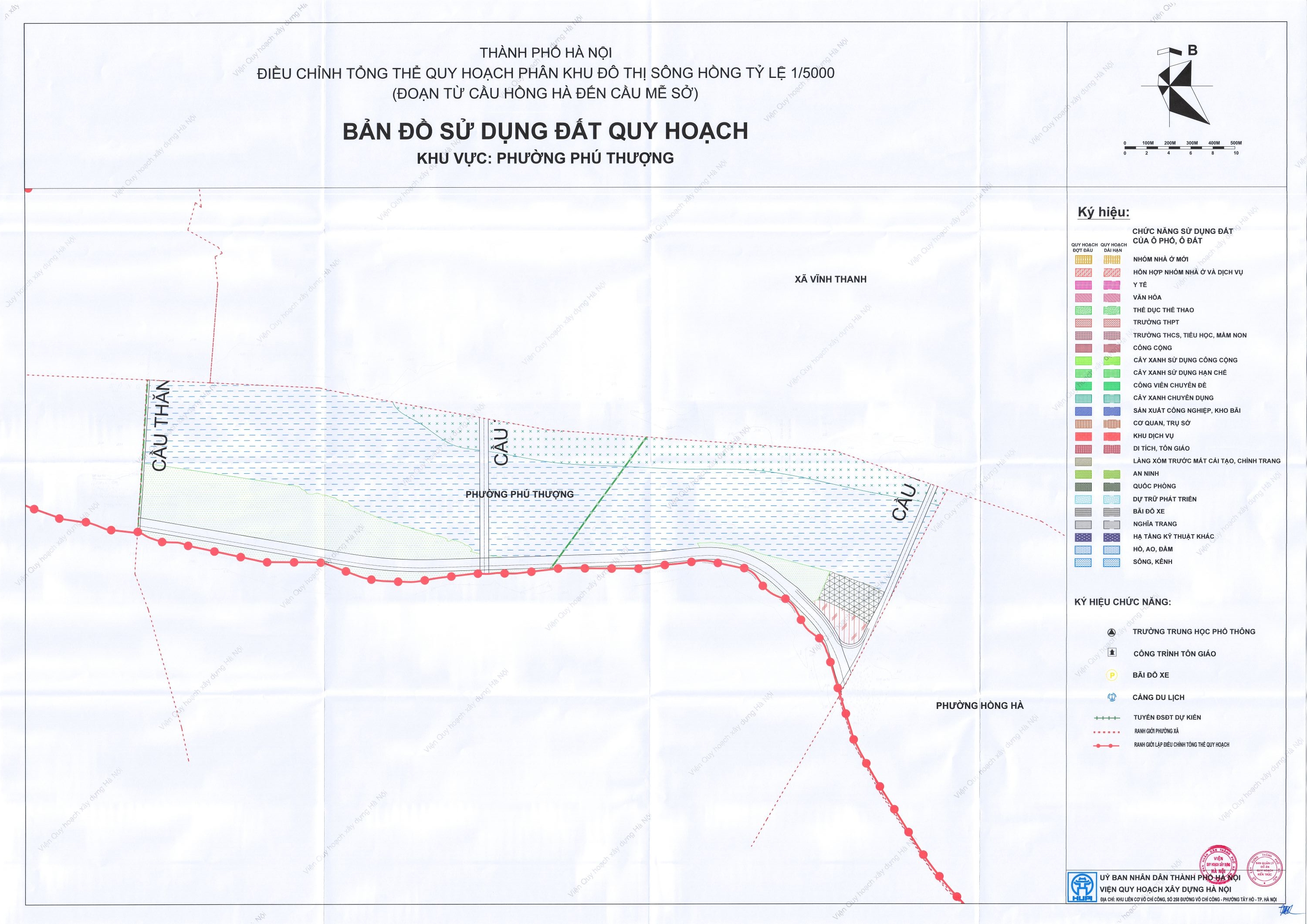 |
Phu Thuong ward borders Hong Ha, Tay Ho, Dong Ngac, Xuan Dinh wards, and Vinh Thanh and Thien Loc communes. It covers 7,71 km2 and has a population of 39,322. Phu Thuong ward is oriented towards its green corridor and scenic transportation system. Most of its area is within the green spaces, water bodies, and ecological zones along the river. Areas adjacent to bridges are allocated for urban functions, creating connection points between the riverside space and the transportation network.
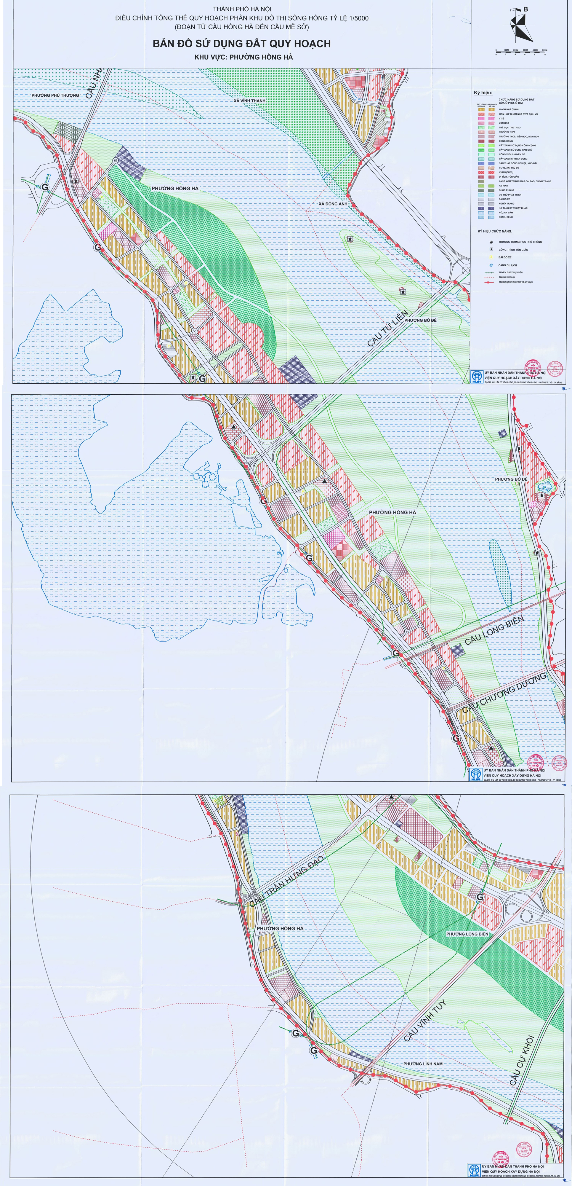 |
Hong Ha ward borders Bo De, Long Bien, Hai Ba Trung, Cua Nam, Hoan Kiem, Ba Dinh, Tay Ho, Vinh Tuy, Linh Nam, Vinh Hung, and Phu Thuong wards, as well as Vinh Thanh and Dong Anh communes. It spans 15,09 km2 with a population of 123,282. Under the proposed planning scheme, Hong Ha ward is set to develop as a hybrid model, combining existing urban areas with a riverside green corridor. Inside the dike, land is interspersed for residential, public, commercial-service, and transportation uses. Most of the river-facing space is dedicated to green areas, water bodies, and ecological functions. A riverside road runs through the area, connecting to main transport axes and intersections, including the Tu Lien Bridge area in the north and southern transport hubs. The orientation for Hong Ha ward is to enhance transport connectivity, upgrade existing residential areas, and expand riverside green spaces and public facilities, while also allocating land for urban functions in strategically connected locations.
 |
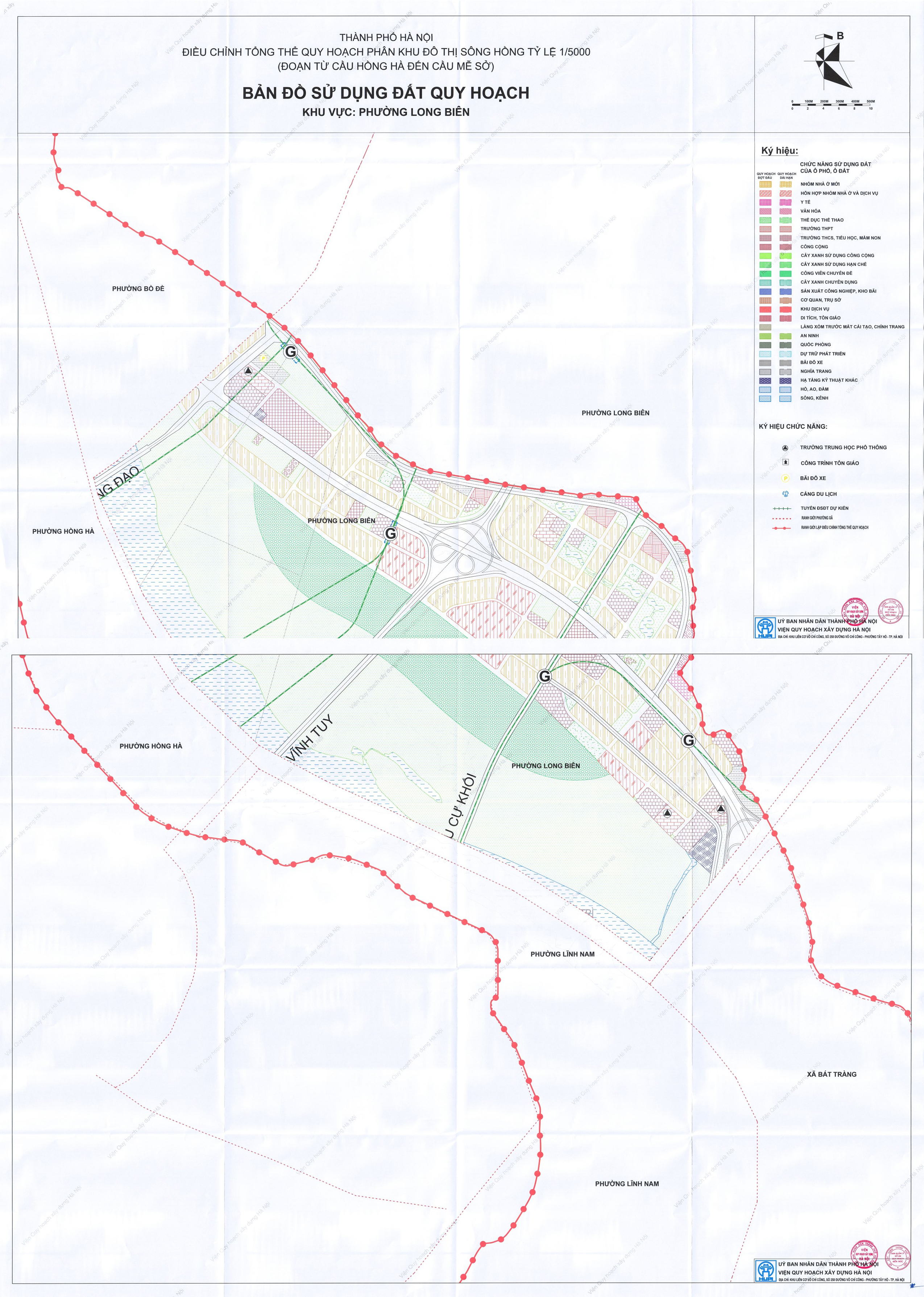 |
Long Bien ward, covering 19,15 km2 with a population exceeding 70,000, is planned for a higher degree of urban spatial organization compared to other areas. Land is interspersed for residential, urban facilities, green spaces, and transportation, with major roads traversing the area and connecting to important intersections. Green spaces are arranged in strips and concentrated areas, creating links with the riverside green corridor. This area also aims to enhance transport connectivity and reorganize urban land and public spaces.
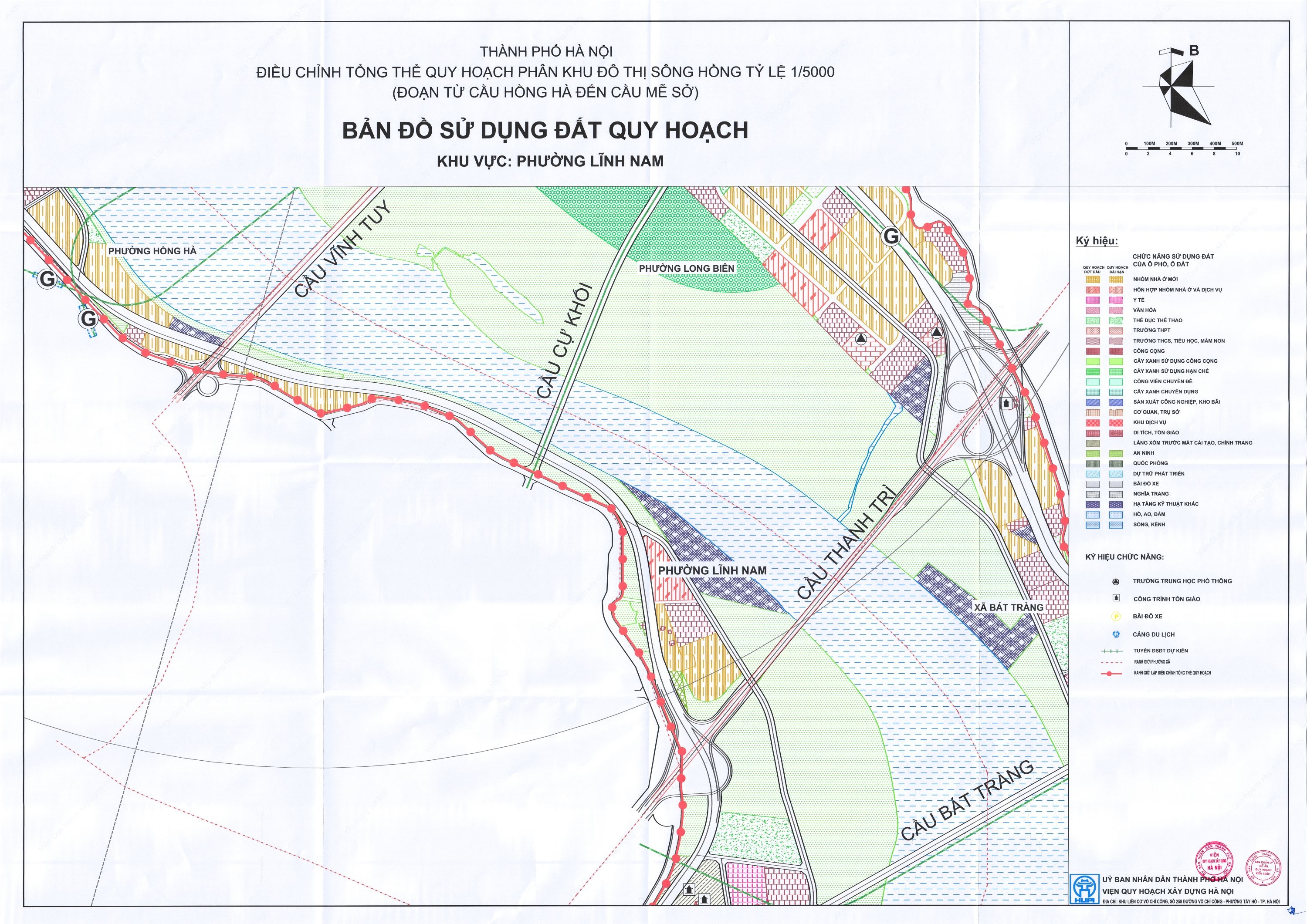 |
Linh Nam ward borders Vinh Hung, Hoang Mai, Yen So, Hong Ha, Long Bien, and Vinh Tuy wards, as well as Thanh Tri and Bat Trang communes. It spans 10,86 km2 with a population of 20,706. This area is planned for mixed development, combining urban functional zones with the riverside green corridor. Inside the riverside road, significant land is allocated for residential, public, commercial-service, and urban facilities. The riverside area features a large strip of land for green spaces, water bodies, and ecological zones. The locality includes important connecting routes such as Vinh Tuy Bridge, Cu Khoi Bridge, and Thanh Tri Bridge, along with intersections on the riverside axis.
 |
Son Ha
Source: Hanoi People's Committee