On the morning of 5/6, a tropical depression was located off the southwest coast of Taiwan (China). It had maximum winds of 49 km/h, equivalent to level 6, with gusts up to level 8. The system is moving northeast out of the East Sea at 25 km/h.
The National Center for Hydro-Meteorological Forecasting stated that the tropical depression will continue its northeast trajectory over the next 24 hours and is not expected to re-enter the East Sea. However, its circulation influenced the northeastern part of the North East Sea this morning, bringing winds of level 6, gusting to level 8, and waves 2-4 meters high. Vessels in these areas face risks from thunderstorms, whirlwinds, strong winds, and high waves.
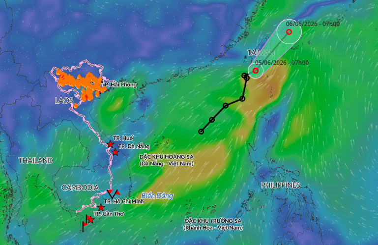 |
Tropical depression leaves the East Sea. *Photo: Disaster Monitoring System*
In mid-May, the National Center for Hydro-Meteorological Forecasting predicted that the ENSO phenomenon – unusual warming and cooling in the Pacific – will likely shift to an El Nino state around June 2026 and persist until early 2027. This shift is expected to reduce the number of storms and tropical depressions in the East Sea compared to the multi-year average.
Despite fewer systems, El Nino increases the risk of strong or very strong storms. Hoang Phuc Lam, Deputy Director of the National Center for Hydro-Meteorological Forecasting, explained that while El Nino years typically see fewer than the average 11-13 storms annually, systems forming in the Northwest Pacific – a region known for producing super typhoons – can maintain their intensity when entering the East Sea. Moreover, prolonged periods of calm at sea could allow later storms to develop more intensely or follow complex paths.
From June to August, the East Sea is forecast to experience about five storms and tropical depressions, aligning with the multi-year average. Nearly two of these could directly affect Vietnam's mainland. However, storm and tropical depression activity from September to December tends to be below the multi-year average.
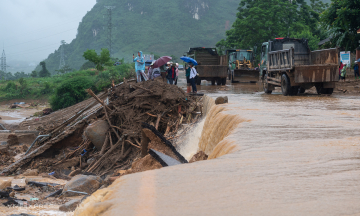
Despite the overall reduction in storm numbers, the meteorological agency warns of a high risk of extreme weather events. These include localized heavy rain, flash floods, and landslides, particularly in the mountainous areas of Vietnam's Northern and Central regions.
The year 2025 serves as a stark reminder of natural disaster impacts. The East Sea recorded 21 storms and tropical depressions, the highest number since data collection began in 1961. These events caused 484 deaths and disappearances and resulted in economic damages exceeding 104,700 billion VND, making it one of Vietnam's most devastating years for natural disaster losses.
By Gia Chinh