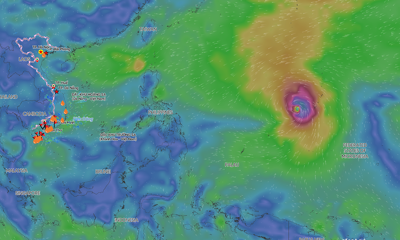
The National Center for Hydro-Meteorological Forecasting (NCHMF) reported that at 7h on 20/8, the tropical depression's center was located east of Hainan Island, China. It had maximum winds of 49 km/h, corresponding to level 6, with gusts up to level 8, and was moving west at a speed of 5-10 km/h.
The NCHMF forecasts that by 7h tomorrow, the tropical depression will continue moving west at 5-10 km/h, with its center over the northern mainland of Hainan Island. Its intensity is expected to remain at level 6, with gusts up to level 8.
By 7h on 22/8, the system is projected to shift its direction to west-northwest, moving at approximately 5 km/h. Its center will be over the eastern part of the Gulf of Tonkin, with the potential to strengthen to levels 6-7 and gust up to level 9. Over the subsequent 48-72 hours, the tropical depression will maintain a west-northwest trajectory at a speed of 3-5 km/h.
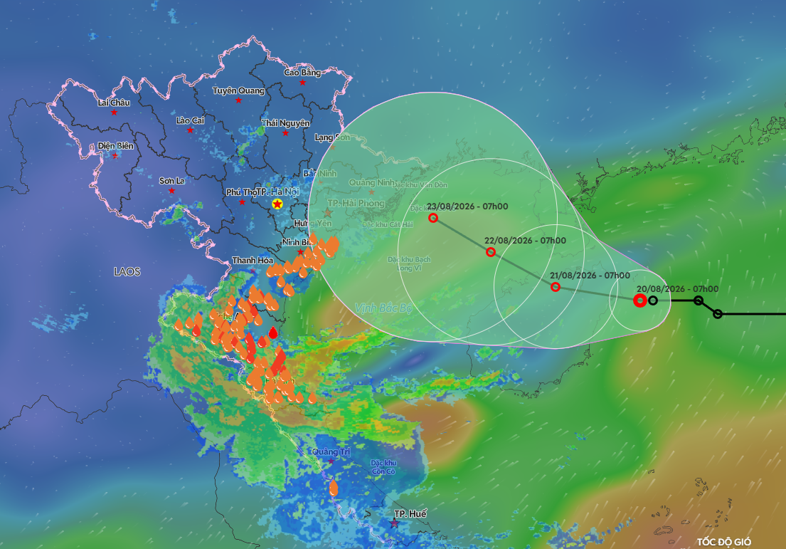 |
Forecast path of the tropical depression on the morning of 20/8. Photo: Disaster Monitoring System |
Forecast path of the tropical depression on the morning of 20/8. Photo: Disaster Monitoring System
The northwestern area of the East Sea is experiencing strong winds at level 6, gusting up to level 8, with waves reaching 2-4 m. From 21/8, the eastern Gulf of Tonkin will see winds gradually increase to levels 6-7, gusting up to levels 8-9, and waves 2-3 m high. Vessels operating in these hazardous areas face risks from thunderstorms, whirlwinds, strong winds, and large waves.
The National Steering Committee for Civil Defense has urged localities, ministries, and sectors to closely monitor the tropical depression's development. They are to manage offshore vessels, conduct inspections, and notify owners and captains to take preventative measures and avoid dangerous zones. Furthermore, they should monitor all vessels, especially tourist boats near coastal areas and islands, and ensure rescue forces and equipment are prepared.
Since the beginning of the year, the East Sea has experienced two storms. On 1/7, a tropical depression formed in the central East Sea, later strengthening into storm number one, Maysak, reaching level 9 with gusts up to level 11. The storm made landfall in Mong Cai, Quang Ninh, on the evening of 4/7, with winds of levels 8-9 and gusts up to level 12.
On 23/7, a tropical depression near the East Sea intensified into storm Noul, becoming storm number two. It then moved towards Guangdong, China, without directly impacting the Vietnamese mainland.
According to the meteorological agency's assessment, storm and tropical depression activity in the East Sea and its impact on the mainland from July to September are forecast to be consistent with the multi-year average.
Gia Chinh