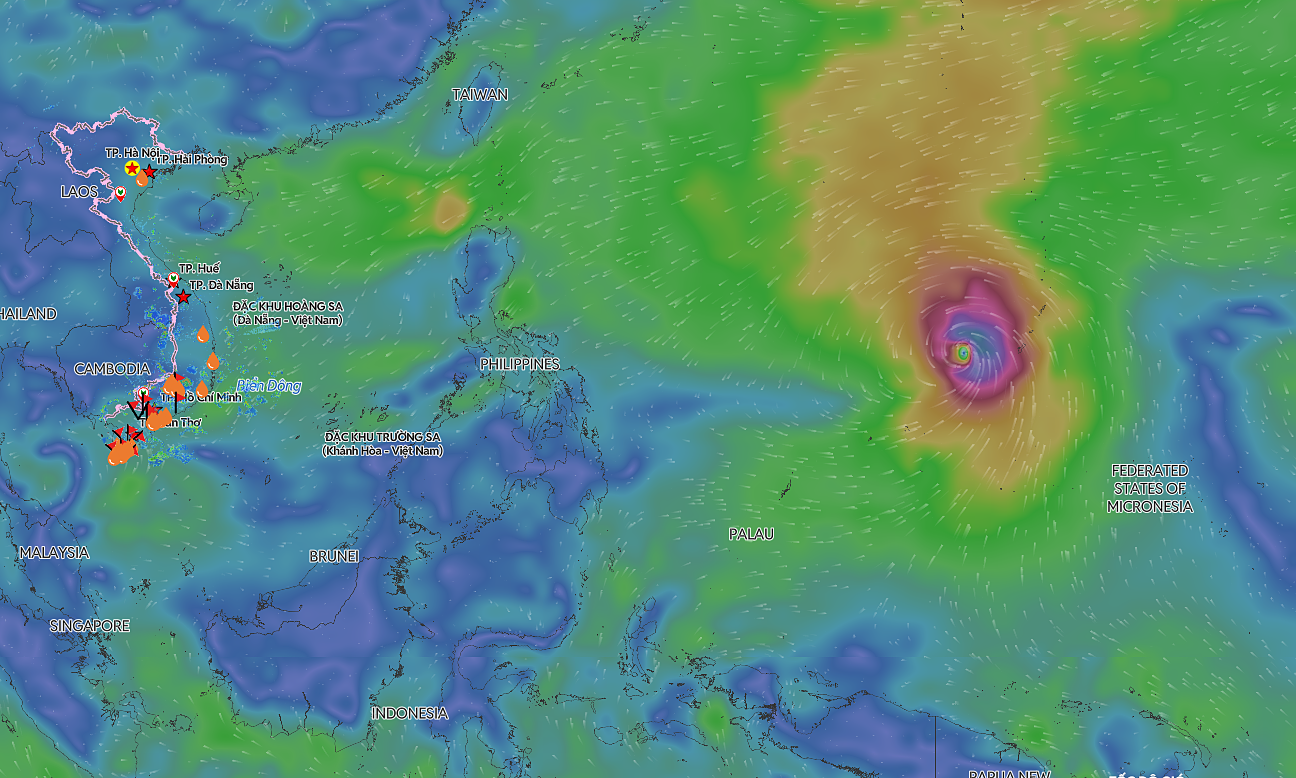
The National Center for Hydro-Meteorological Forecasting reported that at 1h on 19/8, the tropical depression's center was in the northern part of the East Sea. It had maximum winds of 49 km/h, force 6, gusting two levels higher, and was moving westward at 20 km/h.
By 1h tomorrow, the tropical depression is forecast to be about 200 km east of Hainan Island. It will be at force 6, gusting to force 8, and will turn west-northwest at 5 km/h.
By 1h on 21/8, the tropical depression will be about 110 km east-northeast of Hainan Island, maintaining its direction and speed. Over the next 48-72 hours, the tropical depression is forecast to move slowly.
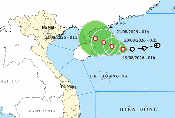 |
Forecast track of the tropical depression on 19/8. *Photo: NCHMF* |
International meteorological agencies have not yet issued forecasts for this tropical depression.
The northern part of the East Sea will experience strong winds of force 6, gusting to force 8, and waves 2-3,5 m high due to the tropical depression. Vessels in the dangerous area could be affected by thunderstorms, whirlwinds, strong winds, and high waves.
The National Steering Committee for Civil Defense requested People's Committees of provinces and cities, along with ministries and agencies, to closely monitor the tropical depression. They are to manage offshore vessels, organize checks, and promptly inform vessel owners and captains to proactively prevent, escape, or avoid entering dangerous areas.
Local authorities are requested to supervise vessel activities, especially tourist boats in bays, coastal areas, and islands. They should disseminate information and guide captains on proactively preventing and responding to thunderstorms, whirlwinds, strong winds, and high waves to ensure the safety of people and property.
Search and rescue forces and equipment are also requested to be ready for deployment in case of incidents.
Since the beginning of the year, the East Sea has recorded two storms. On 1/7, a tropical depression formed in the central East Sea, later strengthening into Storm Maysak, the first storm of the year. It reached force 9, gusting to force 11, and made landfall in Mong Cai (Quang Ninh) on the evening of 4/7 with winds of force 8-9, gusting to force 12.
On 23/7, a tropical depression near the East Sea strengthened into Storm Noul, the second storm of the year. It then headed towards Guangdong (China), not directly affecting mainland Vietnam.
Meteorological agencies forecast that from July to September, storm and tropical depression activity in the East Sea and their impact on the mainland will be at an average level compared to previous years. This period is the peak of the rainy and storm season, so maritime weather systems are warned to expect complex developments.
Gia Chinh