

At 7 a.m., the National Center for Hydro-Meteorological Forecasting reported that the tropical depression, with sustained winds of 49 km/h (level 6) and gusts reaching level 8, made landfall in Quang Ninh and Hai Phong. It was moving north-northwest at a speed of 15 km/h.
The coastal meteorological station in Quang Ha recorded winds of level 6 with gusts reaching level 9. Bach Long Vi station reported level 7 winds with gusts reaching level 8, while Co To and Cua Ong stations both recorded level 6 winds with gusts reaching level 8. Further inland in both provinces, the weather this morning was cloudy but without rain, and winds were light, creating favorable conditions for the commencement and inauguration of several projects commemorating the August Revolution.
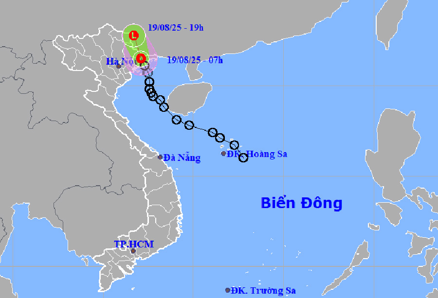 |
Forecast track and affected area of the tropical depression. Photo: *NCHMF* |
The tropical depression is forecast to move into Lang Son today and weaken on the Vietnam-China border. The northern part of the Gulf of Tonkin (including the special administrative-economic units of Bach Long Vi, Cat Hai, Co To, and Van Don) will continue to experience strong winds of level 6, with gusts up to level 8, and waves of 2-3.5 meters. Vessels operating in these dangerous areas are likely to be affected. Coastal areas of Quang Ninh and Hai Phong will experience strong winds of level 6 with gusts reaching level 8.
Today and tonight, the northeast region and Thanh Hoa will experience widespread rainfall of 40-70 mm, with some areas receiving over 150 mm. Due to several days of rain, soil moisture has reached saturation point, and the meteorological agency has issued a landslide warning for 133 communes in Cao Bang, Dien Bien, Son La, Lao Cai, Thai Nguyen, Lang Son, Quang Ninh, Bac Ninh, Hai Phong, Thanh Hoa, and Nghe An.
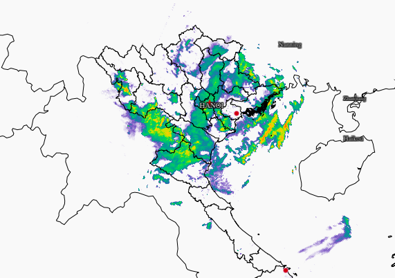 |
Rainfall area (blue) due to the tropical depression. Photo: *Hydro-Meteorological Forecasting Center* |
In response to the tropical depression, Hai Phong and Quang Ninh issued sea bans on the afternoon of 17/8, urging vessels at sea, workers on aquaculture rafts and watchtowers to take all necessary measures to find safe shelter and arrange to prevent collisions and sinking at anchorages. Hai Phong also suspended operations of the Cat Hai - Phu Long cable car and all tourism and entertainment activities in the coastal and island areas from 2 p.m. on 18/8.
Since the beginning of the year, four typhoons have formed in the East Sea (South China Sea), two of which have affected Vietnam. The most recent, Typhoon Wipha, made landfall in Hung Yen and Ninh Binh. Although not particularly strong, it caused heavy rainfall, especially in Thanh Hoa and Nghe An provinces, resulting in two deaths from flash floods and landslides, and five injuries. 687 houses were damaged or destroyed. Over 119,000 hectares of rice, mainly in Ninh Binh, were flooded. Many households in the mountainous areas of Nghe An had to evacuate during the night, with floodwaters reaching up to one meter in some homes.
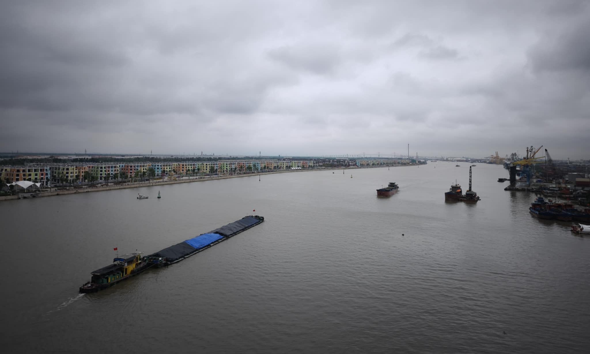 |
Overcast skies in Hai Phong on the morning of 19/8, no rain. Photo: *Le Tan* |
Gia Chinh - Le Tan


