The Can Tho 2 bridge project, a vital link across the Hau river and a key component of the Ho Chi Minh City - Ca Mau expressway, is slated for groundbreaking in late 2026, with an estimated completion time of five years. This significant infrastructure endeavor carries a total investment approaching 30.000 billion dong. According to the My Thuan Project Management Board on 30/12, the Ministry of Construction is currently evaluating the pre-feasibility study for the Can Tho 2 bridge and its approach roads. The Board has urged the Ministry to allocate necessary funds to accelerate the project. Plans anticipate the investment policy, project approval, and contractor selection processes to be finalized within 2026.
The Can Tho 2 bridge holds a crucial role in connecting the My Thuan - Can Tho and Can Tho - Ca Mau expressways, forming an integral part of the Eastern North-South expressway axis. It will also facilitate linkages between horizontal expressways, including Chau Doc - Can Tho - Soc Trang and Ha Tien - Rach Gia - Bac Lieu. This project is expected to complete the strategic transport network in the Southwest region, significantly enhancing connectivity between economic centers, airports, seaports, and river ports. Furthermore, it aims to alleviate congestion on National Highway 1, foster socio-economic development, and bolster regional security and defense across the Mekong Delta.
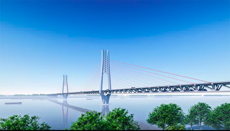 |
Perspective view of Can Tho 2 bridge. *Photo: My Thuan Project Management Board*. |
The proposed design for the Can Tho 2 bridge features a combined road and rail structure, integrating with the Ho Chi Minh City - Can Tho railway line's crossing of the Hau river. The entire route spans approximately 17,5 km. The project's starting point is the existing Cha Va intersection, located at the end of the My Thuan - Can Tho expressway in Binh Minh ward, Vinh Long province. It will conclude by connecting with the Can Tho - Ca Mau expressway at the IC2 intersection in Hung Phu ward, Can Tho City, where it will also intersect with the Nam Song Hau national highway connection.
The main bridge will be a cable-stayed structure, stretching over one km to span the Hau river. It will be situated about 4,5 km downstream from the existing Can Tho bridge. Designed for a navigation clearance of 300 m, the bridge will feature six lanes, a design speed of 100 km/h, and a lane width of 3,75 m. The approach road system, comprising several medium and small bridges, will also include six complete lanes, a design speed of 100 km/h, and designated emergency stopping lanes.
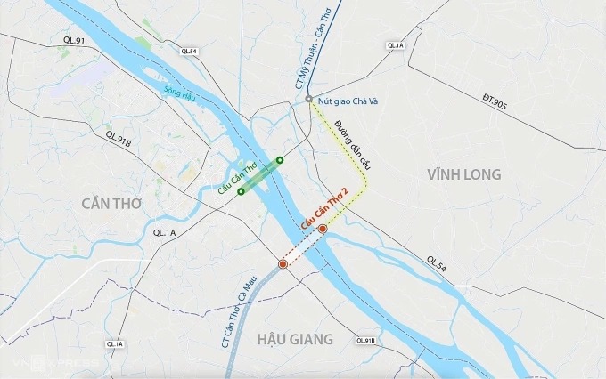 |
Route alignment of Can Tho 2 bridge. *Graphics: Dang Hieu*. |
The preliminary total investment for the project is estimated at 29.525 billion dong. This includes over 21.200 billion dong for construction and equipment, more than 2.100 billion dong for project management and consulting, and over 2.650 billion dong allocated for compensation, support, and resettlement. The remaining portion accounts for contingency costs.
An Binh