A team of experts from the Institute of Earth Sciences (Vietnam Academy of Science and Technology) made the proposal after a field survey in the Nam Voi - Pu Dao area, Le Loi commune.
According to Doctor Pham Van Tien, head of the survey team, the Nam Voi area is located in a highly dissected mountainous terrain, where geological hazards frequently occur and continue to evolve. The most prominent feature is the Nam Voi rock flow, which local residents call the "rock dragon".
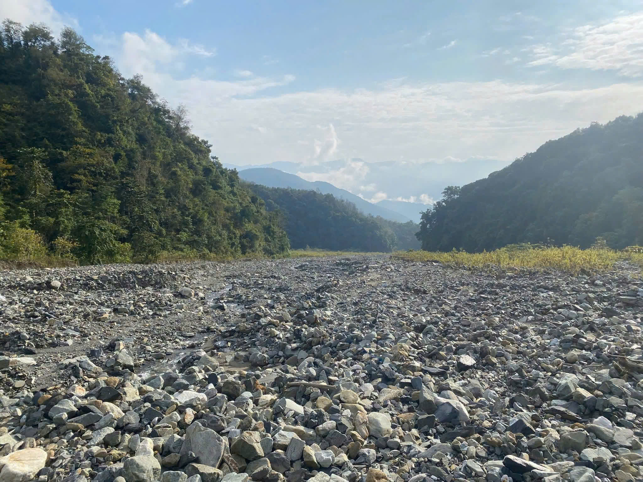 |
The rock flow in Nam Voi. Photo: Institute of Earth Sciences |
Experts state that the rock flow, approximately 10 km long and 100 to 600 m wide, has been forming and active for nearly 100 years. The flow developed in stages with varying intensity, experiencing periods of strong activity and periods of weakening, but it continues to expand its scope. According to the research group, this is one of the largest and most unique rock flows globally.
Unlike ordinary flash floods, which primarily involve rapidly flowing water, rock flows are a mixed phenomenon consisting of soil, boulders, mud, and water moving from mountain slopes downstream with immense destructive power. After each period of activity, massive amounts of material are deposited, creating rock fields hundreds of meters wide and altering the natural topography. The scale and formation process, spanning decades to centuries, make large rock flows important subjects of study in geology and geomorphology.
Associate Professor Doctor Vu Cao Minh stated that many countries, including Switzerland, Japan, the US, Italy, and Austria, have transformed areas affected by earthquakes, volcanic eruptions, or rock flows into "natural disaster relics". These sites preserve scientific value while serving educational purposes and tourism development. Visitors can directly observe traces of natural phenomena, while students, university students, and scientists gain additional field research locations.
Drawing from this experience, the research group proposed that Lai Chau develop the Nam Voi area as a geological park and ecotourism model. Suggested components include: establishing a scientific research station, a bridge or viewpoint over the rock flow, a geological tour route, and integrating the development of resort tourism products, medicinal herbs, nature exploration, and indigenous cultural experiences.
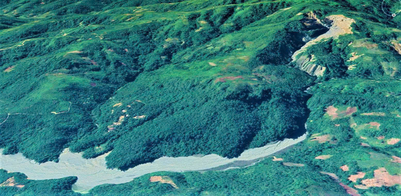 |
Location of the rock flow in Nam Voi. Photo: Googlemaps |
According to experts, if planned properly, this area could not only become a new destination for Lai Chau but also contribute to raising community awareness about disaster prevention, preserving natural landscapes, and promoting local economic development.
A representative from the Lai Chau Department of Culture, Sports and Tourism assessed that this discovery opens a new direction for the province's tourism sector. The Nam Voi area is home to the Mang ethnic group, one of Vietnam's smallest ethnic minorities, which preserves many traditional cultural values. Within the same Le Loi commune, there is also the Le Loi Stele, a national historical relic that attracts many visitors.
According to the Department of Culture, Sports and Tourism, connecting geological, historical, and indigenous cultural values could form a unique tourism complex in Lai Chau, diversifying products and extending tourist stays.
The Department proposed that the Institute of Earth Sciences continue to coordinate with the provincial People's Committee and specialized agencies to conduct deeper research on the scientific value, conservation potential, and exploitation plans for the Nam Voi area. This research should aim for sustainable development, ensuring harmony between nature conservation, tourism development, and the livelihoods of local residents.
Gia Chinh