According to Nguyen Xuan Anh, Director of the Institute of Geophysics, the earthquake occurred at 6:21 p.m. at a depth of about 8 km. Despite its moderate intensity, the tremors spread widely, allowing residents in areas tens of kilometers from the epicenter to feel them.
Beyond areas close to the epicenter like Son Tay, Ba To, and Son Ha, shaking was also reported in eastern Quang Ngai districts such as: Duc Pho, Nghia Hanh, and Long Phung, and even in coastal areas like My Khe and Dung Quat, located about 80 km from the earthquake's center. Many people reported feeling the shaking for approximately 3 seconds.
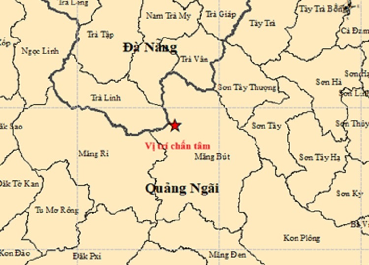 |
Location of the earthquake in Mang But commune, formerly Kon Tum. Photo: Institute of Geophysics. |
"I was lying in my house when I heard the door shaking. I thought a truck was passing by, only to realize later it was an earthquake," said Minh Cuong from Nghia Hanh. Some residents near Dung Quat port also initially mistook the tremors for a road roller or heavy vehicles. This was unexpected, as people in the lowlands and coastal areas of Quang Ngai rarely feel earthquakes.
Earlier on the same day, at 4:30 p.m., the area recorded a 2.7-magnitude earthquake; on the evening of 20/3, another 2.6-magnitude quake occurred. All these earthquakes are assessed as having a disaster risk level 0 and are being continuously monitored by the Institute of Geophysics.
Since 2021, the Kon Plong area (formerly Kon Tum) has recorded over 1,000 earthquakes. According to experts, this is a weak earthquake zone, with a maximum intensity not exceeding 5.5 magnitude. Most tremors are identified as induced earthquakes, related to the water storage activities of hydropower reservoirs, which increase pressure on fault lines within the earth.
Pham Linh