 |
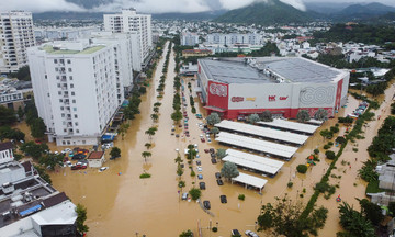
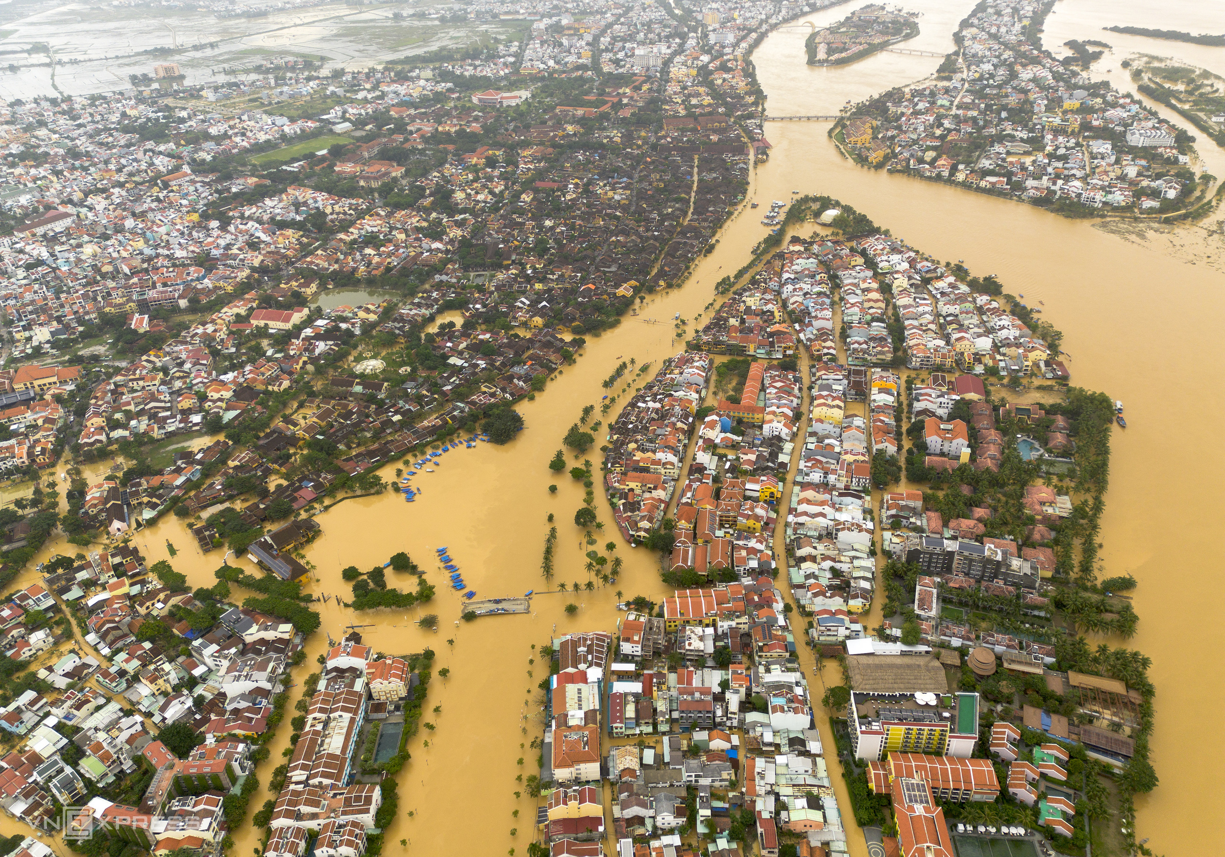
Floodwaters surrounded Hoi An ancient town and its neighboring areas. Streets along the river, such as Bach Dang, Ton Nu Ngoc Hoa, and Nguyen Phuc Chu, were submerged by 1.2-1.5 m, with many inner streets also under 0.8-1 m of water.
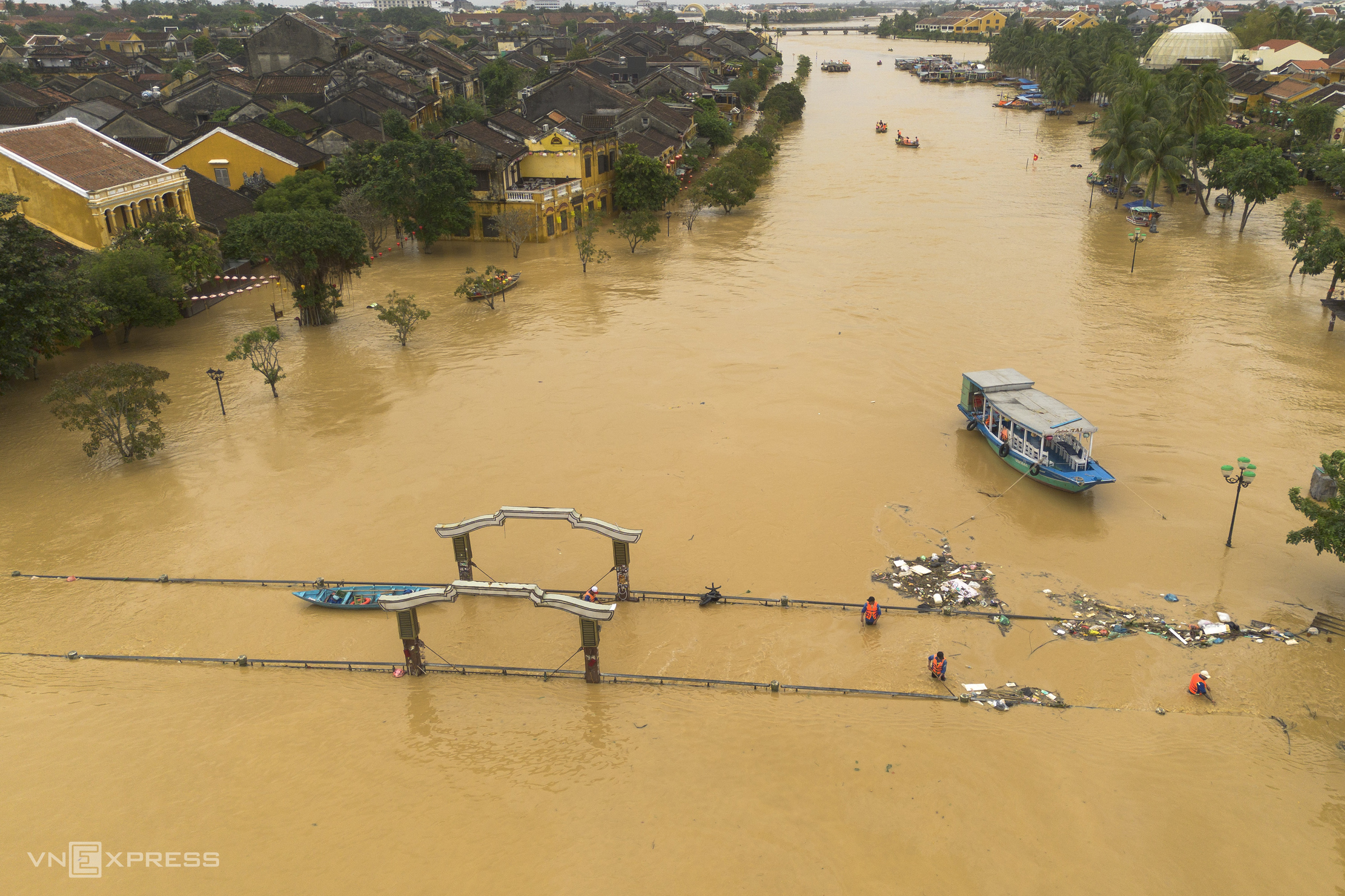 |
An Hoi bridge, which connects the ancient town with Nguyen Hoang night market across the Hoai river, turned into a river itself. Environmental workers waded waist-deep to collect trash and clear the flow, aiming to help the floodwaters drain faster into Cua Dai beach.
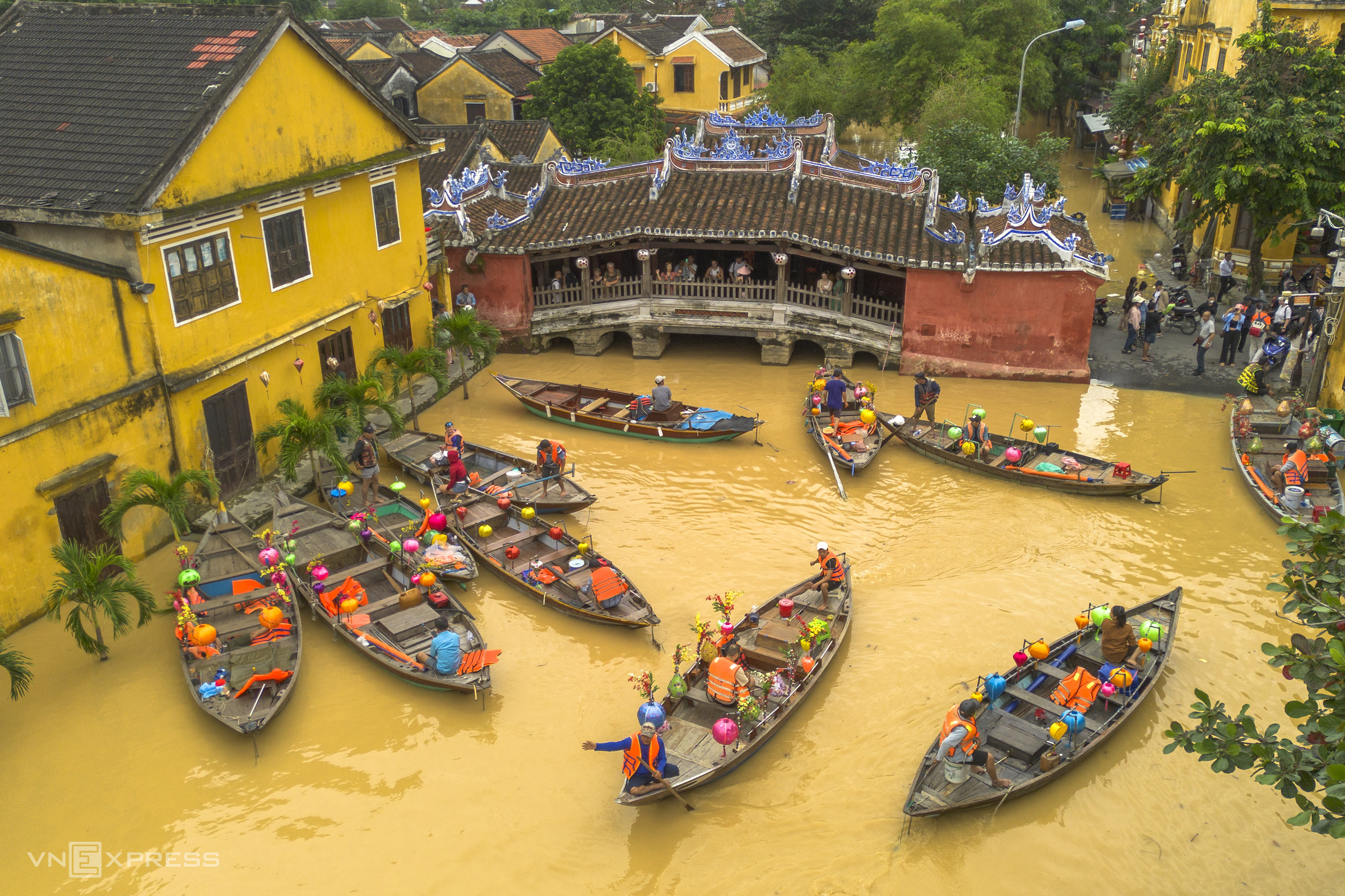 |
Chua Cau, Hoi An’s iconic landmark, remained crowded with visitors, despite requiring wading through several streets to reach. A rare dry area amid the floods, the beginning of Tran Phu street near Chua Cau became a hub where small boats picked up visitors and residents, ferrying them between the submerged areas and the town.
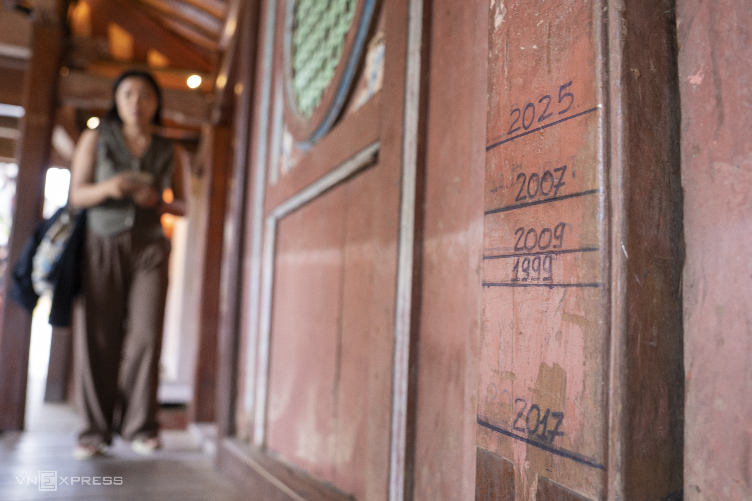 |
The water level inside Chua Cau was about 1 m lower than on the night of 28/10. On a wooden board at the entrance of the Pagoda Bridge, staff had marked flood levels from previous years, with 2025 showing the highest level since the historic flood of 1999.
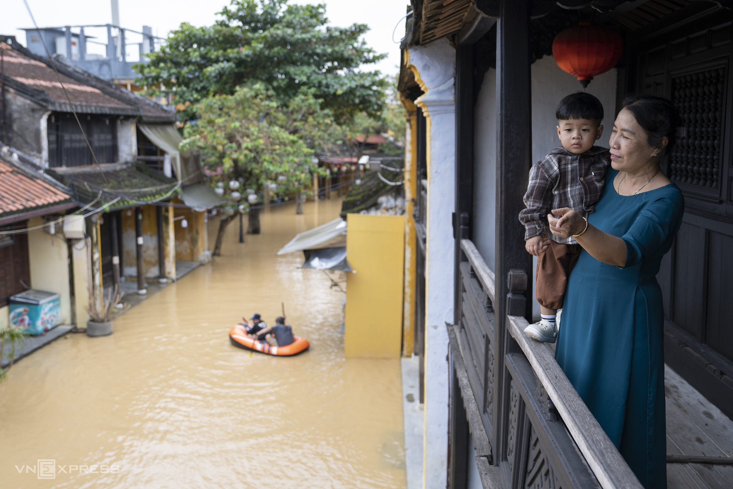 |
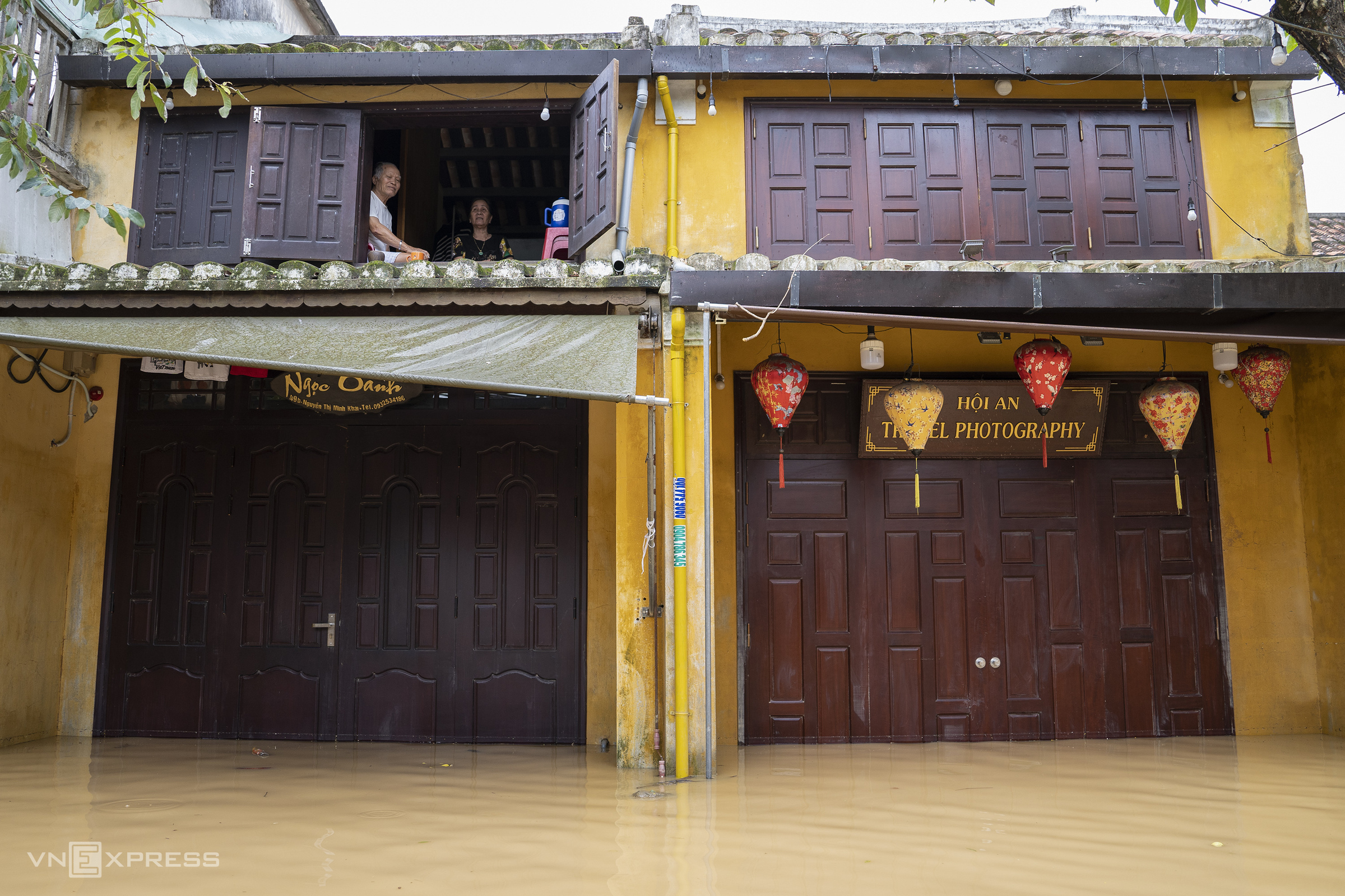
On Nguyen Thi Minh Khai and Nguyen Thai Hoc streets, which run parallel to Ton Nu Ngoc Hoa and Bach Dang streets along the Hoai river, many households evacuated to their second floors to avoid the water. Below, residents used boats and canoes to navigate through deeply flooded sections.
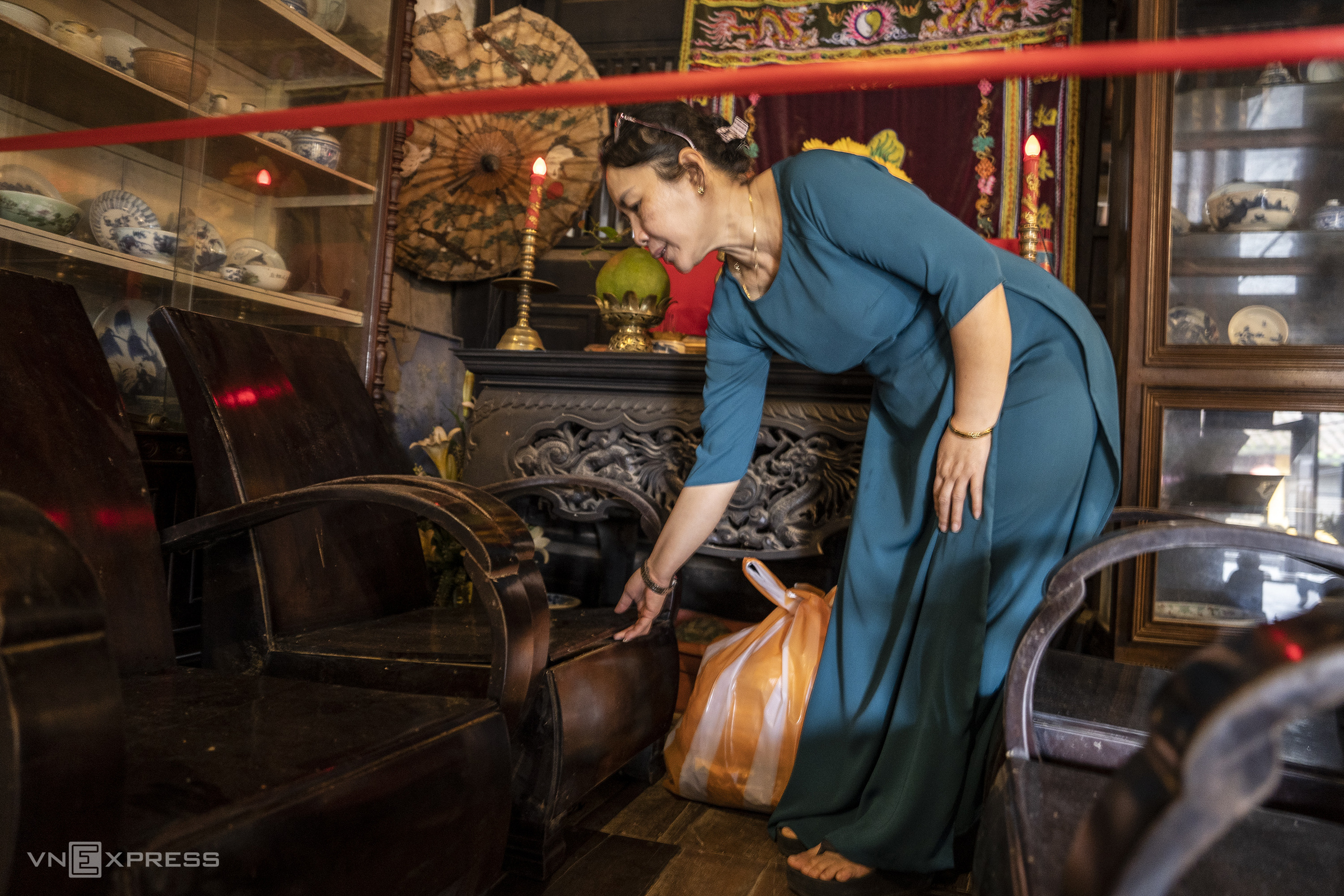
Inside Phung Hung ancient house (number 4 Nguyen Thi Minh Khai street, next to Chua Cau), staff elevated tables and chairs using plastic stools. The flood on the night of 28/10 had submerged the ancient house by more than 1 m, damaging many properties.
This ancient house was built in 1780 by a Vietnamese merchant during the prosperous era of Hoi An port city. The current owners are descendants of the 8th generation, living in and preserving the ancient house.
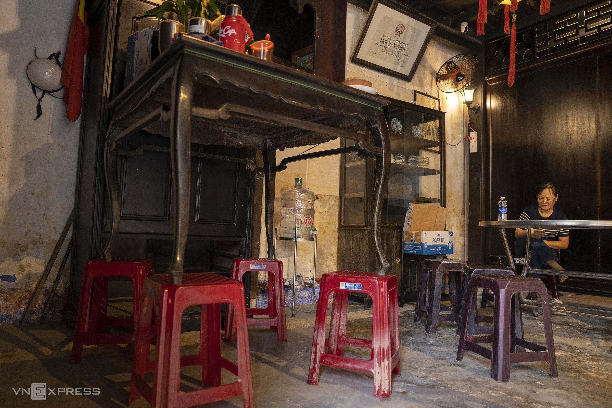 |
On the second floor of this ancient house, many tables and chairs were moved up to avoid flooding. Some sets of tables and chairs, damaged during the flood 20 days prior, were cordoned off with warnings to tourists to ensure safety.
 |
Nguyen Van Bien, 82 years old, living at number 49 Nguyen Thi Minh Khai, had an evening meal with his wife in their second-floor room, while floodwaters below rose to nearly 1 m. He stated that this was the third flood in three weeks. Learning from the previous time, the couple proactively stocked up on food and provisions. "Our children wanted to move us to a drier area, but we are used to living at home, so we didn't go," he said, adding that their attic is more than 3 m above street level, so they feel temporarily safe.
 |
Many historical sites, which are popular tourist attractions in the ancient town, had to close due to deep flooding. The ancient town also stopped selling entrance tickets and removed barriers to allow residents to evacuate their belongings.
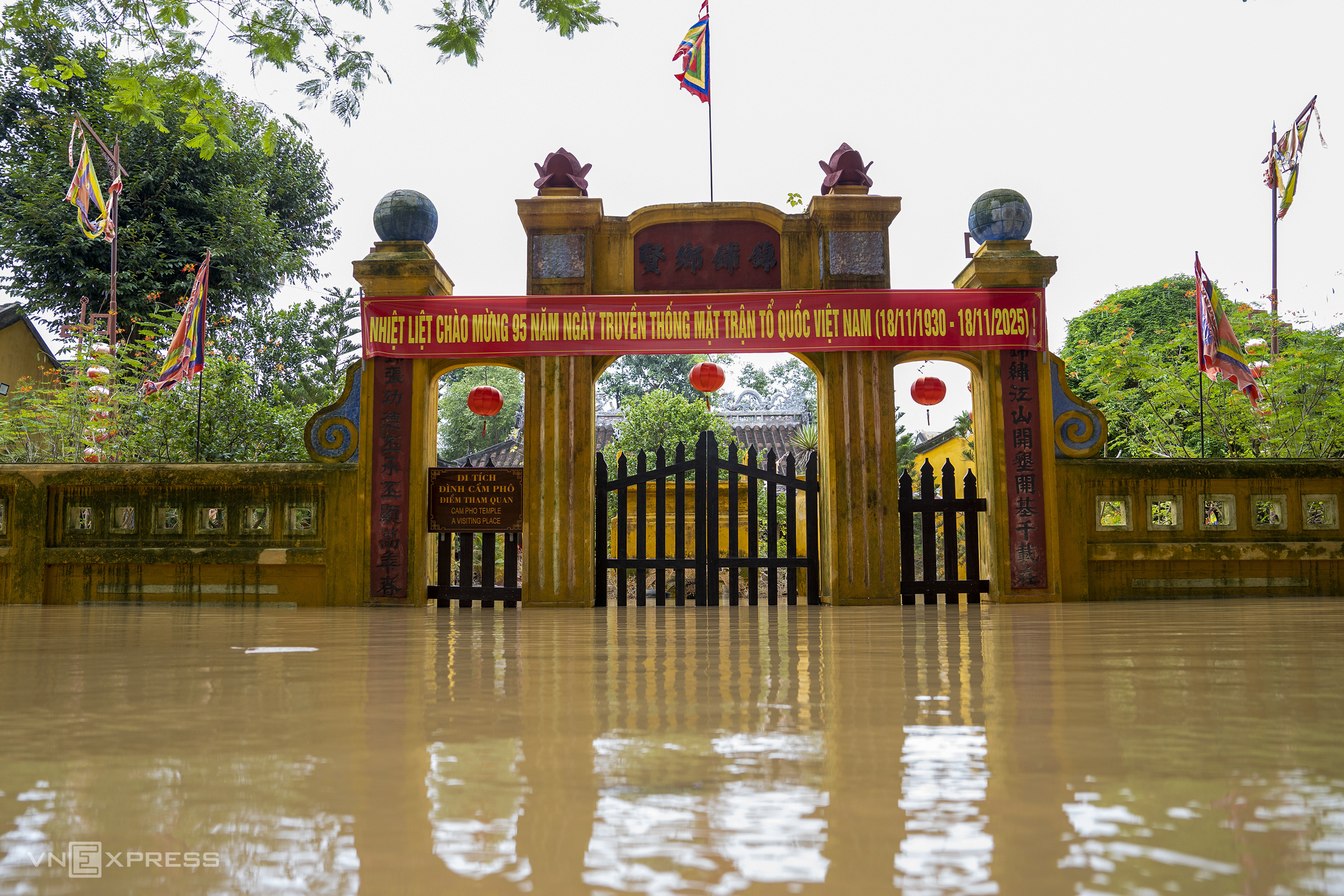 |
Inside the more than 500-year-old Cam Pho ancient communal house, floodwaters surrounded it on all sides. Many trees, submerged through successive floods, had yellowed leaves or even died from waterlogging.
The communal house was restored in 1817 and 1897. Despite enduring many upheavals, it largely retains its original architecture and was classified as a national architectural and artistic relic in 1991.
 |
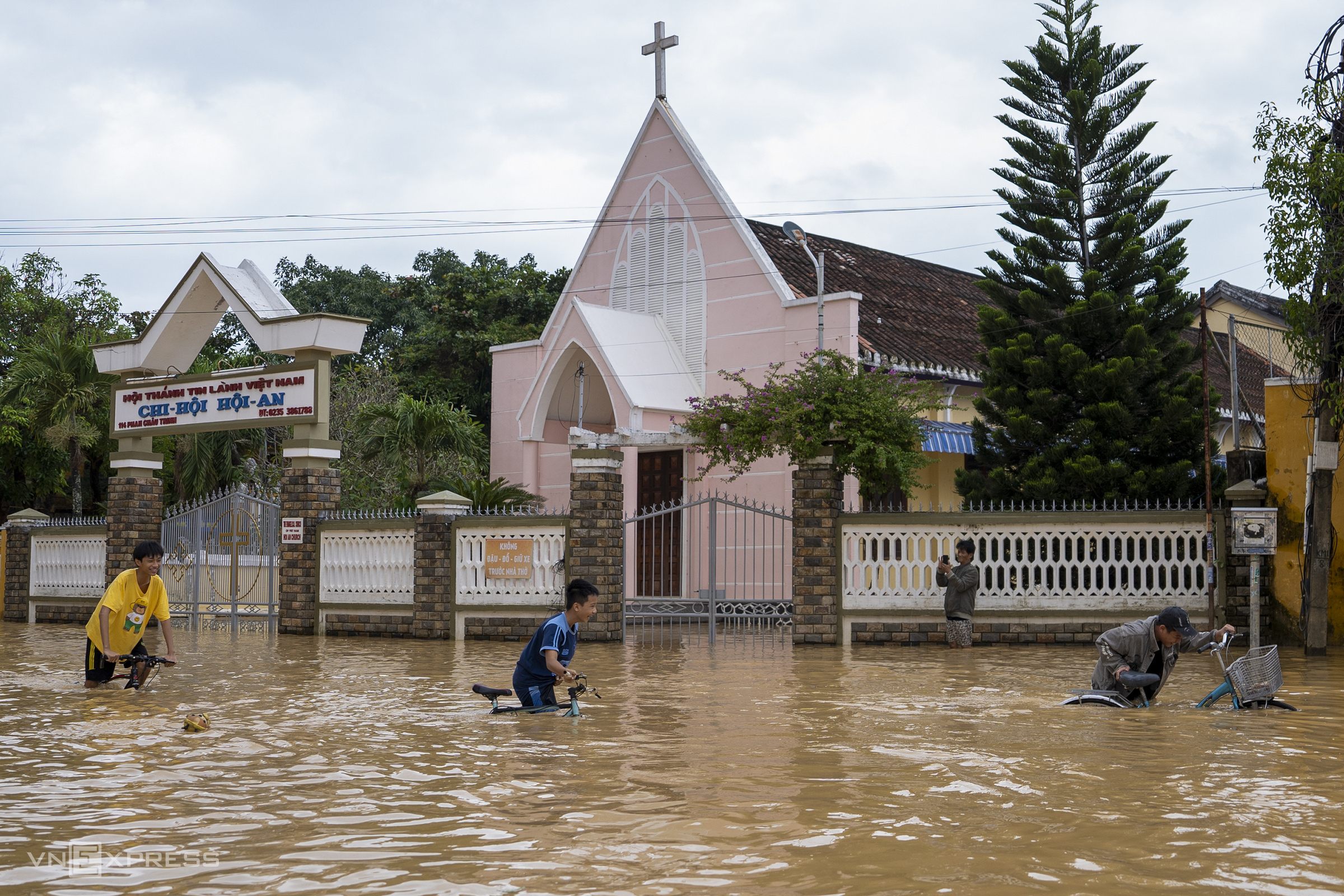
In front of the Hoi An Protestant Church on Phan Chu Trinh street, water was still about 0.8 m deep on the evening of 18/11, with many students cycling and playing. The Hoai River Square area in front of the church was also surrounded by floodwaters.
 |
Many tourists rented boats to navigate the ancient town, experiencing the flood season in Hoi An, while local residents, including children, accustomed to the flooded landscape, sat calmly in front of their homes watching the floodwaters.
On the afternoon of 18/11, water levels in Hoi An began to recede but very slowly. During an online meeting on floods held the same day, a representative from the National Center for Hydro-Meteorological Forecasting announced that from 18 to 20/11, heavy rains would cause floods on rivers from Da Nang to Gia Lai to rise again. Specifically, the Vu Gia - Thu Bon river system could reach alarm levels 2-3 and above alarm level 3, meaning that flooding in Hoi An could still increase overnight as the Hoai river is a tributary of the Thu Bon river.
Nguyen Dong