The northwestern region and Tuyen Quang continued to experience rain today, following heavy rainfall last night. From 7h to 20h, Che Tao (Lao Cai) recorded 233 mm of rain, Na Tau (Dien Bien) 179 mm, and Bum To (Lai Chau) 153 mm.
The National Center for Hydro-Meteorological Forecasting predicts continued rain for mountainous and midland areas of the northern region from tonight until the end of 19/7, with widespread amounts of 60-120 mm and localized areas exceeding 250 mm. The agency also warns of intense rainfall, potentially over 100 mm within three hours, which increases the risk of inundation, flash floods, and landslides.
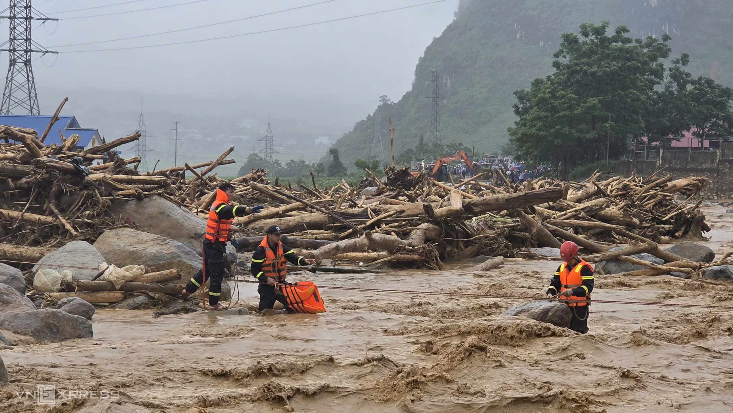 |
Police rescue people trapped in floodwaters in Muong Than commune, Lai Chau on 17/7. *Bich Ngoc* |
Rain will persist through the night of 19/7 and the morning of 20/7, with amounts generally ranging from 20-50 mm, and some areas receiving over 100 mm.
After several days of continuous rain, soil moisture models indicate that many areas in Lai Chau, Dien Bien, Son La, and Lao Cai are near or have reached saturation, exceeding 85%. Consequently, the National Center for Hydro-Meteorological Forecasting warns that within the next 6 hours, flash floods on small rivers and streams, and landslides, could affect hundreds of communes and wards across these four provinces. The disaster risk level for flash floods and landslides is set at level one, with Lai Chau and Lao Cai specifically at level two.
High-risk areas include numerous communes and wards in Lai Chau, such as Muong Than, Than Uyen, Le Loi, Hua Bum, Bum To, Phong Tho, Sin Ho. Dien Bien faces similar risks in Na Tau, Muong Phang, Muong Ang, Tuan Giao, Tua Chua. In Son La, vulnerable areas include Ngoc Chien, Muong La, Bac Yen, Ta Xua, Thuan Chau. Lao Cai also lists Che Tao, Khao Mang, Lao Chai, Mu Cang Chai, and Pung Luong, along with many adjacent regions, as high-risk.
These flash floods and landslides threaten human lives, cause traffic congestion, destroy infrastructure, and severely impact production and socio-economic development.
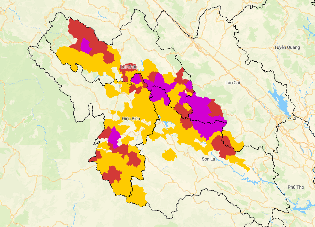 |
Map of landslide and flash flood risk at 21h30 on 17/7. Yellow indicates medium risk, red high risk, purple very high risk. *NCHMF* |
In response to the unfolding flood situation, the Prime Minister issued an official dispatch. He instructed local authorities to review and update response plans, proactively evacuate residents from areas at risk of flash floods and landslides, ensure safety on submerged and landslide-affected transport routes, and prepare essential supplies for people in isolated regions.
The Ministry of National Defense and the Ministry of Public Security are tasked with preparing rescue forces to support local authorities upon request. Related ministries and sectors are responsible for ensuring the safety of reservoirs, dikes, hydropower plants, and essential infrastructure.
The Department of Dike Management and Disaster Prevention reported severe damage in Lai Chau, where one person died, 5 people remain missing, and two were injured.
The floods damaged 22 homes, with 13 houses in Muong Than commune completely swept away by flash floods, necessitating urgent resident evacuation. In Pa U commune, landslides affected 5 houses, 4 of which completely collapsed. Dozens of hectares of rice and crops were inundated, buried, or washed away, leading to losses in many aquaculture ponds, livestock, and poultry.
Numerous transport routes were also cut off. Sections of national highways 12, 32, 279, along with provincial roads 127, 128, 129, 133, 133B, 134, 135, and many inter-commune and inter-village roads experienced landslides and blockages. This has significantly impacted travel and rescue efforts in the affected localities.
Gia Chinh