The Earthquake Information and Tsunami Warning Center, part of the Institute of Earth Sciences, reported that six earthquakes struck the Mang But commune area between 0:40 and 3:28.
The most powerful tremor, measuring 4.0 magnitude, occurred at 0:40. The subsequent five earthquakes, ranging from 2.6 to 3.2 magnitude, happened over nearly three hours, with a focal depth of approximately 8,1 km.
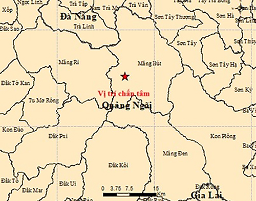 |
Location of the earthquake at 3:28 in Mang But commune, Quang Ngai. *Photo: Institute of Earth Sciences*
The affected region, previously part of Kon Plong district in Kon Tum province, now belongs to Quang Ngai province following administrative boundary adjustments. This area has frequently recorded induced earthquakes in recent years.
According to the Institute of Earth Sciences, induced earthquakes are linked to reservoir impoundment activities. These events are typically weak or moderate in intensity and rarely cause serious damage.
Experts have previously stated that induced earthquakes in this area could persist for many years, potentially taking around 10 years to gradually stabilize. However, the likelihood of an earthquake exceeding 5,5 magnitude is low.
Linh Pham