Around 4 PM, heavy rain on Song Pha Pass triggered a landslide. Earth, rocks, and trees from the hillside spilled onto more than 30 m of the road surface in Lam Son commune, Khanh Hoa. Many oto and motorbikes had to stop from a distance to avoid danger.
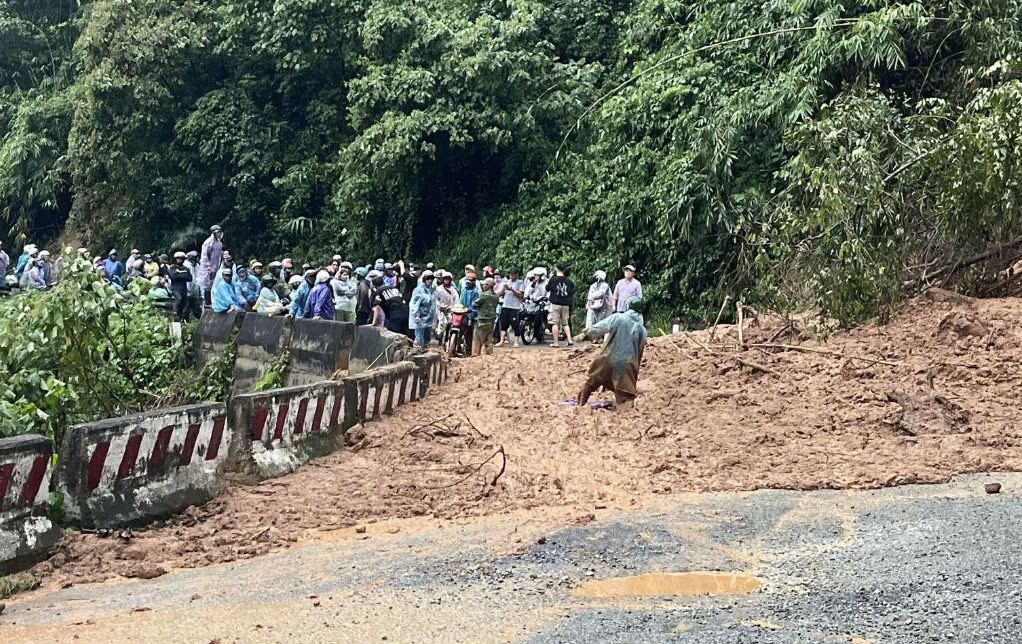 |
Song Pha Pass was affected by a landslide on the afternoon of 2/12. Photo: Hoang Sao |
Doan Van Hung, Secretary of the Party Committee of Lam Son commune, reported no casualties from the landslide. The pass was temporarily closed to ensure safety and facilitate site clearance. The Khanh Hoa Traffic Infrastructure Maintenance Management Board expects to complete debris removal and reopen the road by approximately 6 PM on the same day.
More than 20 km from the landslide site, two hours of heavy rain caused National Route 27 in D'ran commune to flood 0,3-0,5 m deep over a stretch of about 500 m. Swift currents over the road made it impassable for motorbikes and low-clearance oto. Residents had to pull over at houses along the road to wait for the water to recede.
By 4:45 PM, the area remained flooded, with traffic disrupted. Authorities had set up checkpoints, warning vehicles not to enter the hazardous zone.
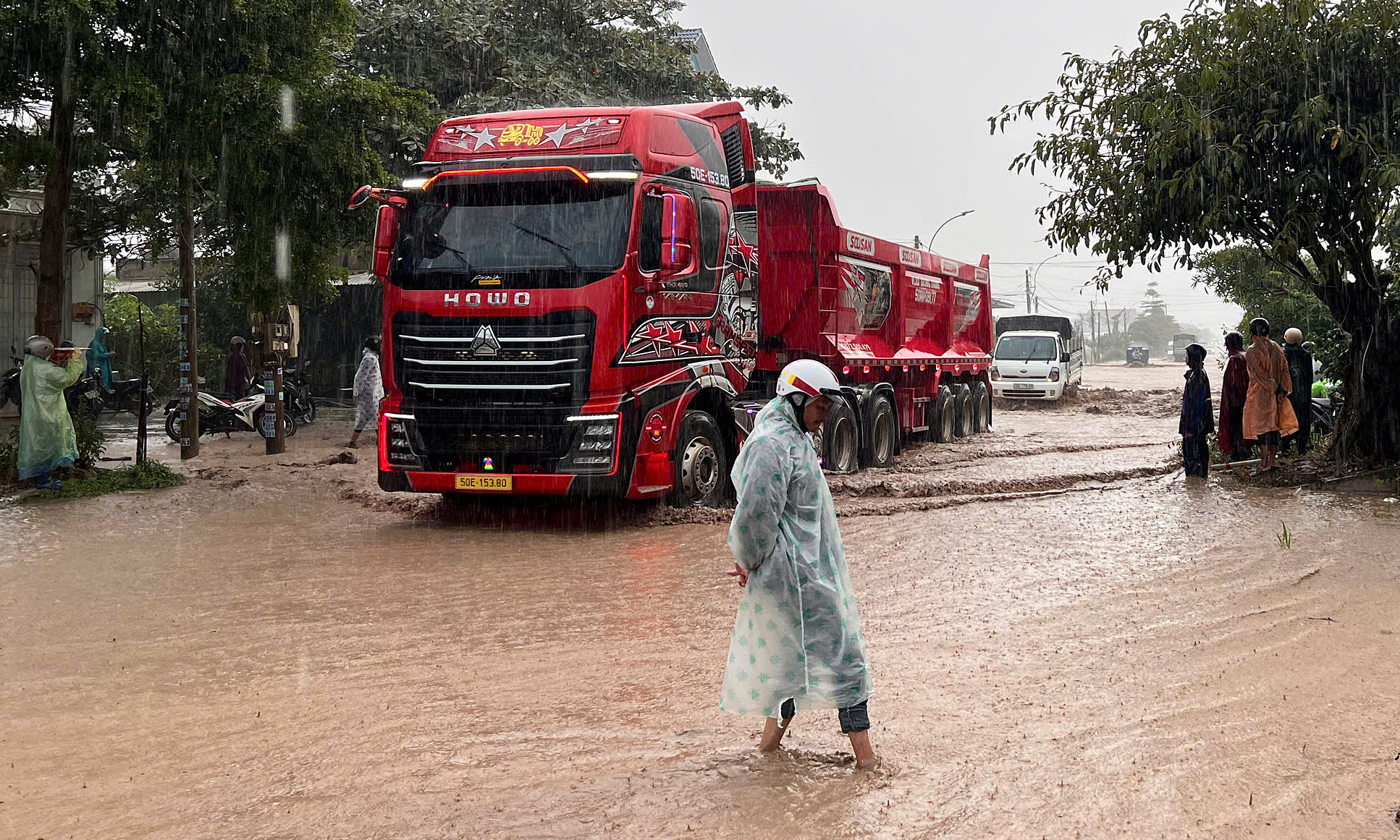 |
National Route 27 in D'ran commune experienced localized flooding. Photo: Anh Tuan |
National Route 27 spans 290 km, linking Khanh Hoa, Lam Dong, and Dak Lak. Song Pha Pass, also known as Ngoan Muc Pass, is 18 km long and serves as a key route to the Lang Biang plateau and Da Lat. It has experienced frequent landslides due to heavy rains. More than 10 days prior, recent landslide sites here were cleared, reopening the route.
According to the National Center for Hydrometeorological Forecasting, from the night of 2/12 until the end of 3/12, the eastern provinces from Quang Ngai to Dak Lak and Khanh Hoa are expected to receive 70-120 mm of rain, with some areas exceeding 180 mm. This is due to the remnants of Typhoon Koto combined with a strengthening cold air mass.
Bui Toan - Dang Khoa