Starting 1/7, the National Center for Hydro-Meteorological Forecasting (NCHMF) will provide forecasts and warnings for 7 specific climate zones across Vietnam, with Ho Chi Minh City added as a separate zone. These zones have been adjusted to reflect the new administrative boundaries.
The Northwest region includes Lai Chau, Dien Bien, Son La, Lao Cai provinces, and the western and southwestern parts of Phu Tho province (formerly Hoa Binh province).
The Northeast region includes Tuyen Quang, Cao Bang, Thai Nguyen, Lang Son, Bac Ninh, Bac Giang, Hai Phong, Hung Yen, Ninh Binh, Hanoi, and the northern part of Phu Tho province (formerly Vinh Phuc and Phu Tho provinces).
The South-Central Coast region includes Da Nang, Khanh Hoa, and the coastal areas of Quang Ngai, Gia Lai, Dak Lak, and Lam Dong provinces.
The Central Highlands region includes the western parts of Quang Ngai, Gia Lai, Dak Lak, and Lam Dong provinces.
The remaining 4 zones are Thanh Hoa - Hue; Southern Vietnam; Hanoi; and Ho Chi Minh City.
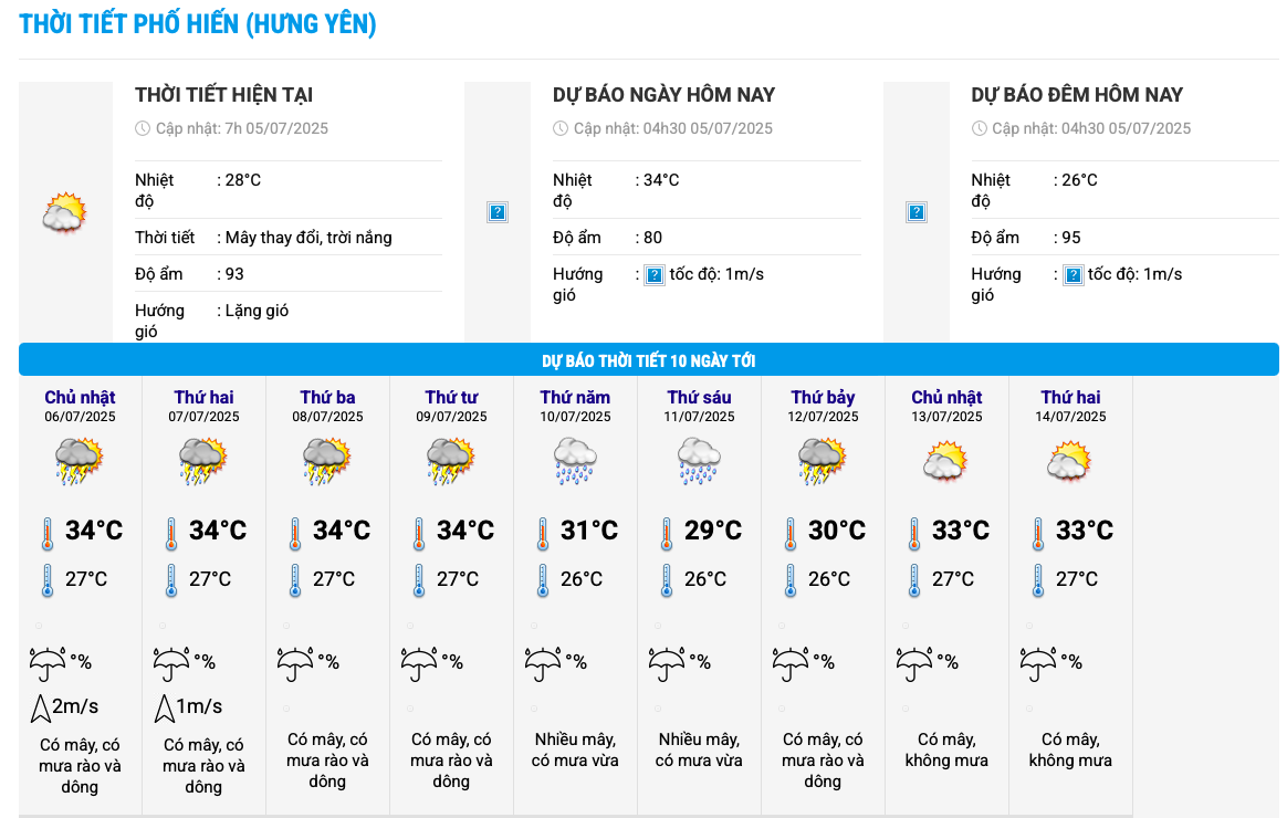 |
10-day weather forecasts now provide commune-level detail. Photo: NCHMF |
10-day weather forecasts now provide commune-level detail. Photo: NCHMF
Mai Van Khiem, Director of the NCHMF, stated that previously, forecasts only covered 63 points corresponding to the 63 former provinces and cities. Now, the center provides 10-day forecasts for 3,321 communes and wards, updated around the clock. This information is available on the NCHMF website.
Khiem also shared that the NCHMF is developing a weather application for phones and computers. "We expect to complete it in August. Besides weather information, the app will also include natural disaster warnings for flash floods, landslides, storms, tropical depressions, heavy rain, thunderstorms, tornadoes, and lightning," he said.
For storms and tropical depressions, the NCHMF will provide detailed forecasts down to the provincial and city level. For merged provinces with diverse topography, geography, and climate characteristics, forecasts will be specific to areas with similar climates. Former island districts and communes will be designated as special zones. Coastal areas will also be renamed according to the new provincial names.
For heavy rain, cold air, and heatwave forecasts, the NCHMF will provide regional forecasts. In cases of varying impacts from natural disasters, forecasts will be detailed for specific province clusters. Within a province, if there are differences, the forecast will be detailed by location. For example, the eastern part of province A, the plains of province B, or the coastal area of province C.
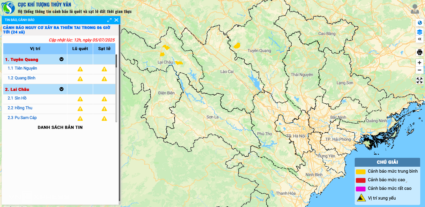 |
Landslide and flash flood warning map based on new communes and wards. Photo: Hydro-Meteorological Department |
Landslide and flash flood warning map based on new communes and wards. Photo: Hydro-Meteorological Department
Flood forecasts and warnings will be detailed for points along river basins nationwide; flooding will be detailed by region and area within the river basins. Thunderstorm, tornado, and lightning warnings; flash flood and landslide warnings will be issued for specific areas within provinces and cities.
The NCHMF plans to update all provincial and commune-level maps within the software system. Bulletins will describe details down to the commune level or list provincial-level areas by location.
Regional and provincial Hydro-Meteorological Stations will also increase the frequency of their forecast bulletins to twice daily, providing 10-day forecasts to align with the national center's bulletins. Forecasting and warning will be conducted under a unified principle, avoiding overlap between levels; lower-level bulletins will provide more detail than higher-level ones.
Seasonal hydro-meteorological forecast bulletins will no longer be a single bulletin but will be separated into three: seasonal climate, seasonal hydrology, and seasonal oceanography, to align with the practices of forecasting units.
Gia Chinh