The flash flood on the morning of 17/7 swept soil, rocks, and trees across approximately 800 m along National Highway 32 through Muong Than commune, Lai Chau province. This disaster resulted in six deaths, two people missing, dozens of homes flattened, and 300 ha of rice, crops, and aquaculture buried.
Professor Do Minh Duc, from the University of Natural Sciences, Vietnam National University, Hanoi, stated that the natural disaster in Muong Than could be considered a complex event. Heavy rainfall simultaneously triggered landslides, flash floods, and mud-rock flows.
Over the past month, the National Center for Hydro-Meteorological Forecasting recorded five periods of rain in the Northern region: 15-22/6, 26/6-6/7, 8-12/7, 16-17/7, and 19-20/7. The total rainfall across most of the country was 20-40% lower than the multi-year average. However, in the northern mountainous areas, rainfall was 15-40% higher.
Specifically, the rain from 19h on 15/7 to 7h on 19/7 in the northern mountains reached a total of 150-300 mm. In Lai Chau, the rainfall on 16-17/7 alone was 120-150 mm, with the highest recorded at Tua Sin Chai station reaching 380 mm.
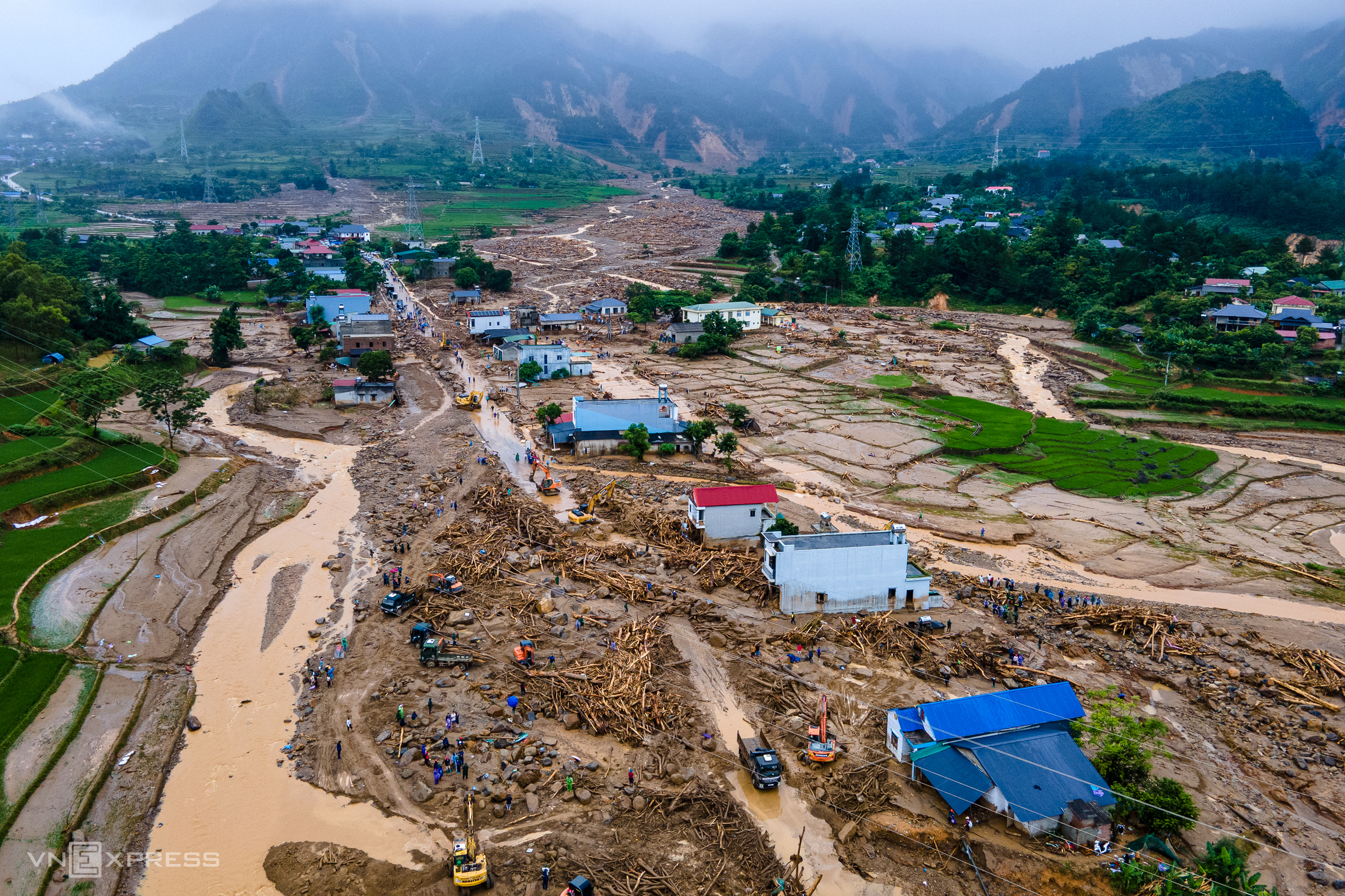 |
Flash floods from mountain ranges swept down into residential areas in Muong Than commune. Photo: The Bang
According to Professor Duc, the rainfall on 17/7 occurred after the area had been continuously affected by heavy rain periods. From late 6 to mid-7, numerous small and medium-scale landslides appeared. These events caused the soil and rocks on steep slopes to become saturated, increasing their weight and raising the risk of instability.
In Muong Than, rainfall exceeded 120 mm in approximately three hours before the flash flood occurred, and reached about 150 mm after four hours. This significant volume of water, rushing down steep terrain in a short time, carried away soil, rocks, trees, and other materials accumulated in the stream channels.
"Materials already present in the stream channels were swept away by the water, creating flash floods and mud-rock floods with immense destructive power," he said.
**Steep terrain and geology prone to landslides**
Muong Than valley lies at an elevation of approximately 500 m above sea level, on the edge of the Hoang Lien Son mountain range, forming a natural boundary between Lai Chau and Lao Cai. The area features highly dissected terrain, with streams flowing from elevations of approximately 1,500-2,500 m down to lower regions.
The Nam Sang stream, for example, originates from an elevation of about 1,600 m, has a basin area of approximately 6 km2, a length of about 5 km, and an average slope of 11-12 degrees.
Professor Duc explained that the steep slope allows water to accelerate rapidly as it descends from the mountains into the valley. However, the stream does not maintain a continuous slope; it includes wider, relatively gentle sections. These areas facilitate the accumulation of soil, rocks, and trees after landslides, or temporarily collect water.
The stream also features short, winding sections. These may indicate that the flow has been altered or partially blocked multiple times by large-scale landslides. During heavy rain, water rushes into the stream at high speeds. If a landslide or accumulated debris creates a blockage upstream, water can temporarily build up. When this blockage breaks, a large volume of water, along with soil and trees, surges downstream simultaneously, forming a flash flood or mud-rock flood.
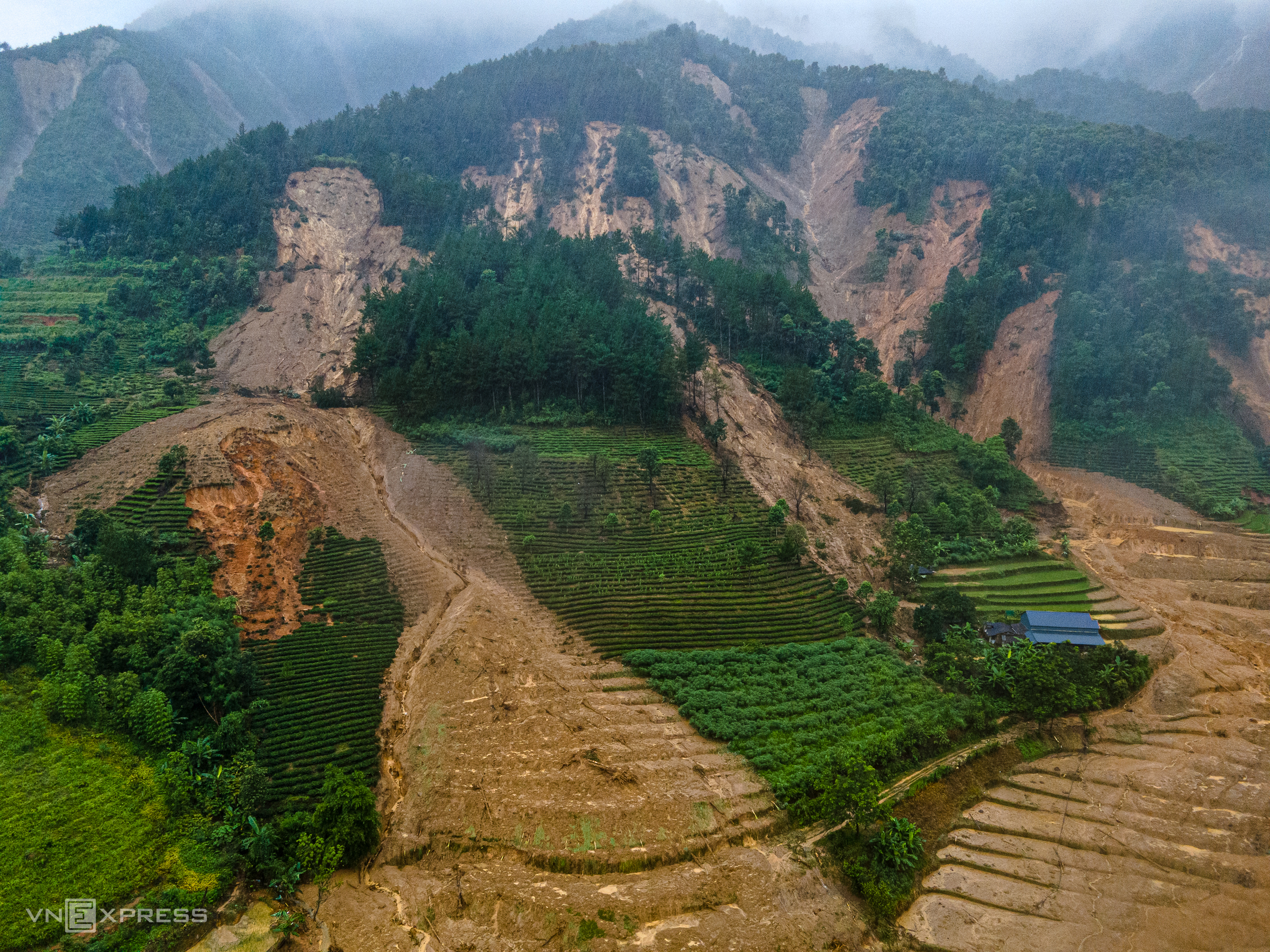 |
Landslide scars on the mountain ranges in Muong Than commune. Photo: The Bang
The geological foundation of the area also increases the risk. According to Professor Duc, the landslide and flash flood site features magmatic rock formations and several major fault systems. The bedrock is heavily fractured and fragmented, while the weathered soil layer is thick. Under these conditions, soil and rocks easily absorb water, reducing their stability and making them prone to sliding during heavy rainfall.
"The terrain, geology, and rainfall combine to create a complex disaster. This explains the particularly destructive power of the recent flood," Professor Duc observed.
**Many areas face similar risks**
Professor Duc warns that the risk of landslides and flash floods due to heavy rainfall persists in areas with highly dissected terrain, steep slopes, weathered geology, and prolonged periods of rain.
In Lai Chau, areas requiring particular attention include Bum To, Hua Bum, Thu Lum, Muong Te, Pa U, Pu Sam Cap, Sin Ho, and Tua Sin Chai. In Lao Cai, these areas are Che Tao, Lao Chai, Mu Cang Chai, and Pung Luong. In Dien Bien, they are Na Tau, Muong Phang, and Pu Nhi. Large-scale slides or mud-rock flows, caused by upstream blockages, can occur even after the rain has completely stopped.
Professor Duc advises residents not to rush back home immediately after the rain stops or water begins to recede. Local authorities should inspect tributary streams, promptly identify blockages caused by soil, rocks, and fallen trees, and evacuate residents from low-lying areas and downstream regions to safety.
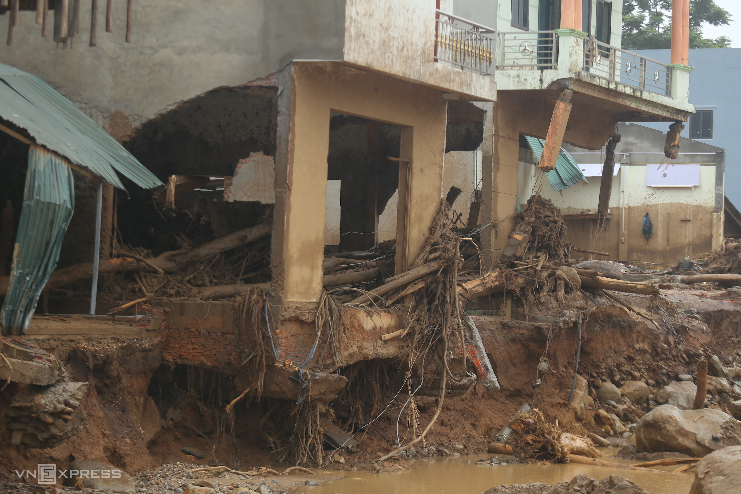 |
Flash floods destroyed solid structures in Muong Than commune. Photo: Gia Chinh
Another dangerous sign is the appearance of long cracks on slopes. While some cracks may not immediately lead to landslides, once formed, the slope cannot "heal" itself, and the risk of sliding always remains. Residents should be especially vigilant if water suddenly seeps or gushes from slopes or earthen banks, or if they hear the cracking of branches, the dull impact of boulders, or unusual explosive sounds.
Stream water can also serve as a warning sign. If the stream water, normally clear or slightly turbid, suddenly turns murky with mud, residents must immediately evacuate the stream banks. "Natural disasters often occur very unexpectedly, especially at night, from midnight to dawn," Professor Duc warned.
During heavy rainfall, stream channels with nearby residential areas should be checked frequently, approximately every 15-30 minutes. If water levels rise rapidly, residents must immediately move to higher ground.
If heavy rain continues but water levels do not increase, or even decrease, this could also indicate an upstream blockage. When the blockage breaks, a large volume of water and debris could suddenly surge downstream. Professor Duc recommends that residents move to terrain at least 10-12 m higher than the stream flow and only return when authorities confirm the area is safe.
Gia Chinh