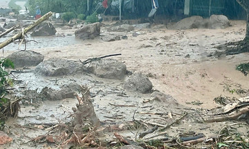
Dang Dinh Luc, chairman of the Nhan Hoa Commune People's Committee (CPC), reported that while the rain stopped at 5 a.m. on 23/7, water levels from streams and hillsides began to rise due to upstream hydropower dam releases. By the afternoon, the water level rose rapidly, submerging numerous houses. The water peaked that evening, reaching depths of over two meters in some areas.
"Of the commune's 22,000 households, approximately 7,000 had to evacuate to safety during the night. Hundreds of houses are currently submerged up to their roofs," Luc said.
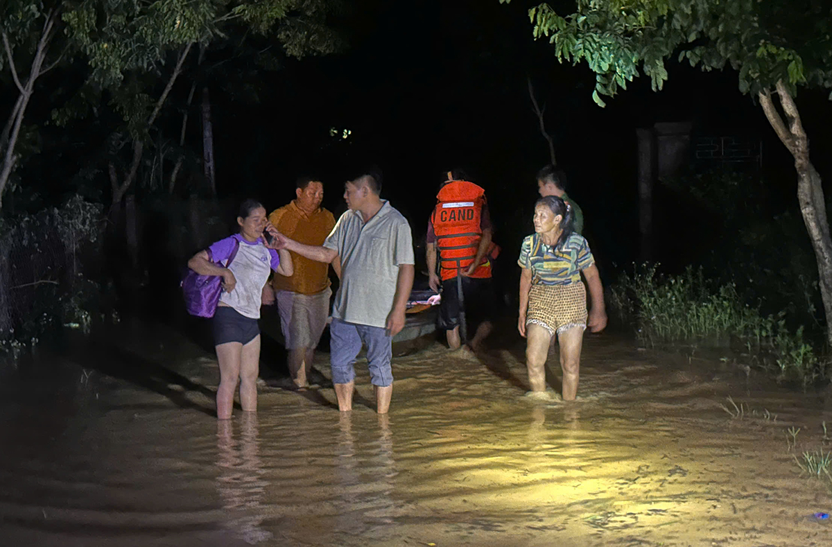 |
Residents of Nhan Hoa commune in the former Anh Son district evacuate to escape the flood on the night of 23/7. Photo: Hung Le |
Residents of Nhan Hoa commune in the former Anh Son district evacuate to escape the flood on the night of 23/7. Photo: Hung Le
Local authorities deployed officials who worked through the night, using motorboats to reach severely flooded areas and bring residents to safety. By dawn on 24/7, an additional 30 households in Dinh Hop village were urgently evacuated due to floodwaters cutting them off.
"These households are located in higher areas and initially didn't think they needed to leave their homes. They only called for help when the water started pouring in. Despite the late hour and strong currents, we were determined to evacuate all residents from the danger zone," Luc explained.
Currently, 26 villages in Nhan Hoa commune are flooded, with some areas completely isolated and inaccessible to rescue forces. Authorities are setting up temporary shelters, distributing emergency food supplies, and closely monitoring the flood situation.
Several highways paralyzed
On the morning of 24/7, National Highway 7 passing through Anh Son, Tuong Duong, and Con Cuong communes (centers of the former districts of the same names) was flooded from 0.5 to over one meter due to heavy rain and upstream water flow over the past two days. Several checkpoints have been established on the road to prohibit vehicles from passing through.
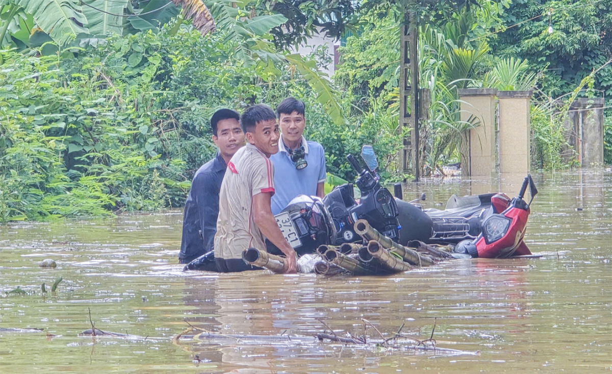 |
Residents living along National Highway 7 move their belongings to higher ground on 23/7. Photo: Hung Le |
Residents living along National Highway 7 move their belongings to higher ground on 23/7. Photo: Hung Le
National Highway 7 spans 227 km, starting from the former Dien Chau district (intersecting with National Highway 1) and ending at the Nam Can international border gate in the former Ky Son district, bordering Laos. It is a vital artery of the North Central Coast region, playing a strategic role in the socio-economic development of the western region of Nghe An.
The route passes through seven former districts: Dien Chau, Yen Thanh, Do Luong, Anh Son, Con Cuong, Tuong Duong, and Ky Son. Despite its complex terrain with numerous passes, rivers, and streams, National Highway 7 remains the sole link between the Nghe An plains and the border districts and Laos through the Nam Can - Namkan border crossing.
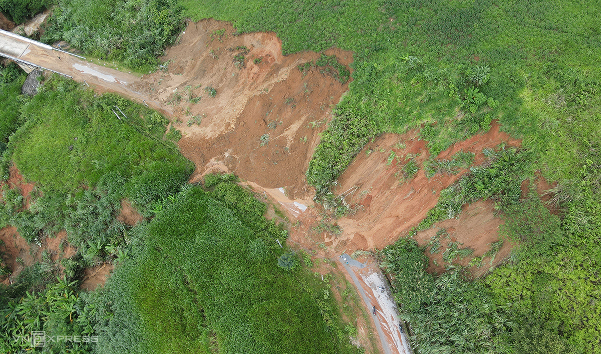 |
A section of a mountain collapsed onto National Highway 16, near Tri Le commune in the former Que Phong district, paralyzing traffic from this location to communes in the former Tuong Duong and Ky Son districts on 24/7. Photo: Duc Hung |
A section of a mountain collapsed onto National Highway 16, near Tri Le commune in the former Que Phong district, paralyzing traffic from this location to communes in the former Tuong Duong and Ky Son districts on 24/7. Photo: Duc Hung
National Highway 16, connecting the four provinces of Son La, Hoa Binh, Thanh Hoa, and Nghe An, and serving as the only route from the center of the former Tuong Duong district to remote communes and neighboring districts such as Ky Son and Que Phong, is also paralyzed due to dozens of major landslides.
Several sections from Tri Le commune (former Que Phong district) to Nhon Mai commune (former Tuong Duong district) and Bac Ly commune (former Ky Son district) are blocked by landslides, with mud and debris reaching 0.5 m high. Surrounding mountains continue to erode, with trees being swept away into streams.
Due to the influence of Typhoon Wipha, from the night of 21/7 to the end of 22/7, heavy rain poured down on Nghe An, generally ranging from 100-200 mm, with Quy Chau reaching 259 mm. Upstream flooding caused widespread inundation, flash floods, and landslides in many mountainous districts such as Ky Son, Con Cuong, Quy Chau, and Que Phong.
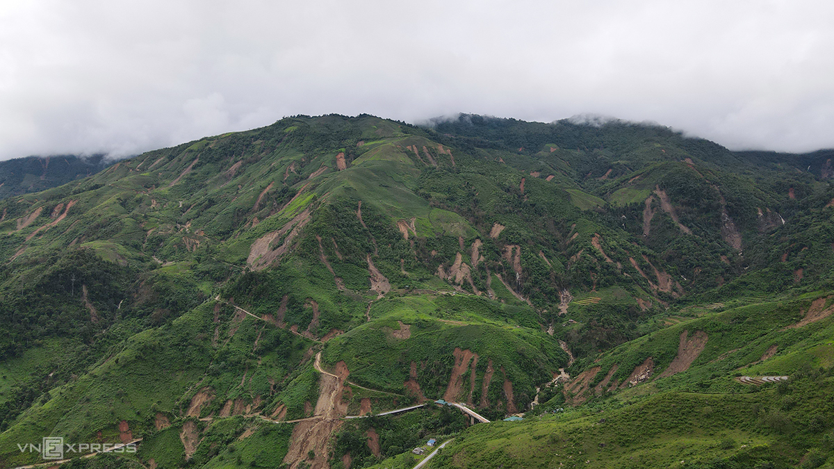 |
Multiple landslides occurred on the mountain passing through the former Que Phong district on 23/7. Photo: Duc Hung |
Multiple landslides occurred on the mountain passing through the former Que Phong district on 23/7. Photo: Duc Hung
The flood peak at the Ban Ve hydropower reservoir reached 12,800 m3/s, far exceeding the design capacity. As of 5:30 p.m. on 23/7, the floods had resulted in three fatalities, one person missing, and four injured. Over 3,700 houses were deeply flooded, hundreds of roofs were blown off, and many villages were isolated.
As of the morning of 24/7, the rain has subsided in the mountainous areas of Nghe An, but hydropower plants have continued to release water since last night. The continued influx of water from upstream is causing widespread flooding in Tuong Duong, Con Cuong, and Anh Son communes, severing National Highway 7 and paralyzing traffic.
Duc Hung