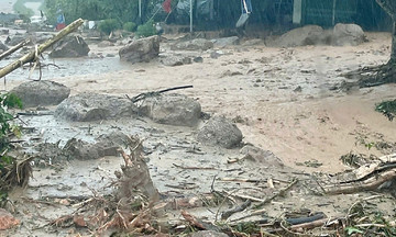
On 22/7, heavy rain and upstream flooding isolated seven villages along the Nam Mo River in My Ly commune, former Ky Son district. Floodwaters reached over half a meter deep, submerging 20 stilt houses in low-lying areas to roof level – a depth of more than two meters. The My Ly Border Post was also flooded to a depth exceeding one meter, forcing officers to move their belongings to higher ground.
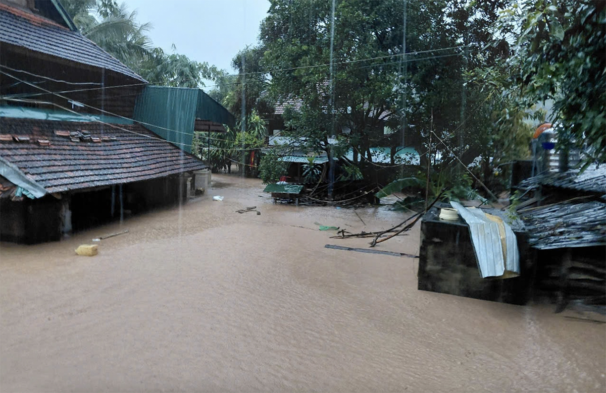 |
Houses in My Ly commune submerged in floodwaters on the evening of 22/7. Photo: Hung Le |
Luong Van Bay, chairman of My Ly commune, reported landslides blocking roads and preventing access to villages like Xop Tu and Hoa Ly. No casualties have been reported so far. With heavy rain continuing into the evening, authorities are helping residents relocate to higher ground, often staying with relatives, for safety.
After 9 PM, National Highway 7 through Muong Xen commune, the former district center of Ky Son, was flooded to a depth of more than one meter, making it impassable for vehicles. Floodwaters entered houses along the highway, reaching over half a meter deep and sweeping away machinery, belongings, documents, and computers.
"Besides heavy rain, we are concerned about flash floods and landslides as the water from upstream continues to rise," a commune leader said. "If the rain continues into tomorrow, the situation will become very complex. Many families will be up all night dealing with the flood."
Lo Thi Hong, a resident of Muong Xen commune, said the water began rising around 10 PM, reaching about 10 cm higher than earlier in the evening. Her family evacuated valuables like their television and refrigerator to a relative's house on higher ground.
In Muong Quang commune, former Que Phong district, heavy rainfall and hydropower dam releases caused the Quang River to swell, overturning a nearly six-meter-long suspension bridge connecting Hien and Quanh villages, isolating 105 households.
Sam Ba Tuan, chairman of Muong Quang commune, reported continuous heavy rain since the evening of 21/7. The river rose by more than three meters, flooding six main roads to a depth of nearly half a meter and causing localized isolation. "Authorities have evacuated 9 households in flood-prone areas to safety," Tuan said. "Evacuating dozens more households in dangerous areas is difficult due to the heavy rain." He added that teams are on standby, ready to respond to any incidents.
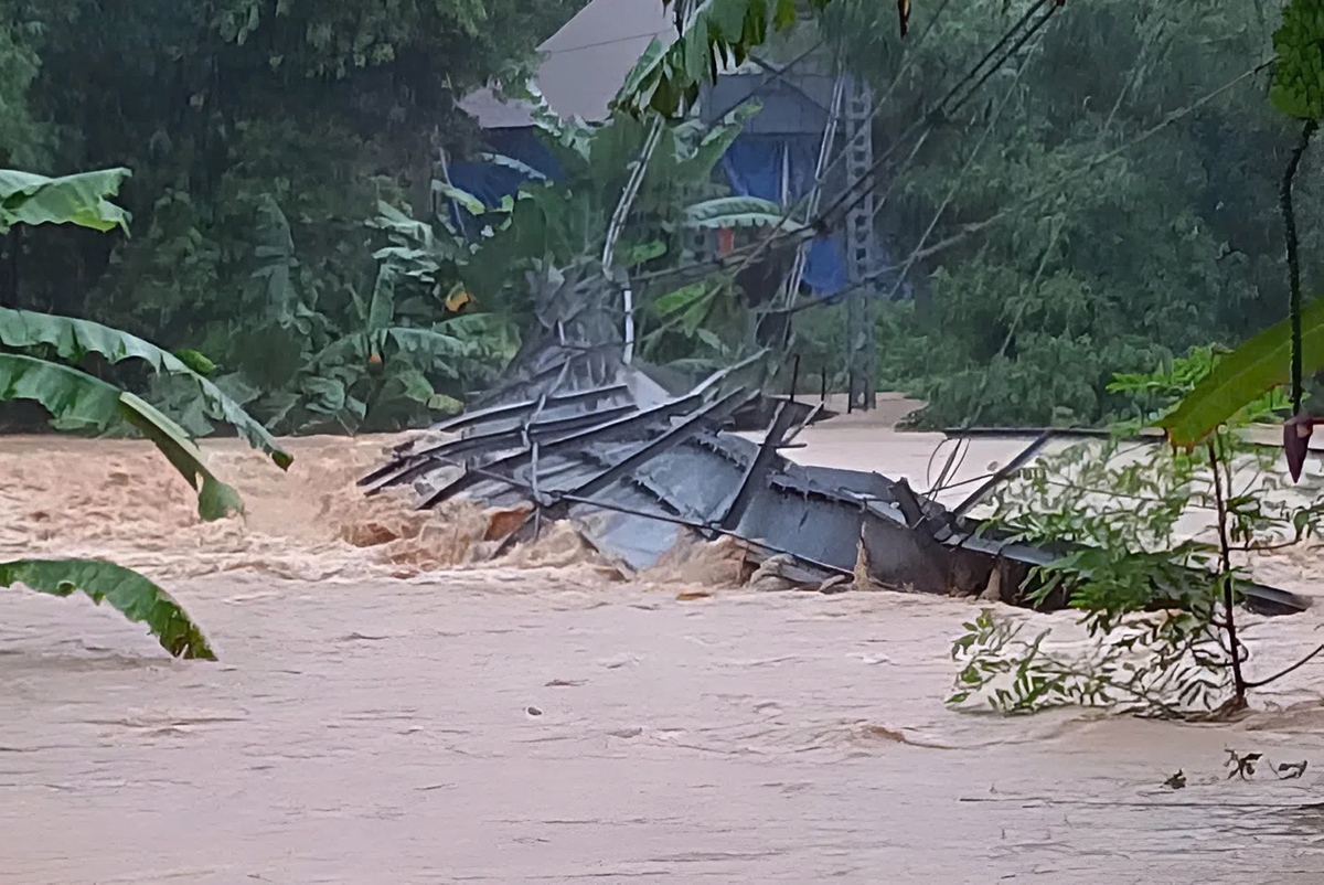 |
A suspension bridge over the Quang River in Muong Quang commune, former Que Phong district, overturned due to rising floodwaters on the afternoon of 22/7. Photo: Hung Le |
At noon, Nhon Mai commune, former Tuong Duong district, experienced a three-hour flash flood that swept away several bridges over streams in Nhon Mai village. The commune police headquarters was flooded to a depth of over half a meter. National Highway 16 through the area was cut off at 4 or 5 points, isolating at least 4 villages. Landslides occurred in neighboring communes, causing cracks in the national highway and cutting off village and commune roads.
Nghe An Provincial Steering Committee for Natural Disaster Prevention and Control reported one person missing in Nam Can commune due to the flood, 161 damaged houses, two commune headquarters flooded, and 45 landslides on national and provincial roads due to Typhoon Wipha.
Nghe An authorities evacuated 591 households in Nhon Mai, Huu Kiem, Tam Thai, Tam Hop, Muong Quang, Huoi Tu, Que Phong, Nga My, Tien Phong, and Muong Xen communes to safety as a precaution against flash floods, landslides, and localized flooding.
At 7:25 PM on 22/7, nine hours after making landfall in the Hung Yen - Thanh Hoa area, Typhoon Wipha weakened into a tropical depression, continuing to bring heavy rain to Thanh Hoa and Nghe An. The National Center for Hydro-Meteorological Forecasting reported that the tropical depression had sustained winds of level 7, gusting to level 9 in the Ninh Binh - Thanh Hoa area.
From tomorrow, heavy rain will concentrate in the southern part of the northern delta, Thanh Hoa, and Nghe An, with widespread rainfall of 100-200 mm and over 300 mm in some areas. The remaining areas of northern Vietnam and Ha Tinh will experience rainfall from 20-50 mm, exceeding 100 mm in some places. The meteorological center warned of the risk of heavy rain exceeding 150 mm in three hours, potentially leading to flooding, flash floods, and landslides in many areas.
Duc Hung