The Lung Cung peak in Nam Co commune experienced an unprecedented surge in visitor numbers in early November, particularly peaking on the weekend of 14-16/11. This influx led to severe congestion on the trekking trails and overwhelmed rest stop facilities, significantly disrupting the experience for hundreds of trekkers.
The overcrowding severely disrupted the journey to Lung Cung. Normally, the trek from the gathering point to the rest stop and summit takes about 7 hours. However, due to the congestion, many groups reported taking 11-14 hours to complete the route. Giang A Chinh, Head of the Culture and Information Department of Nam Co commune, noted the sharp increase in visitors from the beginning of the month.
"Many trekkers had to squeeze into narrow spaces or sit by fires until morning because there was no room to lie down," Chinh said. The shared drinking water and food resources at the rest stops also created many difficulties for visitors.
 |
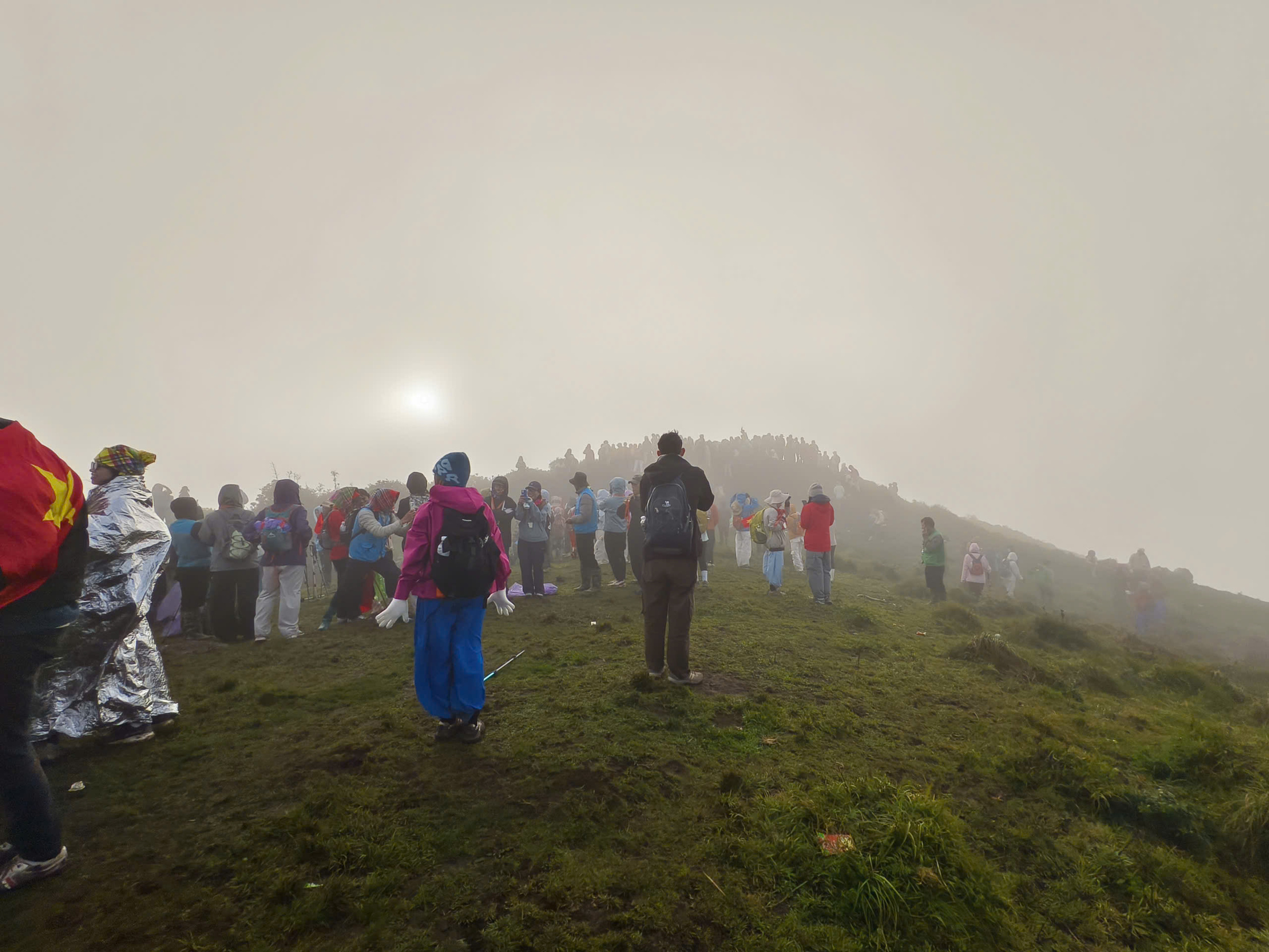
Trekkers check in at Lung Cung peak on the morning of 16/11. *Photo: Nguyen Trong Cung* |
Local guides attributed the congestion to dry, favorable weather and many people "making up" for last year's maple leaf season, which was missed due to storms and floods. Quoc Khanh, a guide, stated that weekend visitor numbers increased by 200% compared to weekdays and were much higher than the same period last year. Many tour operators are fully booked until the end of December.
Nguyen Trong Cung, a photographer who has climbed Lung Cung many times, described the scene as unprecedented. "Many sections were completely jammed, requiring long waits which strained muscles and made the climb much more tiring," Cung said.
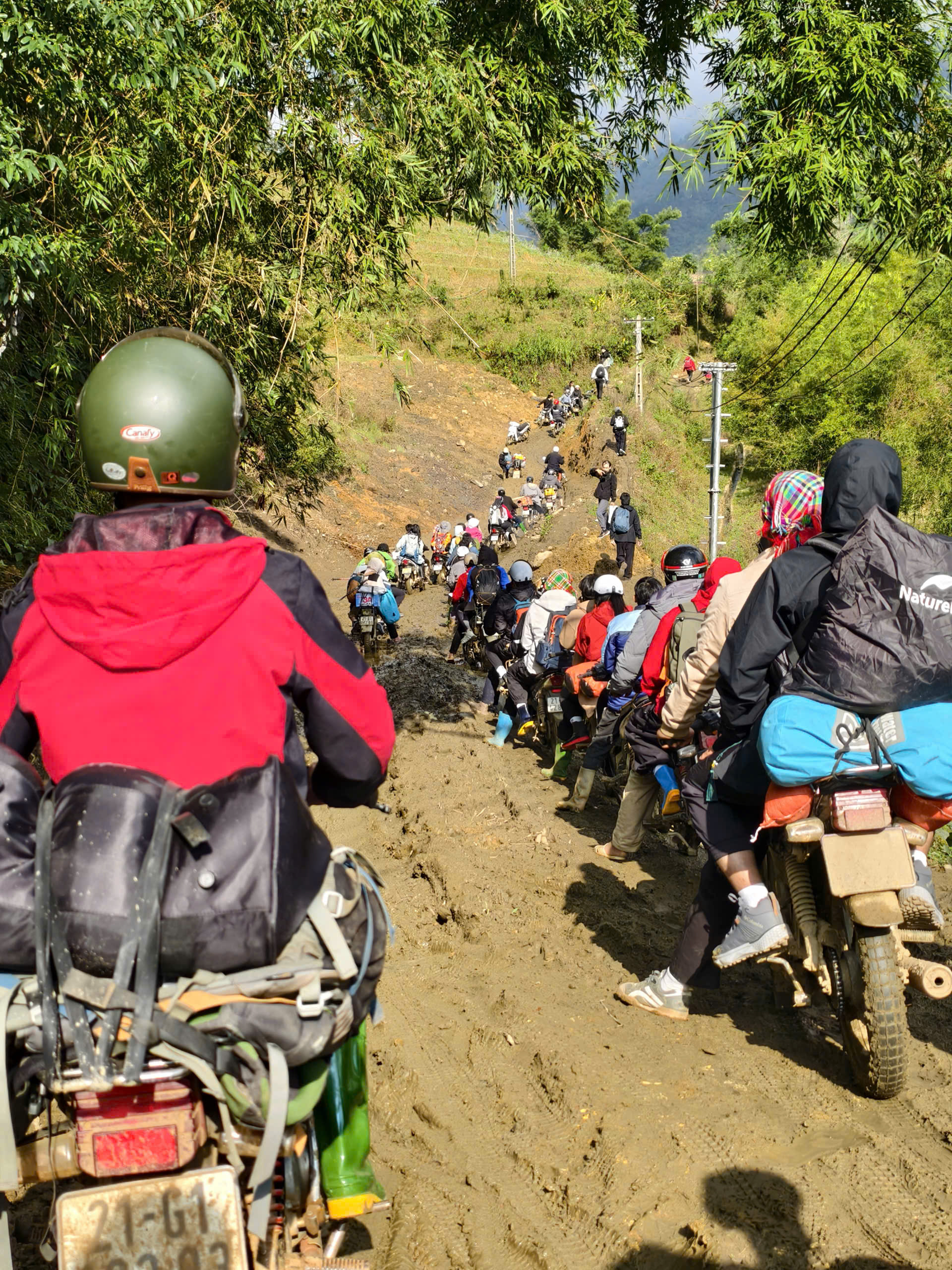
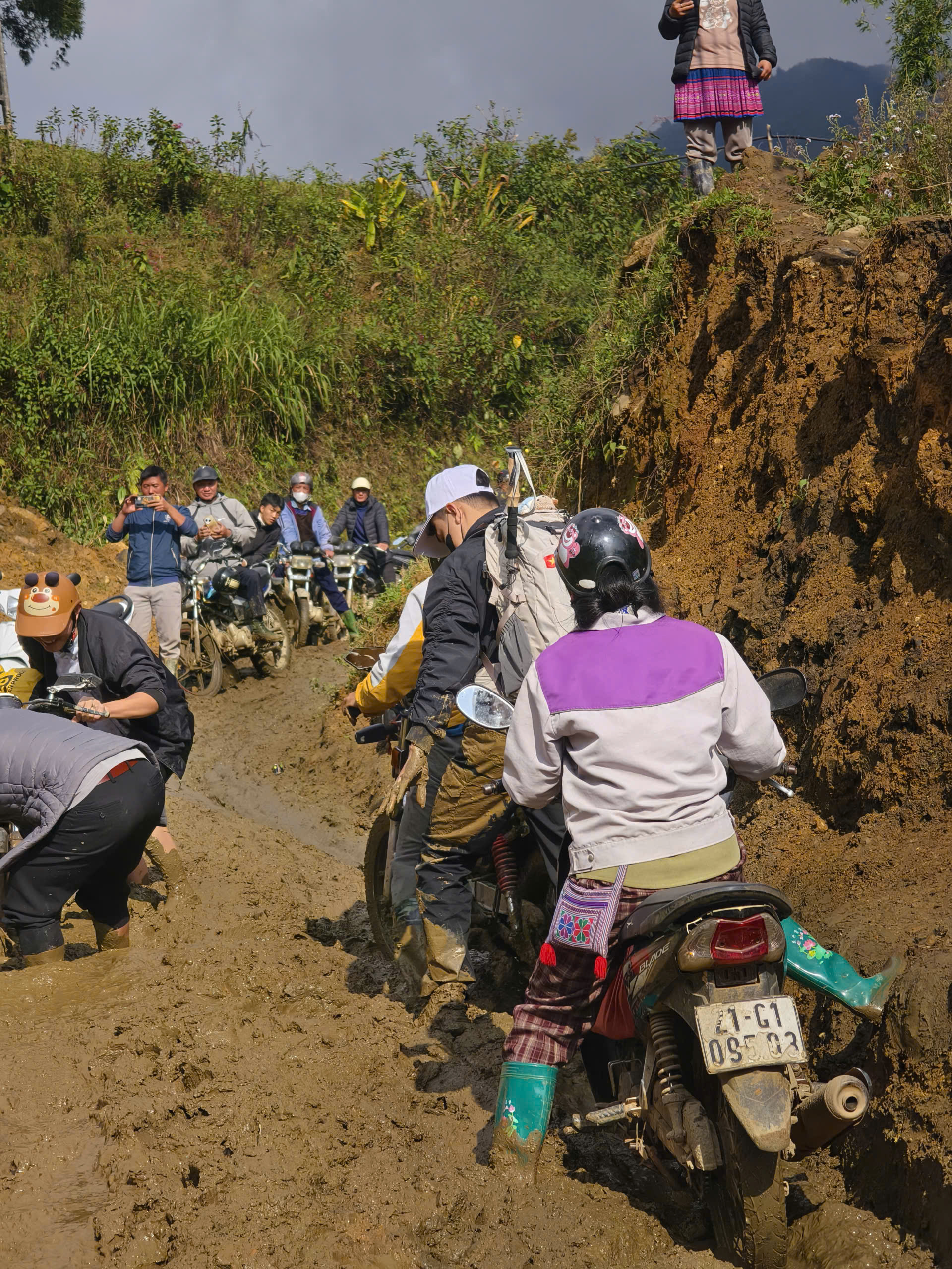
The descent proved equally challenging. On the afternoon of 16/11, the more than 1 km path from the rest stop to Tu San village took nearly two hours due to the continuous line of people. Previous rain had made the path slippery and muddy, further impeding progress.
Tran Quoc Thinh, a visitor from Da Nang, reported that early fog limited visibility. "We only descended the mountain by 18h, forcing us to stay in Nam Co for an extra night to wait for the next day's bus," Thinh said.
Local authorities and the Forest Management Board currently face limitations in expanding rest stops due to existing regulations on forest management and protection, according to Giang A Chinh. This presents a significant challenge in balancing the growth of tourism with environmental preservation.
While the increased visitor numbers provide additional income for local residents through porter services, food, and transportation, this situation also creates environmental pressure. Waste appeared at some rest points, and the cutting of forest trees for firewood continued. Local officials stated they are continuously reminding visitors and tour operators to collect and bring down trash from the mountain to preserve the landscape.
 |
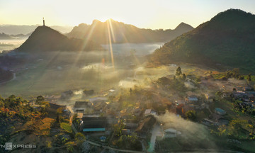
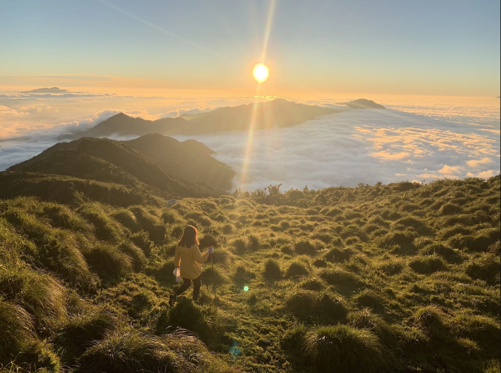
Sunset on Lung Cung peak. *Photo: Duc Hung* |
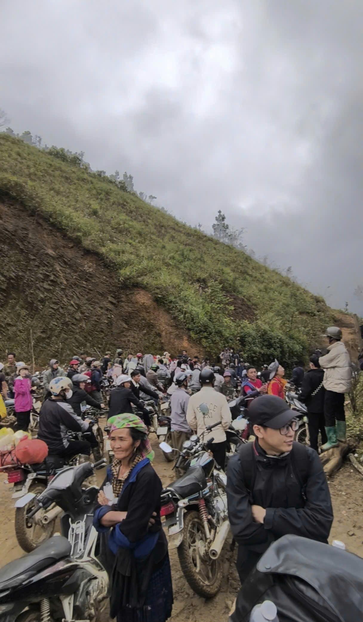
Motorbikes line up to descend the mountain. *Photo: Nguyen Trong Cung*
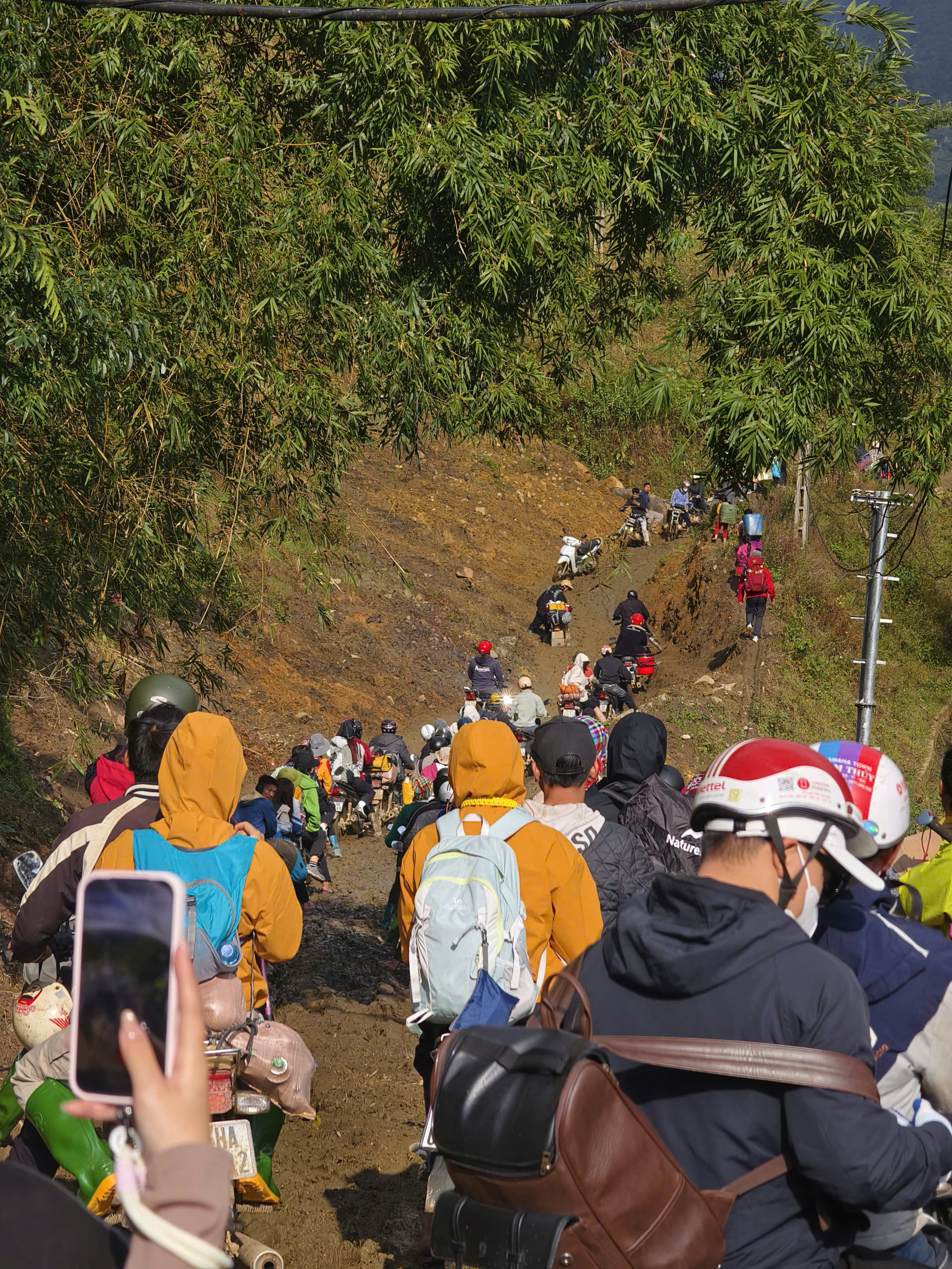 |
A section of the road in Tu San village on 16/11. *Photo: Nguyen Trong Cung*
 |
A section of the road in Tu San village on 16/11. *Photo: Nguyen Trong Cung*
 |
Trekkers wading through mud to descend the mountain. *Photo: Nguyen Trong Cung*
Lung Cung peak, standing at 2,913 m high, is located in Nam Co commune and is among the top 15 highest mountains in Vietnam. The trekking route, approximately 20 km long, features terrain that is not overly difficult, making it an ideal spot to view sunrise, sunset, and a sea of clouds with 360-degree views.
Visitors can start from three different directions to reach the peak: Lung Cung village, Tu San village, and Thao Chua Chai village. Trekkers often choose Tu San village and return via Ta Cua Y valley and Thao Chua Chai village to pass waterfalls and enjoy the most beautiful mountain forest scenery of the climbing route.
 |
Tuan Anh