Southern California entered its third consecutive day of unprecedented high temperatures for March, as an unusually intense heatwave gripped the region.
On 17/3, Los Angeles and Ventura counties established over 10 temperature records, according to the National Weather Service (NWS). Woodland Hills saw temperatures exceed 38 degrees Celsius, while Burbank and Long Beach surpassed 37 degrees Celsius. Downtown Los Angeles recorded a temperature of 36,7 degrees Celsius.
Other areas, including Orange County, San Diego, and the Inland Empire, also reported record-breaking temperatures for March. Anaheim reached 37,8 degrees Celsius, significantly exceeding its previous March record of 32,2 degrees Celsius set in 3/2010. Palm Springs' temperature surged to approximately 39,4 degrees Celsius.
"We are breaking too many records; this is clearly one of the hottest Marches in history," stated Bryan Lewis, a meteorologist with the NWS. He added that "this heat feels more like summer heat," despite California still being in winter.
Astronomical spring in California is scheduled to officially begin at 7:46 AM on 20/3, indicating that the state's winter season has not yet concluded.
 |
Hot air rises from the Great Highway in San Francisco, California, on 17/3. Photo: AP
Temperatures in California initially rose sharply from 12/3, briefly subsided over the weekend, and then intensified again from 16/3. Some areas could reach 45,6 degrees Celsius this week.
Observers attribute this year's extreme mid-winter heatwave in the western US to a rare convergence of atmospheric factors.
One contributing factor originated thousands of kilometers away. Last week, Hawaii experienced prolonged heavy rainfall and its most severe flash floods in decades, influenced by the Kona storm.
The storm propelled a mass of hot, humid air into the upper atmosphere, bolstering a high-pressure system that formed in its wake. This created a "heat conveyor belt." Meteorologist Bob Henson noted, "The North Pacific has long had heat conveyor belts stimulating upper-level high pressure in the western US."
Concurrently, the Northern Hemisphere's jet stream exhibited unusually strong oscillations, generating large atmospheric wave bands moving north-south from the Pacific to North America. This system became prone to stalling, allowing the high-pressure mass to strengthen over several days and shift slowly. The result was the formation of an intense, nearly stationary "heat dome" over California.
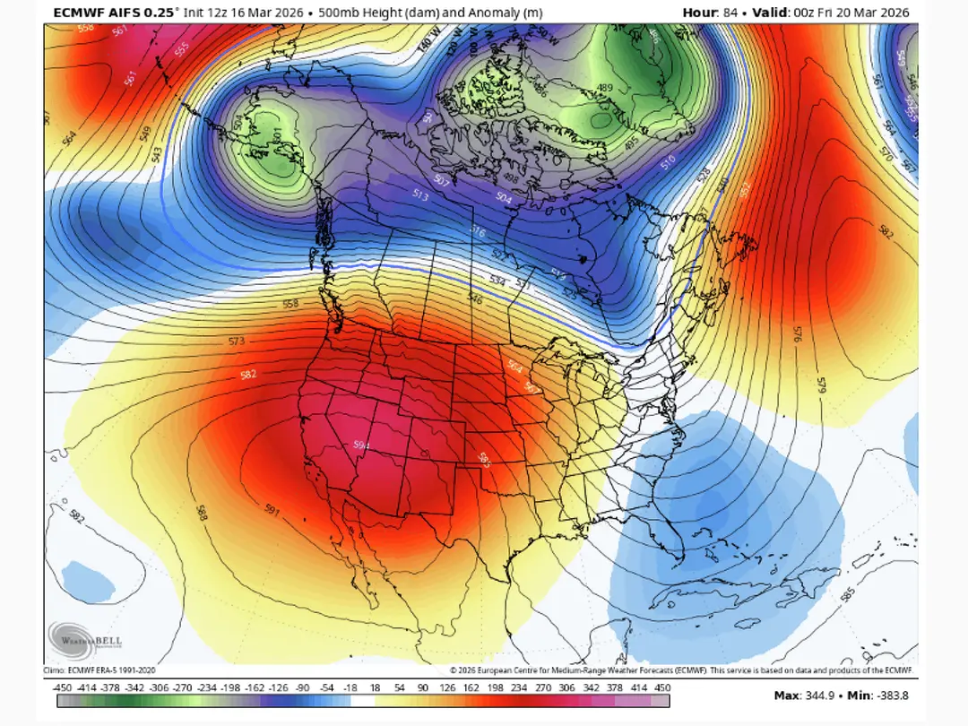 |
A heat dome affects California during the record mid-winter heat. Graphic: ECMWF
Ground-level factors further intensified the heat dome. In much of southwest California and the Rocky Mountains, drought conditions from previous summers left the ground dry. This meant almost all solar radiation converted into heat rather than contributing to water evaporation.
Experts believe these factors are linked to global warming. Los Angeles County officials have advised residents without air conditioning to seek relief at swimming pools, water parks, and nearby cooling centers.
"This is an almost unprecedented heatwave due to its unusual duration," said meteorologist Steward. "High temperatures are likely to persist, possibly into early next week."
Palm Springs could see temperatures climb to approximately 43,3 degrees Celsius today or tomorrow, a level typically observed only in June.
"The weather shouldn't be like this; it feels like mid-summer when it's still winter," commented Greg Porter, senior weather commentator for the SF Chronicle. "More research shows weather will no longer follow old rules."
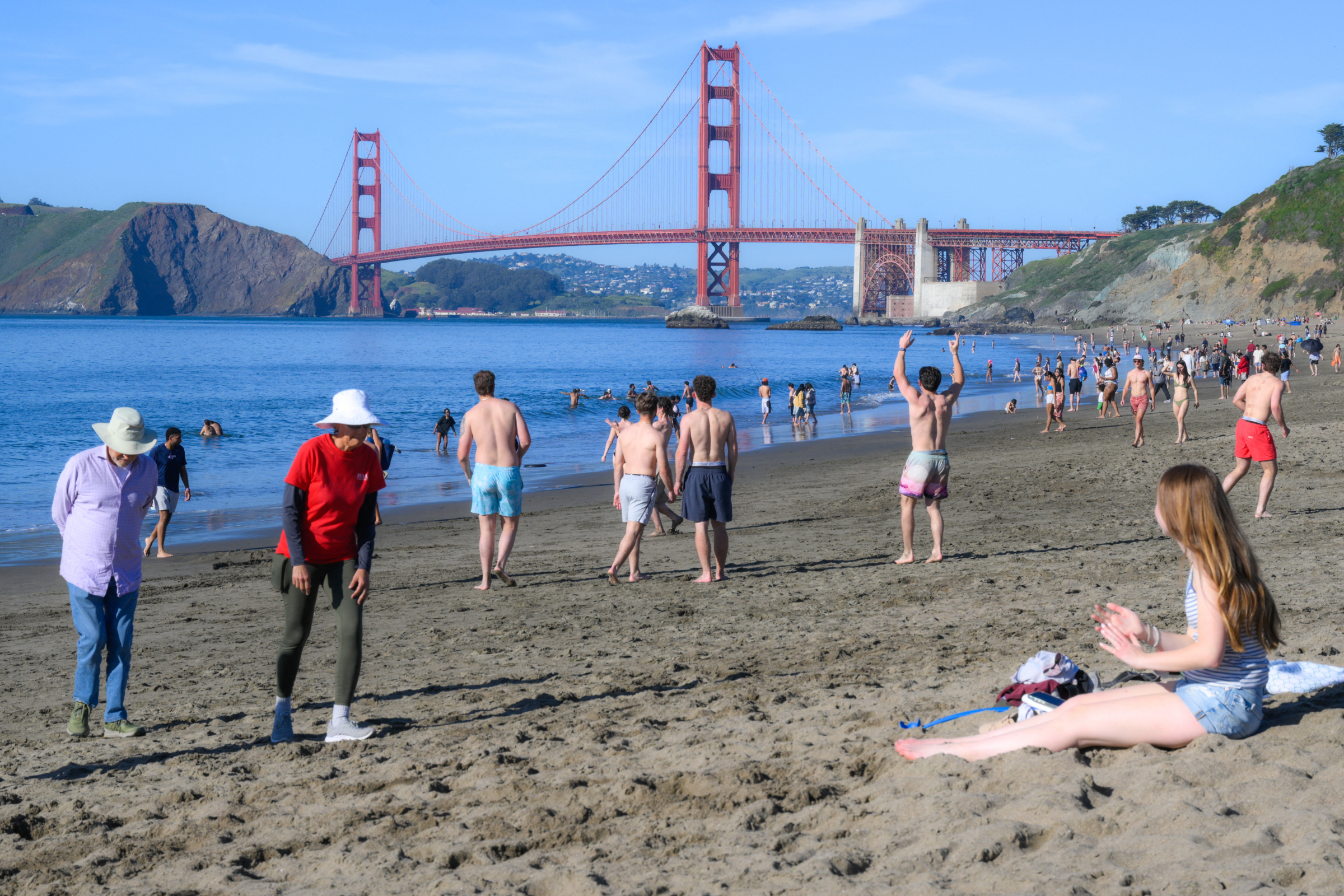 |
Californians seek relief at the beach in mid-winter, on 17/3. Photo: AFP