Hai Phong City is set to begin construction on a significant new connecting road in 2026, a strategic project aimed at linking the western urban area of former Hai Duong province with the eastern urban area of former Hai Phong City. Do Huu Hung, Director of the Hai Phong City Department of Construction, stated that the project will be implemented under a public-private partnership (PPP) model. This initiative is one of 16 key projects scheduled to commence in the city during 2026, highlighting its importance for regional development and infrastructure improvement.
The proposed route, spanning 23.5 km, will connect Ring Road one of former Hai Duong City with National Highway 10. Its path will traverse several key areas, including Nam Dong, Ai Quoc, An Duong, and An Phong wards, as well as Ha Tay, Thanh Ha, Ha Bac, Ha Nam, and Kim Thanh communes. The road's design features a 68 m width, incorporating six lanes designated for trucks, buses, and cars, allowing a minimum speed of 80 km/h. Additionally, parallel roads on both sides will accommodate motorbikes and cars, with a maximum speed of 60 km/h. A 15 m wide median strip is reserved for the future development of modern public transport. To support further growth along the corridor, a 21 m right-of-way on each side will facilitate the construction of service roads.
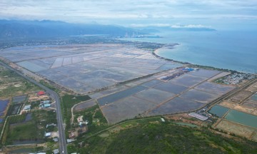
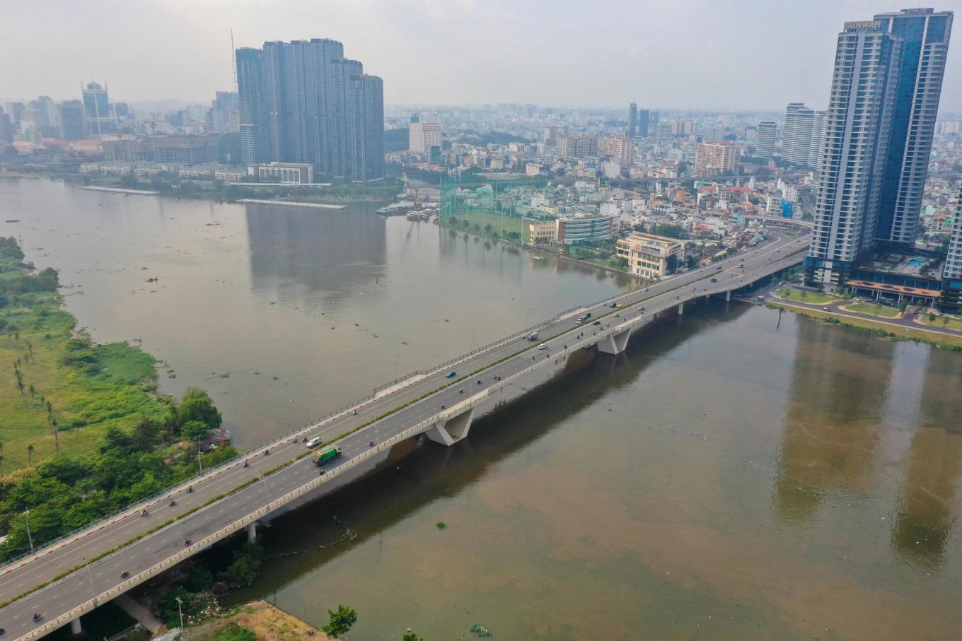
The construction of this East-West connecting road is crucial for addressing existing transportation challenges and fostering economic growth in both regions. Currently, former Hai Phong City and former Hai Duong province rely on several routes for connectivity, including National Highway 5, the Hanoi-Hai Phong Expressway, National Highway 17B, National Highway 37, and the Hanoi-Hai Phong railway line. National Highway 5 is severely overloaded with heavy truck and container traffic, leading to frequent road degradation, rutting, and significant traffic conflicts at intersections with industrial parks such as Dai An and Phuc Dien in Hai Duong during peak hours. While the Hanoi-Hai Phong Expressway offers a modern and uncongested alternative, its high tolls deter many transport companies and private vehicle owners, who often choose National Highway 5 to minimize costs. National Highways 17B and 37 are also narrow and inadequate for current traffic volumes.
This new connecting road is projected to see an annual vehicle traffic growth rate of 3.5-5%, which is expected to catalyze the development of approximately 11,777 ha of land along its sides. By providing an efficient alternative to congested and costly routes, the East-West axis will facilitate smoother goods trade and improve travel for residents, thereby boosting the overall development of both Hai Phong and Hai Duong urban areas.
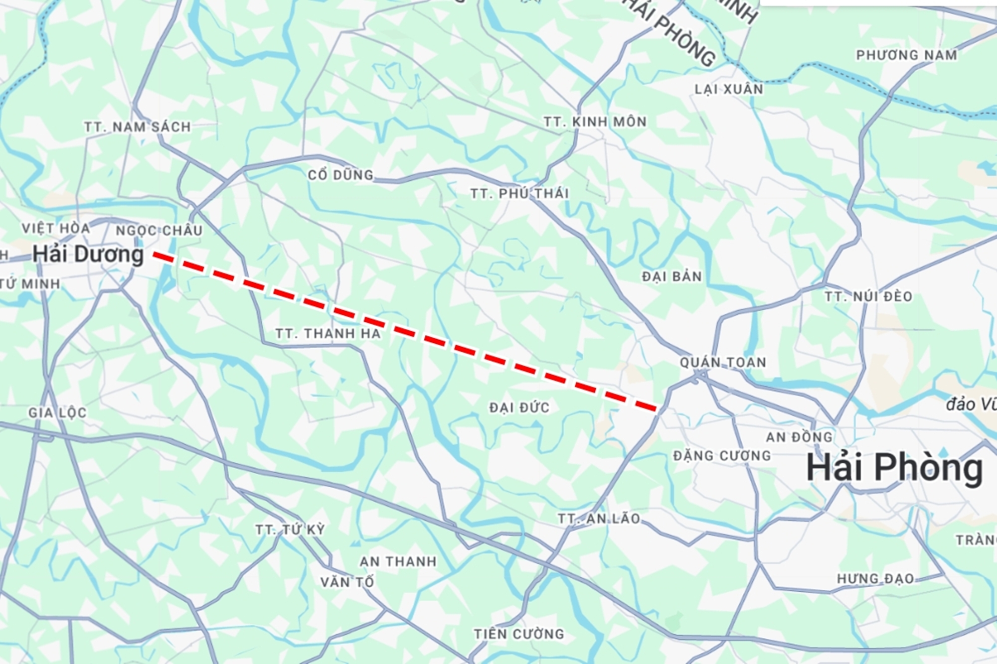 |
Map of the East-West connection route in Hai Phong. Photo: Xuan Hoa |
Map of the East-West connection route in Hai Phong. Photo: Xuan Hoa
Le Tan