The Deo Ca - Van Phu consortium has received approval from the Hanoi People's Committee to research the "Red River Grand Avenue and Landscape" project under a public-private partnership (PPP) model. The consortium has committed to self-funding the project's feasibility study.
The proposed project covers an area of approximately 7,800 hectares and stretches 40 km, from the future Hong Ha Bridge to the Me So Bridge. Both bridges cross the Red River and are part of the capital's 4th Ring Road.
The riverside avenue will include 22 km of elevated roadways, 7.6 km of parallel roads, and 2.3 km of tunnels, with a cross-section of 4-6 lanes. Along the riverbanks, approximately 3,000 hectares will be dedicated to parks, recreational areas, and landmark structures, creating focal points for the capital. These areas could host various cultural activities and showcase traditional crafts.
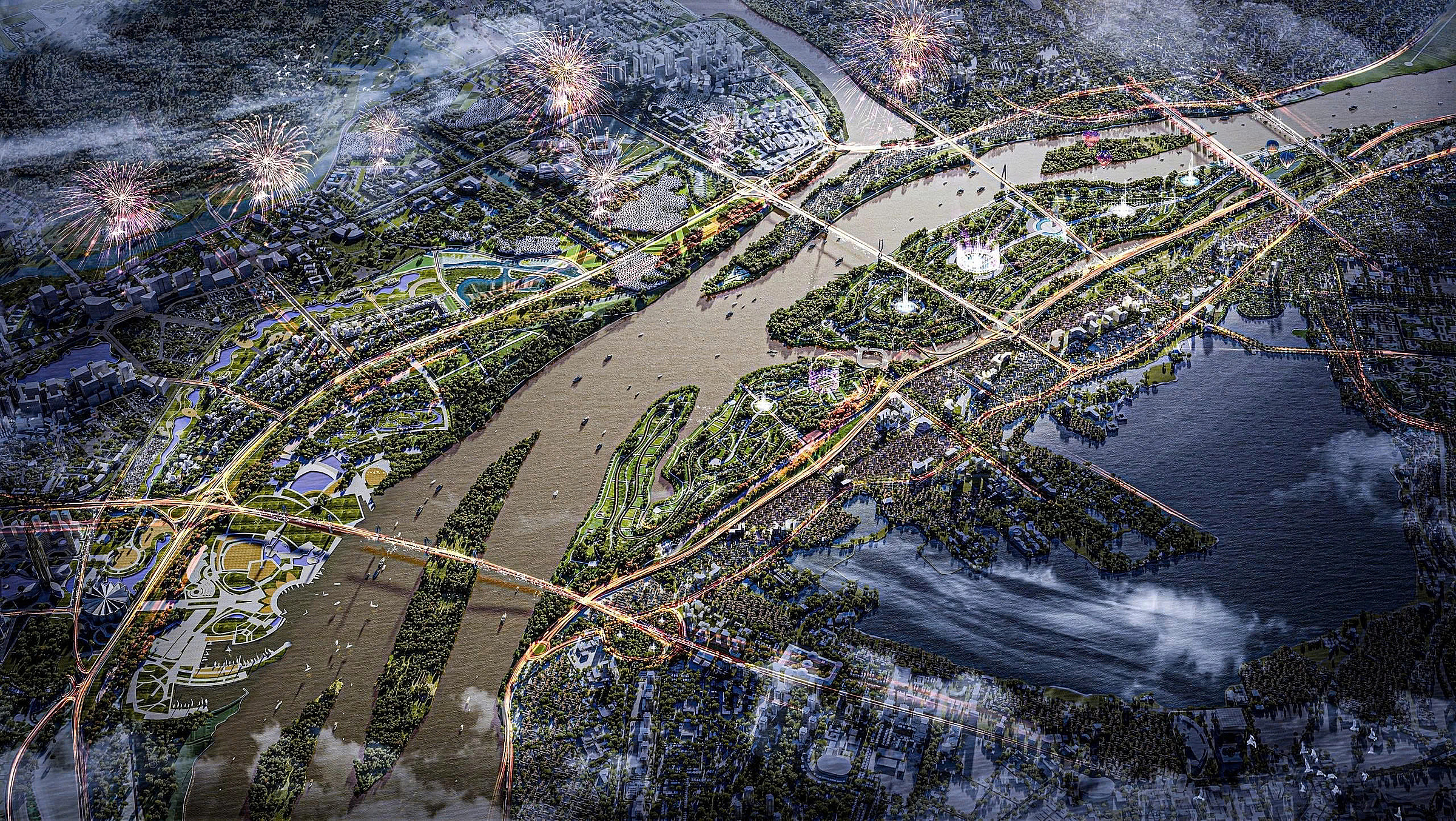 |
Artist's impression of the Red River as envisioned by the research team. (Deo Ca - Van Phu) |
Artist's impression of the Red River as envisioned by the research team. (Deo Ca - Van Phu)
The avenue will not only connect Hanoi with Hung Yen and Phu Tho provinces but also serve as a vibrant cultural and ecological corridor, featuring terraced parks, walkways, riverside plazas, tourism and service complexes, and community spaces.
According to the consortium, the project aims to transform the Red River area into a new symbolic cultural and ecological axis, creating Hanoi's largest public space and enhancing the city's image.
Furthermore, the project aims to address the issue of the "city turning its back on the river" by improving transportation links and developing multifunctional urban spaces to meet residents' needs for living, business, and recreation.
Hanoi's master plan for 2021-2030, with a vision to 2050, designates the Red River as a central green and scenic axis, a space for cultural heritage, tourism, and services, connecting the capital region with the Red River Delta.
The Red River sub-area plan, approved by the Hanoi People's Committee in 3/2022, covers a substantial area of approximately 11,000 hectares, extending from the Hong Ha Bridge to the Me So Bridge.
This area includes 3,600 hectares of the Red River itself, over 5,400 hectares of riverbanks, and the remaining area comprises existing developments, including historic villages like Bat Trang, Van Khe, Trang Viet, Tam Xa, Xuan Canh, and riverside wards such as Tu Lien, Nhat Tan, Thanh Tri, and Linh Nam.
Doan Loan